


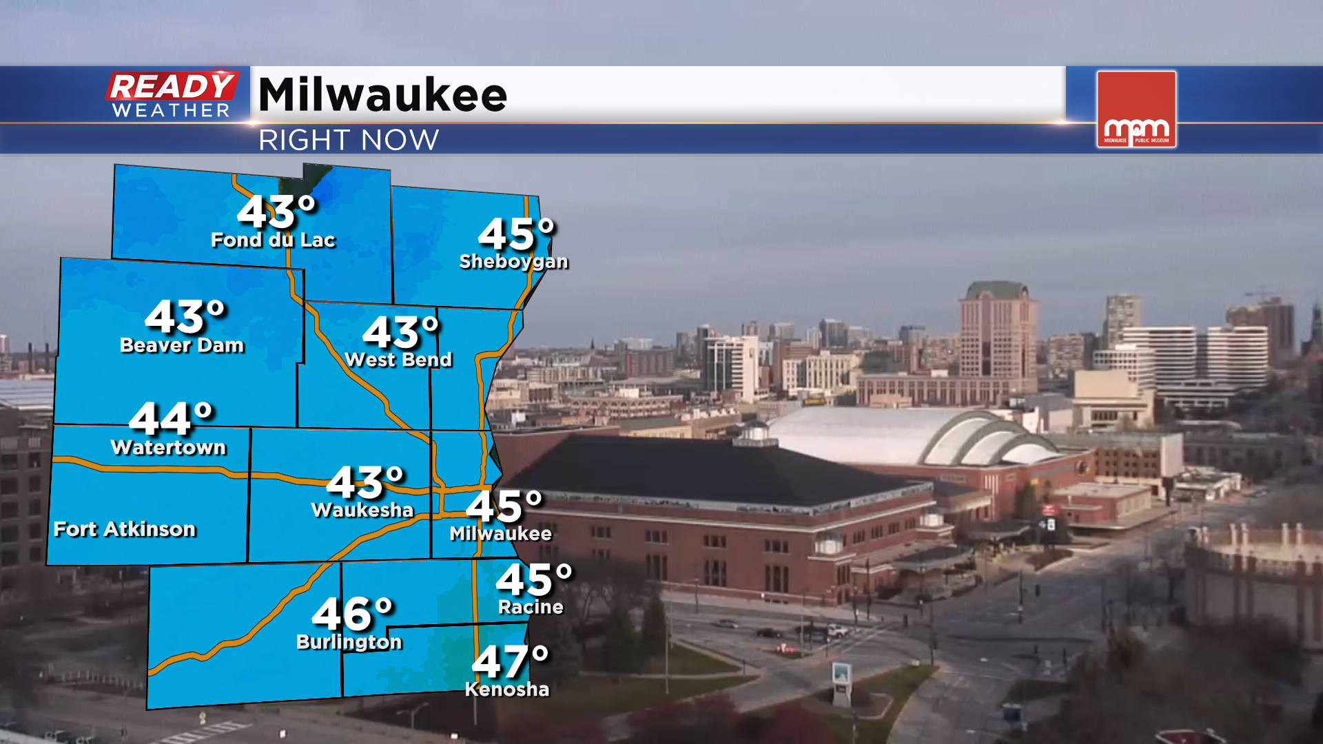
It's been a quiet fall day across southeast Wisconsin with times of sun and clouds, light winds, and temperatures in the low to mid 40s.
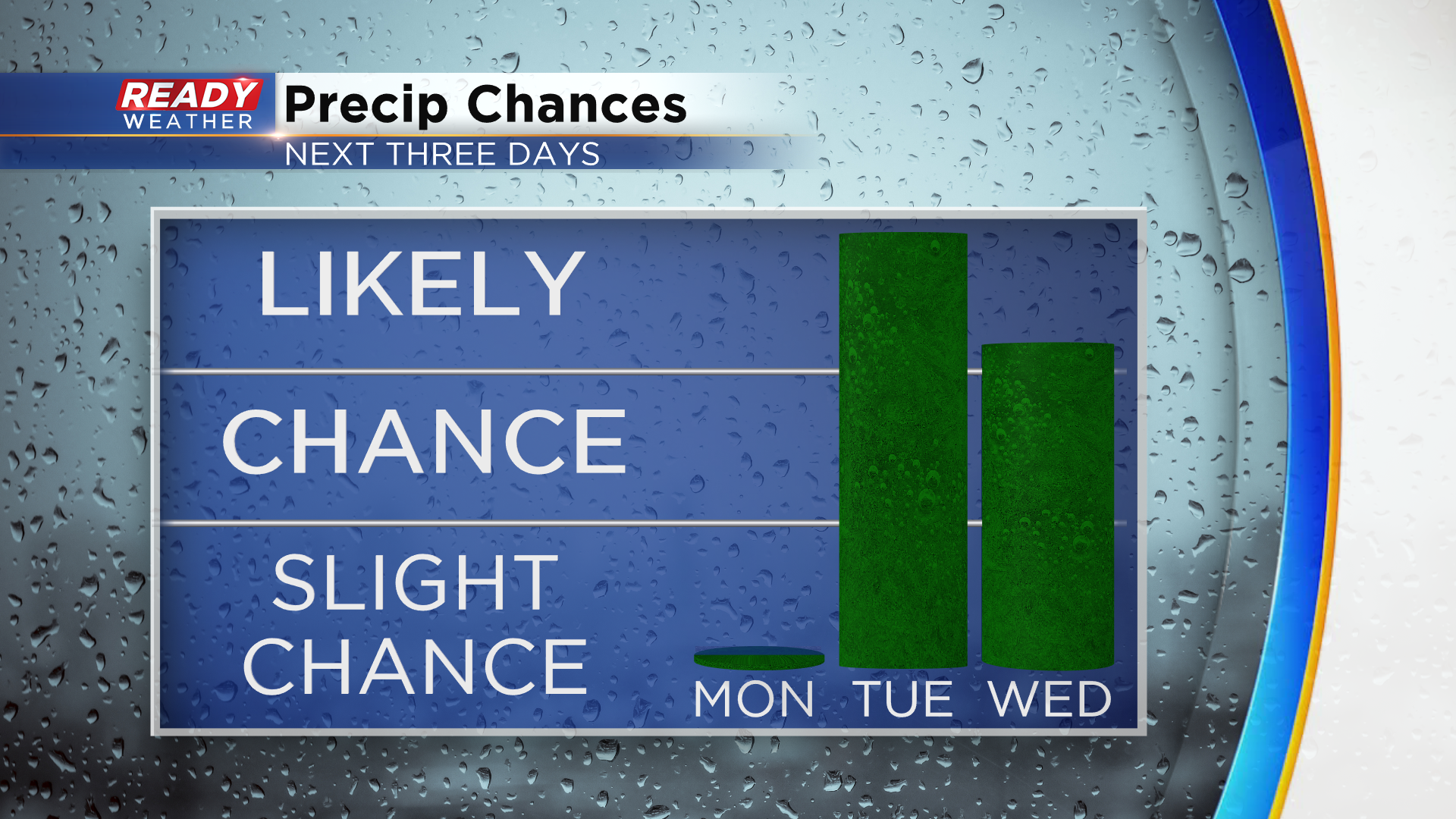
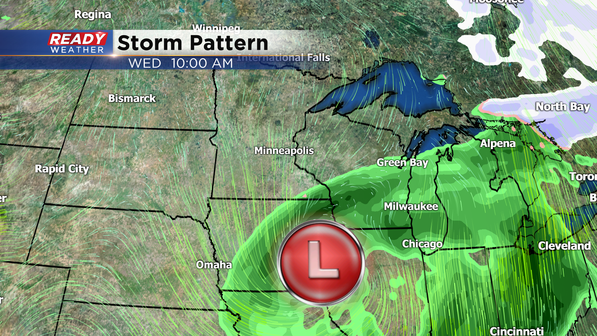
We still can't rule out an isolated sprinkle or flurry this evening as a trough swings through the area, but nearly everyone will remain dry. Dry weather will continue into Monday with more sunshine expected, but wet weather looks likely Tuesday and Wednesday as a low pressure system tracks across the Midwest.
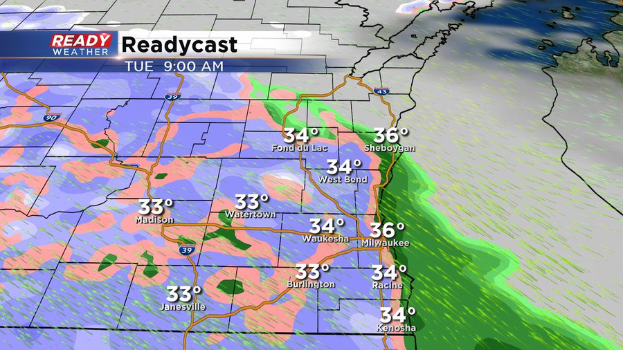
Latest data has wet snow moving in Tuesday morning between 7-9 am.
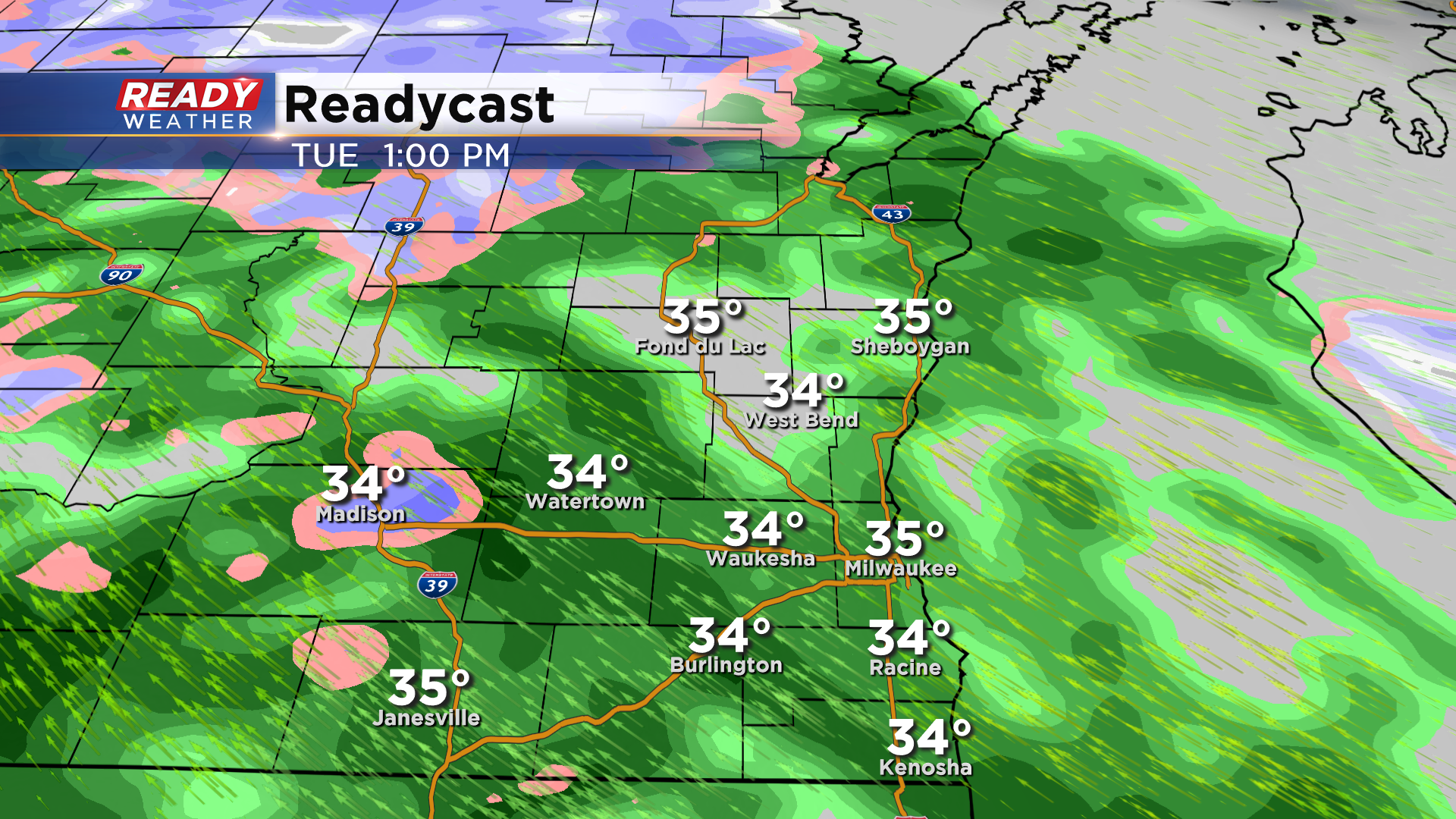
By midday, warmer air will start to move in and change the wet snow over to rain for the afternoon. Some sleet could mix in as well late Tuesday morning.
Temperatures will slowly be rising into the 40s Tuesday evening through Wednesday, so once the snow changes over to rain it'll likely remain rain until it ends Wednesday afternoon.
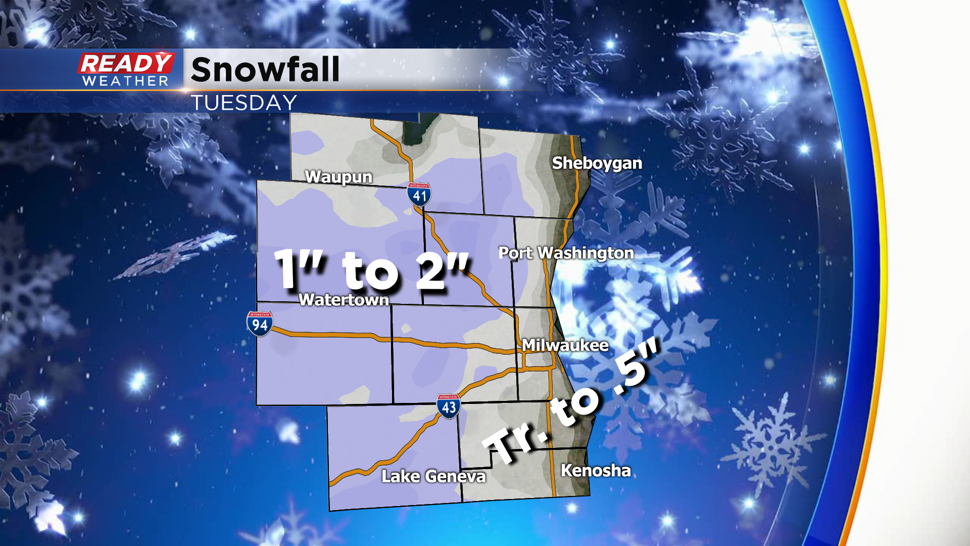
Around an inch or two of wet snow is expected away from the lake Tuesday morning, with the highest totals closer to 2" expected closer to central Wisconsin. Southeast winds will keep lakeside areas a couple of degrees warmer, so only up to a half inch of slush is possible with little to no accumulation right along the lake. With temperatures so close to freezing, only isolated slick spots are possible, but plan on reduced visibilities Tuesday morning.
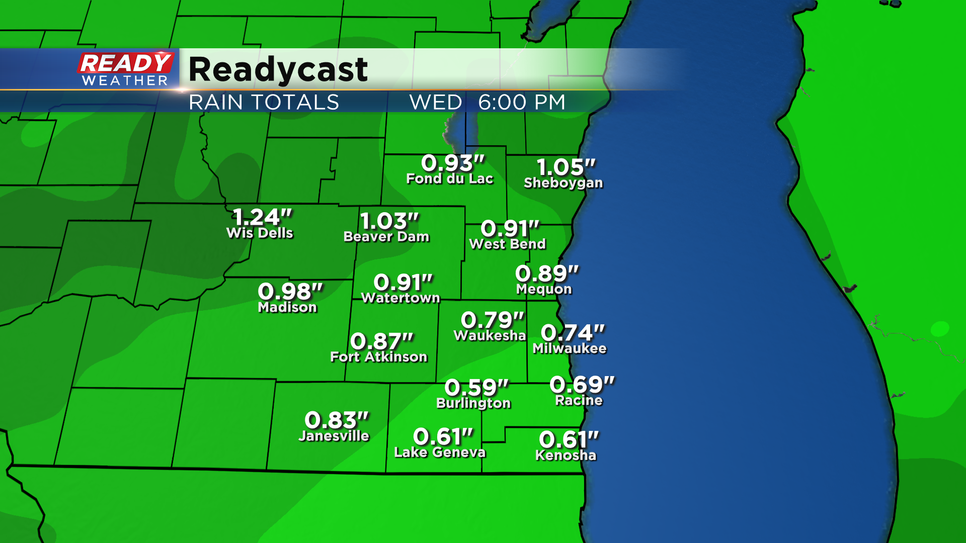
This system will provide a good soaking rain once it changes over. Between .50-1" of rain looks likely Tuesday through Wednesday.
High pressure will move in on Thanksgiving and will dry us out and bring back the sunshine! See if there's any more wet weather in store for this week by downloading the CBS 58 Ready Weather App.