We've had a glorious stretch of weather the last few days with plenty of sunshine and temperatures in the upper 70s to mid 80s. Another really nice day is on tap for today with sunny to partly cloudy skies and highs in the low to mid 80s.

Clouds start to increase this evening ahead of our next batch of rain and rumbles of thunder, which will largely move through overnight.
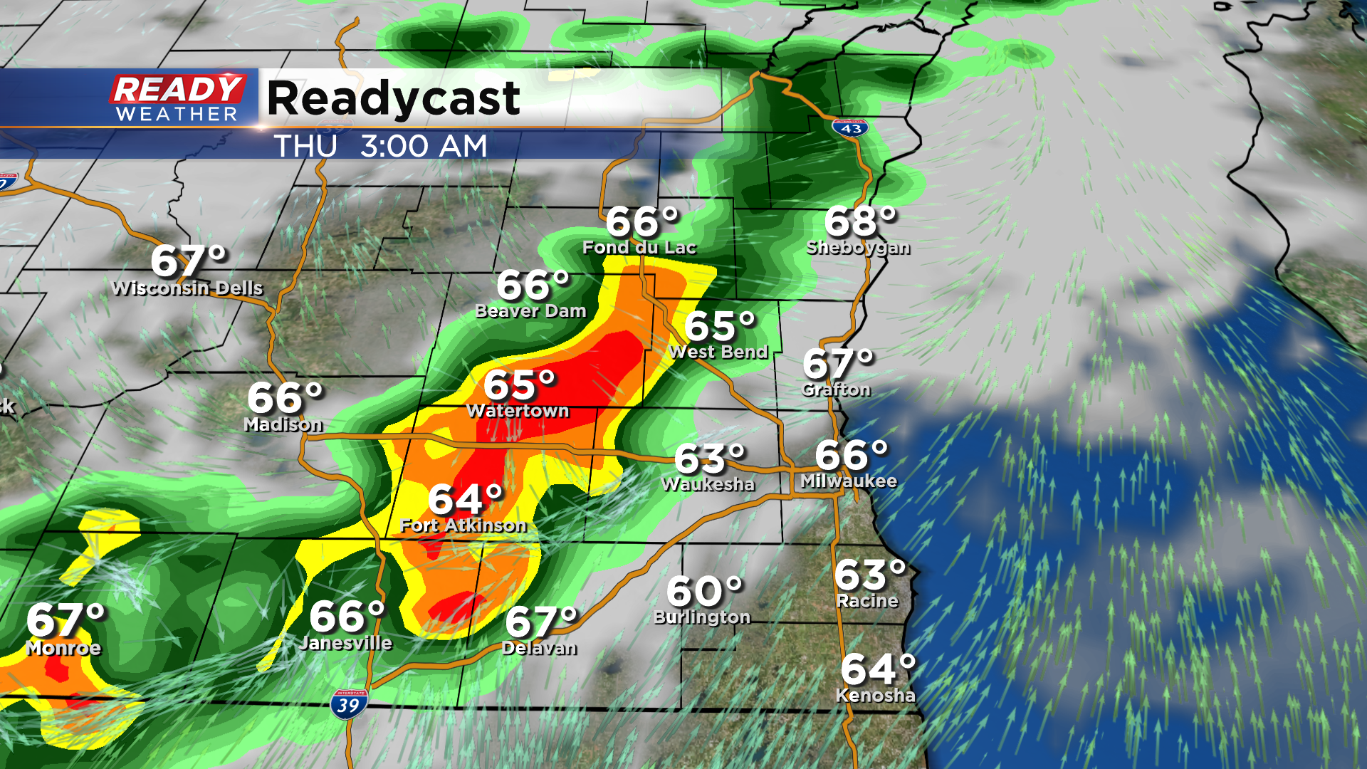
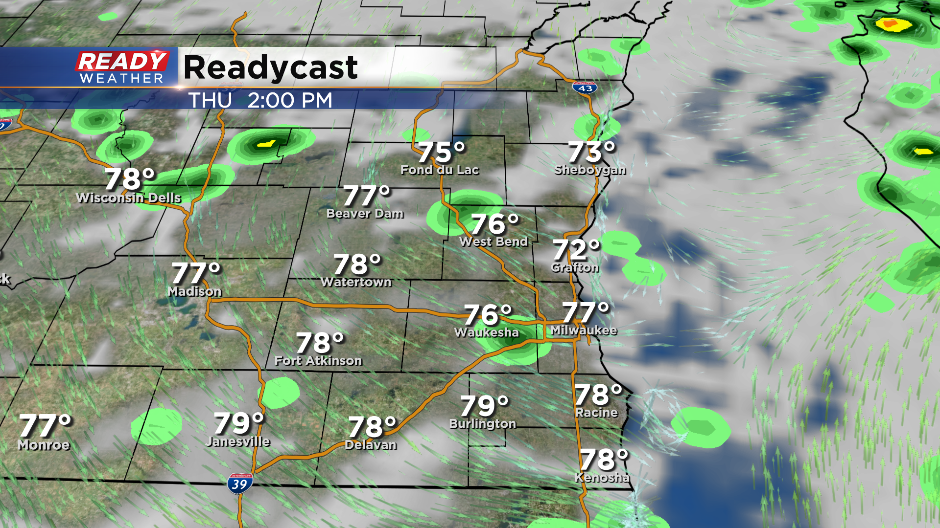
While the heaviest and steadiest rain falls early Thursday morning, additional isolated light showers and storms are possible Thursday afternoon on the backside of this low pressure system. There will be dry time during the day as well, especially mid to late morning.
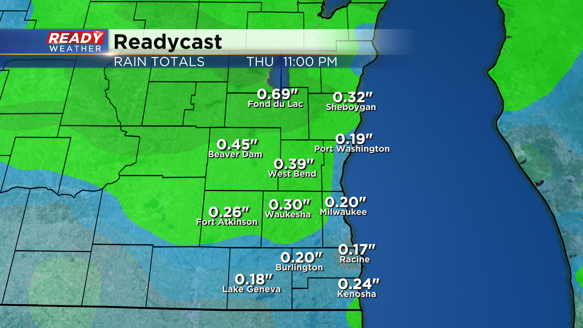
A general .10-.30" of rain is excepted across southeast WI from this system, but locally higher totals are possible in storms.
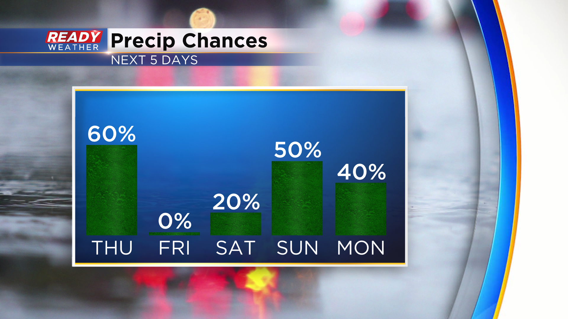
A large area of high pressure moves in behind this system and will keep us dry Friday and Saturday, but rain chances may return as early as Saturday night and be hit or miss into early next week.
Download the CBS 58 Ready Weather App to get the latest updates from videos posted throughout the day.
