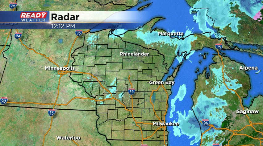
Midday Update: Steady snow is done, but a few stray snow showers are possible through the afternoon


Updated: March 31 12:15 pm
The steady snow has pushed out of southeast Wisconsin, but low clouds will linger for the rest of the day. A few additional flurries, snow, or rain showers are possible this afternoon, but no additional accumulation is expected.
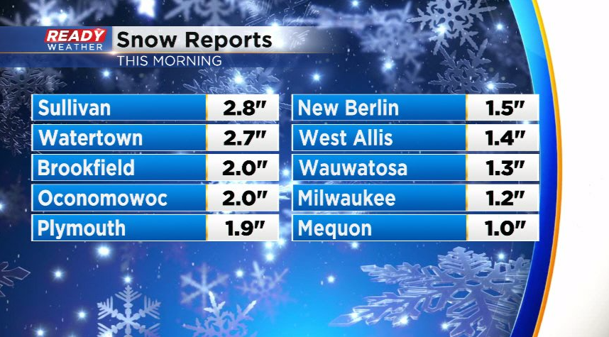
Most of southeast Wisconsin picked up 1-3" of snow with 1.2" officially in Milwaukee.
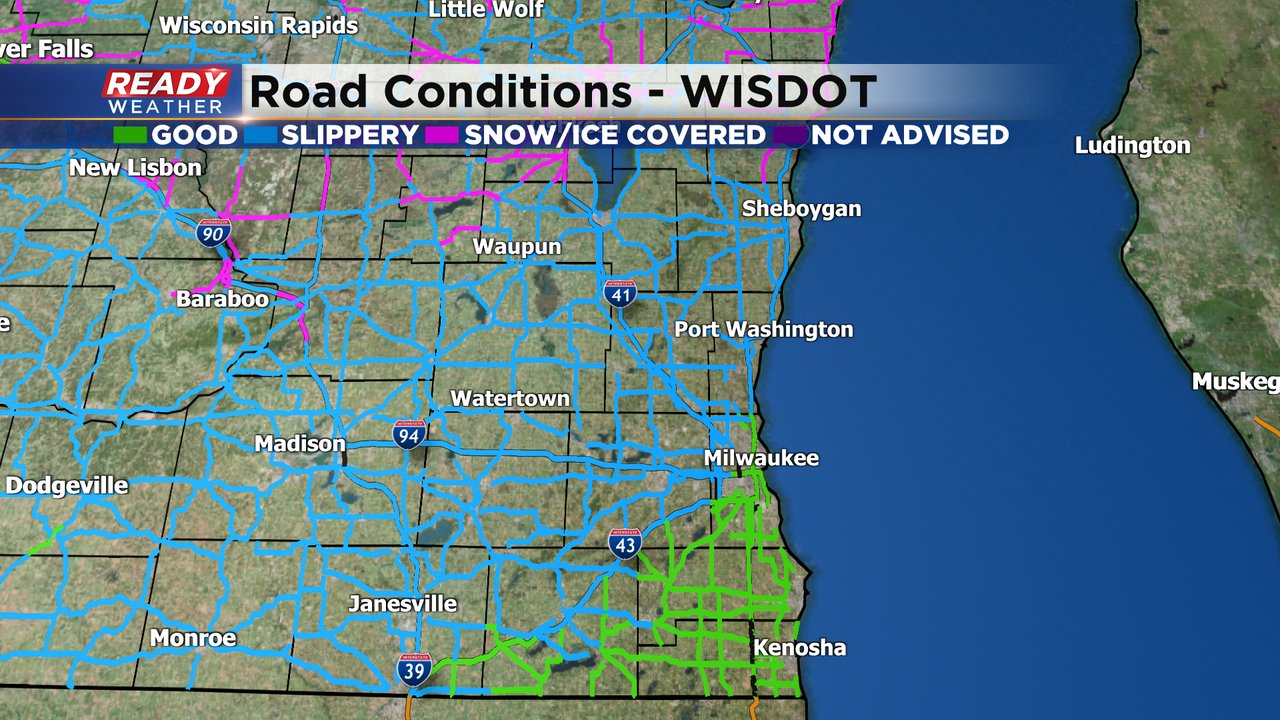
The snow is already melting as temps have risen above freezing. Roads are primarily wet at this point with no additional impacts expected through the afternoon.
-----------------------------------------------------------------
Updated: March 31 10:03 am
Flakes continue to fly across southeast Wisconsin this morning, but the back edge of the steadier snow is pushing through Dodge and Jefferson counties at this time.
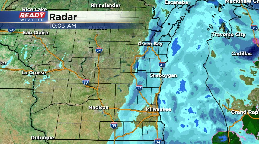
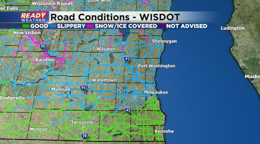
Roads are still slick/slushy away from the lake where temps are at or below freezing, but lakeside times are in the mid 30s so roads are primarily wet there.
While the steadier snow tapers off by noon, additional spotty snow showers will be possible this afternoon.
-------------------------------------------------------------------------------------
Updated: 8:03 a.m. March 31, 2022
A good steady snow is currently falling across all of southeast Wisconsin. Main roads and freeways for the most part are just wet with a little bit of slush but side roads, parking lots and sidewalks are snow covered. A few inches of snow will be possible this morning. The snow will become more light and scattered Thursday afternoon and evening but don't be surprised if you see flakes all the way through midnight.
------
Updated: 6:06 a.m. March 31, 2022
The rain is quickly switching over to snow. Wet snow is being reported in Waukesha and sleet has been reported in parts of Milwaukee County. This will be the heaviest time of precipitation with high snow and mix rates that could lead to some slushy accumulation, mainly on grass but could make roads slick at times.
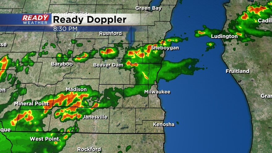
Here is a radar image that will updated with time:
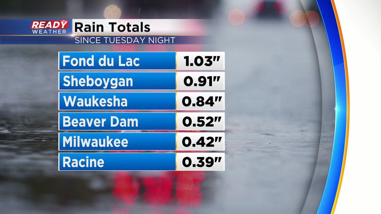
Since some rumbles of thunder Tuesday night most of southeast Wisconsin has picked up anywhere from 0.25 to 1" of rainfall. Most of that fell Wednesday evening through Thursday morning.
------
Posted: 4:53 a.m. March 31, 2022
After a mostly dry day on Wednesday we started to see steady rain roll in late Wednesday evening. A few pockets of steady moderate to heavy rain fell Wednesday into early Thursday morning. As of 5 AM, the rain is starting mix and switch to snow in our inland and northern counties.
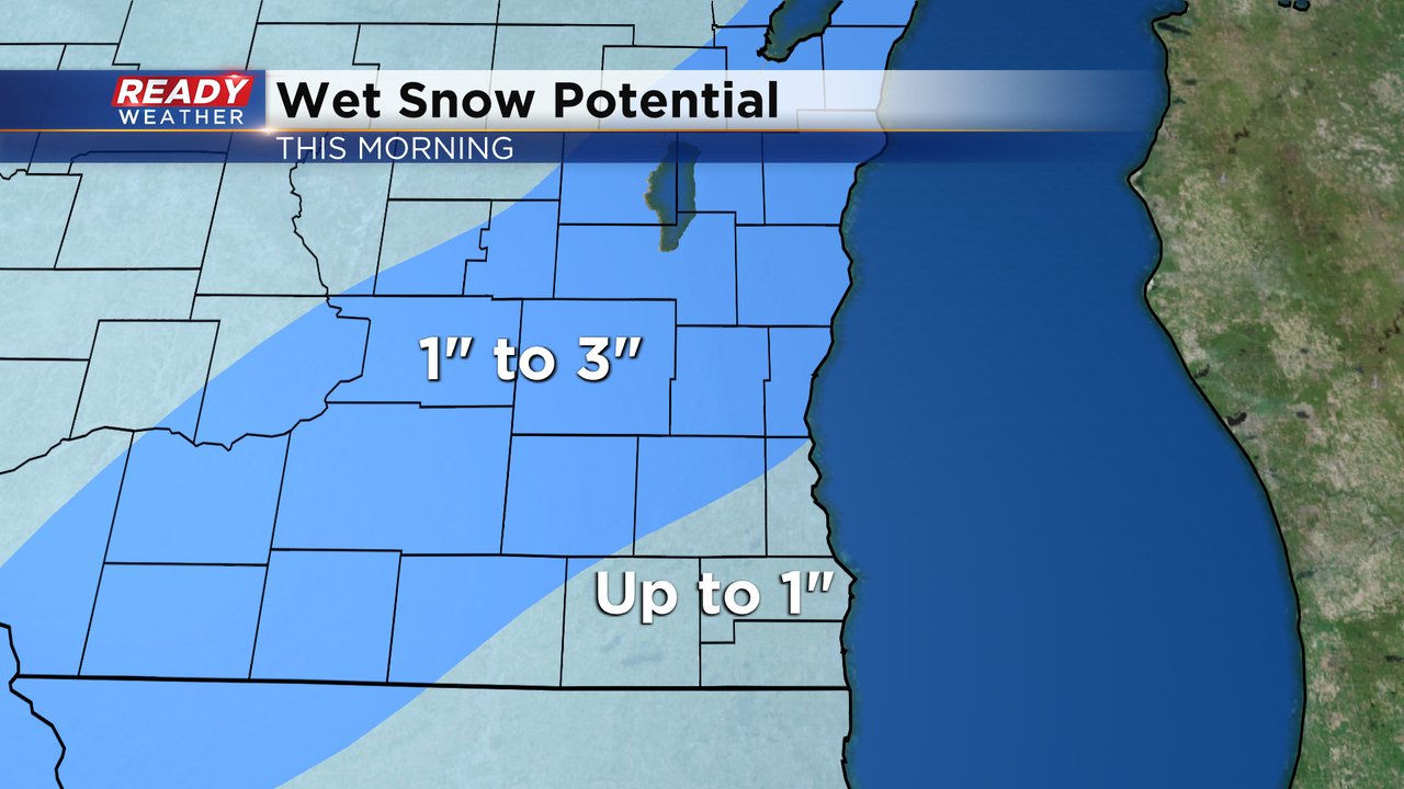
A winter weather advisory remains in effect for counties shaded in purple until noon on Thursday. These are the counties that could see a couple inches of slushy snow. Milwaukee, Walworth, Racine and Kenosha Counties are not included in the advisory as snow totals there will remain under an inch on grass with a bit of slush on the roads.

With a bit of a slower switchover from rain to snow the overall snow totals look a touch less than they did on Wednesday. Up to 1" is expected in southern areas with the counties in the advisory seeing 1-3". Most of the snow that accumulates will be very slushy with most of the accumulation on grass but some slush is definitely expected on sidewalks and roads.
Download the CBS 58 Ready Weather app to track the rain switching to snow.