Record heat Monday could spark a few storms


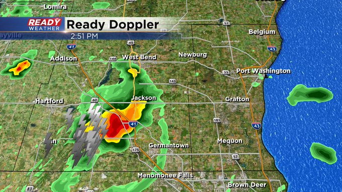
Update: We continue to track isolated cells across the area: Here's the latest with Ready Doppler:

More 90s are expected the first few days to kick off the new work week. Middle 90s are possible Monday and Tuesday and Wednesday could still reach 90. A lake breeze on Thursday gives us some brief relief but then it's right back into the upper 80s to start the weekend.
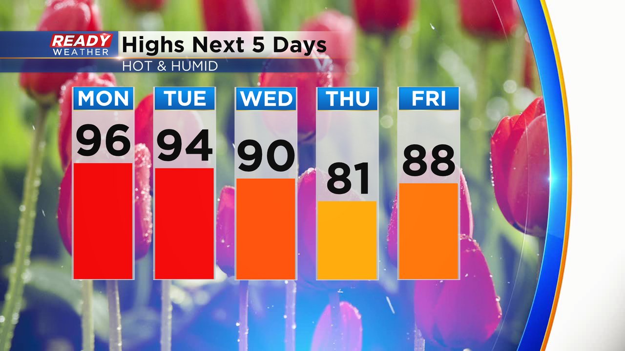
The heat could reach record levels as well. The current record high for today is 94 degrees set back in 1994 and with a forecast high of 96 we would break that record. Tuesday could also come close with the current forecast of 94 getting close to 96 set in 1995. Wednesday's record of 99 degrees looks safe.

Not only is it going to be hot, but also very humid with dew points reaching the low 70s! Tropical level humidity is expected for the first few days of the week so be prepared to sweat!

Once you factor in all of that heat and humidity the feels like temps could reach 100 degrees in some spots. Monday afternoon many locations will have heat indices closing in on the upper 90s or low 100s getting very close to heat advisory level heat.

in addition to all of the heat and humidity, a few storms are also possible. We are watching a cluster of storms roll into western Wisconsin from Minnesota and Iowa. Some of those during the early morning hours were borderline severe but most of them have weakened. As the heat and humidity give more fuel for storms, we could see them gain a bit more strength. Western Wisconsin is under a Level 2 Slight Risk for severe weather for those storms with a Level 1 Marginal Risk that stretches into parts of Fond du Lac, Sheboygan and Dodge Counties locally.

Download the CBS 58 Ready Weather app to track then heat and humidity and a few possible storms.