Record shattering Saturday snow is over with a touch more on the way Sunday


Our heavy wet snowfall for Saturday is over! The snow came down hard and fast Saturday morning then lightened up during the afternoon with everyone done with snow by 5 PM. Snow totals have been rolling in Saturday afternoon and we've noticed two changes to the snow totals compared to the forecast. First, the track moved a considerable amount to the northwest so instead of southeast counties seeing the most snow it was northwest counties. Second, this storm had a lot more moisture to work with which elevated totals across the board and caused the Fox Valley, which was only expecting 1-3" of snow, to get 12-20".

The 8.9" of snowfall in Milwaukee shattered a record for today's date - March 25th. It broke a 90-year-old record of 5.2".
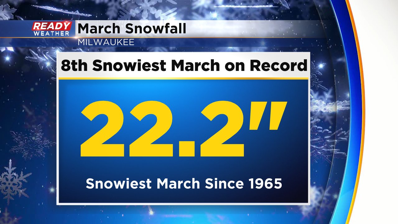
March overall has been a very snowy month in southeast Wisconsin. It's the snowiest March since the 1960s and currently is the 8th snowiest March on record with still a week left that has a few more snow chances.
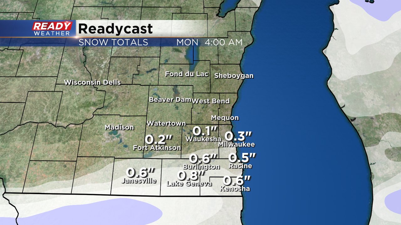
Speaking of those additional snow chances. A but of rain/snow mix is a possibility for Sunday. The morning looks dry with a bit of sunshine then some rain and snow return in the afternoon and evening. A touch of slushy accumulating snow is a possibility mostly on grassy surfaces and where the snow already exists.
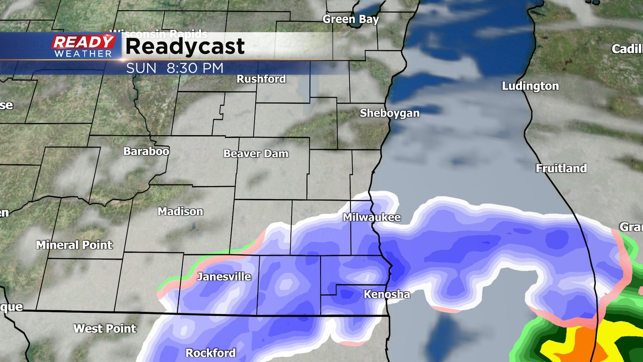
Roads should just stay wet on Sunday but up to an inch of wet slushy snow is a possibility with areas south of I-94 seeing the best chances.
Download the CBS 58 Ready Weather app to track another round of rain and snow (in spring...)!