Remaining below normal with off and on rain chances through the end of the week


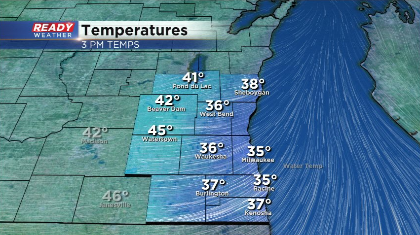
It's been another winter-like day across southeast Wisconsin with temperatures stuck in the 30s for most and feeling like the 20s all day near the lake thanks to the northeast wind.
The northeast wind has been keeping dry air in place today, so while there is precipitation being picked up on radar, it isn't currently reaching the ground.
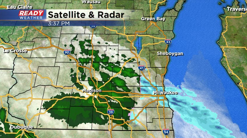
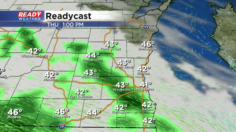
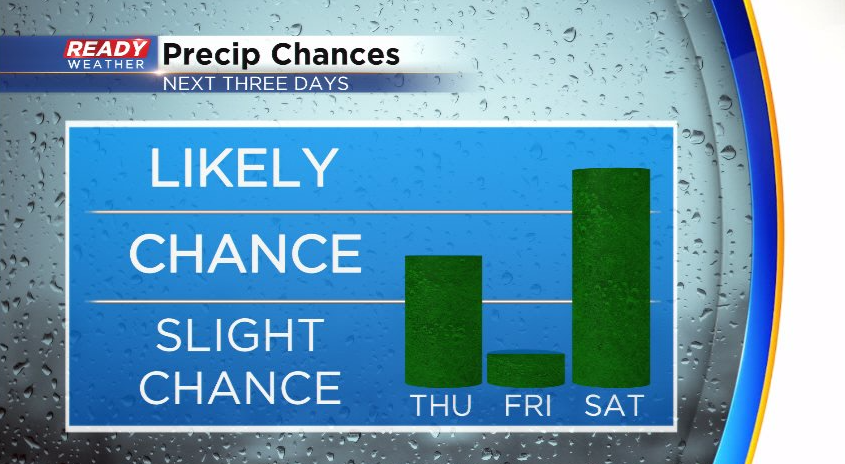
The dry air will erode tonight with a band of light showers expected. Some snowflakes may mix in with the showers, but no accumulation is expected. Spotty light showers will continue off and on for Thursday with the steadiest rain expected southwest of the Milwaukee metro.
A good chunk of the area will dry out on Friday, but we can't rule out a stray shower or some drizzle. Scattered showers return on Saturday with a few isolated storms possible Saturday evening.
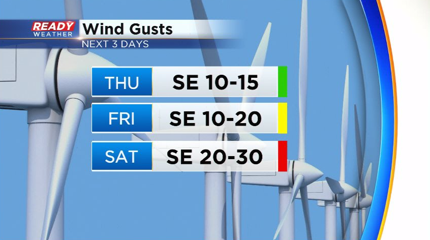
Our northeast wind will turn to the southeast tonight and remain off the lake through Saturday, increasing with time. By Saturday, wind gusts of 25-30 mph are expected.
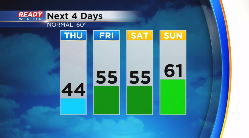
Despite the clouds, rain chances, and southeast wind, temperatures should start to warm a bit heading into the weekend. Like today, expect warmer temps the farther you are away from the lake. If we can get some sunshine on Sunday, temps may even warm up to normal.
Download the CBS 58 Ready Weather App to track the rain chances.