Updated 8am: Rain mixing with wet snow this morning otherwise very windy


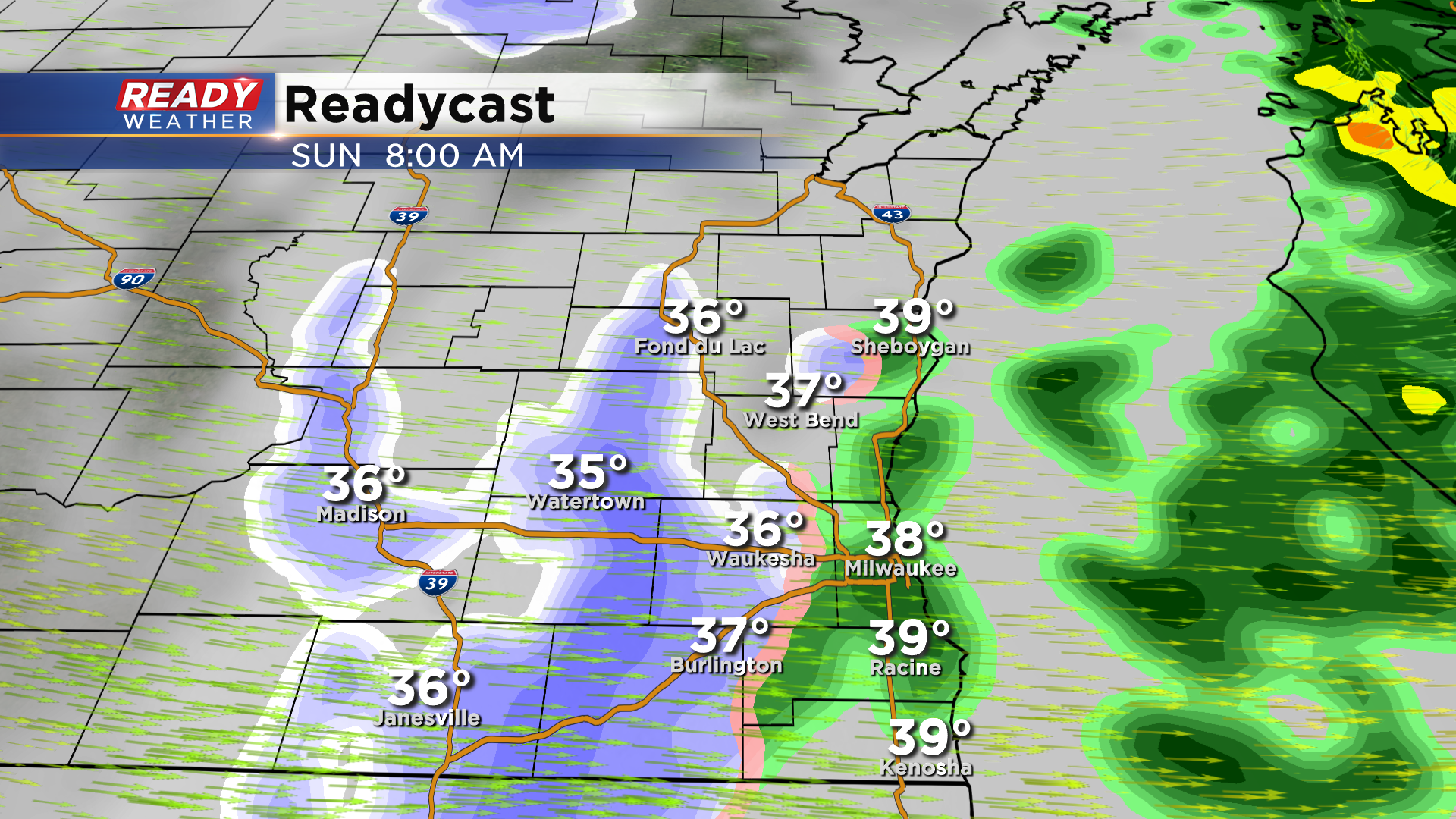
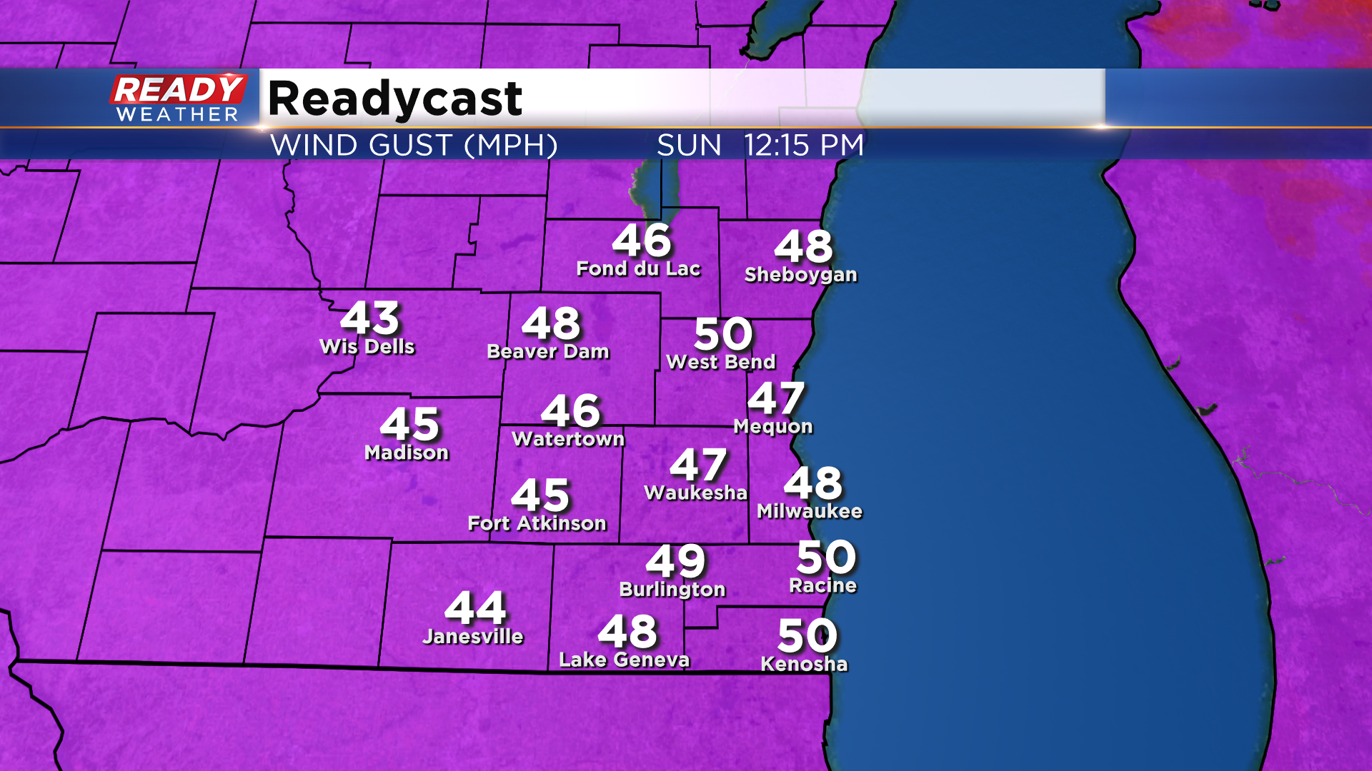
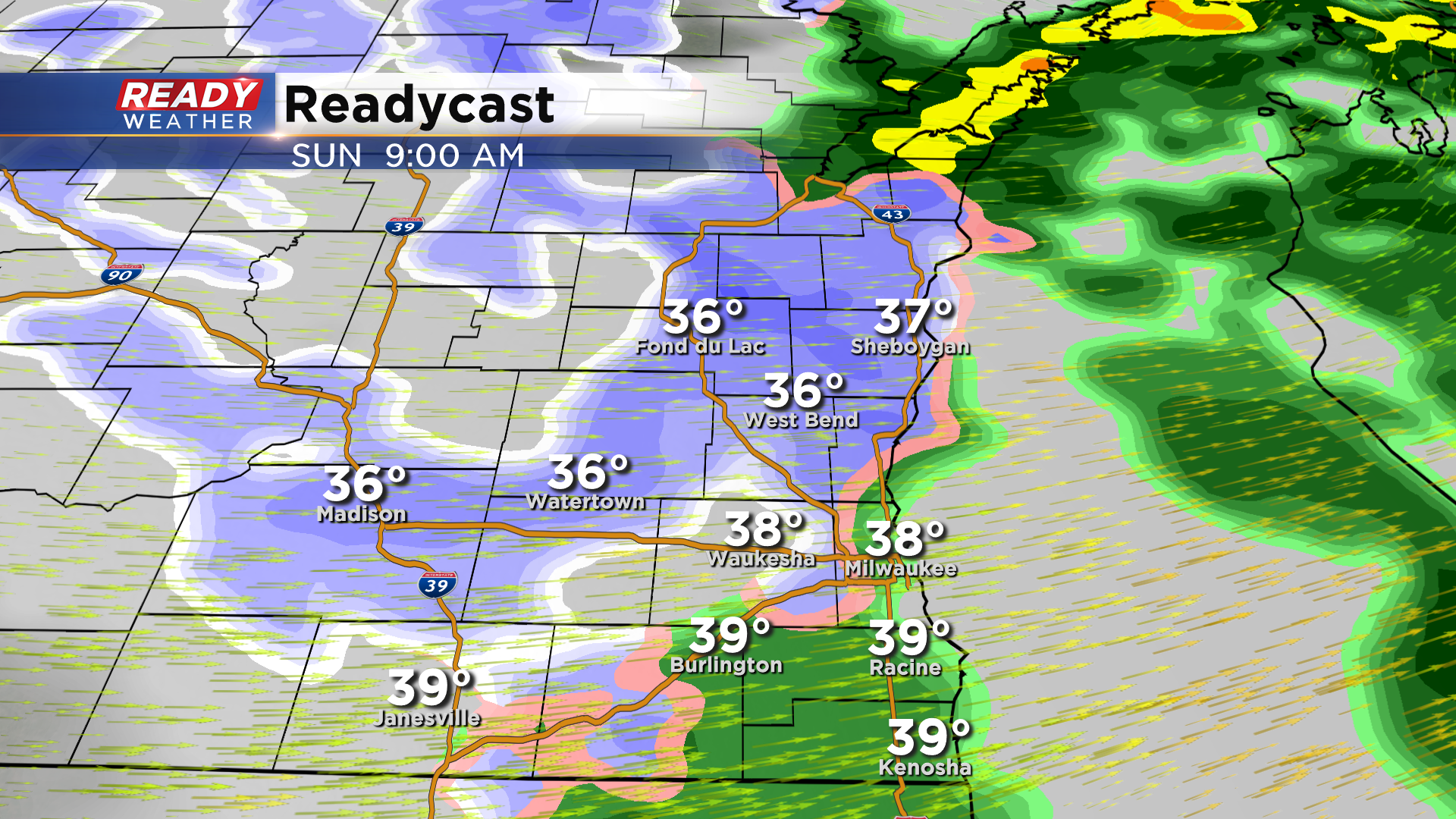
Updated: Sunday, November 15th 8:15am:
The cold front moved through southeast Wisconsin over the last 1-2 hours, dropping temps from the low 50s into the 30s to mid 40s. The cold air filtering in behind this cold front is causing some of the rain to mix with/change over to wet snow.
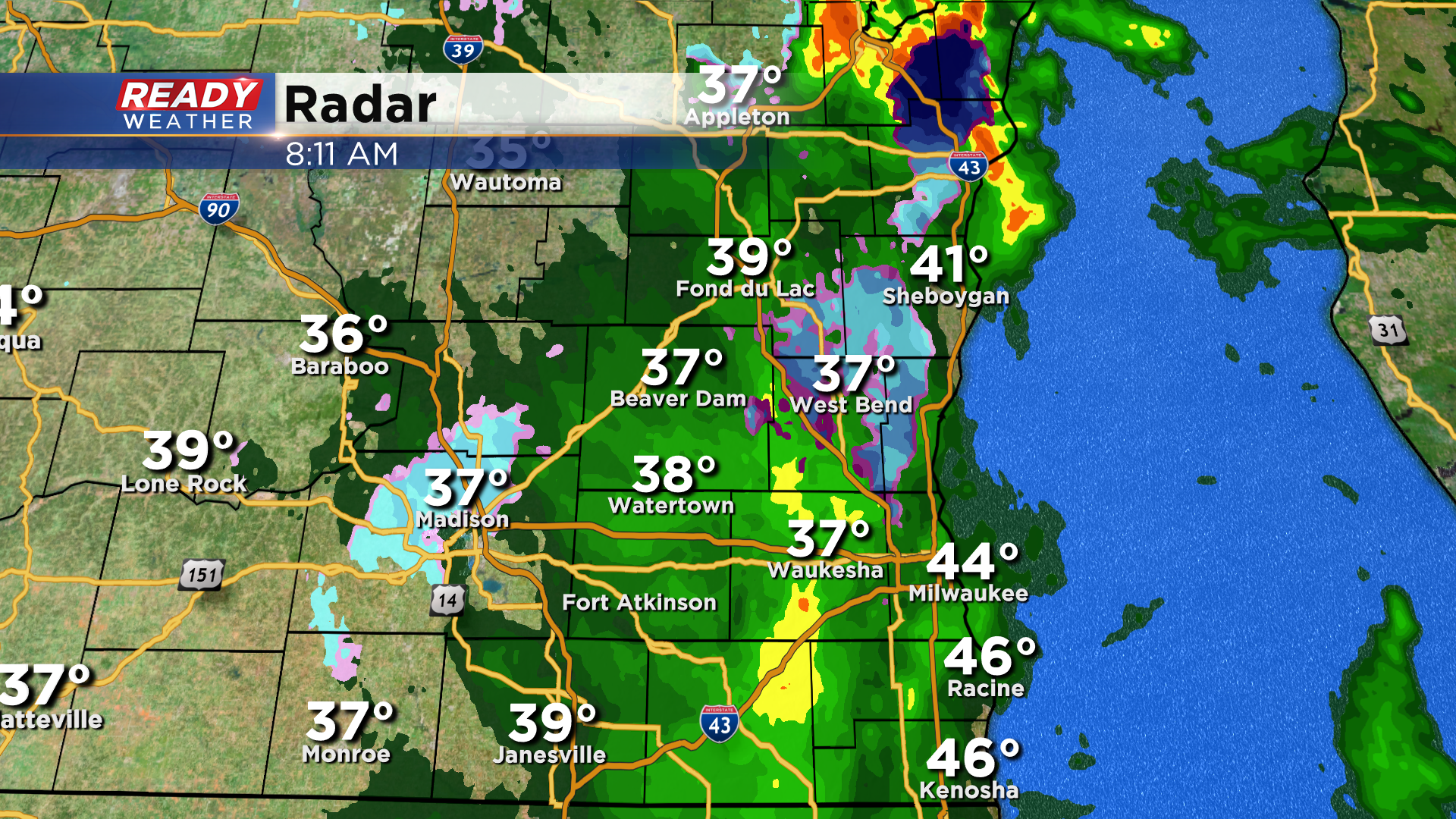
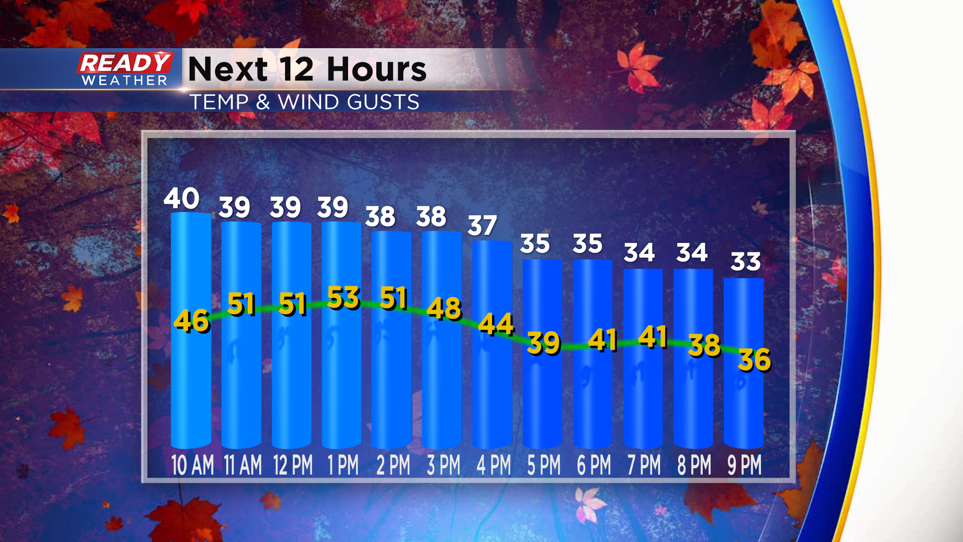
It's too warm for any accumulation on roads, but the wet snow could reduce visibility in spots through 10-11am before exiting the area. We'll likely still have a few flurries through the afternoon under the lingering cloud cover. The bigger story today will be the winds. Winds are already cranking up and gusting over 40 mph in spots.
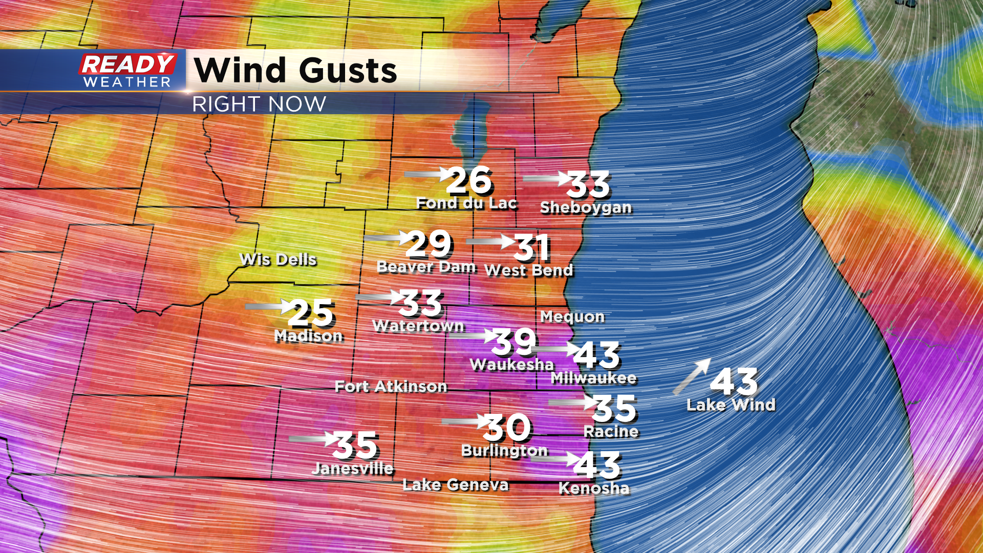
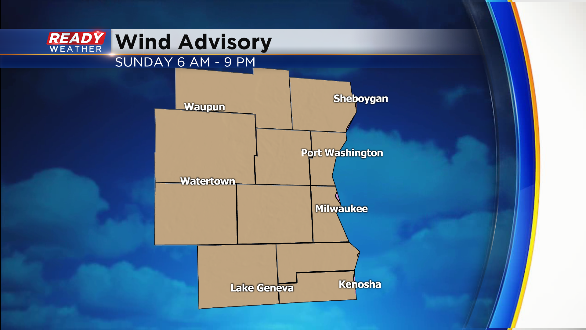
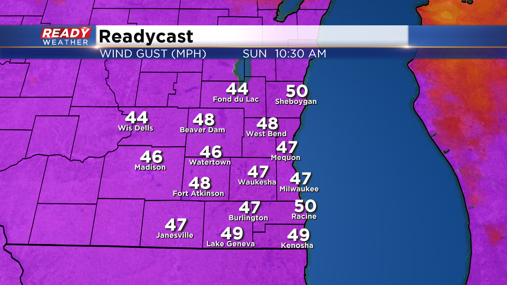
Winds will frequently gust between 40-50 mph throughout the day today, but a few gusts between 50-55 mph are possible from 9am-2pm. A Wind Advisory is in effect for all of southeast Wisconsin through 9pm tonight.
Download the CBS 58 Ready Weather App to track the rain/snow mix.
------------------------------------------------------------------------------------
Updated: Saturday, November 14, 11 pm:
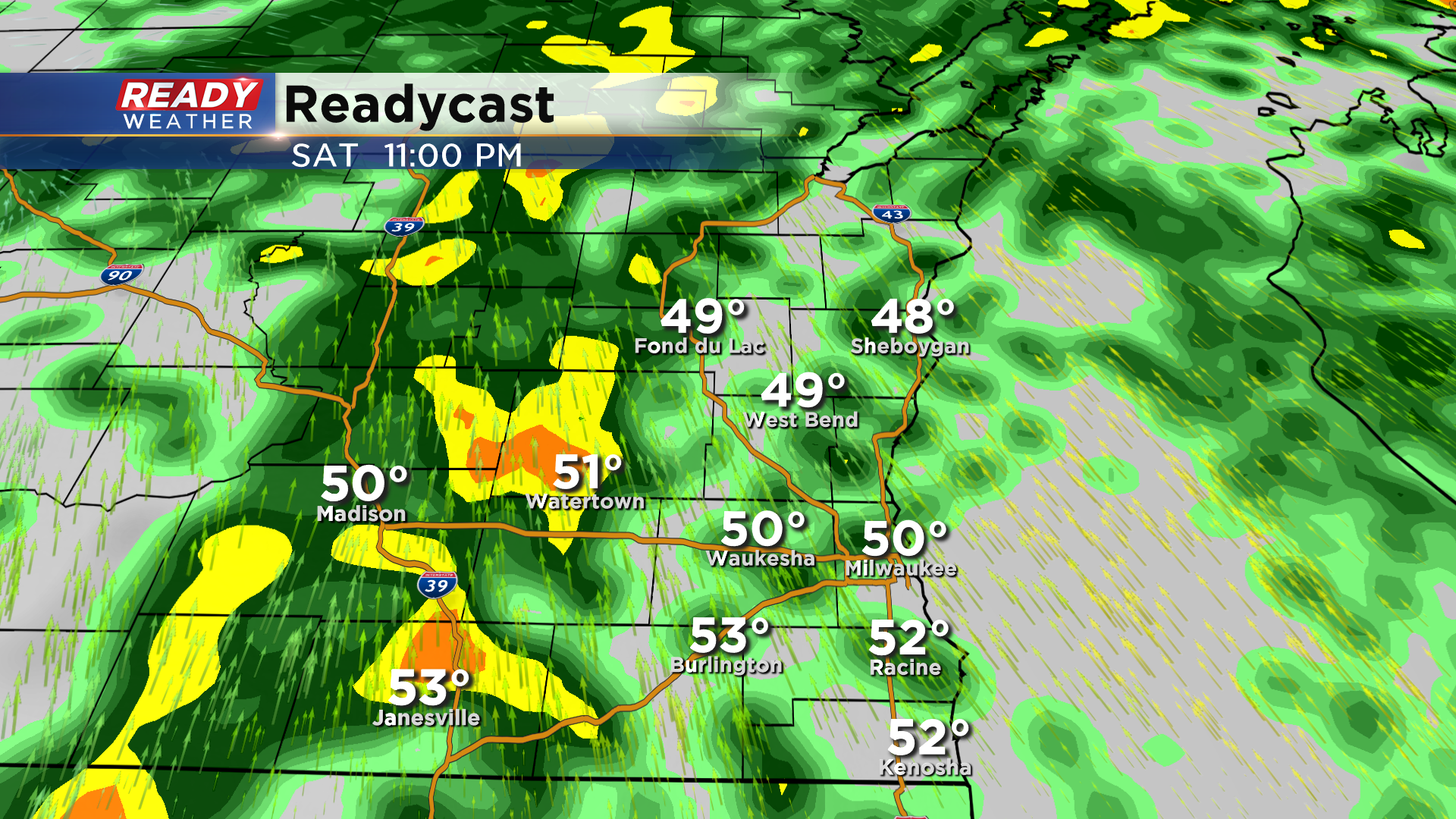
Another wave of rain and isolated storms is tracking into southeast Wisconsin. Once this batch of rain moves through, showers will be more isolated and much lighter overnight with temps rising into the low 50s.
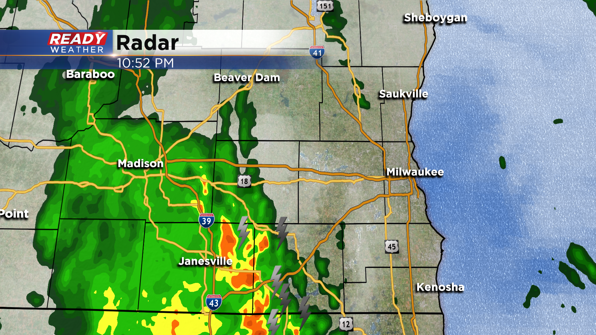
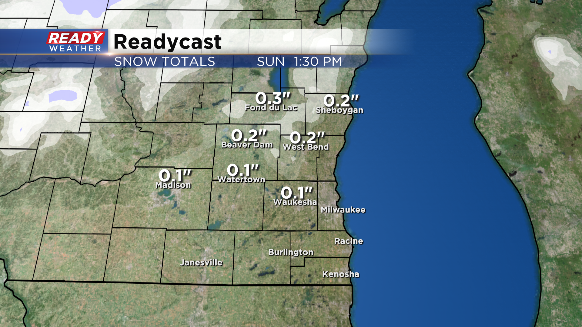
The cold front moves through the area around 6-7 am Sunday morning, dropping temps from the upper 40s into the mid to upper 30s during the morning. As the cold air filters in, rain could mix/change over to wet snow between 8-11 am.
Temperatures will be too warm for any impacts on roads, but visibility may be reduced. If any snow does accumulate, it wouldn't be more than a dusting on the grass away from the lake. The bigger impact will be the strong winds on Sunday.
Winds will gust between 40-50 mph from mid morning into the evening, with a few gusts over 50 mph possible between 9am-2pm. A Wind Advisory will be in effect for the whole area from 6am-9pm Sunday.
-------------------------------------------------------
Updated: Saturday, November 14 3:20 pm:
Light, spotty showers have been moving through parts of southeast Wisconsin this afternoon.
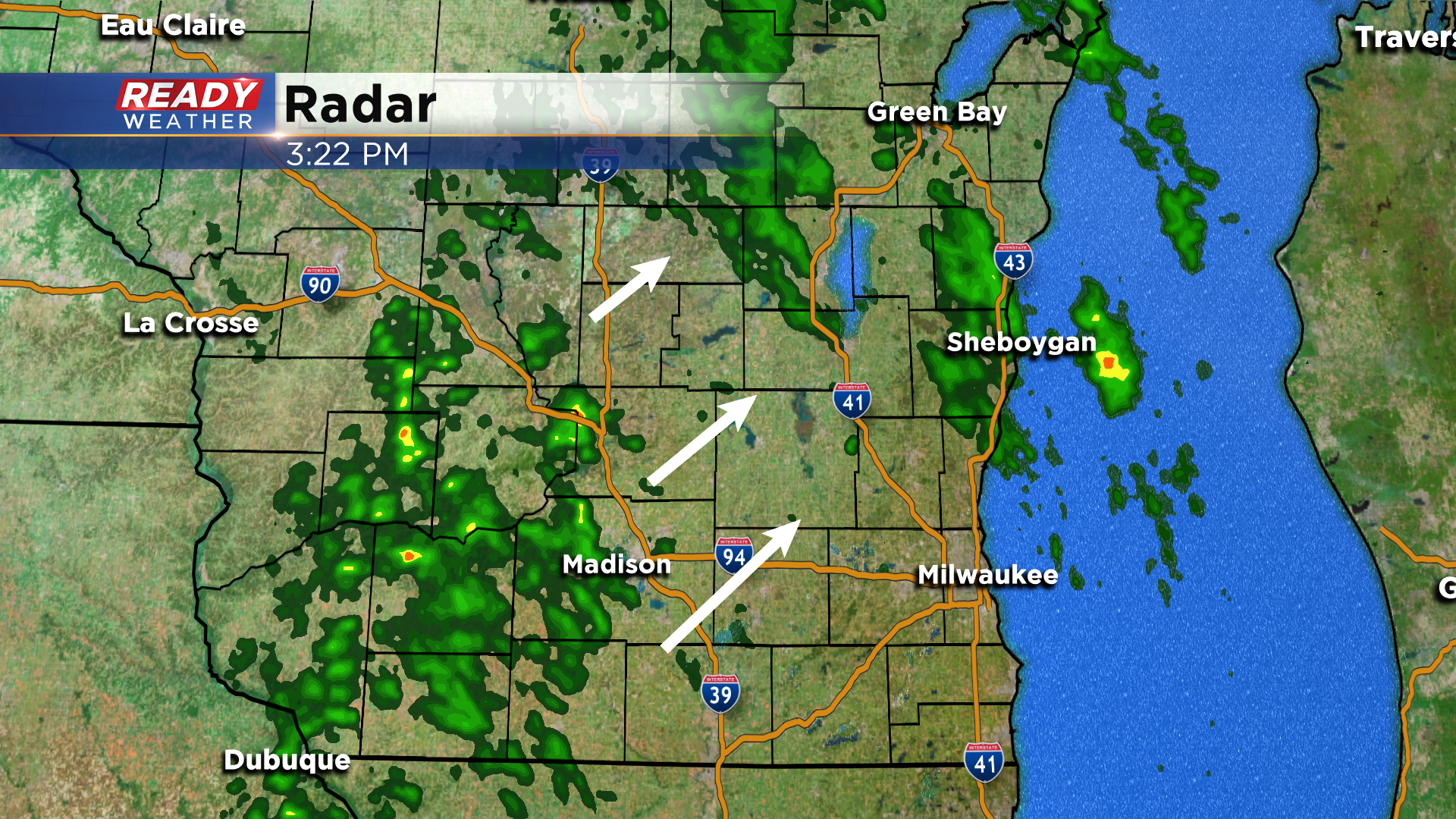
The showers will become more widespread later this evening ahead of the cold front. A few rumbles of thunder are possible as well. Winds have been gusting between 25-35 mph this afternoon, and that will continue into this evening.
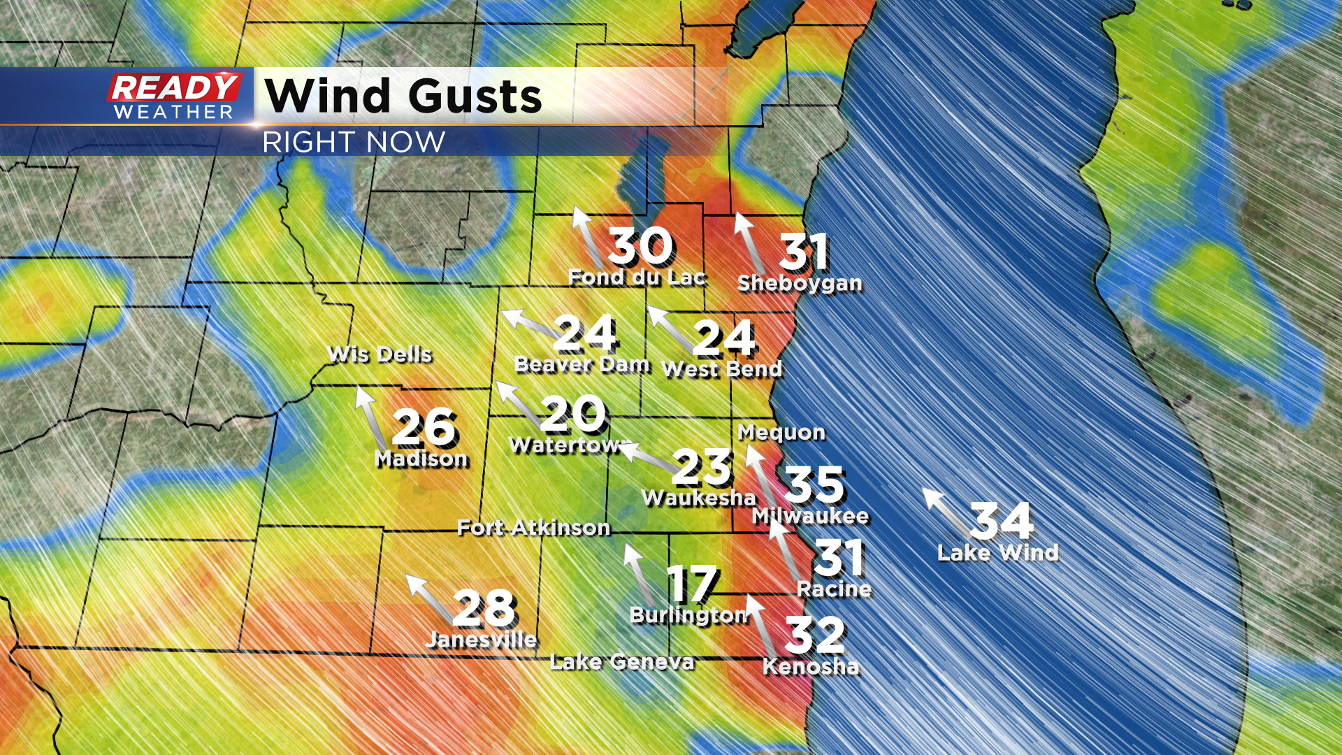
We'll have a lull in the gusty winds briefly overnight, but winds crank up between 35-50 mph Sunday morning into the evening. A Wind Advisory has been issued for all of southeast Wisconsin from 6am - 9pm Sunday.
The rest of the forecast remains on track.
-----------------------------------------------------------------------------------------------------------
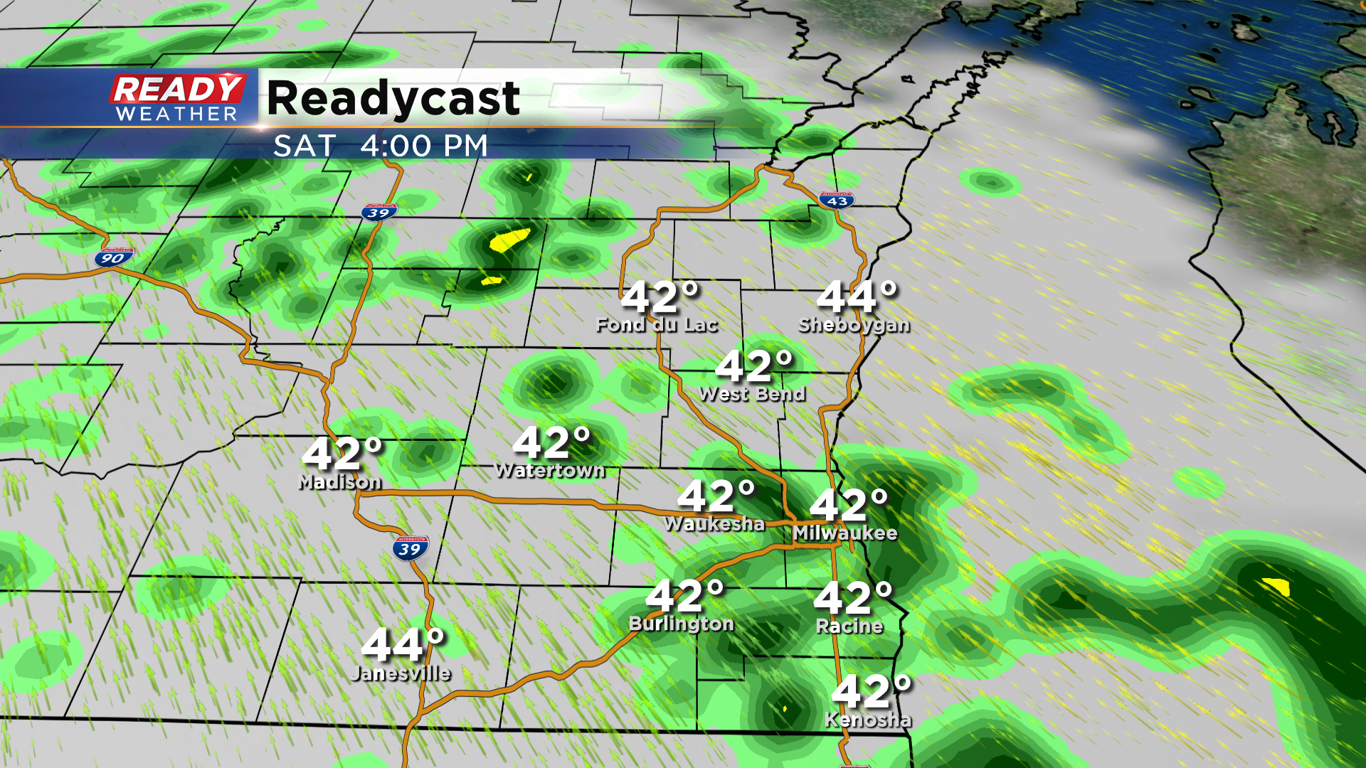
It's been a chilly, but pleasant start to our Saturday across southeast Wisconsin with sunny skies and temperatures rising into the upper 30s and lower 40s. The sunshine will be gone by noon as clouds and a few light showers are moving in from the southwest.
Scattered showers will continue to develop throughout the afternoon and become more numerous after sunset.
Rain will be heaviest and most widespread late this evening. A few rumbles of thunder are also possible before midnight.
We'll have a brief lull in the action for a couple of hours overnight before the cold front swings through around sunrise. This will bring another round of rain into the area, but colder air will start to filter in as the morning progresses and cause the rain mix with and change over to wet snow.
This wet snow will come to an end by late morning Sunday, but we'll likely have a few flurries linger through the afternoon. Temperatures will be too warm for any snow to accumulate or cause impacts on roads, but there could be a light coating on the grass northwest of Milwaukee, similar to early Friday morning. Rain totals of .30-.70" are expected before changing over to wet snow.
The bigger story will be the windy conditions expected both ahead of and behind the cold front. Winds will gust between 25-35 mph throughout the day today and could approach 40 mph later this evening. The gusty southerly winds late in the evening will boost temps close to 50 degrees after spending most of the day in the low to mid 40s.
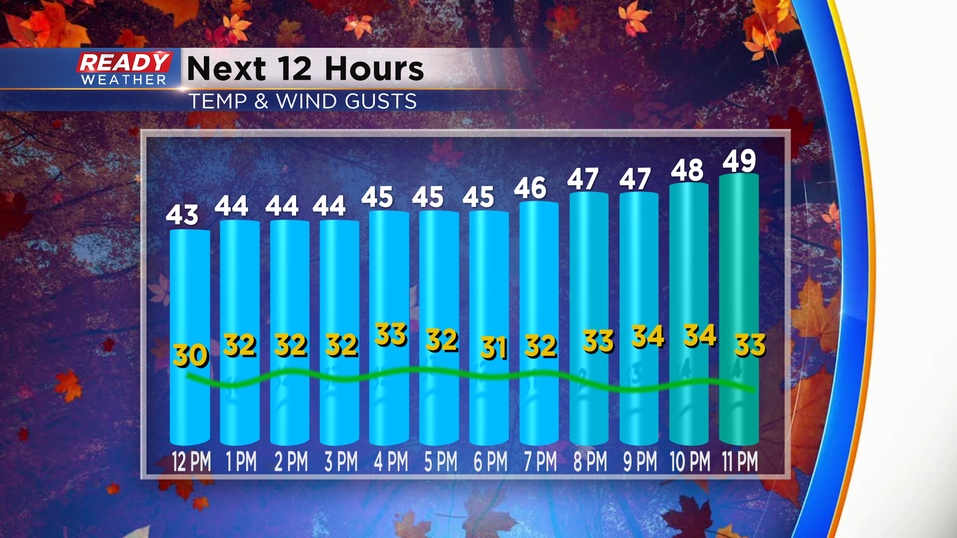
Winds will become even stronger behind the cold front Sunday morning with gusts between 35-50 mph expected. The strongest gusts of 45-50 mph are expected between 8am-2pm. There's a good chance a Wind Advisory will be needed for Sunday.
Download the CBS 58 Ready Weather App to track the incoming showers.