Mid Afternoon Update: Spotty showers and storms continue to pop


Updated: Thursday, May 16th 3:05pm:
Spotty downpours and isolated storms continue to pop this afternoon ahead of a front. The cell that's moved across southern Dane county continues to be the only stronger storm out there. Small hail and 45 mph are possible with that cell as it moves ENE at 25 mph into Jefferson county.

Other cells remain well below severe limits.
-------------------------------------------------------------
Updated: Thursday, May 16th 1:15pm:
One batch of scattered showers and isolated storms is approaching lakeside counties early this afternoon while additional storms are starting to pop west of Madison.

These storms are the ones we'll be watching this afternoon for strengthening. Isolated strong to severe storms are possible through sunset.
-------------------------------------------------------
Updated: Thursday, May 16th 11:15 am:
No change in the forecast late this morning. After a mostly dry morning, isolated showers are beginning to pop ahead of the fronts to our west.

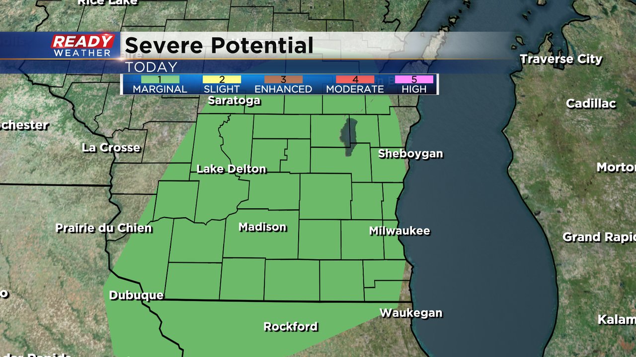
Scattered showers and storms will become more numerous throughout the afternoon into mid evening. All of SE WI remains in a level 1 of 5, Marginal Risk, for severe storms today. Damaging winds and hail are the main concerns, but we can't rule out an isolated spin up.
Download the CBS 58 Ready Weather App to keep up on the radar.
-----------------------------------------------------------------------
Updated: 9:00 a.m. May 16, 2024
A few showers and isolated downpours have rolled through a few of our northwestern counties like Dodge and Fond du Lac but rain for the rest of southeast Wisconsin is still on track to arrive in the late morning through afternoon hours.
Here's a radar image that will update with time:

There's no change to the chance for strong storms and the threats as highlighted below. The best timing for any strong to severe storms looks to be after 3 PM through the evening.
------
Posted: 7:04 a.m. May 16, 2024
After a nice day on Wednesday, showers and storms will return to Wisconsin Thursday. The morning commute looks dry with the best window for rain from 10 AM to 10 PM. This will not be a big area of steady rain for 6-8 hours but rather scattered showers and storms.

The best chance for some stronger storms will be in the late afternoon and early evening. Most of southeast Wisconsin is under a Level 1 Marginal Risk for severe weather so an isolated warning cannot be ruled out.
Any strong storms that do develop could see strong wind, small hail and even an isolated brief tornado.
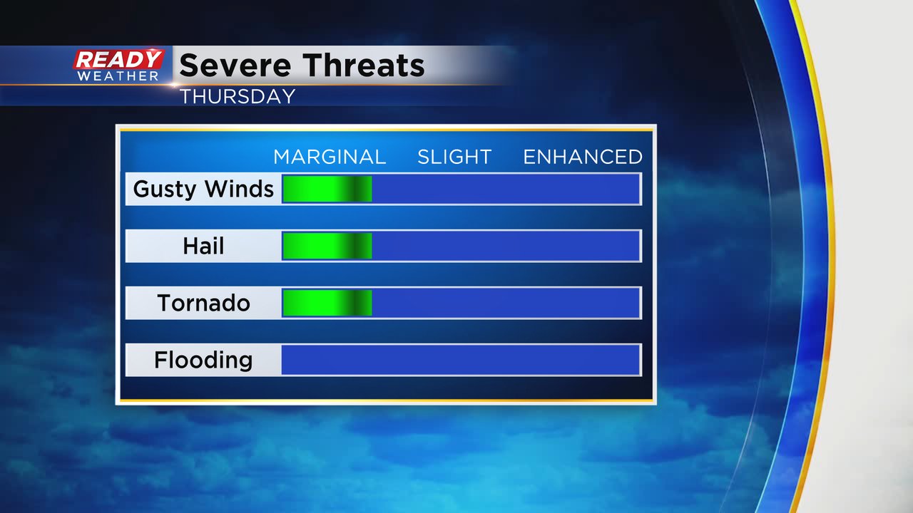
Flooding is not a big risk with these storms. Rain totals will depend on who sees the storms. Those that see multiple storms or a good stronger one might get over a half inch, most of southeast Wisconsin gets 0.25-0.50" with around a tenth of an inch in some areas that only get showers.

Download the CBS 58 Ready Weather app to track the storms.