Scattered showers and storms have arrived. Very heavy rainfall has been reported!


We've had a lot of 50/50 weather the last few days. This past weekend was 50/50 with a gorgeous Saturday then rainy Sunday. Memorial Day was 50/50 with dry weather in the morning then showers in the afternoon. And Tuesday will be another 50/50 day with some sunshine in the morning then showers and storms likely in the afternoon and evening.
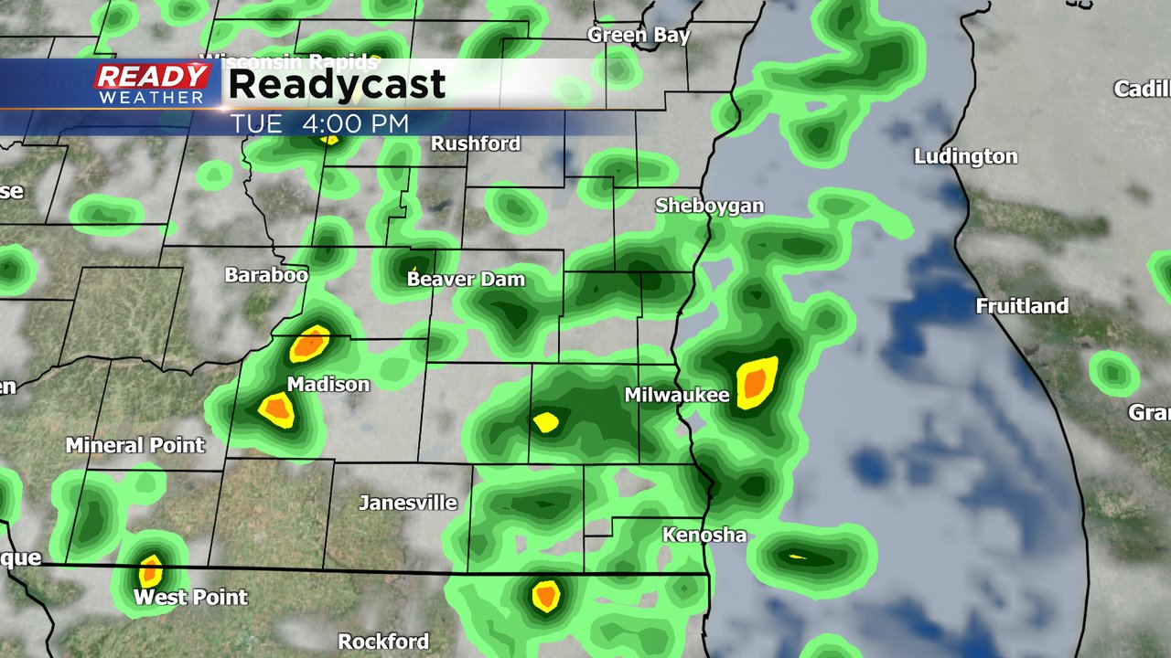
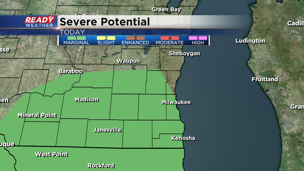
There is a slim chance that a few storms Tuesday could be on the stronger side. As the mid and upper levels of the atmosphere cools a bit a few storms could have some small hail and gusty wind can't be ruled out either. Parts of southeast Wisconsin are under a Level 1 Marginal Risk for Severe Storms.
Rain totals Tuesday range from 0.25" to 0.50" but communities that see thunderstorms could get a bit more.
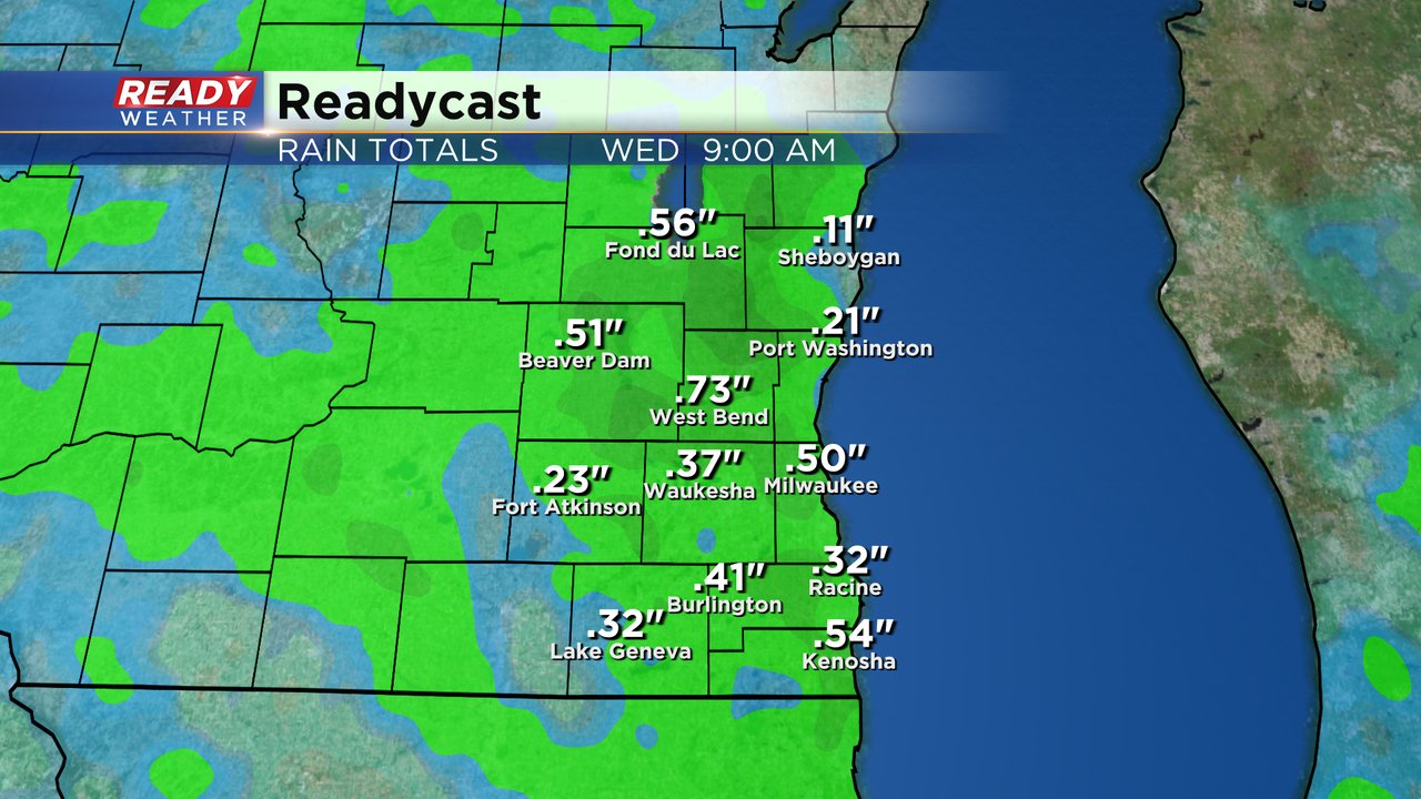
Tuesday's rain should wrap up around midnight then we finally dry out with no rain in the forecast for Wednesday, Thursday or Friday! Download the CBS 58 Ready Weather app to see when rain returns.