


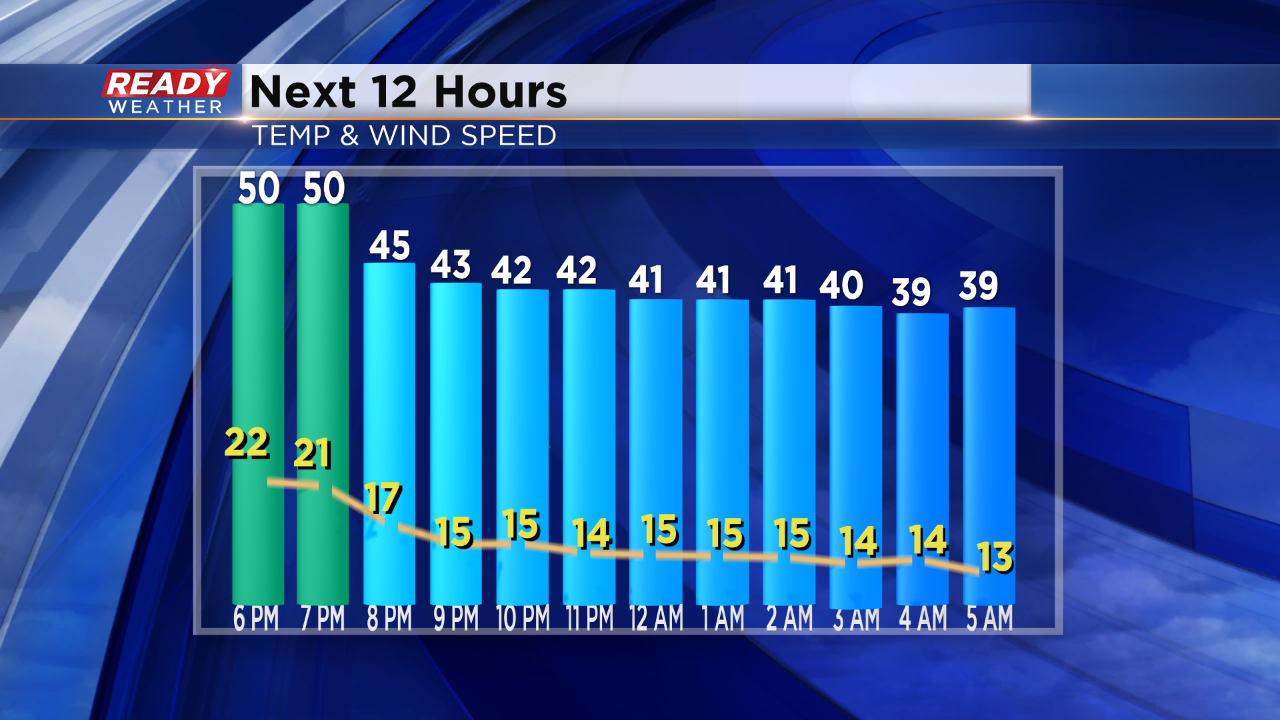
Temperatures will continue to drop into the 30s and 40s overnight on a strong west wind between 15 and 25 mph. It looks like temperatures will stay above freezing, so at least a refreeze isn't expected.
Scattered showers are possible tonight with a chance for a flurry on Friday.
______________________________________________________________________________________________________________
4:30 pm Update:
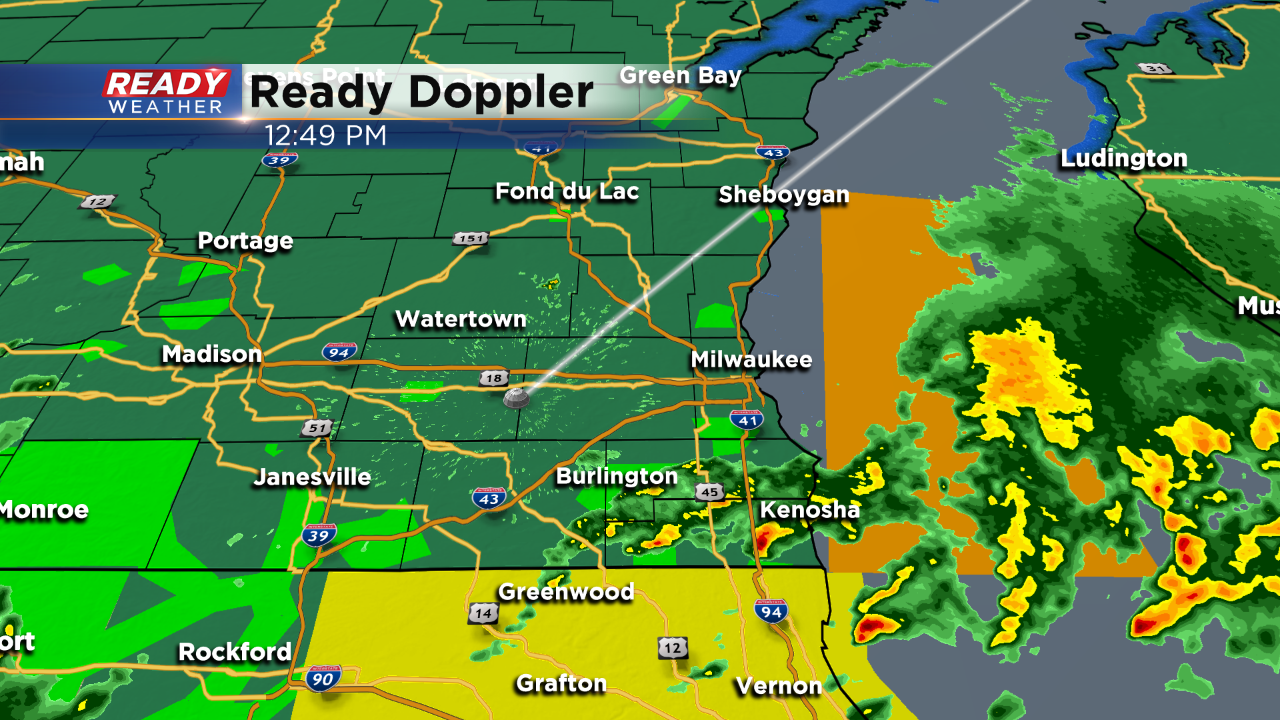
The severe threat and really the thunderstorm threat is over. The line of rain and storms have lifted north; however, another chance for showers will arrive this evening.
Wraparound clouds and showers from our upper level storm system will push back in this evening. Temperatures will drop back into the 40s.
______________________________________________________________________________________________________________
3:30 pm Update:
The line of showers and storms that produced hail and gusty winds continues to lift north. By 4 pm those storms will be north of our area.
Additional storms are not expected this evening. A quick wind shift will spike temperatures in the upper 50s and lower 60s.
______________________________________________________________________________________________________________
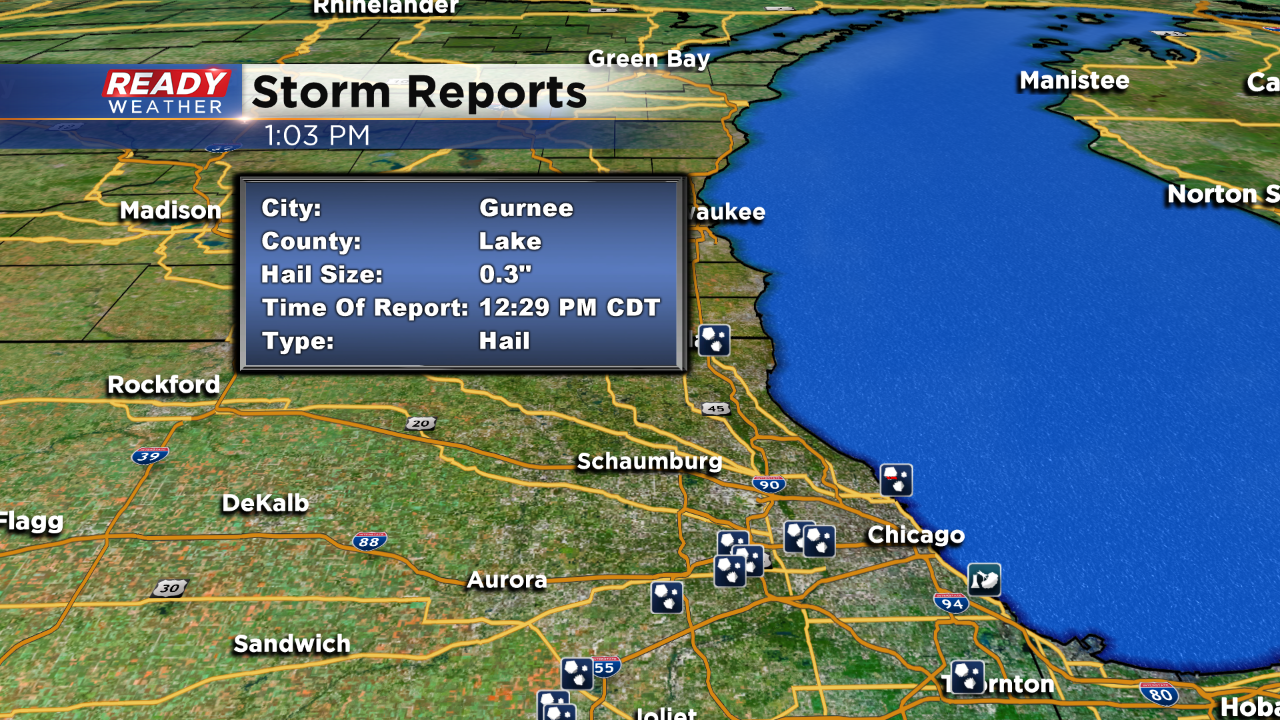
2:30 pm
Scattered showers and storms have developed across southeastern Wisconsin. The strongest storms have produced small hail and gusty winds to 50 mph.
The warnings have expired at this point; however, there's a chance for additional storms to pop throughout the afternoon.
______________________________________________________________________________________________________________
We are enjoying a mild day! With warmer temps and approaching gusty low pressure, we're also tracking storms.
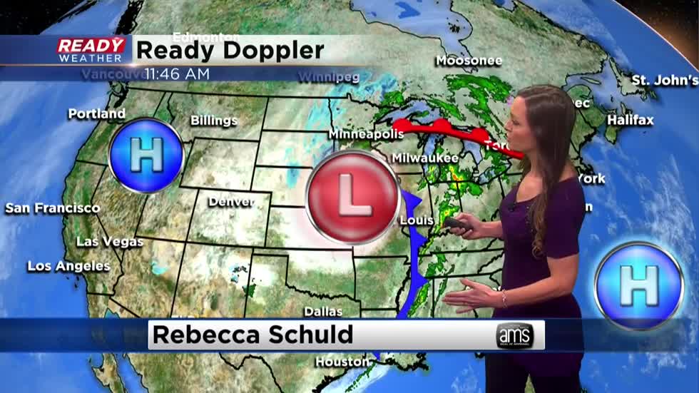
I'm meteorologist Rebecca Schuld.