


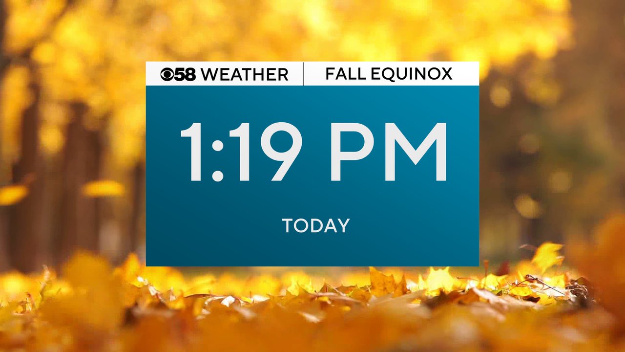
Happy Fall Y'all! The start to the new season is here. The fall equinox happens officially at 1:19 PM for the start of the Autumn season.
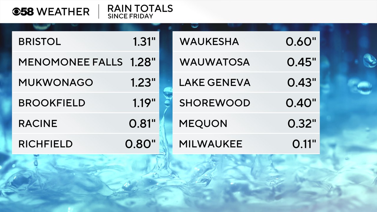
The start to the new season is still feeling like the end of summer with highs in the upper 70s to around 80 for Monday and scattered showers are storms likely. The continued chance for storms comes after a weekend that saw very scattered rain activity. We even had a severe thunderstorm warning for hail in Walworth, Racine and Kenosha Counties on Saturday. Some areas picked up over 1" of rain over the weekend while others got less.
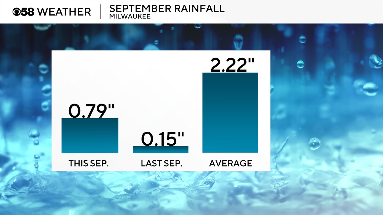
Milwaukee didn't see much of the heavy rain at the airport so our September rainfall total stays below average at 0.79" which is almost an inch and a half below the September average.
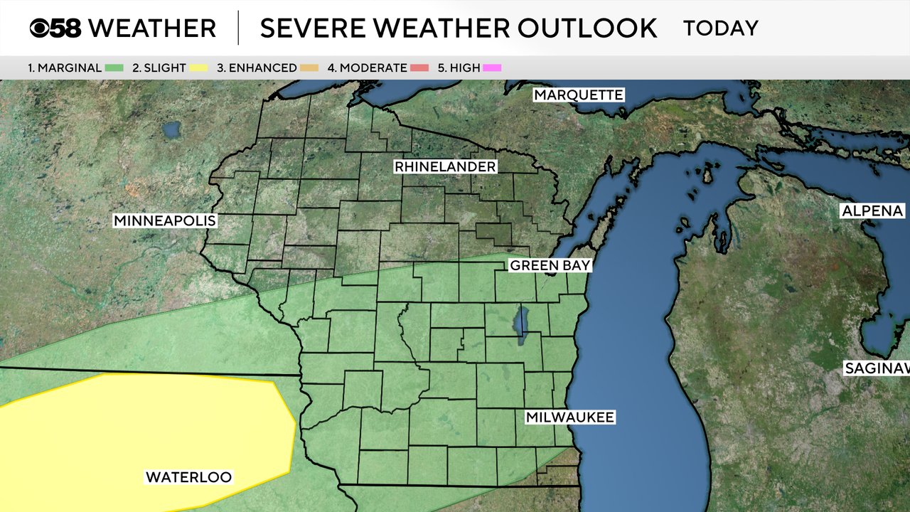
Scattered showers and storms look likely for Monday with some severe storms possible in northern counties during the morning hours then more storms possible in the afternoon and especially the evening. Scattered storms are expected to continue off and on through Tuesday with some lingering showers possible Wednesday.

Any storms that do form and move through southeast Wisconsin on Monday have the potential to be on the stronger to severe side. A Level 1 Marginal Risk is in place for most of the southern half of the state. Gusty wind and hail will be the main threats along with some heavy rain and thunder/lightning.
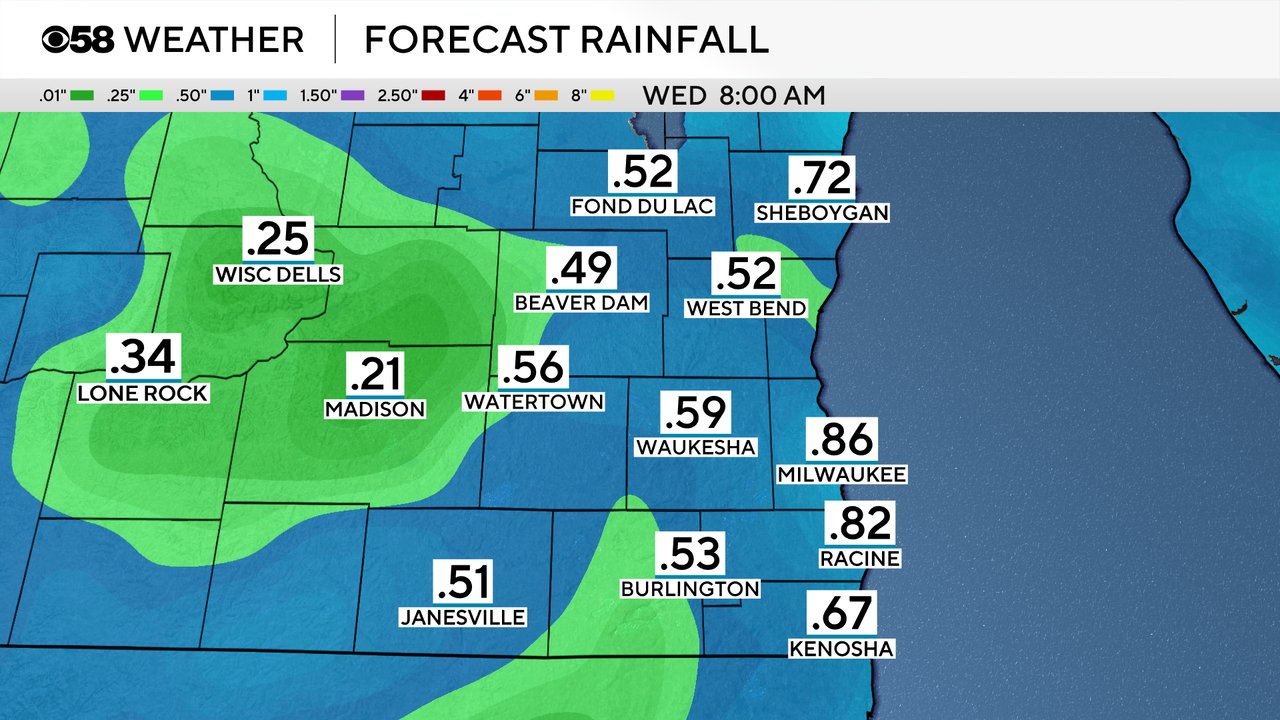
With scattered storms possible both Monday and Tuesday, parts of southeast Wisconsin could see 0.25-0.75" of rainfall over the next 48 hours.
Download the CBS 58 Weather app to track the storms.