Second soggiest end to April leads to above normal rainfall for the month
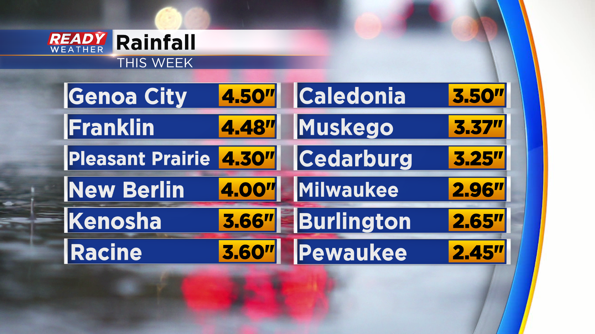
The slow moving low pressure system that brought rounds of rain to southeast Wisconsin over the last 3 days is finally moving to the east, but not before dumping more than a month’s worth of rain in some spots. 2-4” of rain was common across Milwaukee, Racine, Kenosha, Waukesha, Walworth, and Ozaukee counties, but some spots saw closer to 4.5 inches!
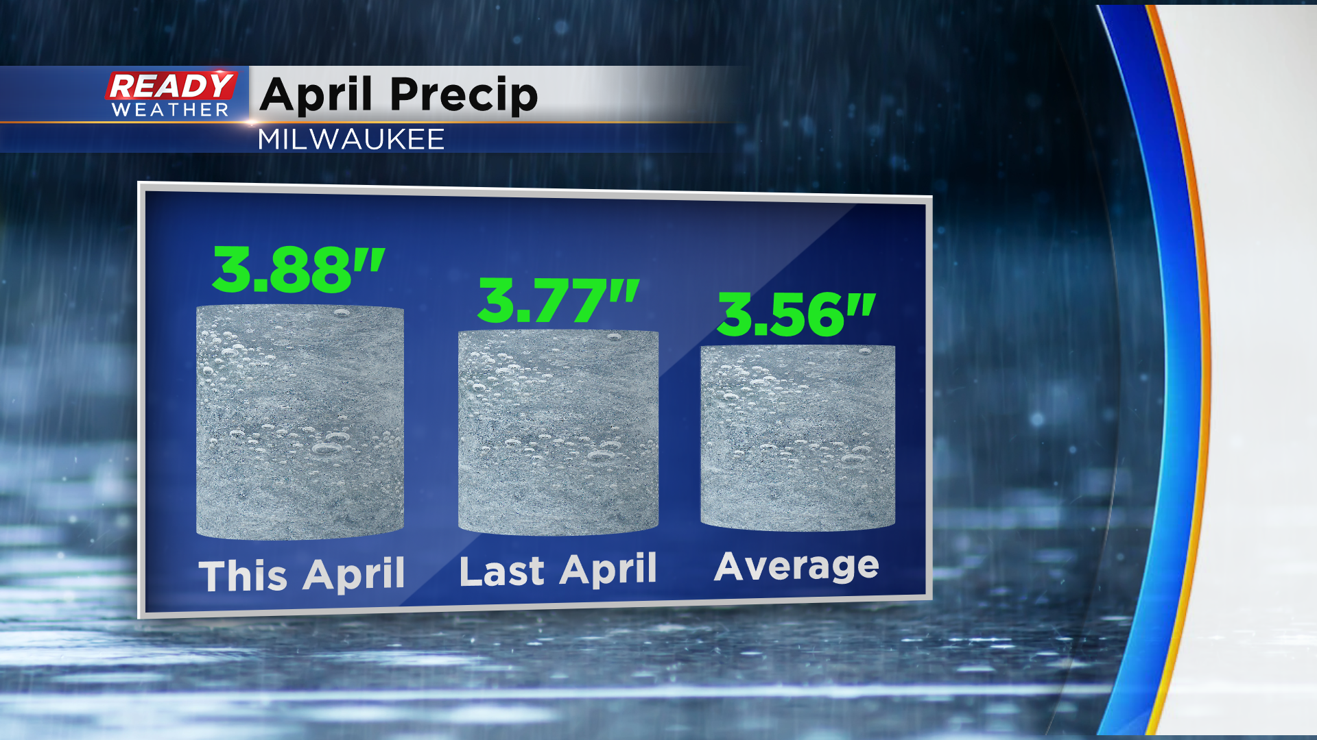
Going into this week, Milwaukee was on pace to have the 10th driest April on record. Now we’ll end up a third of an inch above normal for rainfall this month.
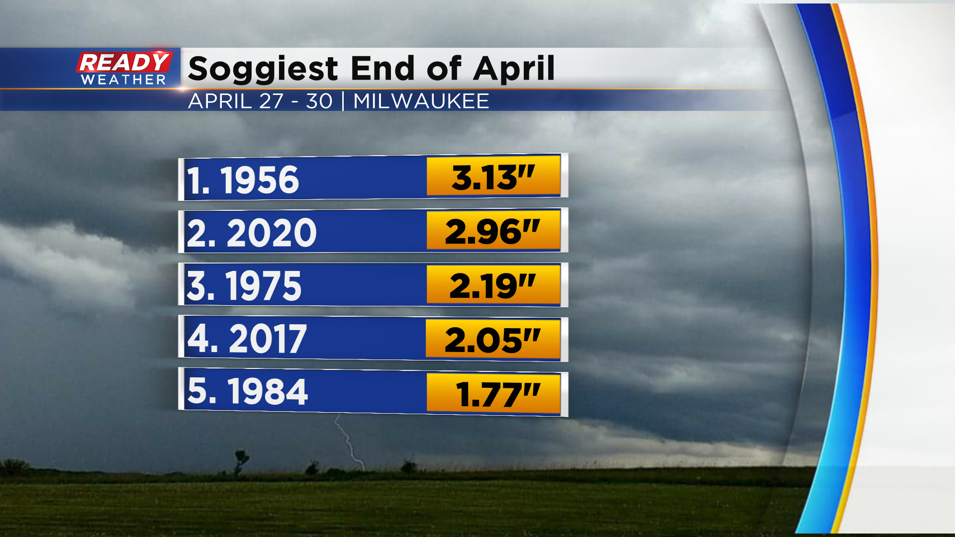
The 2.96” of rain that fell at General Mitchell airport over the last 4 days made this the second wettest end of April on record.
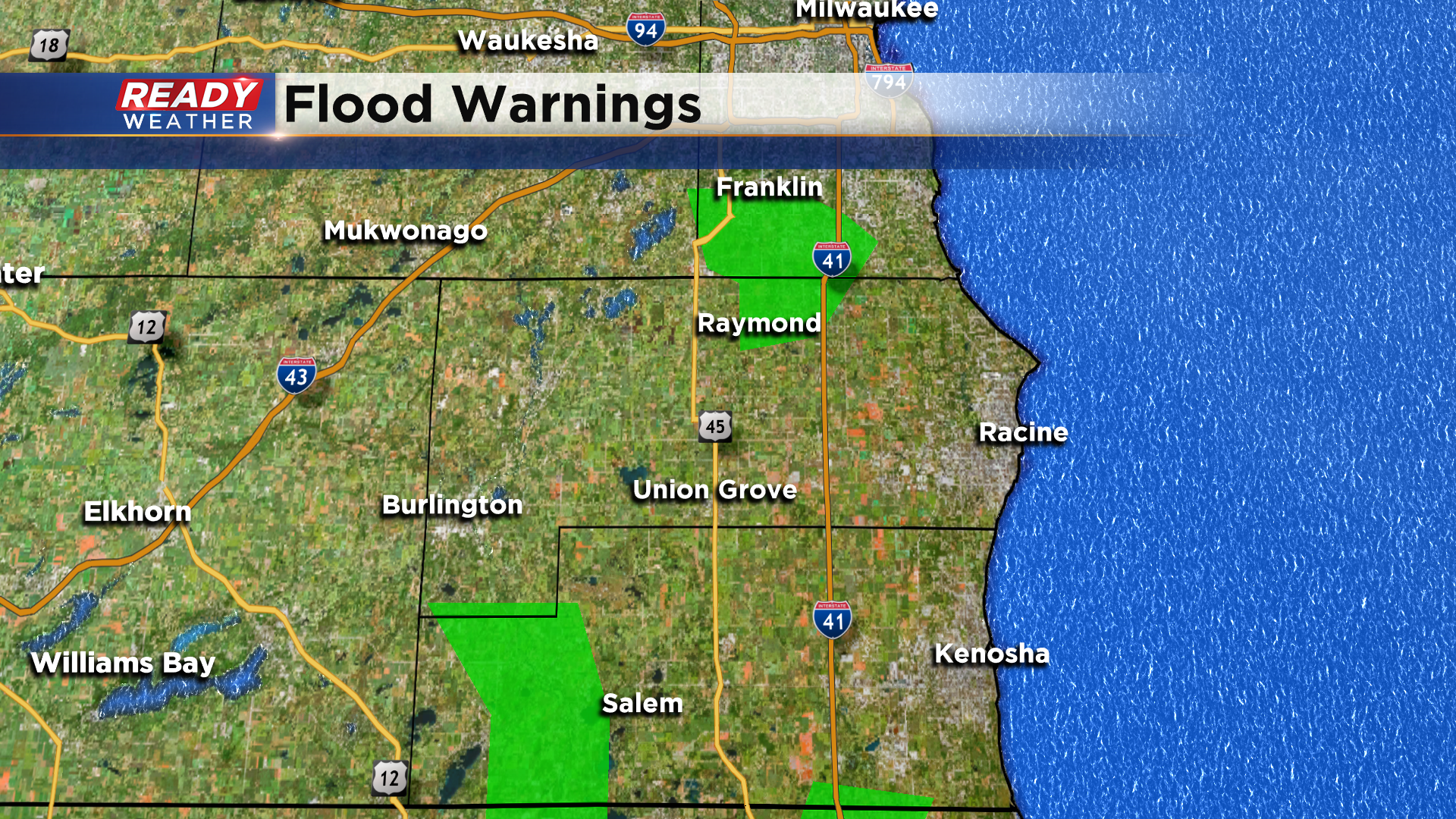
All of this rain is causing area rivers to rise above minor flood stage. The Root River Canal in the Village of Raymond is under a Flood Warning until Saturday morning. The river will crest at 10.8 ft. this evening. A Flood Warning also continues for the Root River in Franklin until Friday afternoon, with the river cresting around 8.5 ft this afternoon. The Fox River in New Munster is under a Flood Warning until Monday evening. The Fox River will crest around 12.3 ft Friday morning, and at that height water will get close to homes in Wheatland and Salem Lakes before receding.
Thankfully we’re looking at some drier weather, some sunshine, and warmth over the next few days! Besides a small chance of an early morning sprinkle on Saturday, this weekend should be dry.

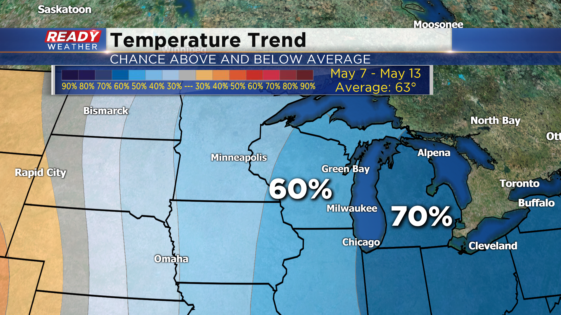
You’ll want to take advantage of the warm and nice weather this weekend because below normal temperatures are favored for the first half of May.