This past week has been Severe Weather Awareness Week across southeast Wisconsin. A chance to brush up on what severe weather terms mean and prepare your safety plan before our severe weather season really ramps up. Monday started off talking about the difference between "Watches" and "Warnings". Bottom line, warnings are worse. That is when severe weather or tornadoes are likely, actively occurring or imminent. A watch is when conditions are favorable for severe weather or tornadoes but not occurring at the moment. A severe thunderstorm or tornado watch is typically issued 2-8 hours before severe weather whereas a warning is issued when storms are expected over the next 60 minutes.

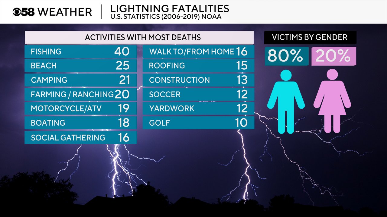
Even when severe weather is not expected, thunderstorms can be dangerous. There are multiple fatalities every year from lightning strikes doing a variety of outdoor activities. Even if it's not raining at your location you can still be struck by lightning. If you can hear thunder, you are close enough to the storm to be struck by lightning.
When we are analyzing the risks for severe weather on any given day we reference the Storm Prediction Center's Severe Risk Categories. Those categories range from a low end Level 1 Marginal Risk to a high end Level 5 High Risk. Most of the risks across Wisconsin are Level 1 Marginal or Level 2 Slight when severe weather is usually fairly isolated. We average one to three Level 3 Enhanced Risks every year when some intense storms and a few tornadoes are possible. Level 4 Moderate and Level 5 High Risks are fairly rare in Wisconsin. We average a Level 4 Moderate risk once every two to three years and High risks even less than that.

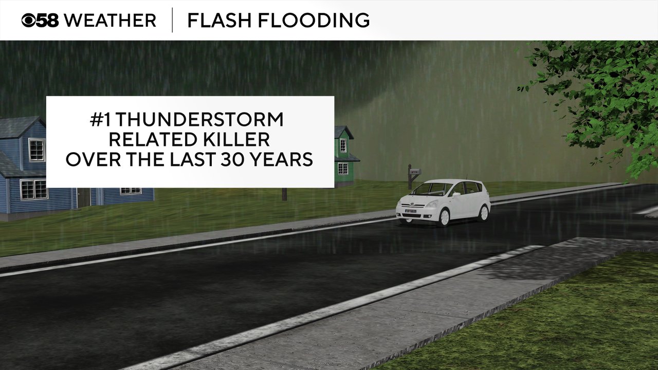
Strong thunderstorms are typically accompanied by heavy rains and if that rain falls too heavy, too fast, flash flooding can occur. Flash flooding is the deadliest thunderstorm related killer over the last 30 years. Just six inches of moving water can sweep someone off their feet and move vehicles. Two feet of moving water is enough to move large trucks. The phrase "turn around, don't drown" is so important during flooding. It's always best to find a different route than to drive through flooded roadways.
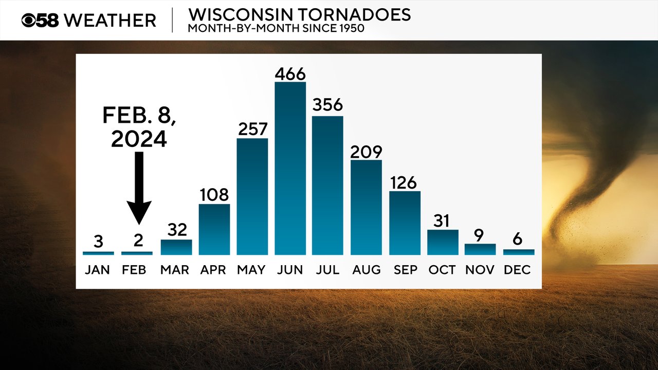
Tornadoes in Wisconsin are possible any time of year. After the February tornadoes of 2024, Wisconsin has witnessed a tornado every single month of the year. Our severe weather season starts in April and becomes very active from May through August. June is the peak of tornado season in Wisconsin.
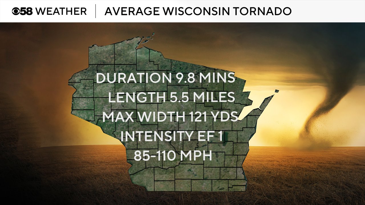
The average Wisconsin is an EF-1 with wind speeds up to 110 mph. Getting the huge tornadoes they see down south is pretty rare around here with the average tornado in Wisconsin a little wider than a football field and on the ground for about 10 minutes and just over five miles.
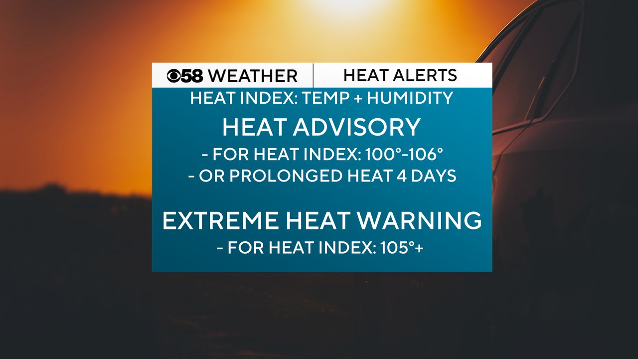
We ended Severe Weather Awareness Week talking about heat. It is the number one weather related killer. There are two types of heat alerts issued by the National Weather Service. A Heat Advisory is issued when heat index values, or the feels like temperature, is above 100 degrees. An Extreme Heat Watch or Warning are issued when the heat index is expected to be over 105 degrees. New for 2025 the watch/warning is now called "Extreme". For previous years it was referred to as an "Excessive" Heat Watch/Warning.
Download the CBS 58 Weather app to track when severe weather, tornadoes and extreme heat are possible this severe weather and summer season.
