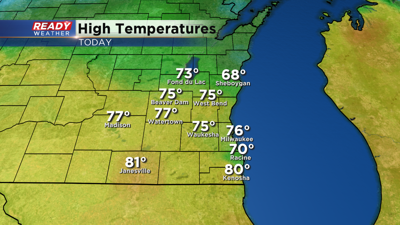
We've enjoyed another beautiful afternoon in southern Wisconsin.
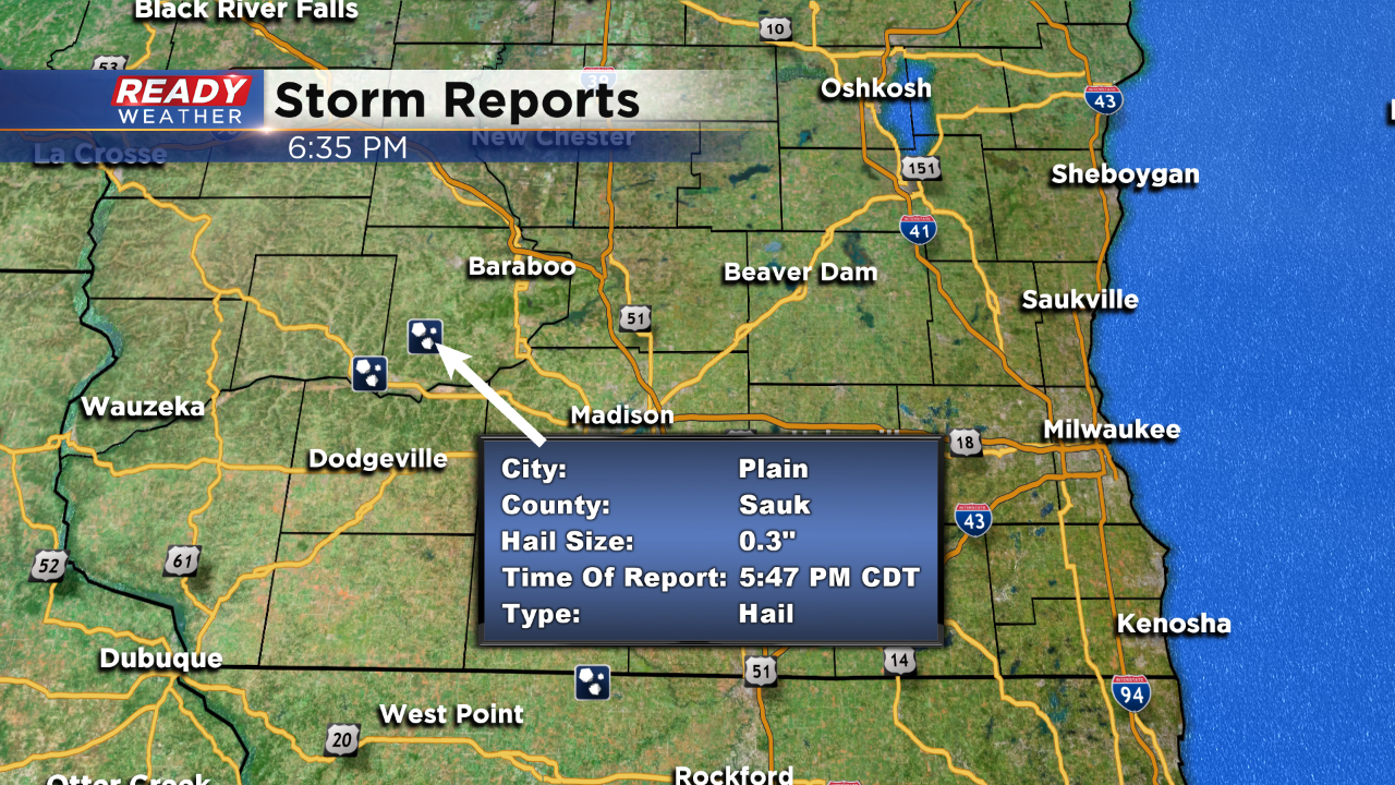
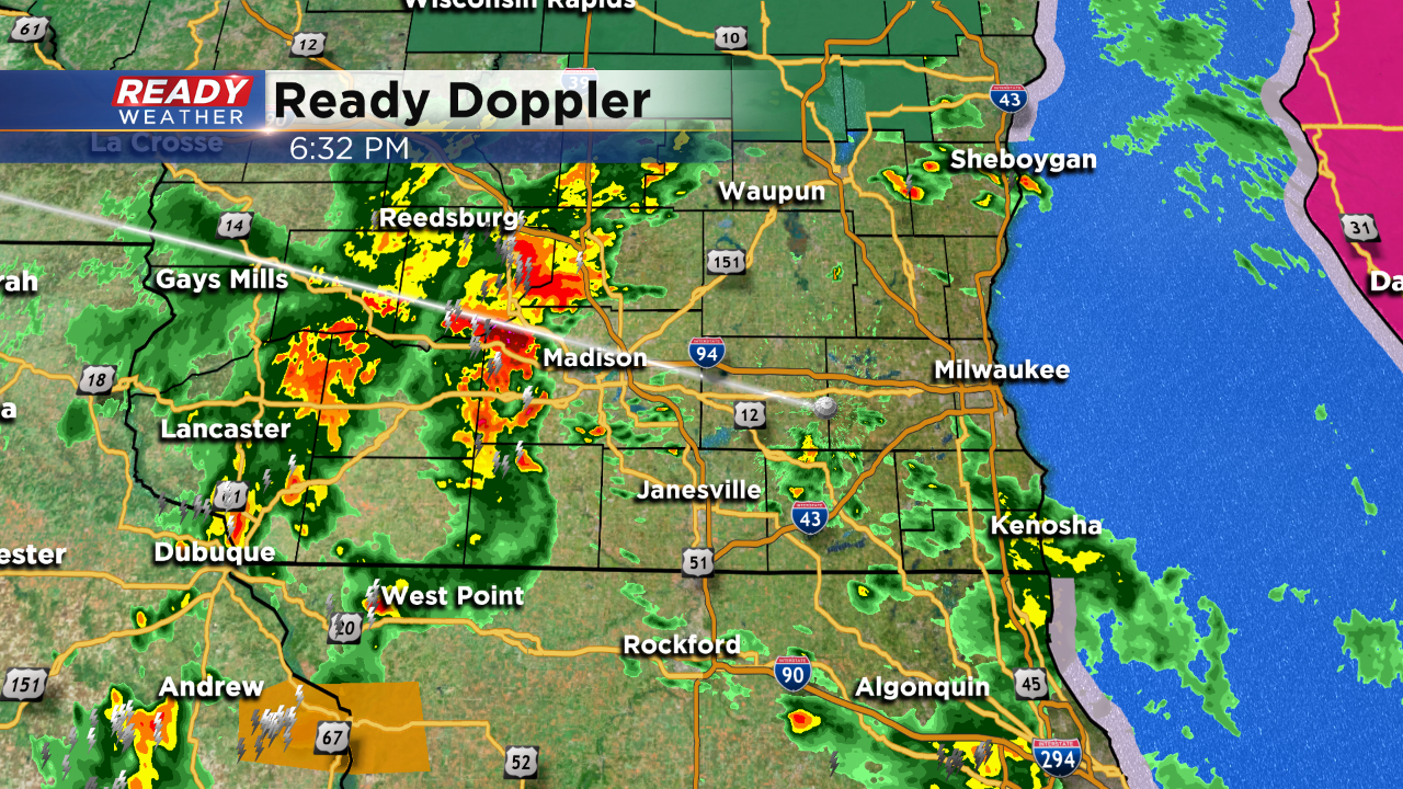
Milwaukee has seen back to back days in the 70s, the warmest air of the season! However, an approaching area of low pressure with trailing cold front is pushing into this warmer air mass. The clash has triggered showers and storms today, west of the area. Most of the severe thunderstorms warnings have been issued today due to a hail threat. Hail to around a quarter in size has been reported in the strongest storms.
Here's what we're tracking as of 6:30pm.
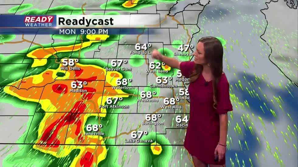
Out ahead of that main batch of storms in western Wisconsin a few isolated cells have flared up. Storms have developed moving through Fond du Lac and Sheboygan counties as well as a few lighter thundershowers sliding across our southern counties that border Illinois. As any additional storms develop, brief gusty wind along with heavy downpours is possible. The strongest storms have also had lightning and quarter size hail. The best window of time for these storms to reach the greater Milwaukee area still appears to be after 9pm.
Find shelter as any storms pass by your area. The threat for storms diminishes after midnight.
I'm meteorologist Rebecca Schuld