Small chance of showers, isolated storm late tonight into Sunday


It's been a mild start to the weekend across southeast Wisconsin with temperatures sitting in the mid 80s under hazy sunshine. However, there's a cold front looming in northern Wisconsin that will drop into our neck of the woods overnight tonight. This front looks to stall out in southern Wisconsin or along the WI/IL border on Sunday, which could lead to a few isolated showers or storms. There's a small chance (20%) for a couple isolated showers or a storms well after midnight into Sunday morning north of I-94, however there's a strong cap in place so showers and storms may struggle to develop until midday Sunday.
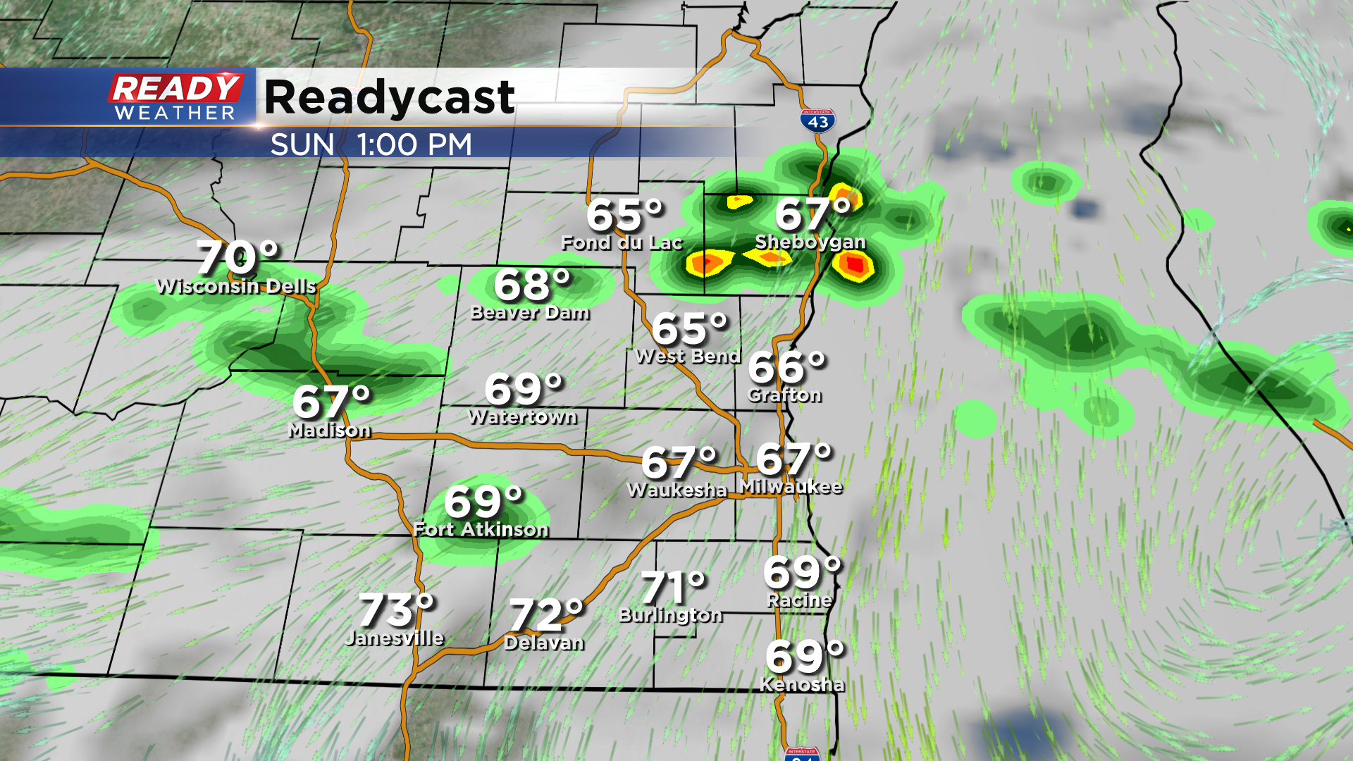
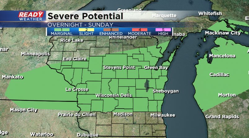
*IF* storms are able to develop, they could be on the stronger side and produce large hail or gusty winds. Best chance of an isolated stronger storm will be north of I-94 where there is a Marginal Risk (level 1 of 5) in place.
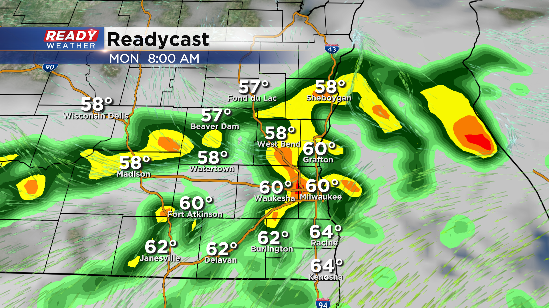
This front will remain stalled near the WI/IL border Sunday night into Monday morning, with another round of scattered showers and isolated storms expected.
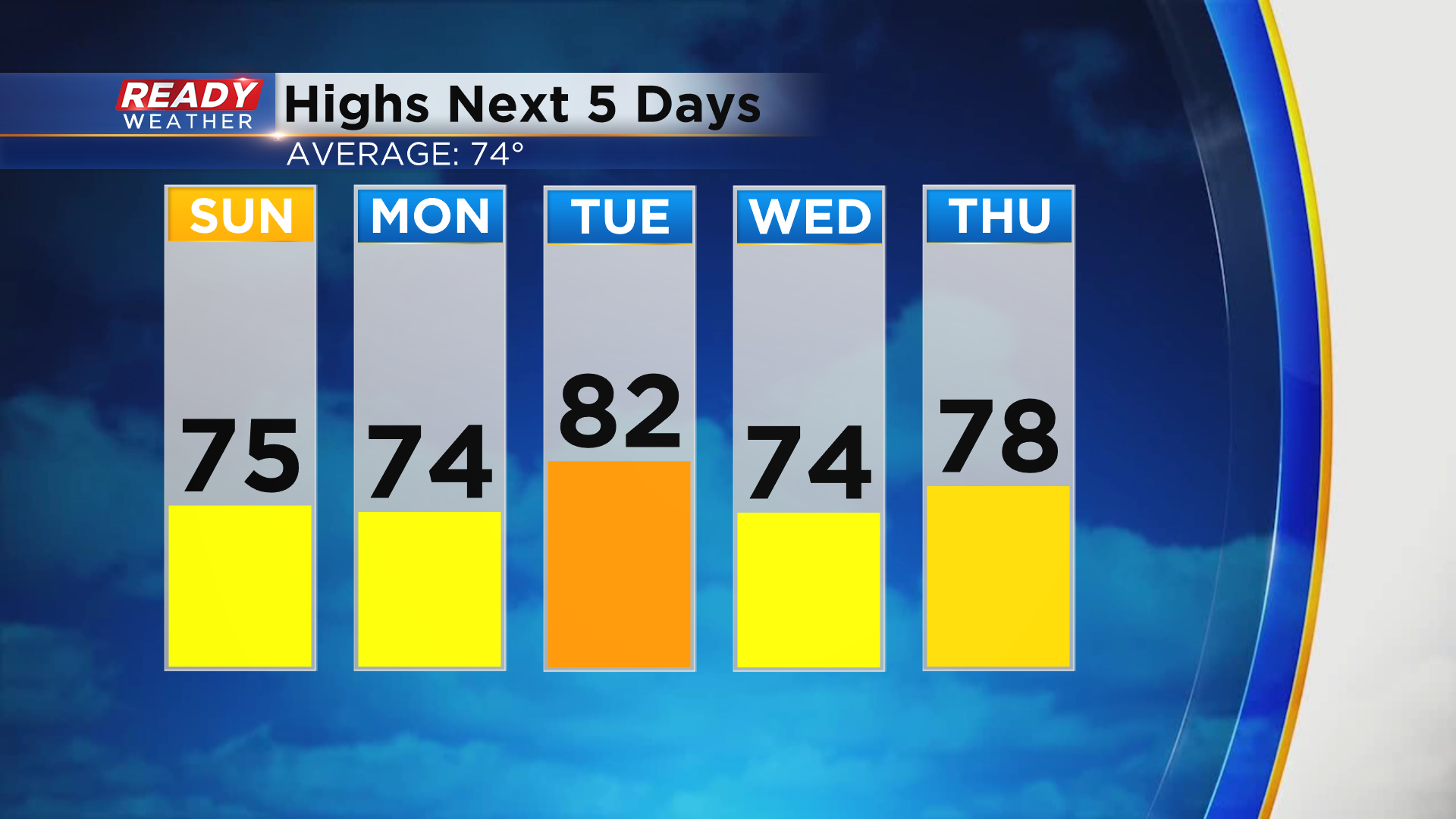
The front will lift northward as a warm front Monday afternoon and evening, giving us a break from the storm chances until the cold front moves through on Tuesday. Temps will rise back into the low 80s ahead of the front on Tuesday and cool into the low to mid 70s behind it on Wednesday. However, temps look return above normal in the upper 70s to low 80s for the second half of the week.
Download the CBS 58 Ready Weather App to get any severe alerts sent to your phone.