Snow chance decreasing for Tuesday but increasing on Wednesday
The snow chance is decreasing for Tuesday, but increasing for Wednesday. We will miss out on the Tuesday snow as it mainly stays south of Chicago. Wednesday will feature some scattered snow showers and then Thursday is when we see the sunshine return and precip chance go down to 0%.
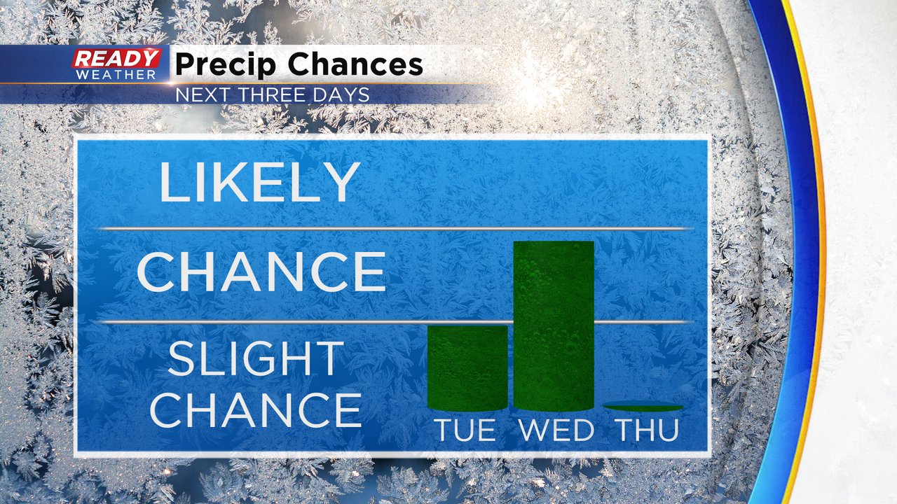
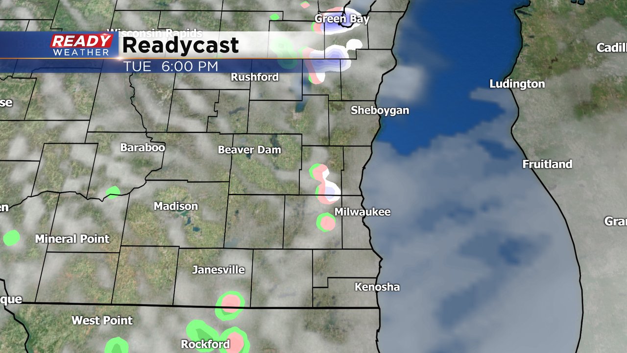
An isolated rain/snow shower can't be ruled out for Tuesday, mainly in the afternoon and evening. But if you do see a snow shower the chance for any accumulation is very, very low.
Wednesday's chance is looking better with some scattered mix and snow showers possible during the morning, afternoon and evening. Those showers look more like the variety that pop up with a downburst for 10 or 15 minutes followed be a dry break and even some sunshine and then we do that over and over throughout the day.
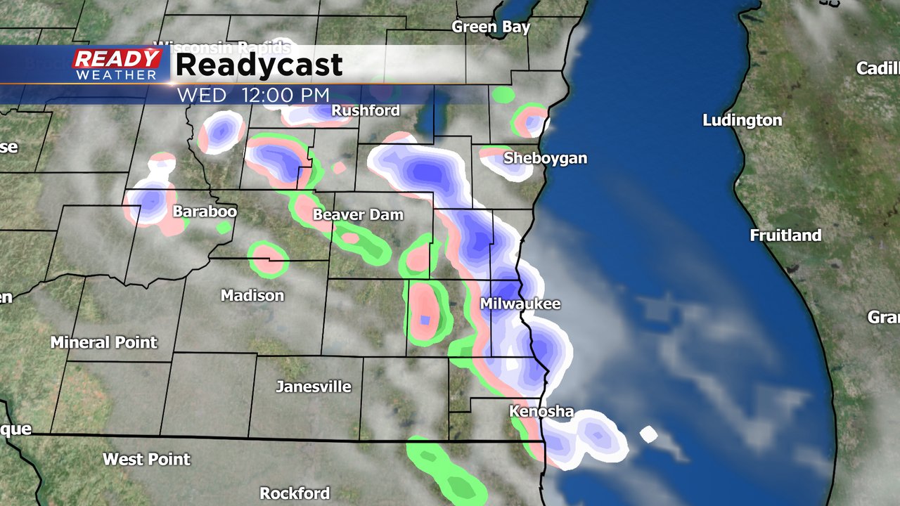
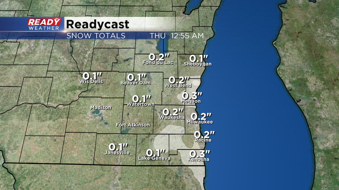
Anytime we get those snow downbursts on Wednesday we could get a dusting of snow or even a few tenths. Any snow that falls during the day Wednesday should melt pretty quick and anything that lingers in the evening will melt Thursday with some sunshine.
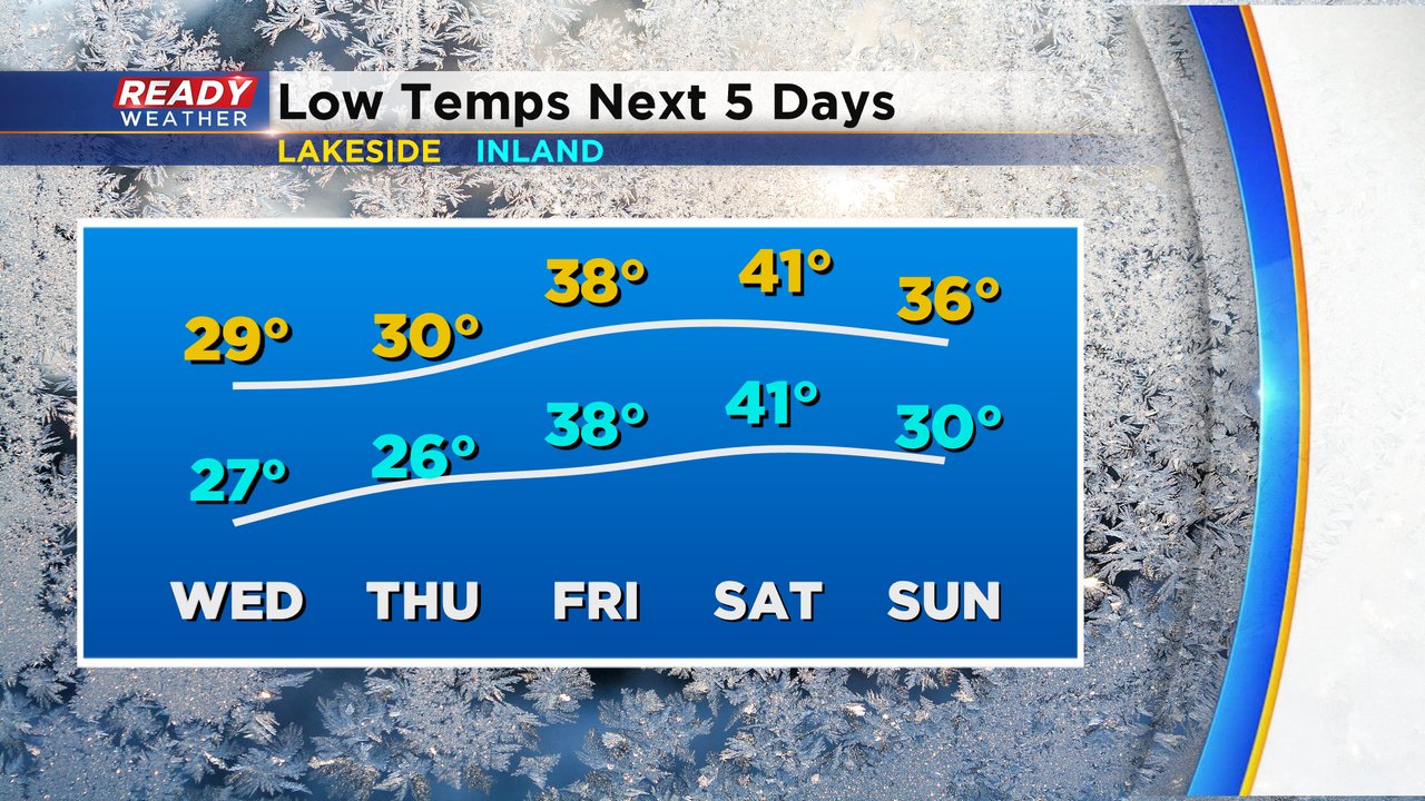
In addition to the chance for snow showers the chilly air is still well in place. Tuesday morning we woke up to a widespread freeze for all inland locations with a few places falling into the upper 20s. Lakeside locations stayed around 34 or 35*. Temps look even colder for Wednesday morning with even lakeside communities dropping into the 20s so a freeze is likely for everyone with a hard freeze below 28* possible inland. Thursday morning is also freezing before we get a break as temperatures warm Friday and Saturday morning and then a chance for frost Sunday morning.
Download the CBS 58 Ready Weather app to track the mix and snow showers the next few days and falling temps.
