Staying warm this week with a few rounds of storms possible Tuesday


The new work week will start dry and still mild. High temperatures Monday are expected to reach the mid 60s and we stay there on Tuesday as well. Wednesday is likely the warmest day of the week with highs in the low 70s. Then a cold front moves in dropping us into the 50s for Thursday. We rebound a bit for the weekend with highs in the 60s.

The dry weather comes to an end Tuesday. Multiple rounds of storms are possible. The most likely round looks to be in the mid to late morning with some strong thunderstorms and downpours. Then if we can get some clearing and sunshine we may get a few more stronger storms in the afternoon and a last round in the evening.
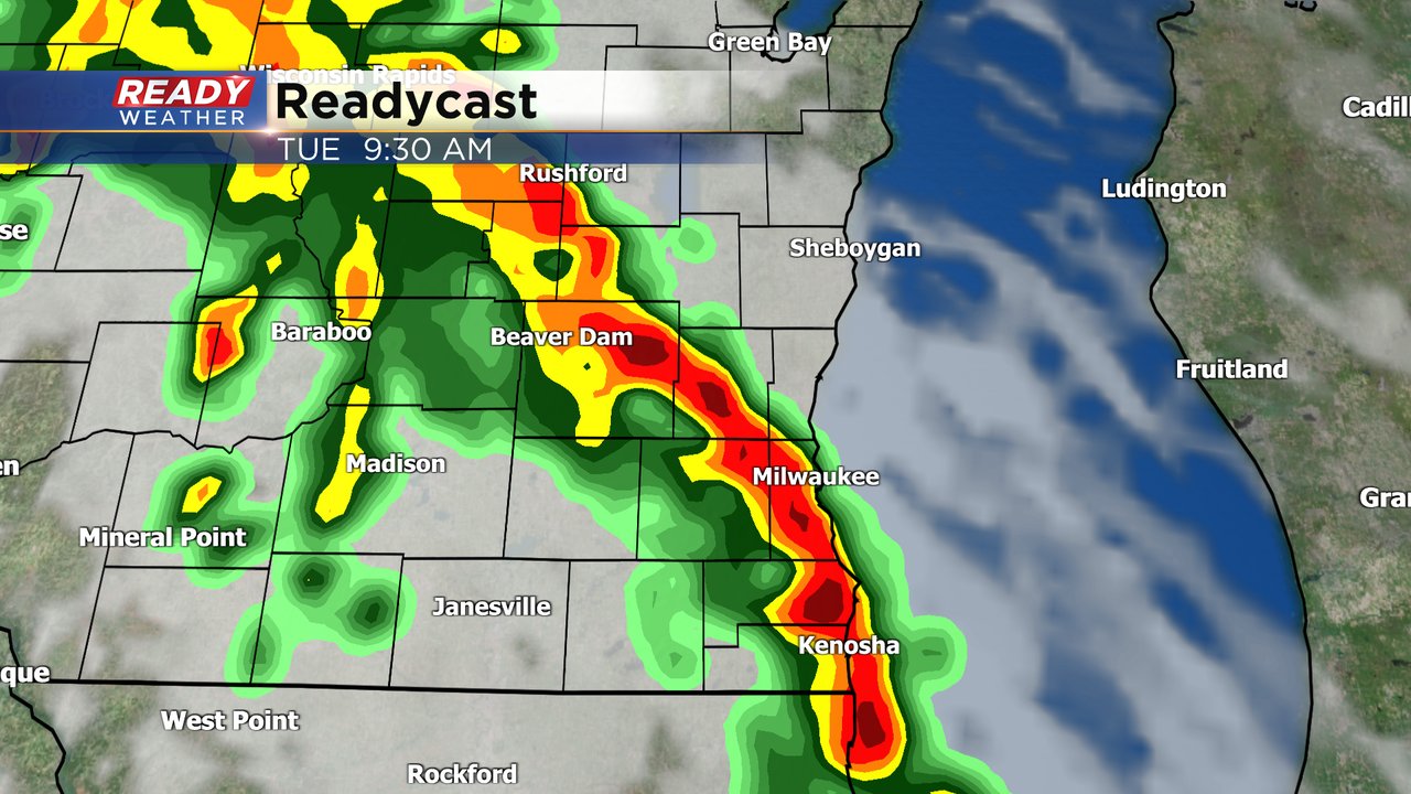
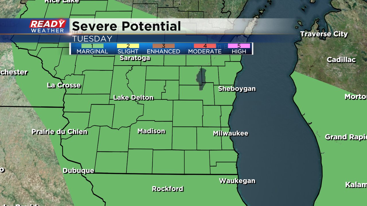
Any storms that do develop on Tuesday from the morning through the evening could be on the stronger side. Gusty wind and small hail will be possible with any storms. All of southeast Wisconsin is currently in the Level 1 Marginal Risk for severe storms.
The storms Tuesday will drop a good soaking rain with most of southeast Wisconsin getting just above or below a half inch of rain. This continues what has already been a top 5 wettest start to meteorological spring.

Download the CBS 58 Ready Weather app to track the Tuesday storms.