Winter weather advisory is cancelled. Light snow and some freezing drizzle possible.


Updated: Thursday, February 9th: 6:00pm:
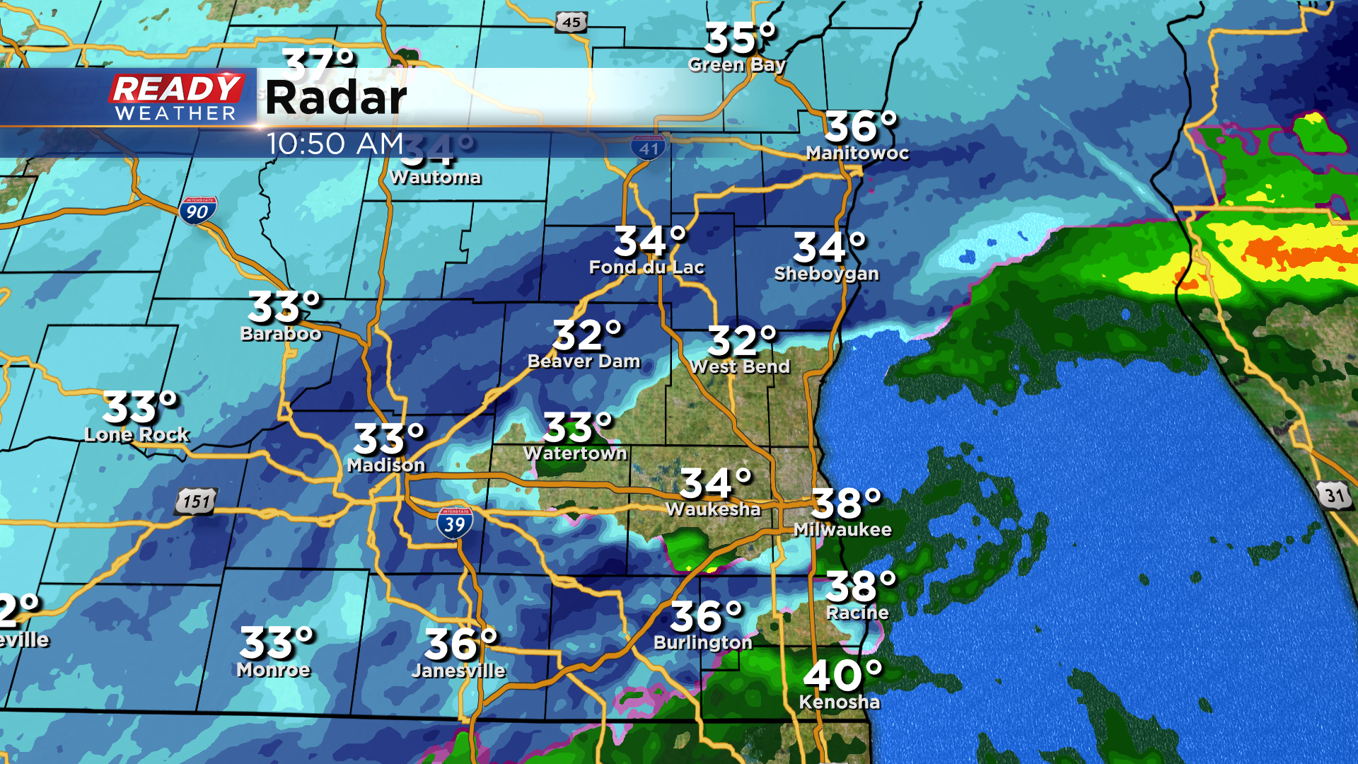
One last batch of light snow is rotating across southeast Wisconsin as the low pressure system pulls away from the area. No additional accumulation is expected. As the snow ends some patchy freezing drizzle is possible.
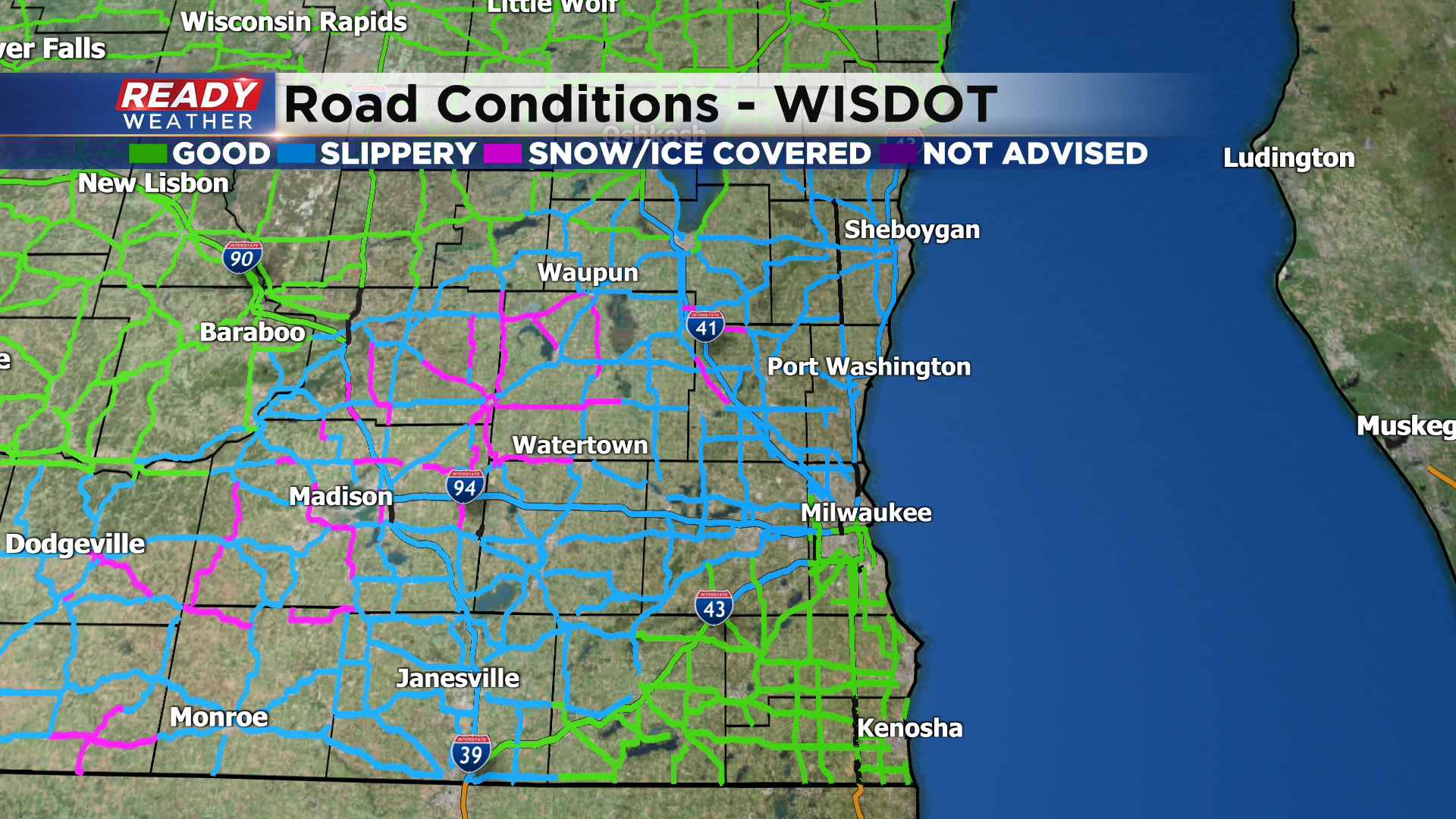
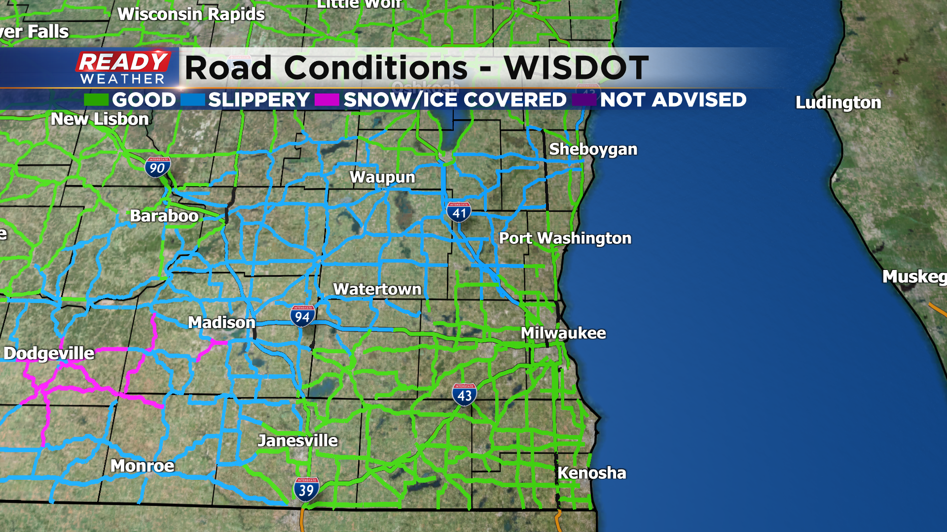
Temps continue to sit at or above freezing so only seeing slippery stretches on area roads at the moment. If you have enough snow/slush to shovel, please take it easy! This is heart attack snow (extremely wet and heavy). Temps will drop back into the 20s early Friday morning, so any puddles or slush will freeze and create icy spots during the morning commute.
-------------------------------------------------------------
Updated: Thursday, February 9th: 2:45pm:
Widespread snow is still falling across southeast Wisconsin, but it's a bit lighter than a few hours ago.
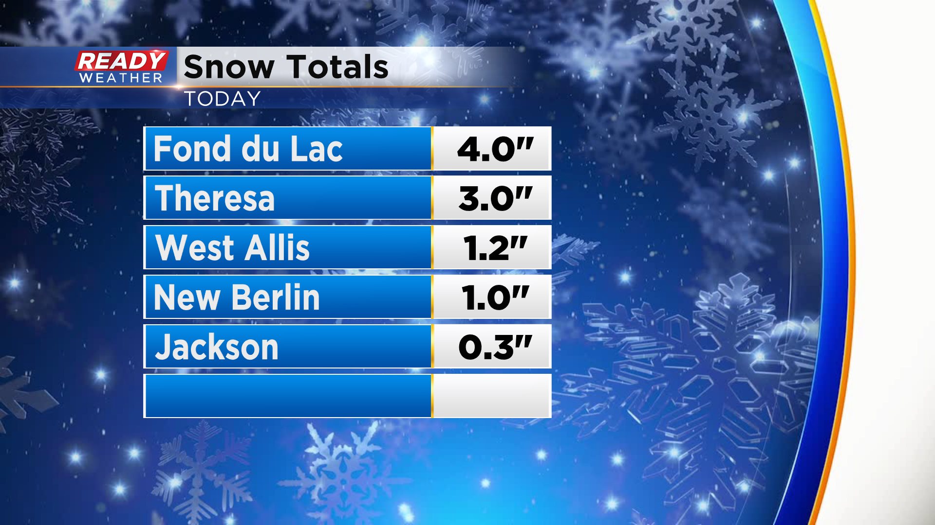
The snow remains very wet, and with temperatures at or above freezing it's difficult to accumulate. There is quite a bit of slush around the Milwaukee metro, but it continues to melt. Not many snow reports as of 3pm, but a couple 3-4" have come in in Dodge and Fond du Lac counties.
Accumulating snow tapers off after 5 pm but light flurries will continue into this evening. Watch out for icy spots tonight into Friday morning as temps drop into the 20s overnight.
---------------------------------------------------------------
Updated: Thursday, February 9th: 12:55pm:
Rain has changed to heavy wet snow in the Milwaukee metro area with a heavy band of snow currently sitting from Whitefish Bay to New Berlin.
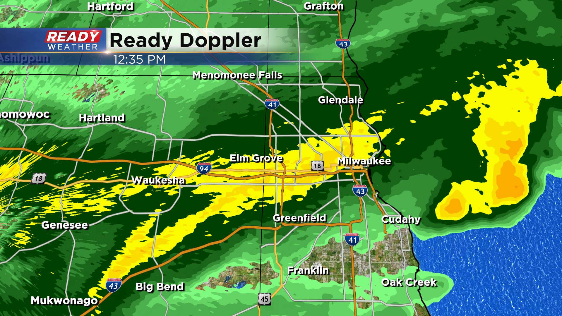
Another area of heavier snow is currently sitting across Jefferson county. Moderate to heavy wet snow will continue through the rest of the afternoon. There have also been areas of rain and sleet mixing in at times in Milwaukee, Racine, and Kenosha counties.
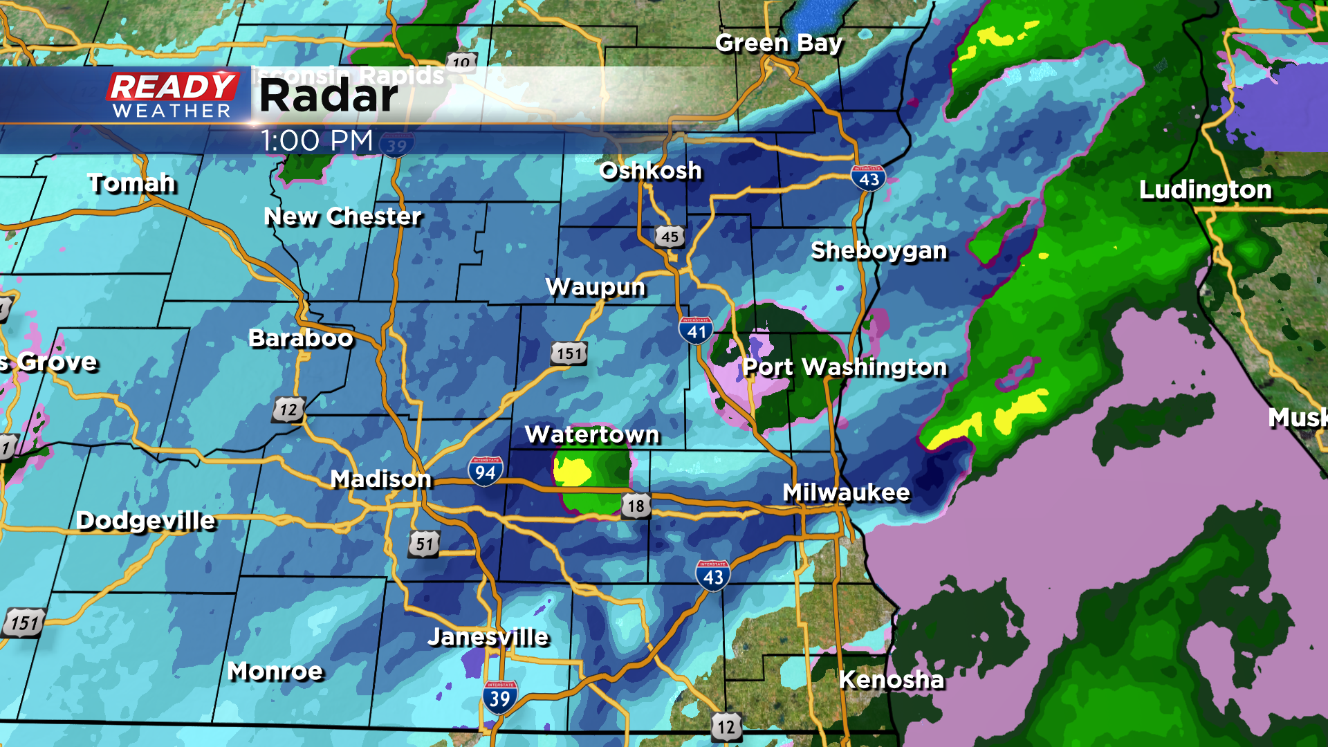
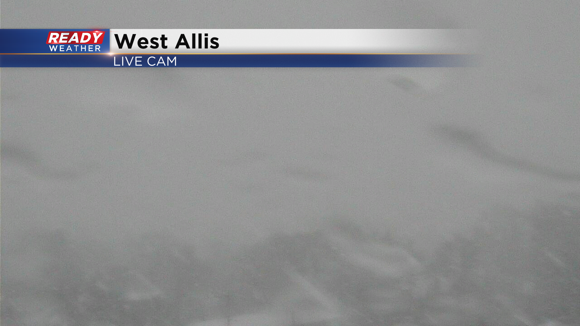
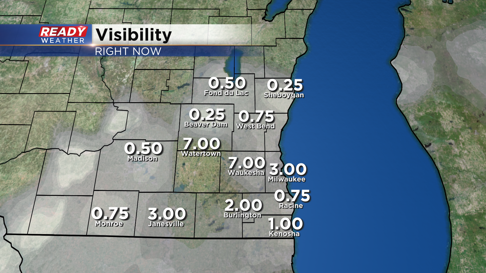
Visibility has been very low in these heavier snow bands with under a quarter mile currently in West Allis. This is a current view of American Family Field from the roof of our station.
Snow is accumulating quickly in the heavier bands of snow with slippery conditions now being reported across the Milwaukee metro and snow covered roads well west.
Plan on slick conditions during your evening commute, but precipitation will become much lighter closer to sunset.
-----------------------------------------------------------------------------------
Updated: Thursday, February 9th: 11:15am:
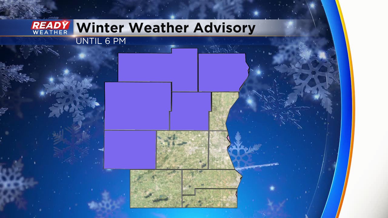
Dodge county has been upgraded to a Winter Storm Warning through 6pm this evening. Heavy snowfall rates of 1"/hr or more will continue into this afternoon with snow totals between 4-8" expected in this area.
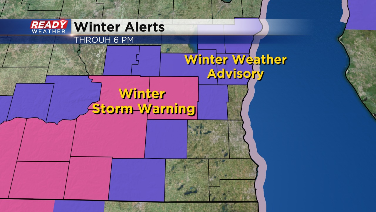
3-6" is still expected in surrounding counties in the Winter Weather Advisory.
-------------------------------------------------
Updated: Thursday, February 9th 10:55am:
Steady rain has transitioned to heavy, wet snow north of Milwaukee late this morning with snowfall rates of 1" per hour occurring in the band set up from Dodge to Sheboygan counties.
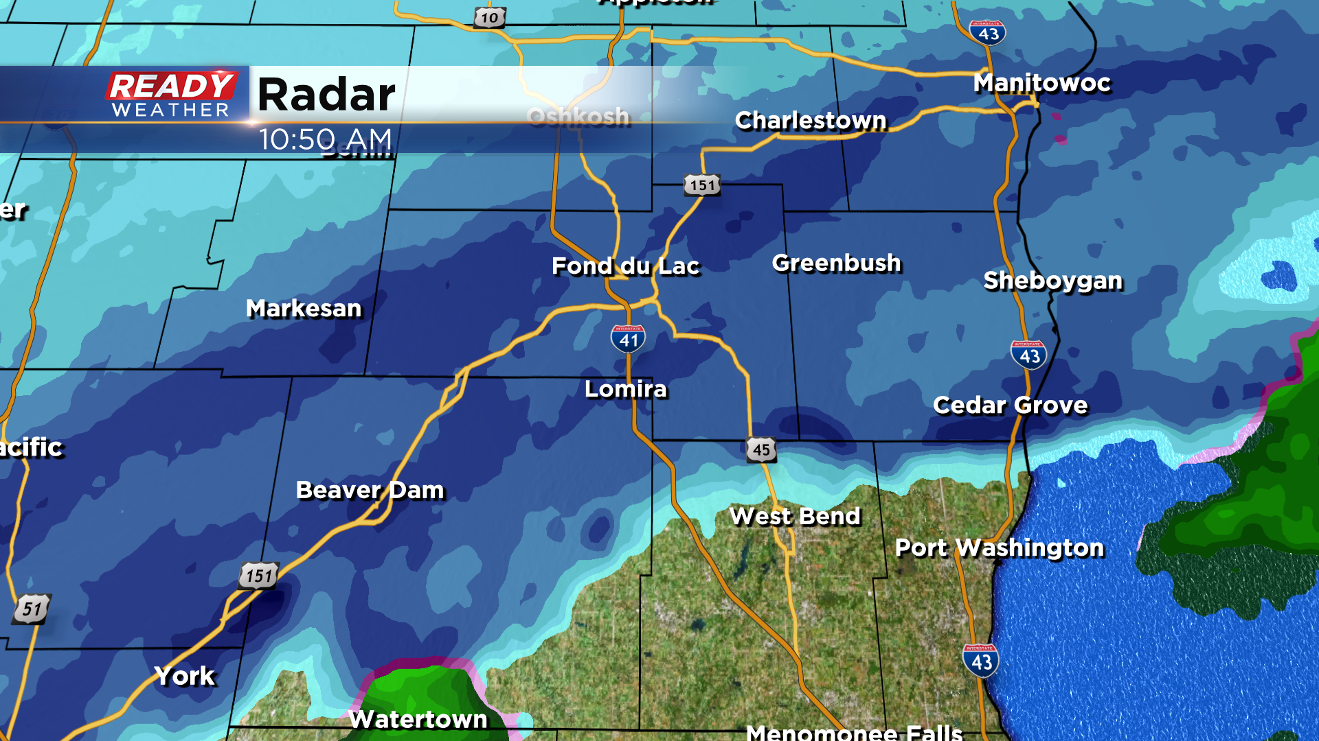
There have been numerous crashes north of the Milwaukee metro due to very low visibility within this snow band and the rate at which the snow is coming down.
Farther south we're still experiencing a mix of rain, sleet, and wet snow at times. Temperatures are much warmer than north of the metro with lakeside areas sitting either side of 40 degrees.
As precipitation fills back in over the next few hours, expect more snow to start falling away from the lake while lakeside areas continue to see a mix of sleet, snow, and rain. Forecasted snow amounts remain on track.
----------------------------------------------------------------------------
Updated: 9:18 a.m. Feb. 9, 2023
Radar is showing a little bit of everything right now. A band of steady rain already dropped half an inch of rainfall in most of Walworth, Racine, Kenosha, Milwaukee and Waukesha Counties and is moving north. Some southern counties are seeing a lull in the precipitation but a rain is now switching to snow in our western and northern counties that are under the winter weather advisory.
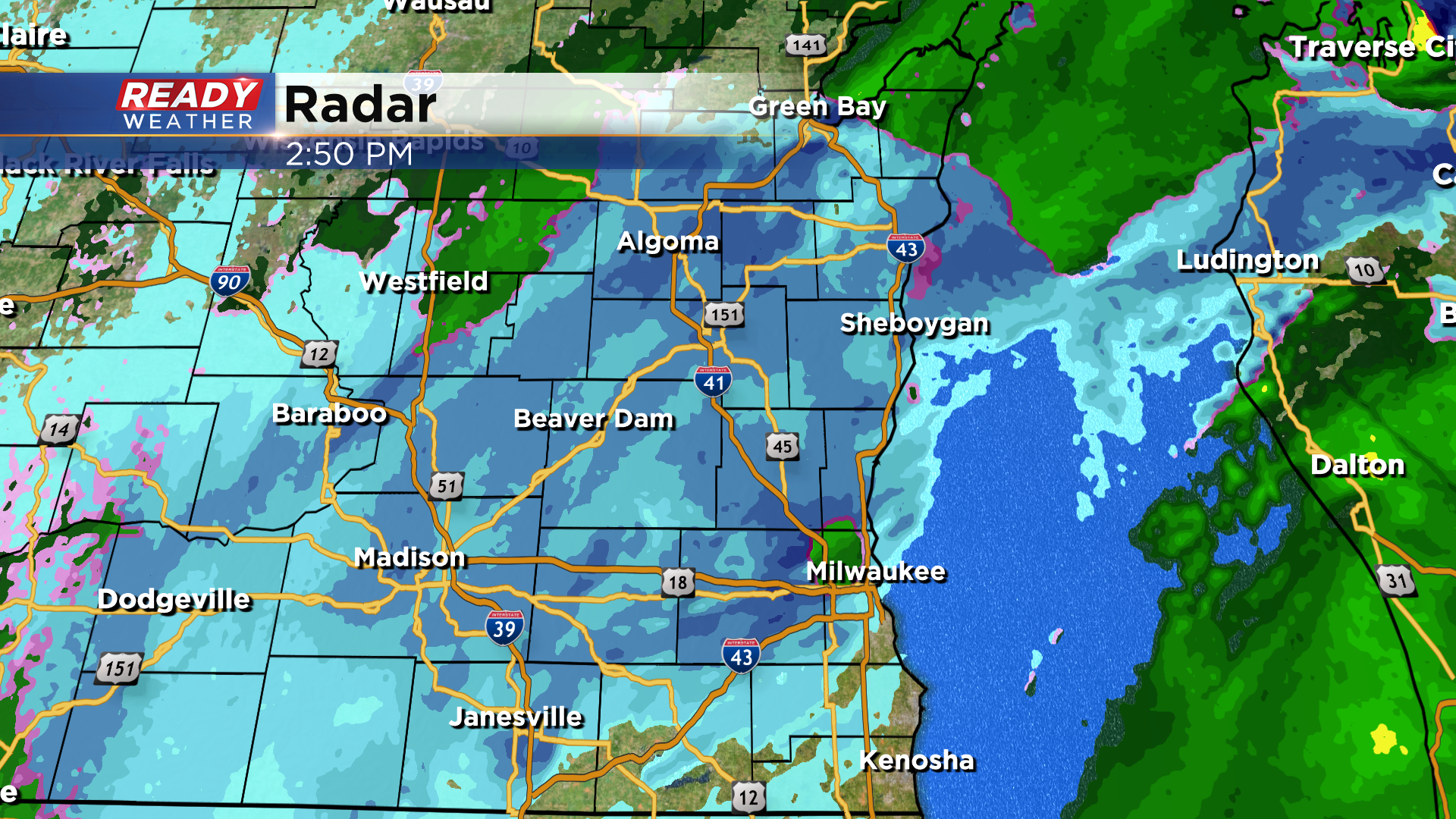
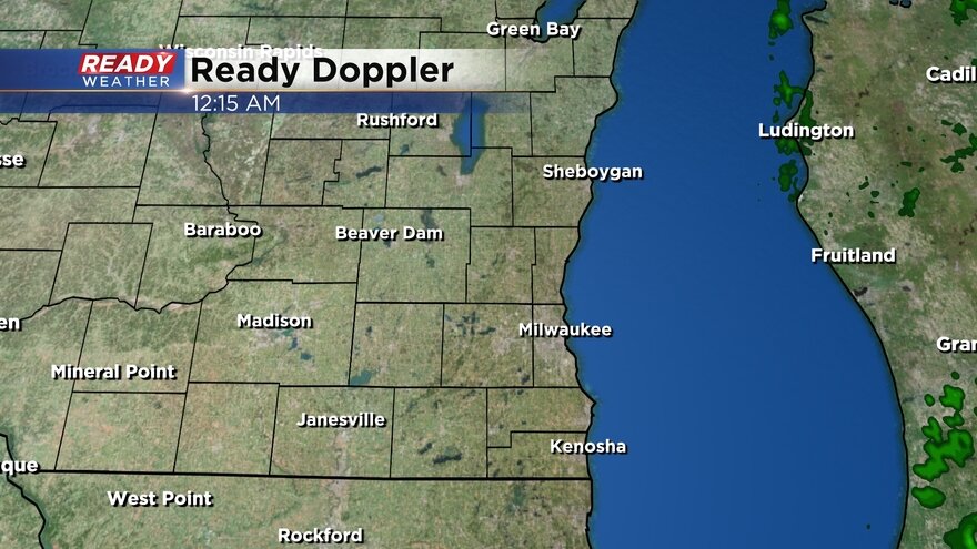
Here's a look at the radar in southeast Wisconsin that will update with time:
In addition to the rain and snow falling, wind gusts are starting to pick up with gusts hitting 40 mph in Kenosha at 9 AM and over 20 mph in many other communities. These were the wind gusts at 9 AM:

There are no changes to the ongoing rain and snow forecast. Up to an inch of rain remains a possibility with rain switching to snow around midday then slushy snow accumulation, especially west and north of Milwaukee expected through evening.
------
Posted: 6:33 a.m. Feb. 9, 2023
Our next storm system is here. Some light rain and snow showers started rolling in just after 1 AM with steady rain arriving shortly after that in our southern counties: Walworth, Racine and Kenosha. That steady rain has moved north into the metro area now with some rain and snow mix north of the metro.
Overall the track of the storm has stayed similar the last 24 hours but a few other items have changed. The timing of the storm has slowed a touch with the switchover from rain to snow for all not expected to happen until around noon. By that point most of southeast Wisconsin, except for right near the lakefront in southern counties, will have switched to heavy wet snow. That snow will last a little later with some impacts to the evening commute as snow wraps up by 7 PM near the lakefront.

A good soaking rain is still on track with over half an inch expected in most of southeast Wisconsin. We might not see as many totals over 1" but up to a full inch of snow is still on track for most of the local area.

Snow totals have been refined a bit to show less than an inch of snow in downtown Milwaukee south into Racine and Kenosha Counties. A narrow band of 1-3" of snow will be possible in north and west suburbs into eastern Waukesha County and most of Walworth Counties. Far western and northern counties will see the most snow with a narrow axis of 3-6" of snow expected there.

There has been no change to the winter weather advisory. It started at 6 AM Thursday morning for Fond du Lac, Sheboygan, Dodge, Washington and Jefferson Counties and will last until 6 PM.
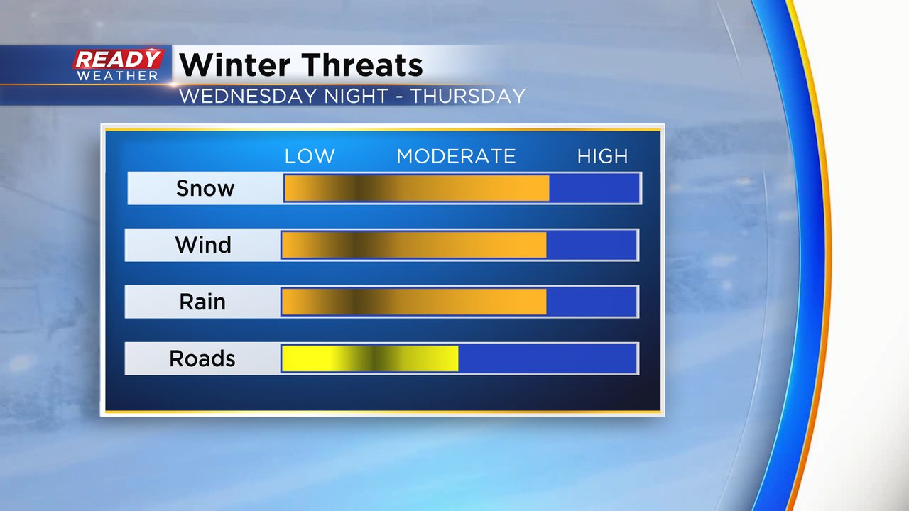
The overall impacts with this winter storm remain moderate. The snow will come down at a heavy rate from late morning through the afternoon making lunch time travel very difficult. The wind will pick up with gusts to 35 mph causing blowing snow and some visibility issues. The rain we pick up is pretty impressive for February standards. Overall with the rain mixing in and fairly mild temps the roads stay mostly slushy.
Download the CBS 58 Ready Weather app to track the switch from rain to snow.