9:30 pm Update: Scattered storms primarily staying north of I-94 tonight


Updated: Sunday, May 2nd 9:25 pm:
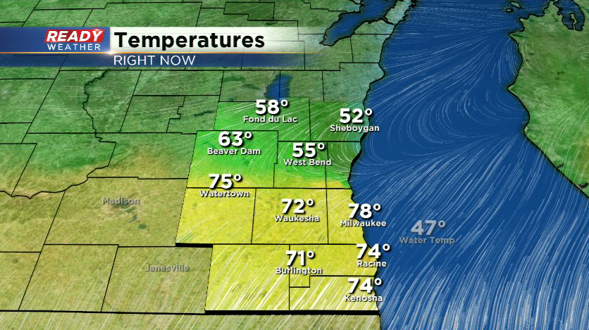
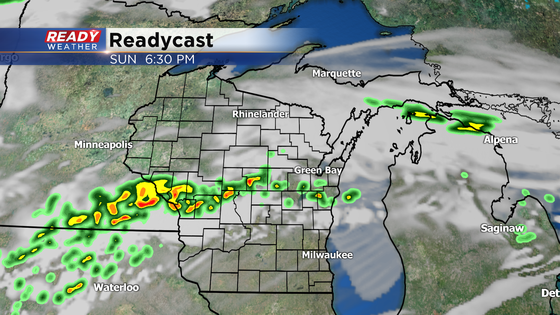
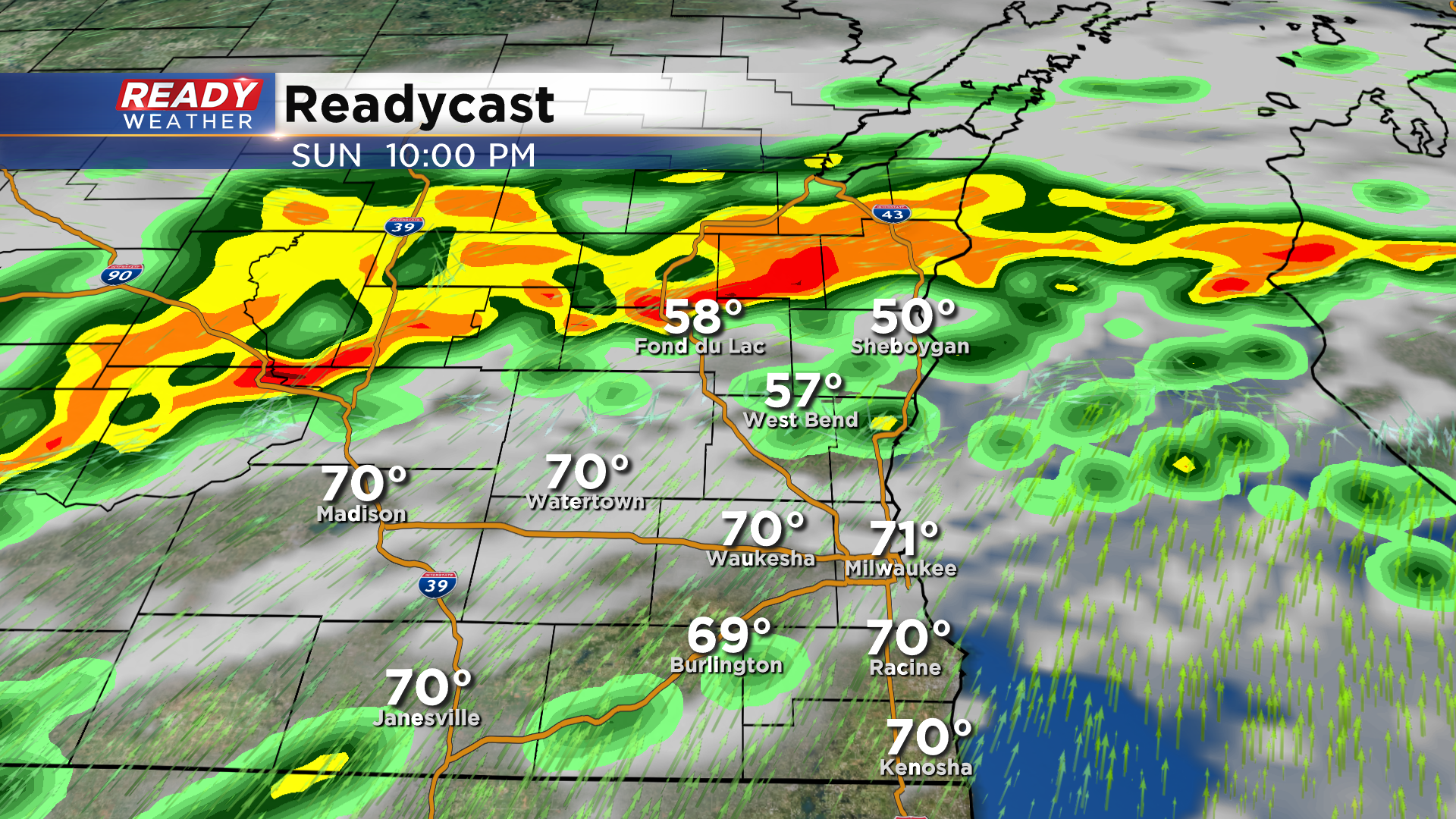
Storms from earlier this evening have pushed an outflow boundary south into southern Dodge, Washington, and northern Milwaukee county. This has dropped temps dramatically into the 50s and 60s.
Scattered storms are developing north of this boundary, tracking northeast. The boundary isn't expected to push much further south, so nearly all of the storm activity will remain north of I-94.
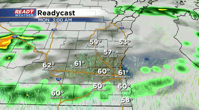
These storms will weaken/dissipate overnight, but we can't rule out a few light showers sneaking into areas south of 94.
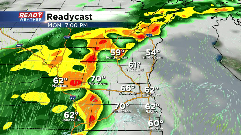
Another round of showers and storms will track across southeast Wisconsin late afternoon - early evening Monday with the cold front.
--------------------------------------------------------------------------------------------------------------
Updated: Sunday, May 2nd 6:20 pm:
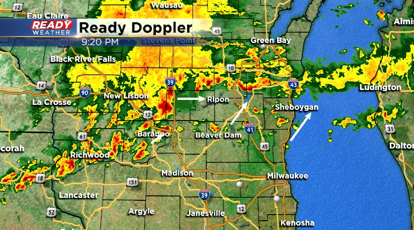
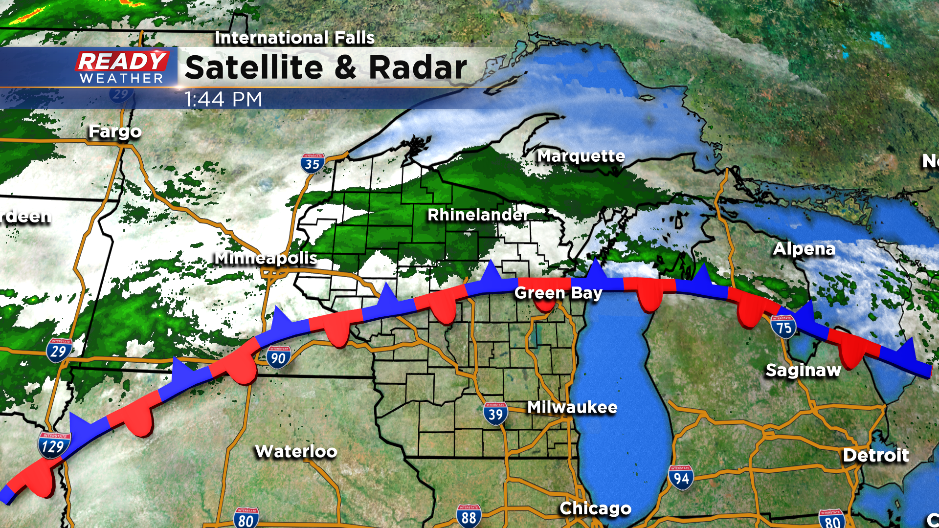
Scattered thunderstorms are firing along and near the stationary front draped across central Wisconsin. There have been a few severe thunderstorm warnings near the Appleton and La Crosse areas for quarter sized hail, but so far hail has not been able to get that large.

There was a report of pea sized hail with a cell near Fond du Lac, but we don't expect hail to get too much larger than that in our area. Storms will likely stay confined to the front for a few more hours, with occasional cells tracking through Fond du Lac and Sheboygan counties, drifting south into Dodge and Washington counties later this evening. Folks in the Milwaukee metro southward should be primarily dry this evening.
-------------------------------------------------------------------------
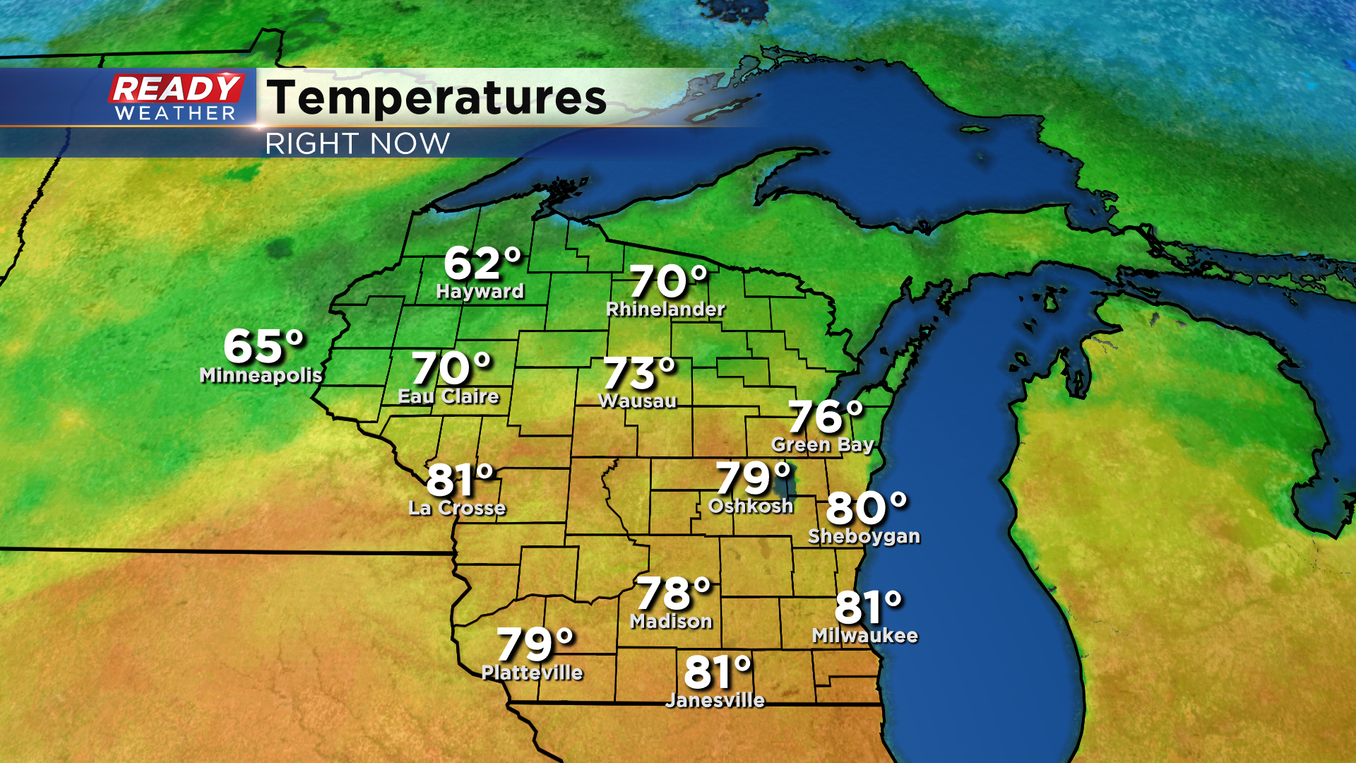
It's been another fantastic early May day across southeast Wisconsin with plenty of sunshine and temperatures in the upper 70s to low 80s.
Unlike yesterday, the entire state isn't enjoying the warm weather today as a frontal boundary is stalled across central Wisconsin. Showers are currently falling north of the front, but the front itself will be the focus for shower and storm development late this afternoon.
Storms look to fire in the Fox Valley between 4-6 pm and continue to develop across that front into the evening.
As we move through the evening, those storms will start to sag south into Fond du Lac and Sheboygan counties. There's a bit of uncertainty if storms will continue to push farther south before falling apart overnight. Right now the best chance for storms will be north of West Bend to Beaver Dam, but an isolated shower or storm may fire this evening south of 94 as well.
A few of the storms near the front could produce strong winds or hail, but the best chance for isolated severe storms will be just to our northwest, closer to the front. The severe threat will wind down by mid to late evening.
Overnight into Monday morning the rain and storms will diminish to a few spotty showers.
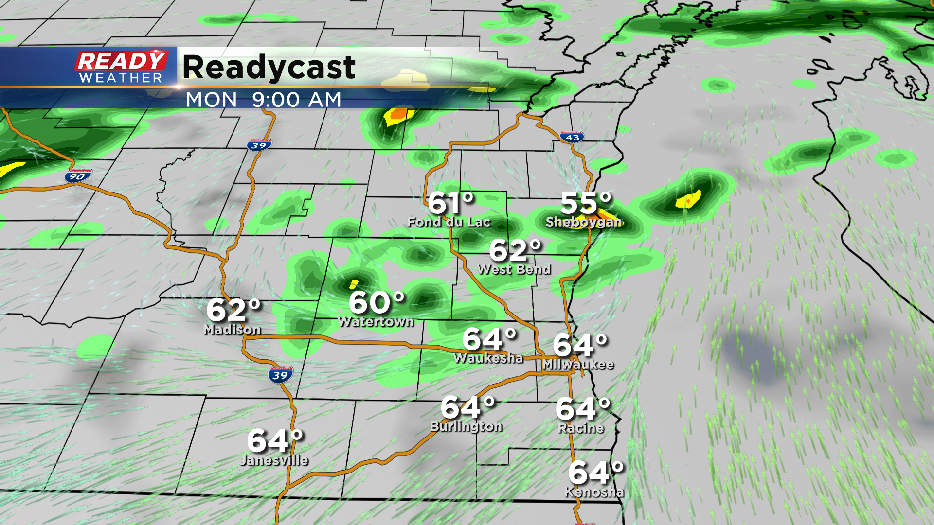
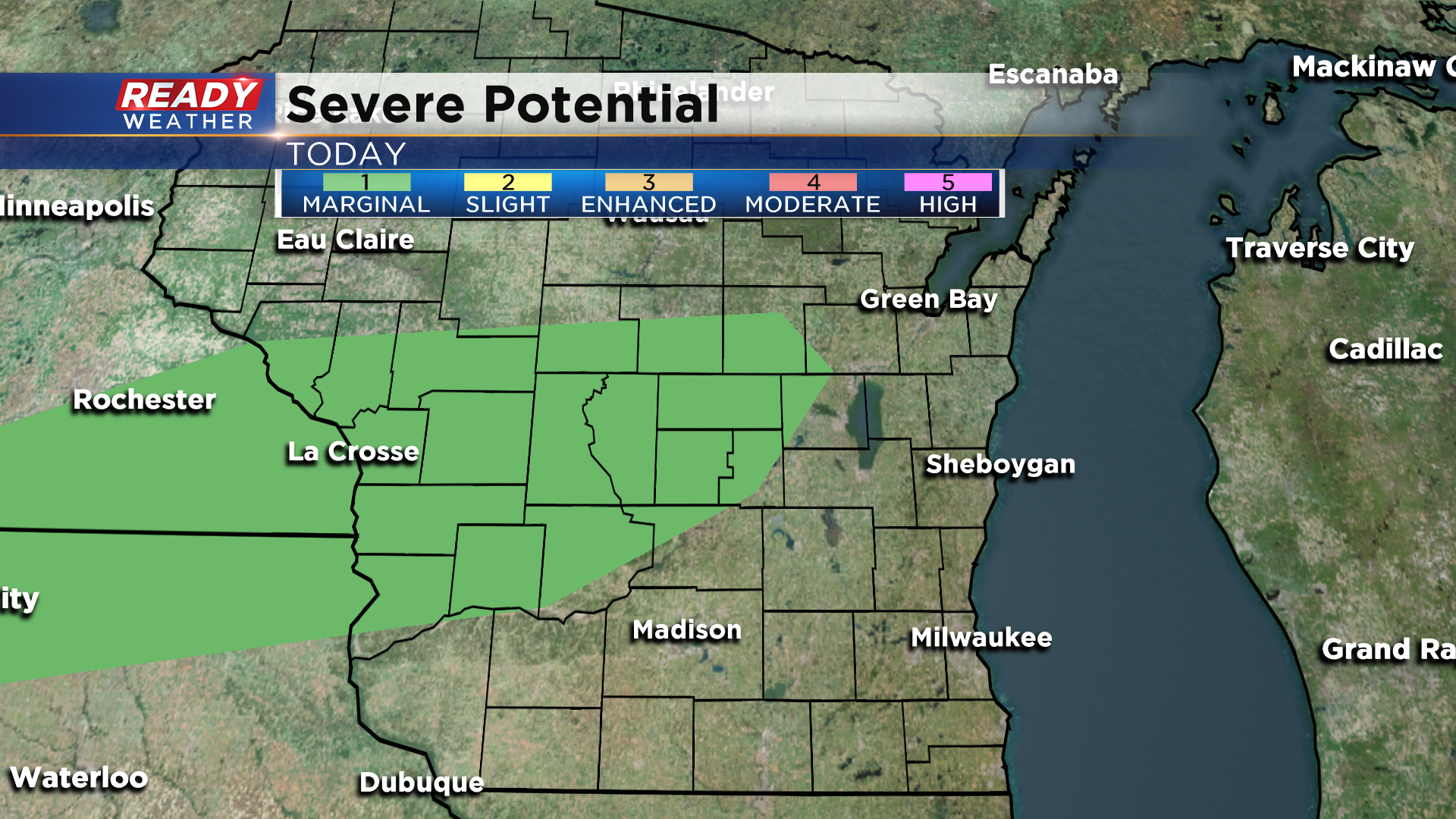
That same front will still be stalled across portions of the Fox Valley and Fond du Lac and Sheboygan counties on Monday, with a second area of low pressure expected to track along it late in the day. There's uncertainty in the timing and track of this system, along with the placement of the fronts, but a much better chance at storms with downpours will come late Monday afternoon into the evening.
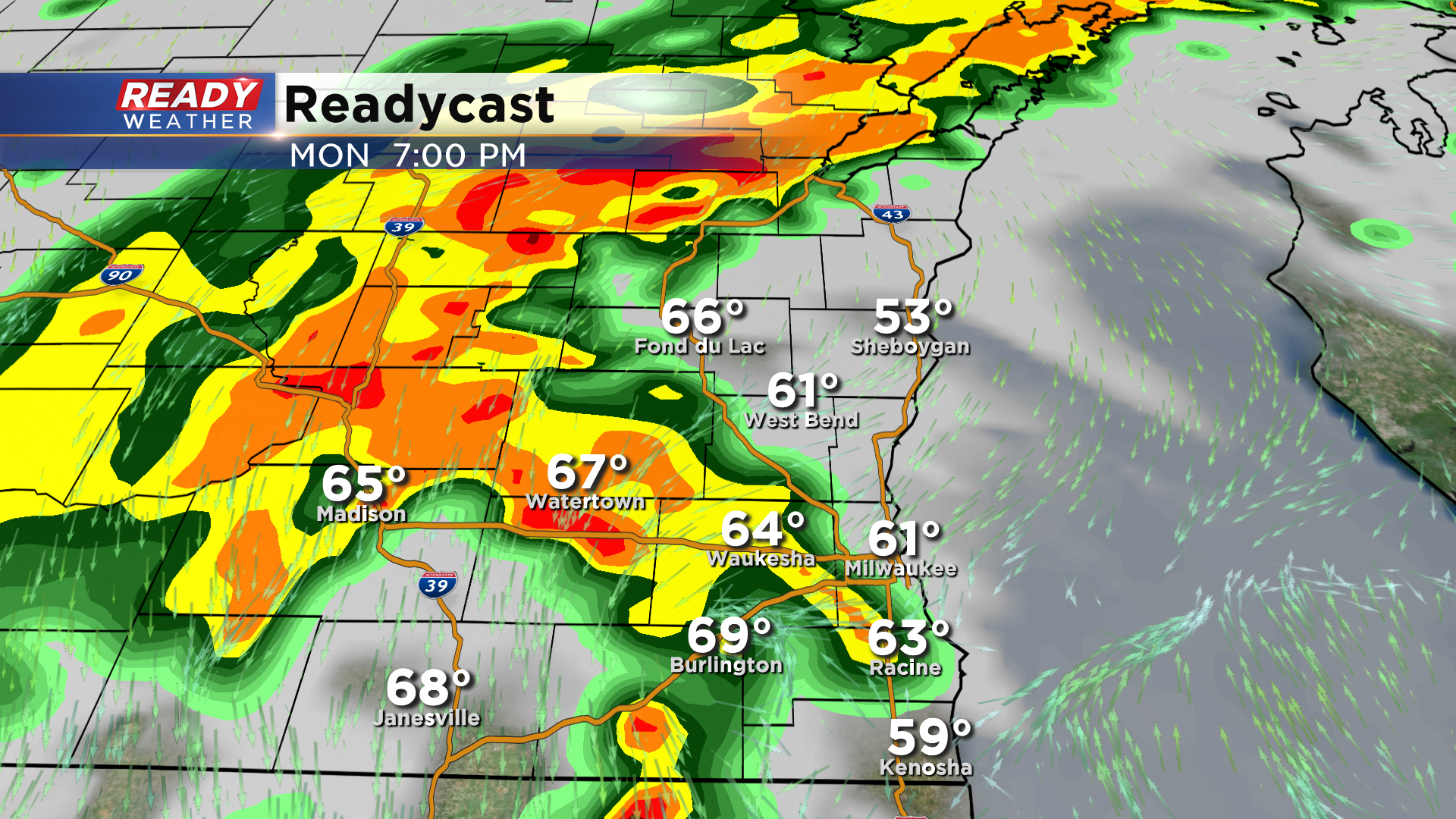
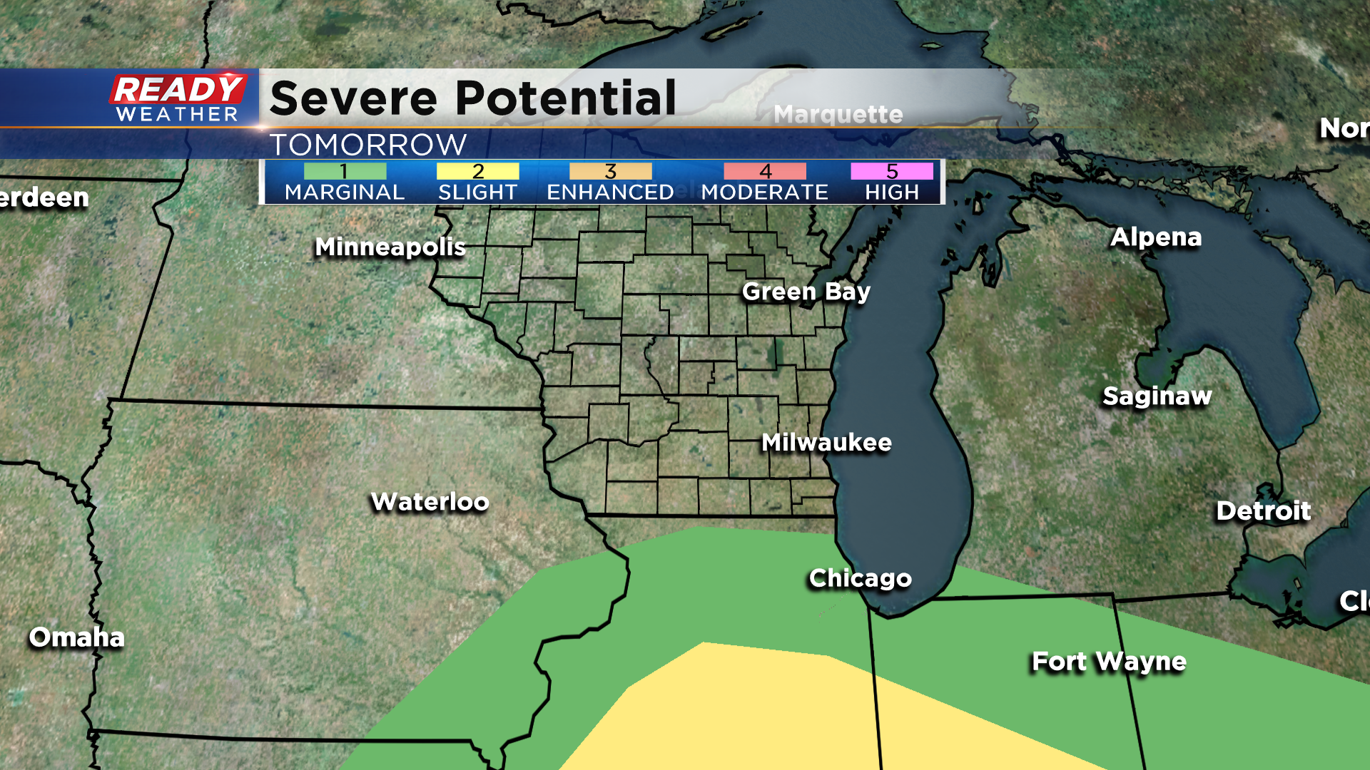
If the system approaches late in the afternoon, we could have a few strong to severe storms early Monday evening. Right now Monday's severe outlook reaches the Wisconsin/Illinois border, but this could be expanded northward once these uncertainties become a bit more clear.
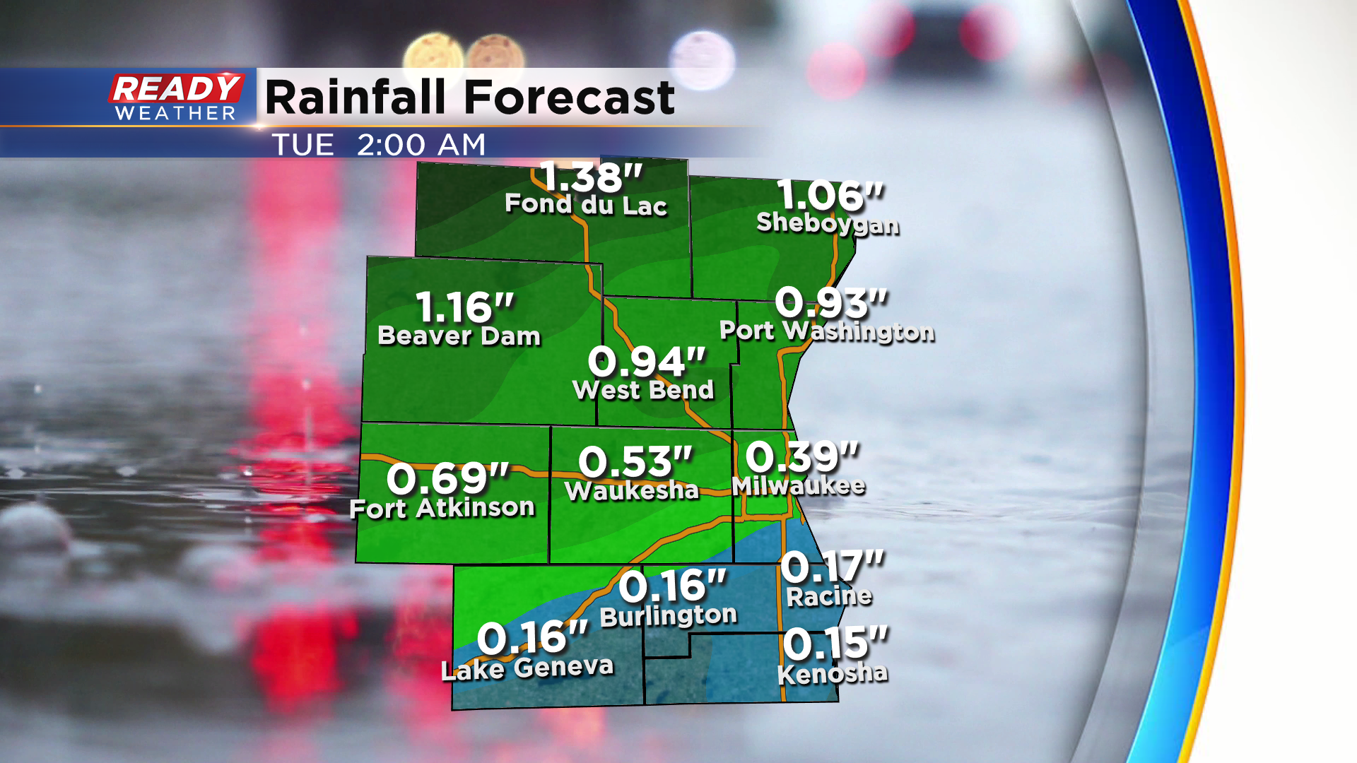
From tonight through Monday night, folks in the far north could pick up over an inch of rain, but that will all depend on how many storms can work into our area this evening. Most of the area will end up between .25-.75" of rain with isolated higher totals possible in storms.
Temperatures will cool back into the 50s behind the cold front for the rest of the week. There will be small chances for showers here or there, but nothing significant or widespread. Download the CBS 58 Ready Weather App to track the showers and storms.