


Parts of southeast Wisconsin have seen pretty good downpours over the last few days and more of those will be possible on Friday. A cold front rolling in from the north will spark the storm chance. Temperatures before the storms arrive will soar through the 70s to around 80 degrees. We should stay fairly dry Friday morning through the midday hours then by early afternoon a few showers and storms are possible that could last through the evening.
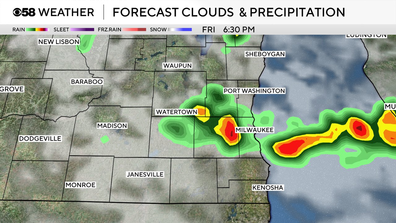
With all of the warmth Friday that could add fuel to any thunderstorms that develop. Because of that we do have the chance for some stronger thunderstorms. Most of eastern Wisconsin, including all of southeast Wisconsin, is under a Level 1 Marginal Risk for strong storms. Small hail and gusty wind will be the biggest threat with any storms that develop.

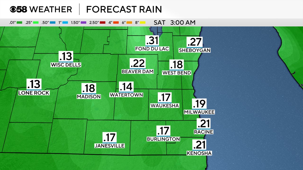
Rain totals with the storms Friday don't look super impressive from 0.10" to 0.30". Storms will be fairly fast movers but if we get multiple rounds of storms over the same area we could get some higher totals.
The approaching cold front that will spark the chance for storms will also usher in some haze and wildfire smoke. Smoke from wildfires burning in Manitoba, Canada will filter into most of the Midwest including all of Wisconsin Friday on breezy northwest winds. Haze is expected as well as the potential to smell some of the smoke. The smoke will get worse as Friday goes along but could linger through part of the weekend as well.
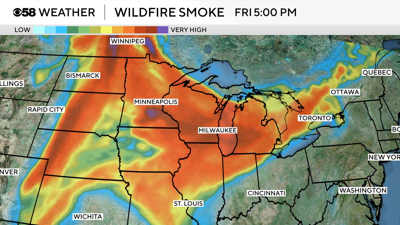
Because of the expected wildfire smoke an Air Quality Alert has been issued for the entire state. The current alert goes until Saturday morning but may be extended through most of Saturday. Air quality at times will be poor for sensitive groups and potentially for everyone.

Download the CBS 58 Weather app to track the storms for Friday and get alerts if any severe thunderstorm warnings are issued.