7 AM Update: Any lingering showers and storms ending by 10 am


Updated: 7:00 am July 19, 2020:
A couple of lingering showers or brief storm will be possible before 10 am south of I-94, but once the cold front moves through the area our shower chances will end for the day.
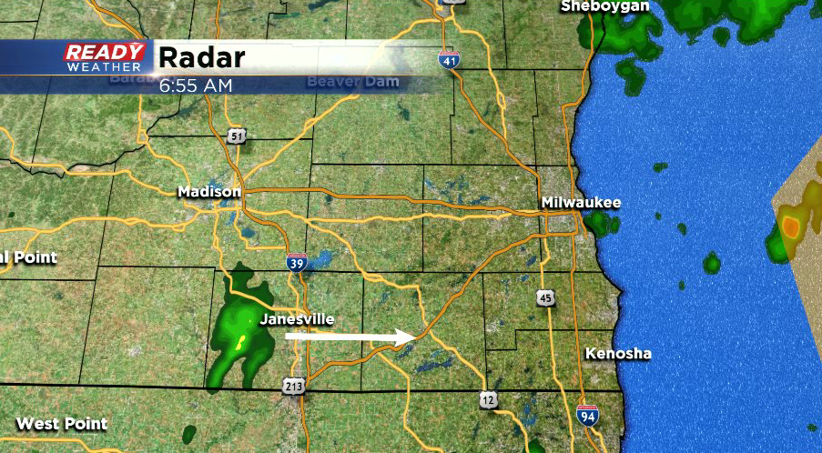
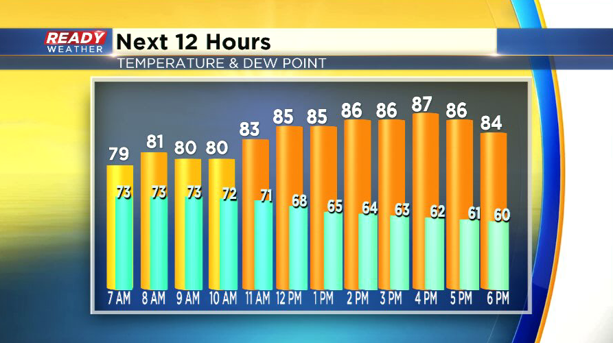
Clouds will decrease during the afternoon, and humidity levels will be falling as well. Dew points will be in the low 60s by late afternoon.
----------------------------------------------------------------------------
Updated: 6:00 am July 19, 2020:
The gust front outraced the line of severe storms, which caused them to weaken and led to the warning being cancelled early. The gust front has been producing 40 mph wind gusts, and it has been generating a few weak storms in it's wake.
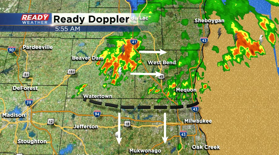
The gust front is moving southward while the storms move ESE, so we'll keep an eye out for any additional storms, but the severe threat is currently low.
-------------------------------------------------------------
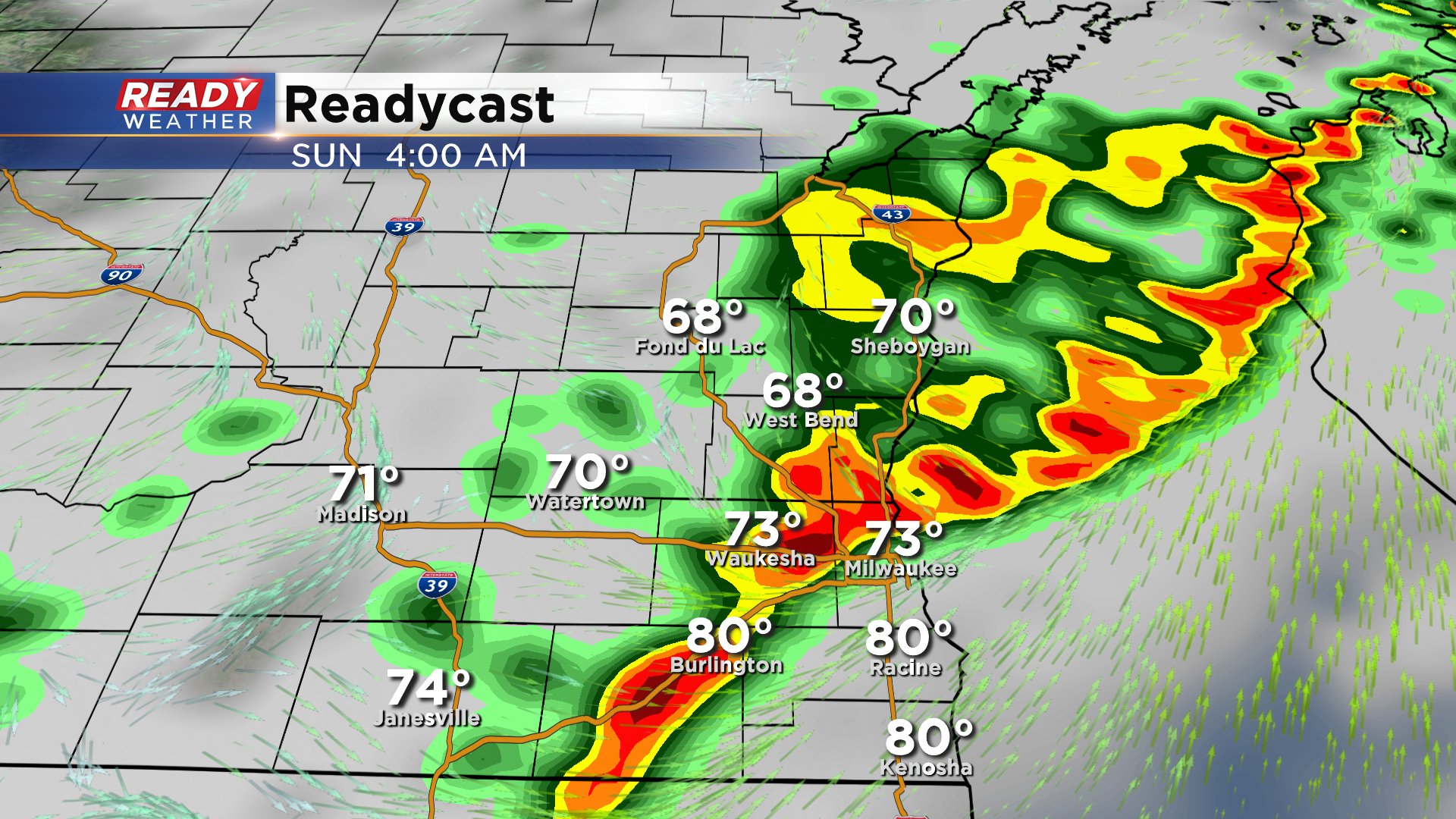
Updated: 5:10 am July 19, 2020:
A Severe Thunderstorm Warning is in effect for Fond du Lac, Dodge, Washington, Ozaukee, and Sheboygan counties through 5:45 am. Damaging winds up to 60 mph will be possible, with the core of strongest winds just to the east of Baraboo.
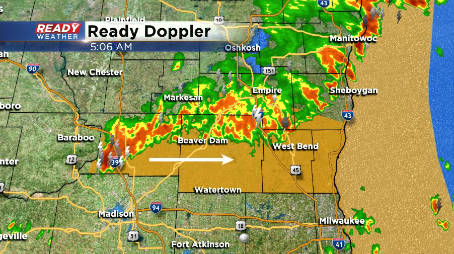
The strongest part of the storm near Baraboo is tracking due east, while the storms in Fond du Lac county are moving southeast at 50 mph. Hail and heavy rain is possible as well.
--------------------------------------------------------------------------
Updated: 3:30 am July 19, 2020:
Line of strong to isolated severe storms is tracking ESE across central Wisconsin at 35 mph. A few spotty showers have popped up in SE Wisconsin ahead of this main line.
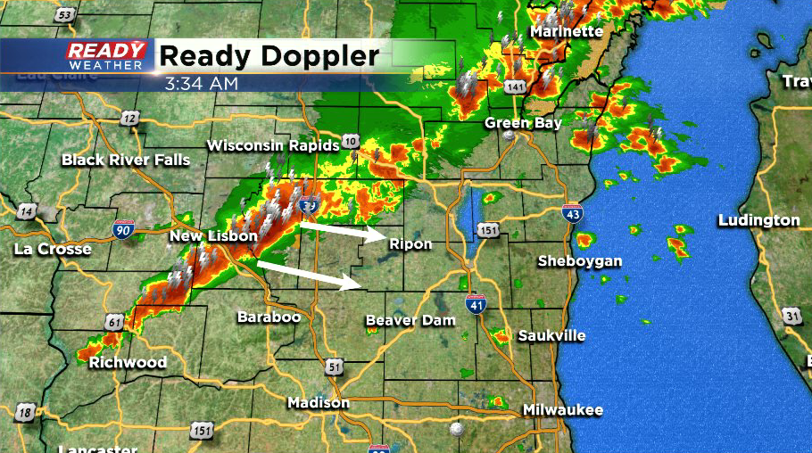
At the current pace, storms should reach Fond du Lac county and NW Dodge county by 4:30am. These storms have struggled to remain organized, so widespread damaging wind gusts are not expected. However, sporadic wind gusts over 40 mph will be possible in the stronger storms.
---------------------------------------------------------------------------------
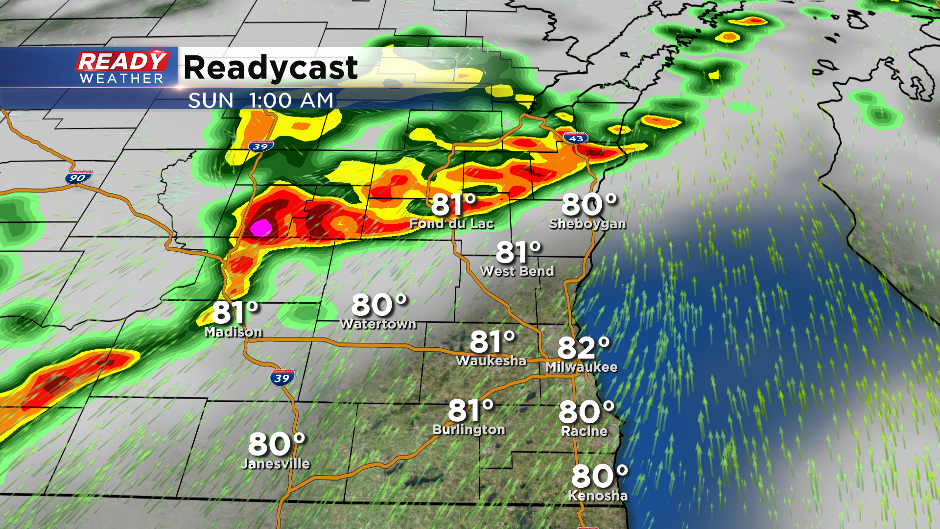
Updated: 1:30 am July 19, 2020:
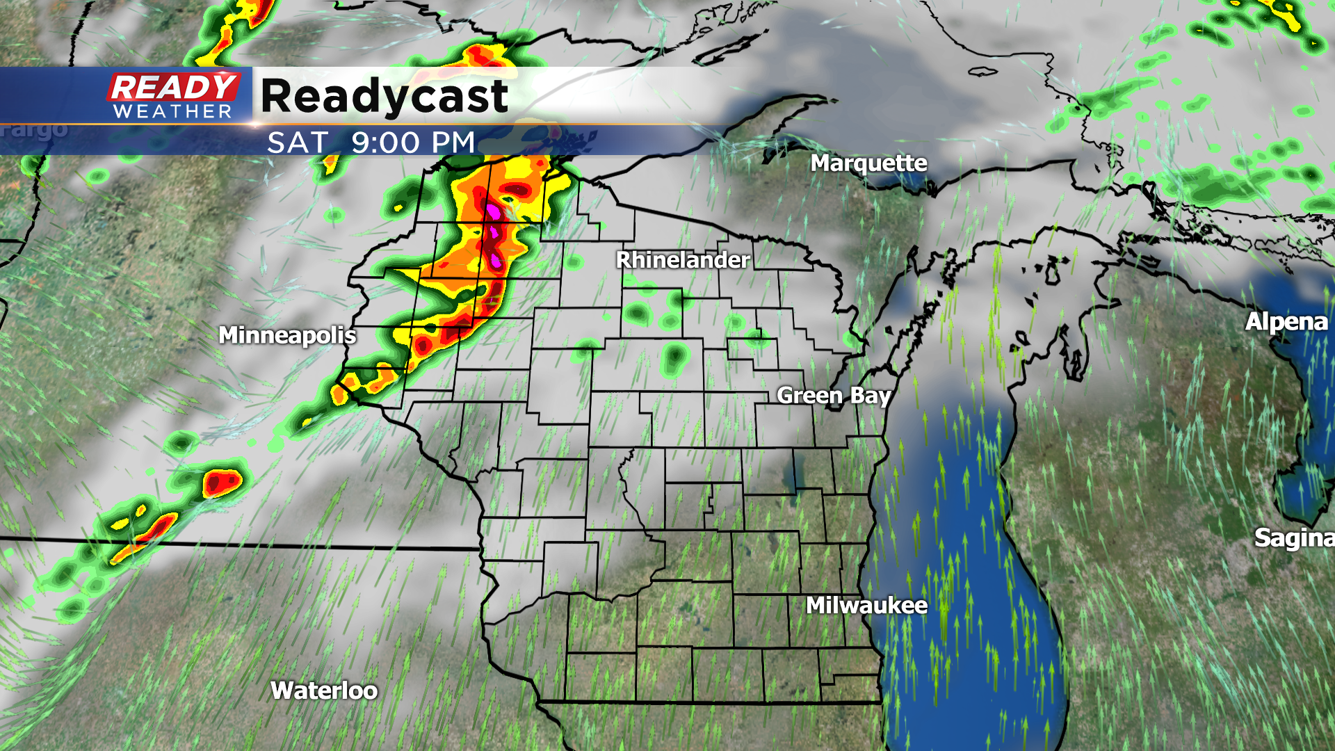
A broken line of strong to severe storms is tracking east across the northern half of the state. Additional thunderstorms have started to develop on the southern edge of this line near La Crosse.
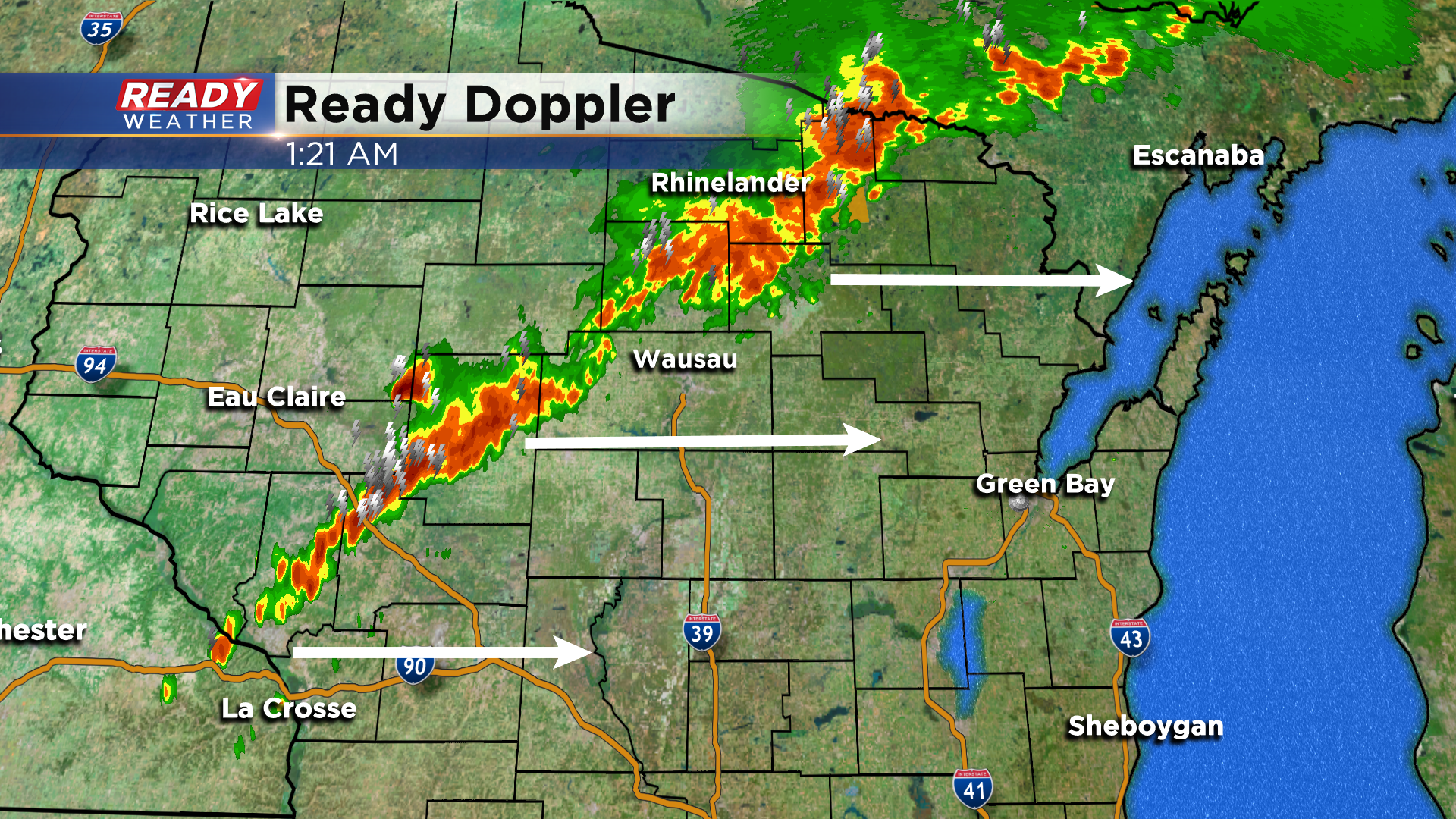
The storms near La Crosse are the ones we're watching for potential strengthening over the next few hours as there's plenty of instability ahead of these storms to help them intensify. The window for storms is now looking more like 4-7 am unless additional storms fire ahead of this line or if this line speeds up.
--------------------------------------------------------------------------
Updated: 10:30 pm July 18, 2020:
A new Severe Thunderstorm Watch has been issued for the northern half of the state.
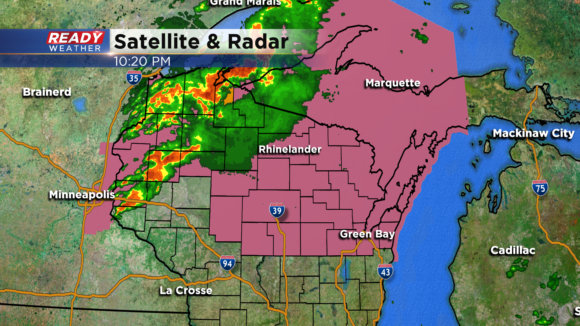
Currently, most of the strong to severe storms are tracking ENE into the Northwoods, but we're keeping an eye on the storm just east of Minneapolis tracking along I-94. That cell may start to travel more SE and trigger more storms through the night.
Still looks like the best chance for any strong to severe storms with damaging winds will be between 3-6:30 am.
-----------------------------------------------------------------------
Updated: 8:00 pm July 18, 2020:
We're keeping an eye on the thunderstorms currently developing around the Twin Cities along a cold front.
These storms are just getting going, so we will have to see if they congeal into a line, and whether or not additional storms fire south of the Twin Cities this evening. This will impact whether or not storms move into the area shortly after midnight or if they hold off until 3-6 am. If they hold off, storms could be a little weaker as they move through. Although there's still some uncertainty in how things will exactly play out tonight, prepare for a chance for strong to severe storms with gusty winds overnight into sunrise Sunday morning.
-------------------------------------------------------------------------------------------------------------------------------
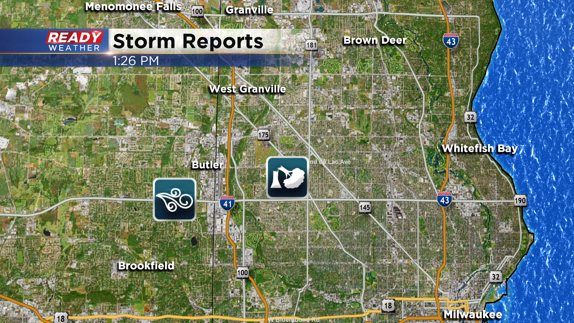
The heat and humidity around the area this morning allowed a complex of rain and storms to hold together as it moved across southern Wisconsin around midday. That line of storms caused some significant wind damage north of Milwaukee in an area between Capitol and Hampton and 92nd and 84th streets. A 54 mph wind gust was also recorded at Timmerman Airport as that storm moved through.
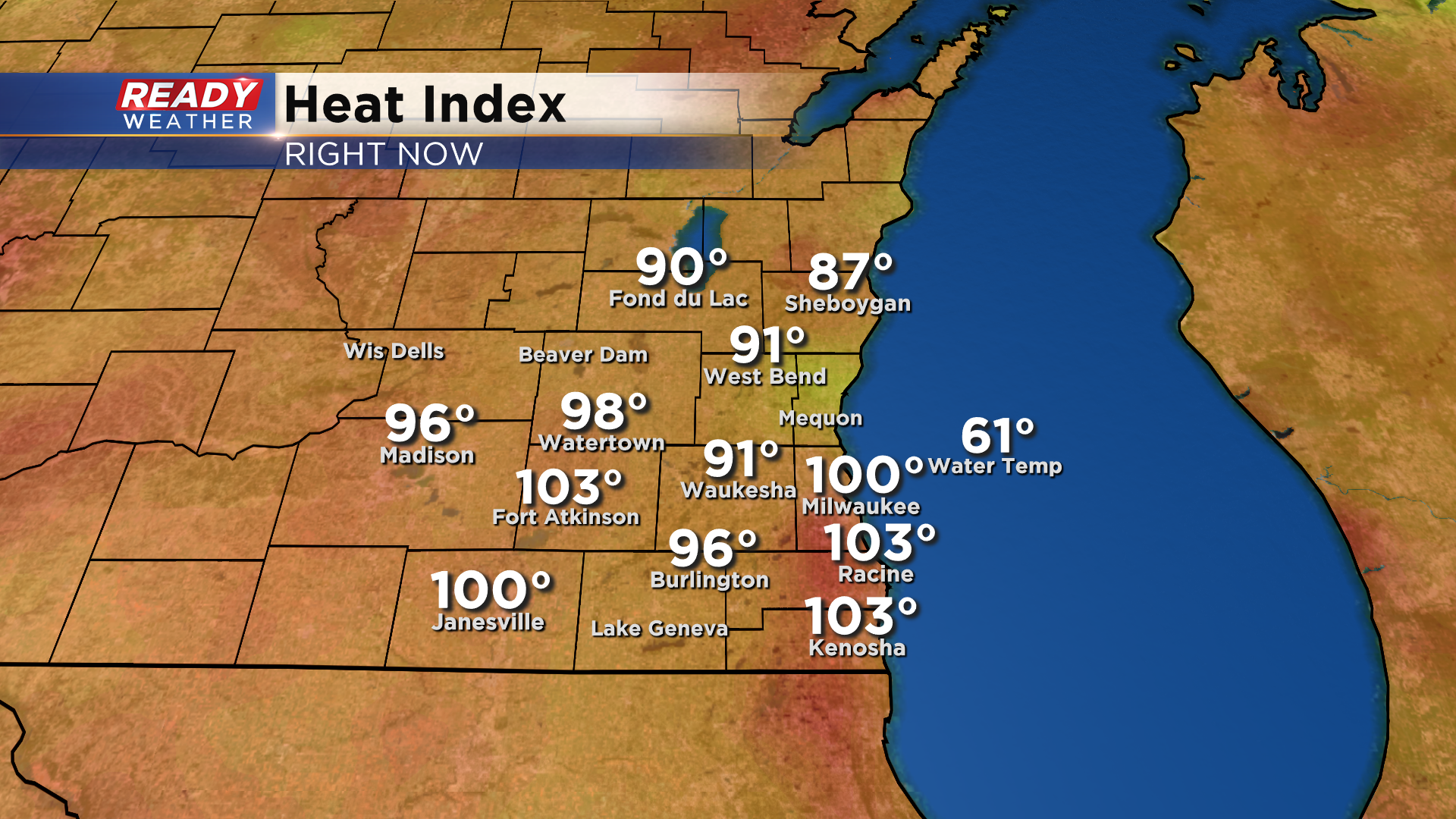
Although the rain and storms did provide brief relief from the heat, temperatures were quickly able to rebound back into the upper 80s to around 90 late this afternoon with dew points in the mid to upper 70s, making it feel like it's in the 100s as of 5:45 pm.
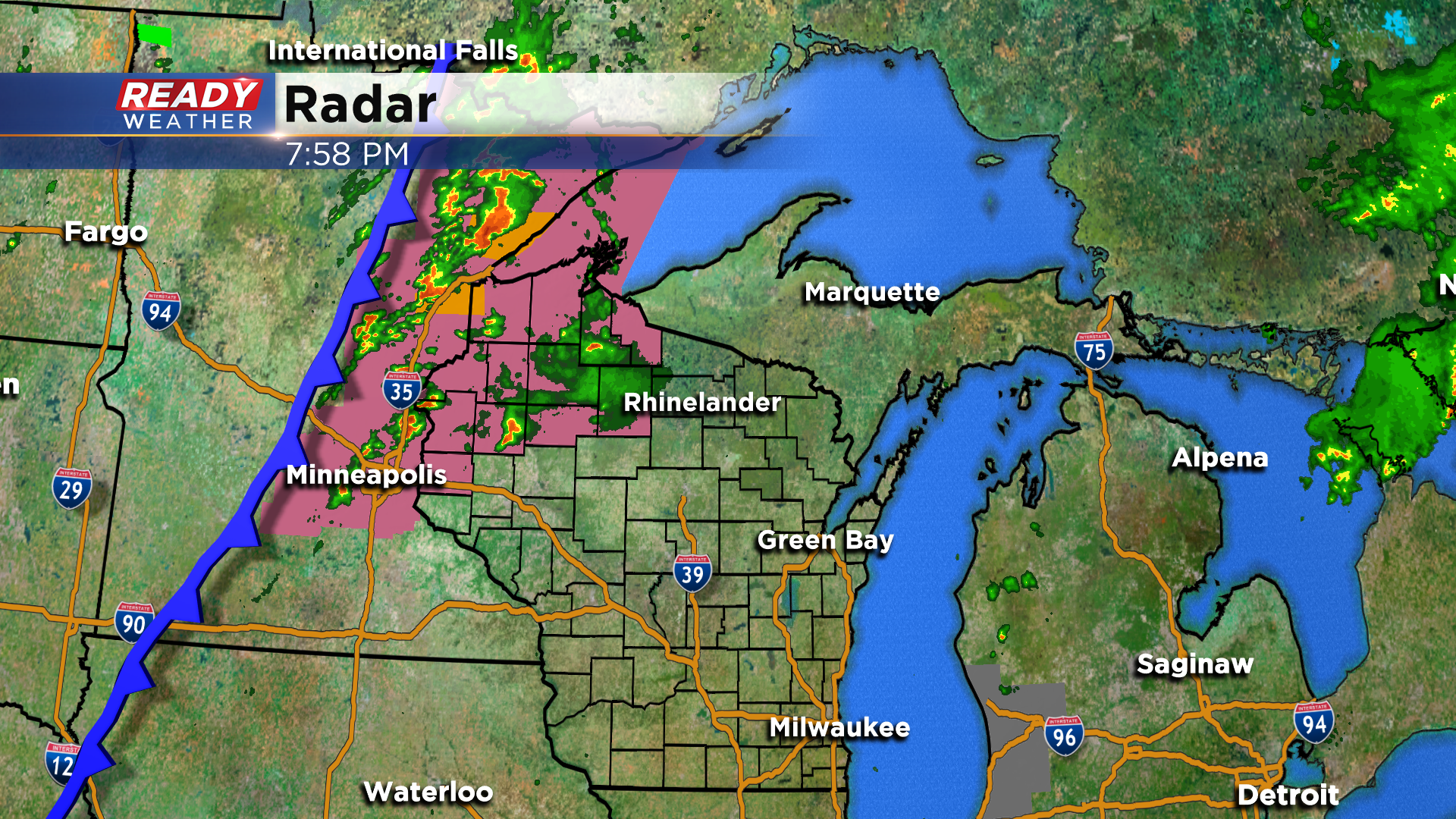
Quiet weather is expected for the next several hours, but we'll be watching as a line of severe storms develops in eastern Minnesota and tracks into NW WI this evening.
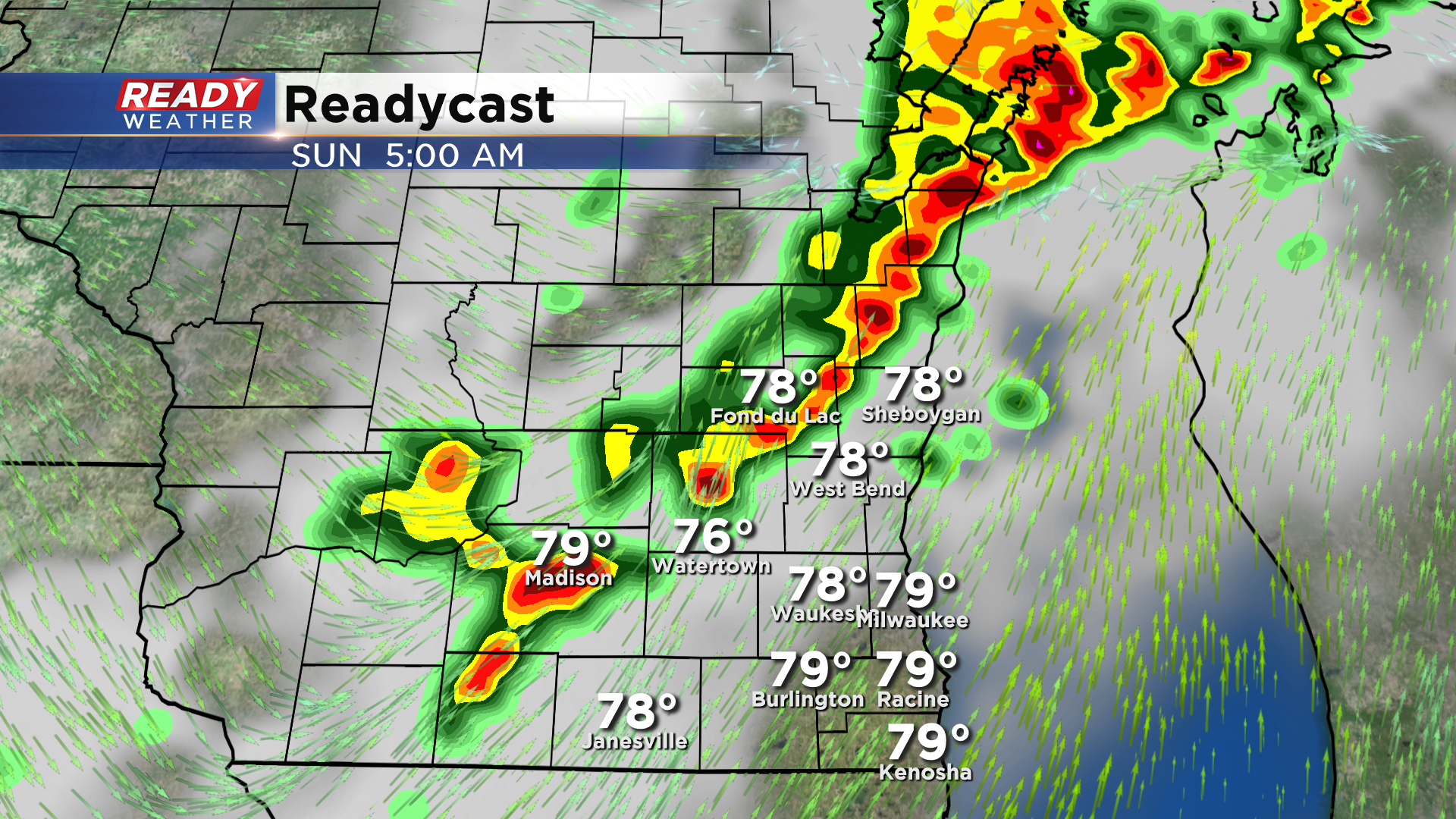
The current expectation is for more storms to fire south of this initial line as we head into the late evening. Current timing as these storms entering our northwestern spots between 12-3 am.
These storms will continue to push southeast, tracking through the Milwaukee metro between 3-6 am.
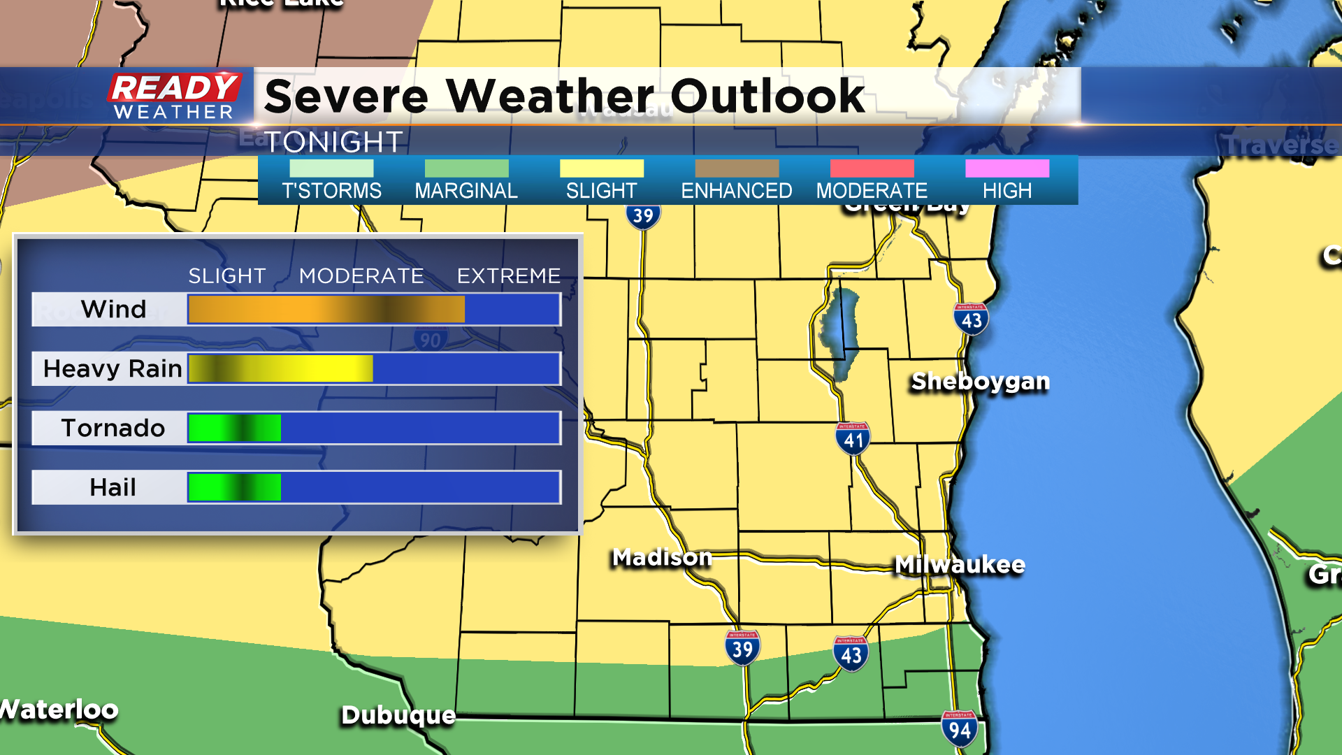
Damaging straight-line winds and heavy rain will be the primary threats, but if we have a solid line of storms track through we will have to watch for embedded spin ups. Almost all of southeast Wisconsin is under a Slight Risk (level 2 of 5) for severe storms for tonight. Counties closer to the WI/IL border are under a level 1, Marginal Risk.
Download the CBS 58 Ready Weather App to get severe weather alerts sent to your phone and to track the storms as they move into the area.