Late Evening Update: Rain is changing over to snow


8 PM Update: March 19th
No changes to the wind advisory or the winter weather advisory. The thunderstorms have ended across the area. Rain is now changing over to wet snow.

Most of the rain should be changed over to snow by 10 pm. The heaviest snow will remain across our northwestern counties within the advisory. Current temperatures remain in the low to middle 30s. Once the temp drops into the upper 20s to around 30, we will see more road issues.

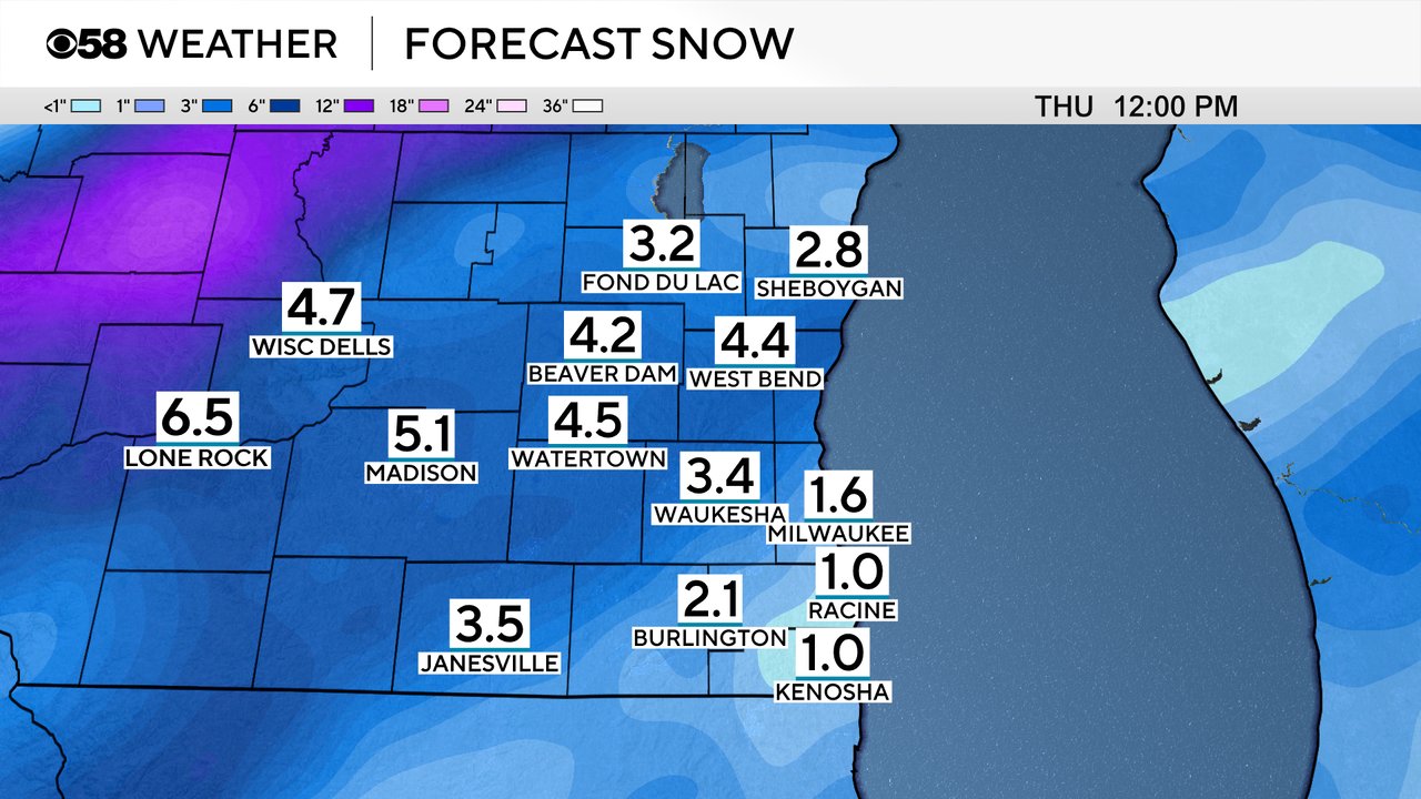
Here is the latest forecast for snowfall. The best chance for several inches of slushy snow will be across our northwestern areas.
The far southeastern areas will see the least. Slushy snow on roads is likely. Snow will come to an end by 8 am on Thursday.
______________________________________________________________________________________________________________
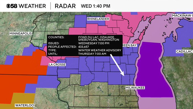
Afternoon Update: A Winter Weather Advisory has been issued for counties north of Milwaukee: Have a look:
Showers and storms are in progress across our area. You can see the dynamic nature of this system with a tornado watch across central Illinois. While not severe here just yet, some of the stronger cells have produced pea size hail. With the better ingredients to our south, the storms have been weakening as they roll up over the border here into Wisconsin.
Here's the latest radar:

The afternoon will continue to feature on and off rain and storms with any severe likely holding off until the timeframe of 5-8pm this evening. Thereafter, the liquid turns to snow for the evening. Want to also mention that at that same time the wind will really ramp up. That means poor visibility will definitely be of concern should you need to venture out from the evening through the early hours of Thursday as the snow is falling.
Our next big storm system is here! A few scattered showers have already popped up in southwest Wisconsin and are moving our way with some snow in the northern part of the state. We are also watching some strong to severe storms moving through Illinois already.
Here is a radar image that will update with time:
The scattered showers and storms will continue through the rest of the morning through the afternoon and dinnertime. Grab the umbrella if you plan on being outside at all.
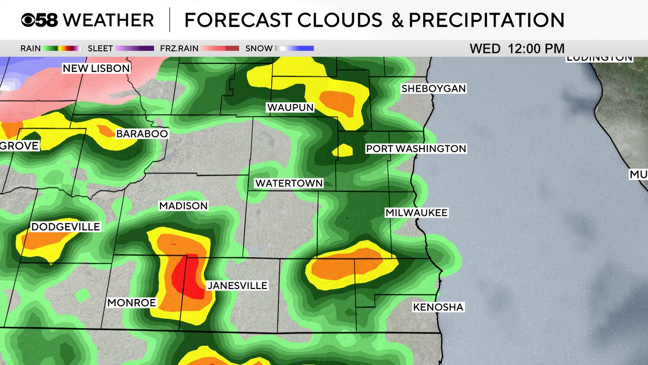
Most of southeast Wisconsin will get a soaking rain throughout Wednesday, especially if we see some stronger storms. Rain totals from a half inch to full inch can be expected for most of the area.
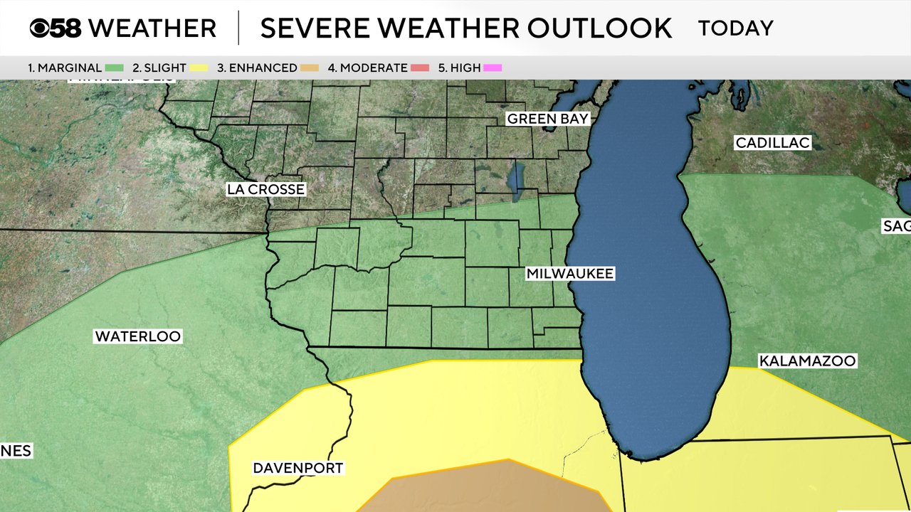
We are still tracking the potential for some stronger storms. Hail will be the biggest risk with any strong storms that do develop. While widespread severe weather is not anticipated an isolated warning cannot be ruled out today. Most of southeast Wisconsin remains under a Level 1 Marginal Risk with the better chance for some severe storms to our south across Illinois with a Level 2 Slight and Level 3 Enhanced Risk there.
By 6 PM the thunderstorm risk is still ongoing for most of southeast Wisconsin but we will quickly see a switchover to snow through the rest of the evening hours.
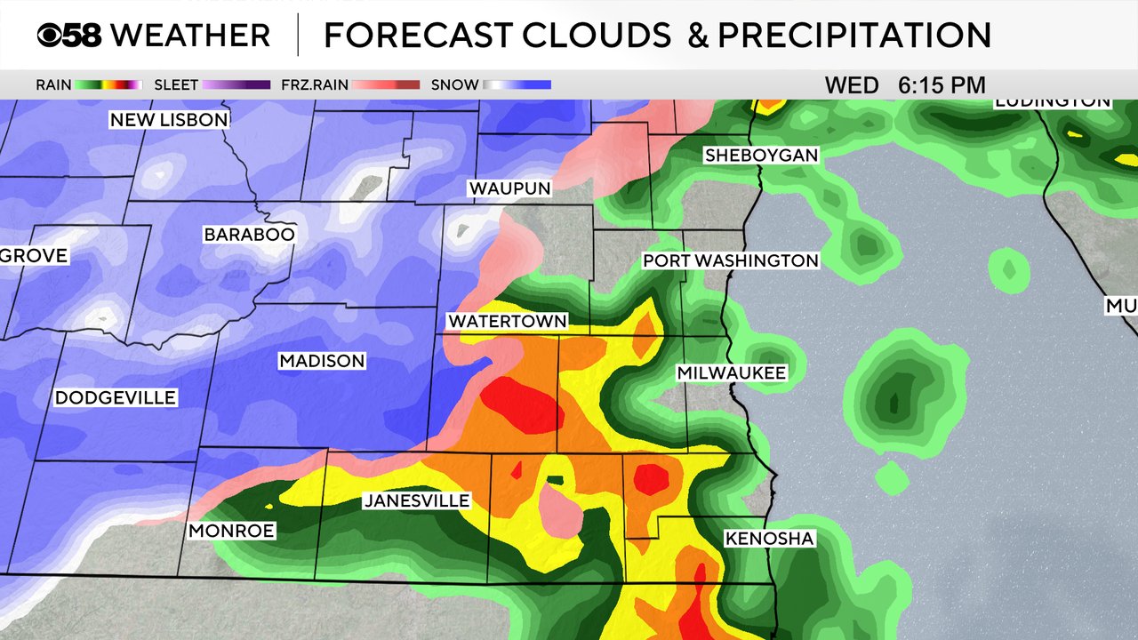
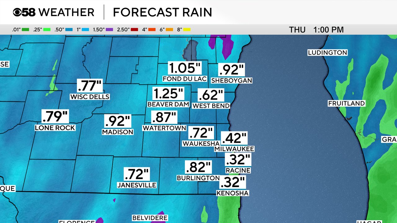
Once the switchover to snow happens the snow could come down pretty fast at times Wednesday evening through early Thursday. Snowfall rates of 1" per hour are possible. With the snow falling at night and coming down fast, we likely see slushy accumulation for most of southeast Wisconsin. Milwaukee area and communities south towards the IL border can expect up to 2" of snow with northern and northwest counties picking up between 2-5" of snow.
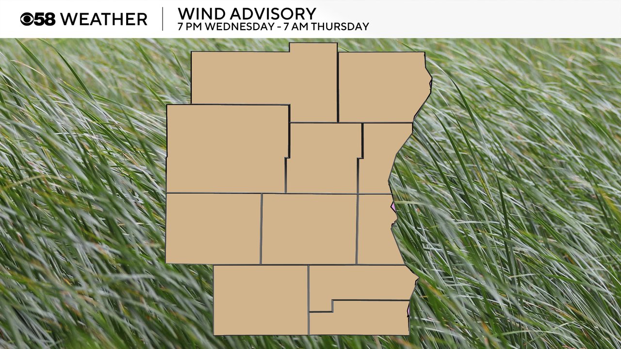
In addition to the strong storms and snow, the wind will be a very big story the next few days. A wind advisory has been issued for all of southeast Wisconsin from 7 PM Wednesday evening through 7 AM Thursday morning.
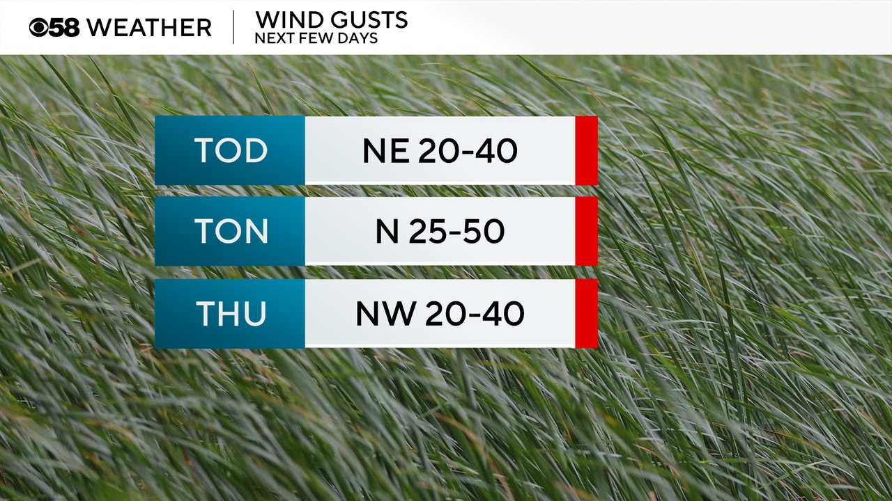
Wind gusts will frequently hit 40 mph during the day Wednesday then increase to 50 mph Wednesday night. They stay gusty most of Thursday between 20-40 mph. Friday will also remain windy.
Download the CBS 58 Weather app to track the storms, snow and wind.