Rain and snow likely Tuesday night, then strong storms Wednesday


4 PM Update:

A water drop alert has been issued from MMSD for tonight and Wednesday. An alert is a way to help reduce the chance for a sewer overflow into Lake Michigan. 1" to 2" of rainfall is expected through Wednesday night.
Not running the dishwasher or doing the laundry can reduce the amount of water in the system.

______________________________________________________________________________________________________________
Happy Election Day! It will be a sunny start to Tuesday with a bit of a breeze throughout the day. Temperatures will warm into the low 40s during the afternoon hours. No weather concerns for voting until the evening hours when we could see some rain and snow showers for the last few hours of voting.

Rain and snow showers likely roll in after 6 PM and continue through tonight into early Wednesday morning.
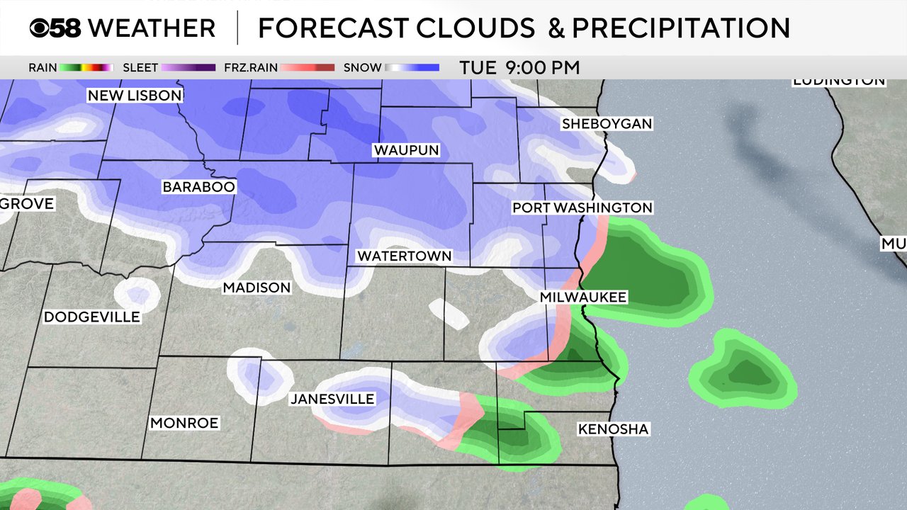
The mix should come down heavy enough for some of the snow to accumulate. Most of the accumulation will happen on grassy surfaces, patio furniture, cars, etc., but up to a slushy inch is possible for most of southeast Wisconsin. Northern counties like Fond du Lac and Sheboygan County could get an inch or even two inches with a chance for slushy roads.

By the Wednesday morning commute the mix chance has switched over to just a thunderstorm chance. Some of the storms could be strong to severe, even during the morning.

Scattered storms will continue through the rest of Wednesday morning and into the afternoon. Storms will wrap up by 8 or 9 PM. Any of the storms that form could be strong to severe.

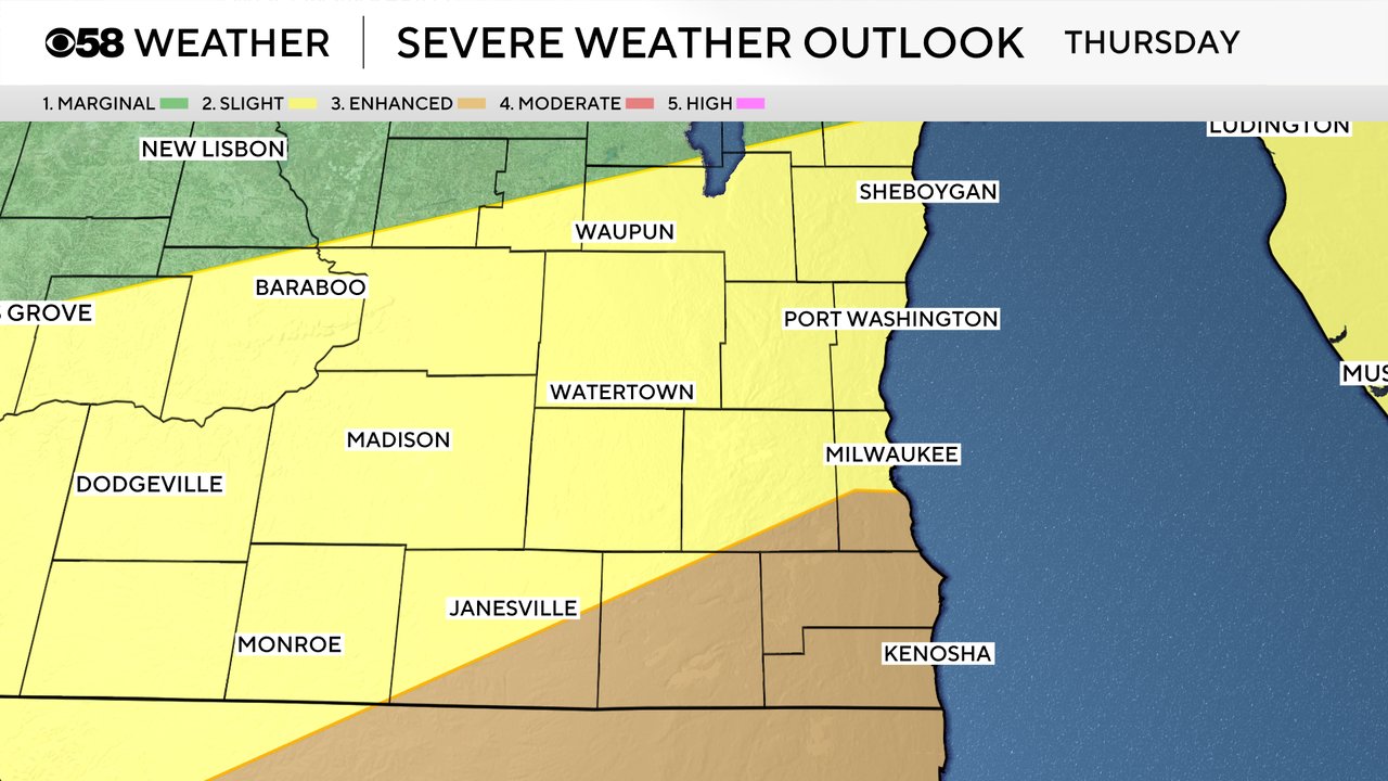
A large area of a Level 3 Enhanced Risk (shown in ran) to our south includes all of Racine and Kenosha Counties and southern parts of Milwaukee and Waukesha Counties and most of Walworth Counties. The rest of southeast Wisconsin is included in a Level 2 Slight Risk (shown in yellow).
Strong wind will be the primary threat with any strong or severe storms that develop. Some hail is also possible with a conditional threat for an isolated tornado and some brief flooding.
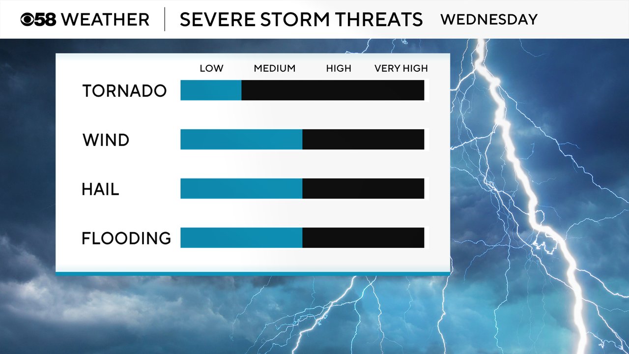
The ground is already pretty soaked with water from some of the heavy rain events of the last few weeks. Any heavy rain that we do get on Wednesday, especially if it comes quickly in a storm, could lead to some minor flooding.

Download the CBS 58 Weather app to track the snow to storms.