Temp roller coaster: Fall, summer, then fall

-
2:33

Gender affirming care in jeopardy for new patients at Children’s...
-
2:40

Wisconsin woman is first in the world to try new experimental...
-
0:48

Betty Brinn Children’s Museum celebrates opening of new pizza...
-
1:50

Kenosha mother demands justice, asks for community’s help in...
-
2:19

Friday Mid-Afternoon Update...Saturday snow still expected but...
-
1:10

Oconomowoc man to compete in national bagging competition in...
-
1:18

Wisconsin DNR shares ice safety tips ahead of sturgeon spearing...
-
2:01

February is prime time for pizza lovers to celebrate
-
3:41

National Wear Red Day highlights women’s heart health awareness
-
2:49

Meet CBS 58’s Pet of the Week: Waffle
-
5:31

CBS 58’s Feel Good Fridays: Football fun, Flannelpalooza, winter...
-
1:41

Former Brookfield East Spartan seeking 3rd Super Bowl

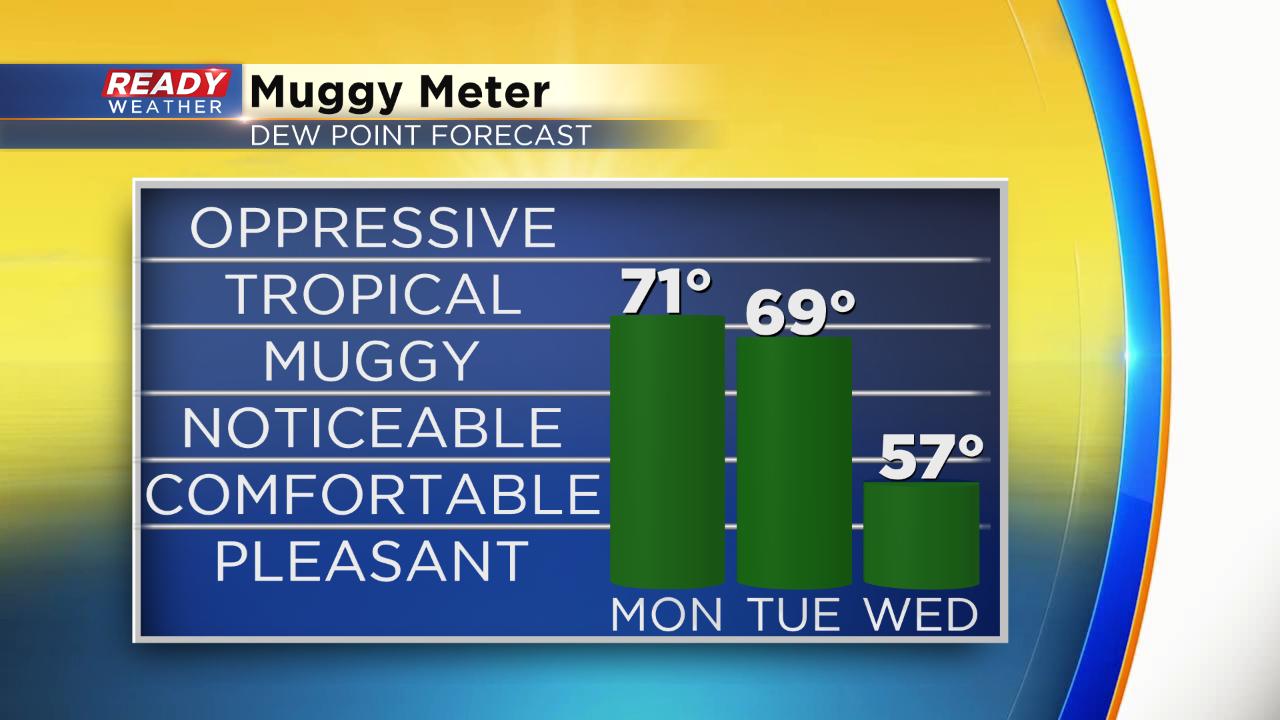
The weekend was very fall-like. Saturday was the coldest since June 2 and Sunday was gloomy all day with rain and mist. Monday - a much different story. Highs will surge about 20° warmer with highs in the low to middle 80s. It's actually not far from record levels. The current record is 88° set back in 1971.

The warmth will last another day into Tuesday where highs hover around 80° before cooling in the afternoon and evening as the cold front moves through. Temperatures will then drop another 20° and hover around 60° Wednesday through Saturday.

Expect lots of humidity with this summer-like warmth. Dew points through Tuesday afternoon hover around 70° making it feel pretty tropical.
Download the CBS 58 Ready Weather App to see if there's any more warmth in the 10-day forecast.