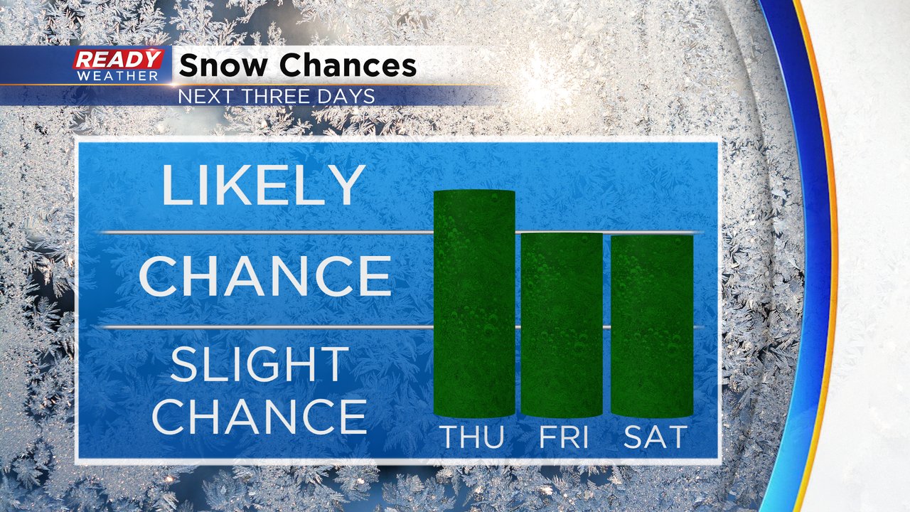
Two rounds of snow the next 72 hours


It's still cold, but the arctic blast will take a bit of a back seat the next 3 days with some snow chances on the way. The first chance arrives Thursday evening and lasts through early Friday. Most of the day Friday will be dry with another round of snow Friday evening through Saturday. The end time of the second round is a little bit uncertain with some weather models ending the snow Saturday morning and others keeping it in place through Saturday evening.
Due to the cold air it will take some time before the snow Thursday evening saturates the air enough for flakes to start falling. After 7 p.m. looks like a good bet for most of southeast Wisconsin with snow showers lasting the rest of the evening through early Friday. By 6 a.m. the snow should be all done.

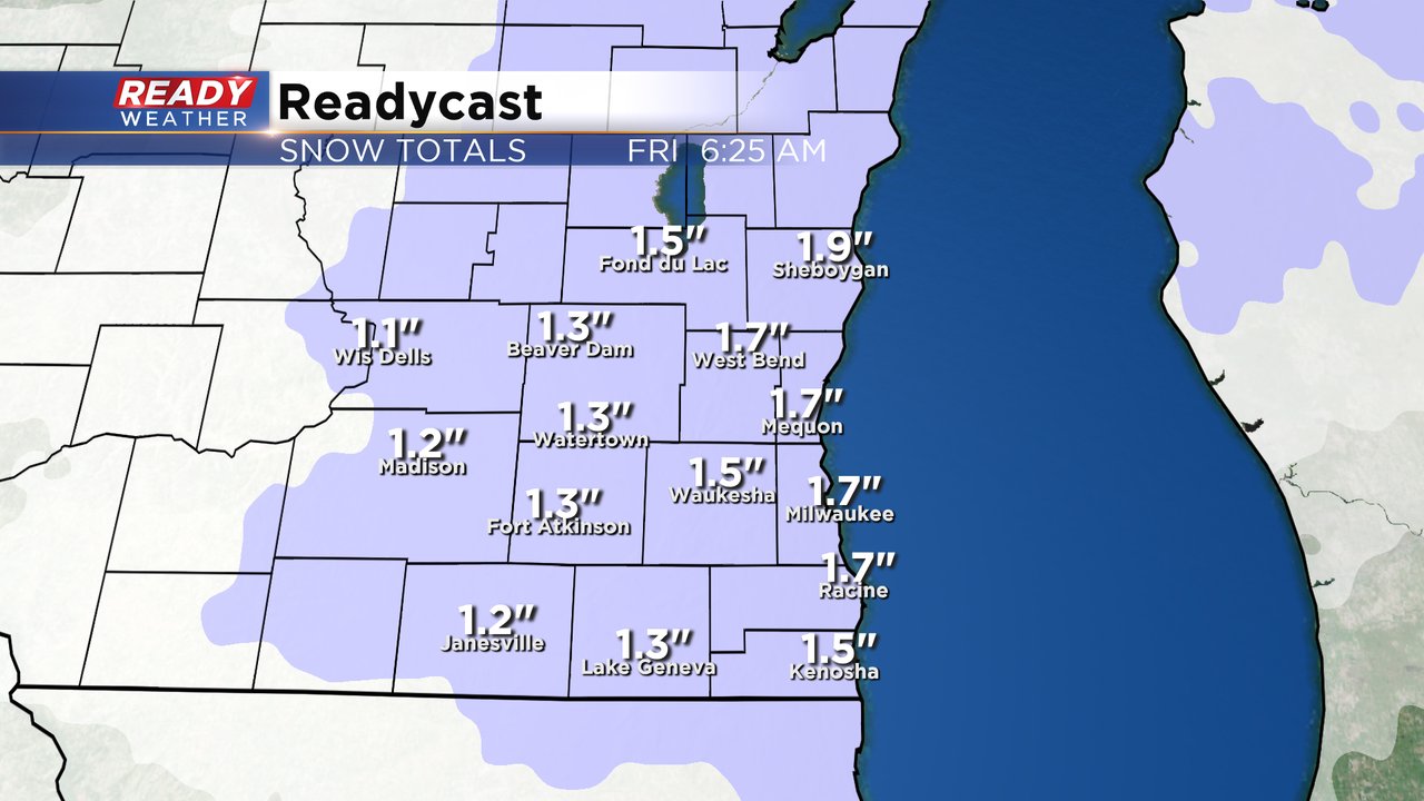
This will be a light and fluffy snow but those snows can pile up easy so an inch or two of snow is possible for most with some just less than that. The good news with the light and fluffy snow is that it won't be hard to shovel and you can probably use the broom or leaf blower if you want!
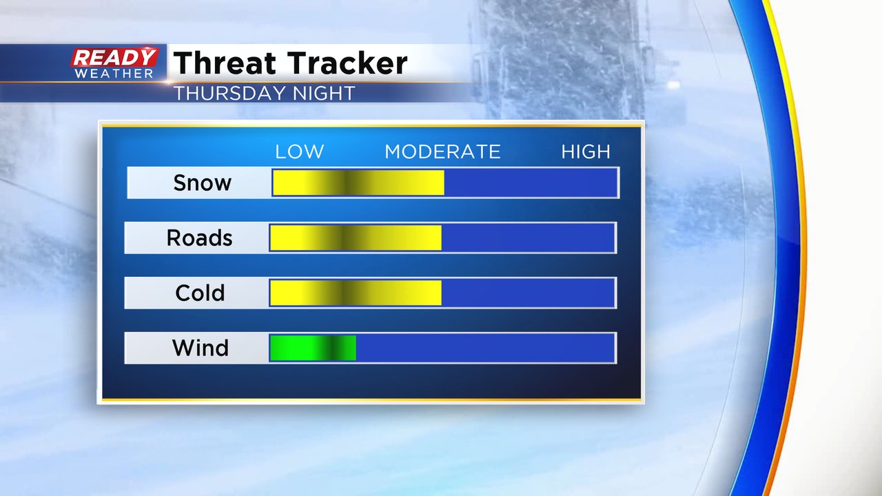
Powdery snows can also be a lot more slippery than the wetter snows so expect roads to become pretty slick Thursday night. Temperatures are also cold enough where salt doesn't work as well. When you add the slippery fresh snow on top of some icy patches that are still on the roads it could make things a little dangerous. The cold air will still be in place so that's also one of our threats but the wind will remain fairly light.
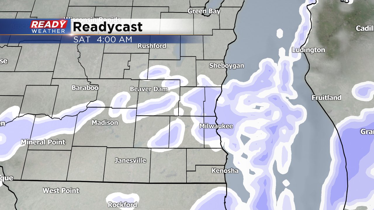
The heart of the day on Friday is dry but the second round of snow moves in Friday evening through Saturday. We will wait until after the first round of snow is done to talk exact numbers for the second round but a few inches of snow looks possible.
Download the CBS 58 Ready Weather app to track the snow with the interactive radar.