Warm and windy through the rest of the Memorial Day weekend


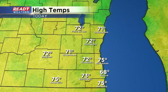
Despite a few isolated afternoon showers, it's been a beautiful start to the extended weekend with temps topping out in the low to mid 70s today.
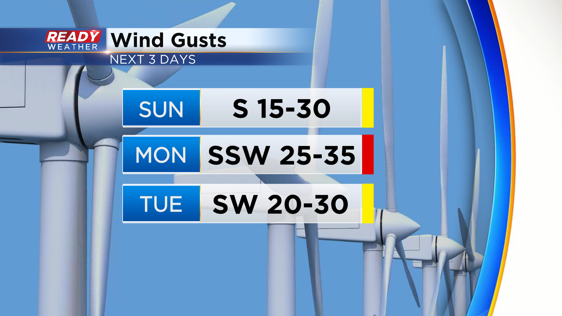
Temps will be even warmer over the next few days thanks to a ridge of high pressure and strong southerly winds. Winds may gust between 25-35 mph at times Sunday through Tuesday.
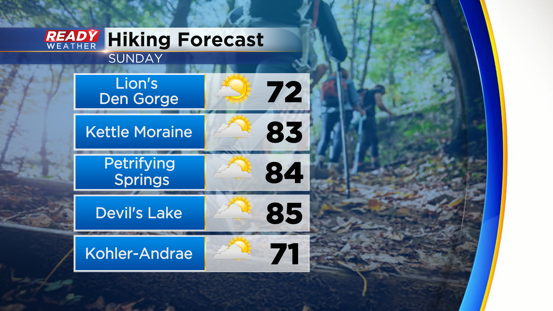
The stronger southerly winds will boost temps into the low to mid 80s for most on Sunday unless you're in Ozaukee or Sheboygan counties where an onshore wind will keep temps in the lower 70s.
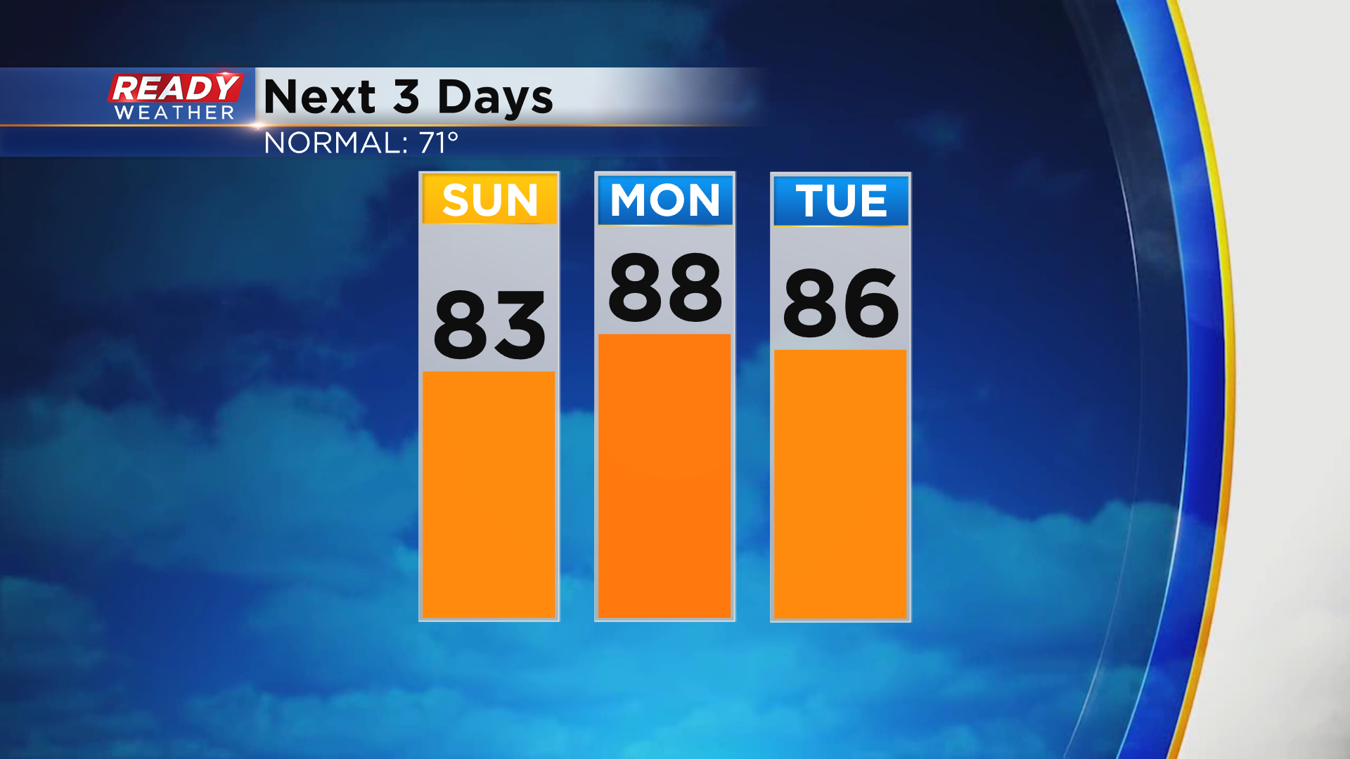
Temps jump into the upper 80s to around 90 degrees on Memorial Day itself, with mid 80s sticking around for Tuesday.
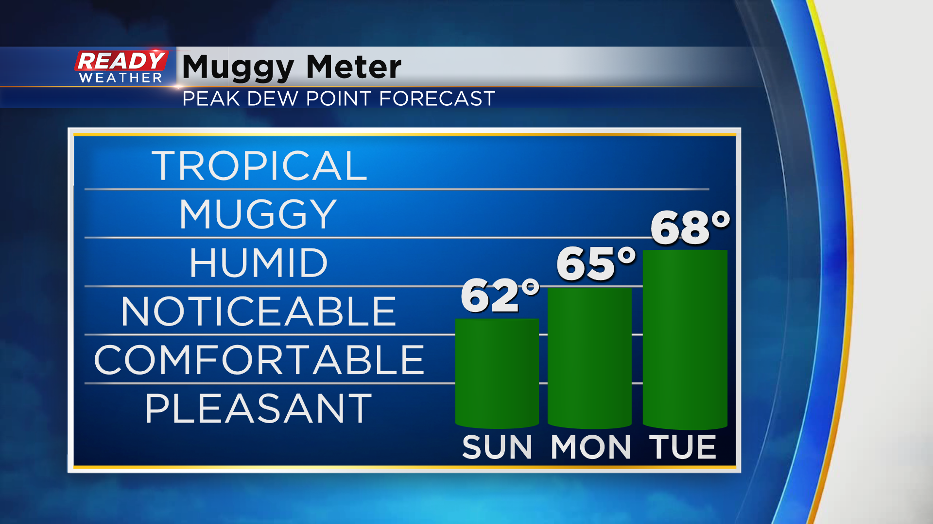
With the increase in temps comes a gradual increase in humidity. You'll notice the humidity on Sunday, but it will be tolerable especially with the gusty winds. Tuesday looks to be the most humid day with dew points in the upper 60s before a cold front arrives late in the day.
Although it'll be very warm the next two days, don't cool off in Lake Michigan! Dangerous currents are expected through Monday night. On top of that, water temperatures are only in the mid 40s.
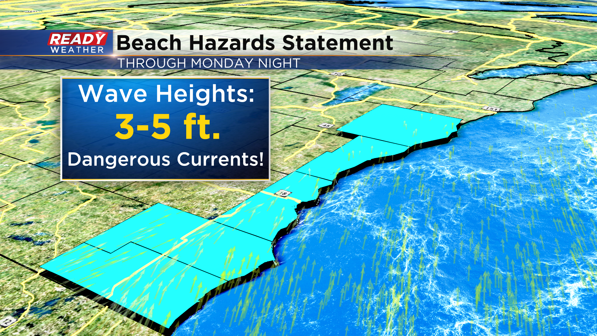
The lack of lifeguards at area beaches makes this even more dangerous, so please stay out of Lake Michigan this weekend. If you want to swim, do it on a smaller inland lake. Tuesday night's cold front will get rid of the heat and humidity, dropping temps into the low 70s for the second half of the week. It'll also be our next chance for rain. Download the CBS 58 Ready Weather App for the full 7 day forecast.