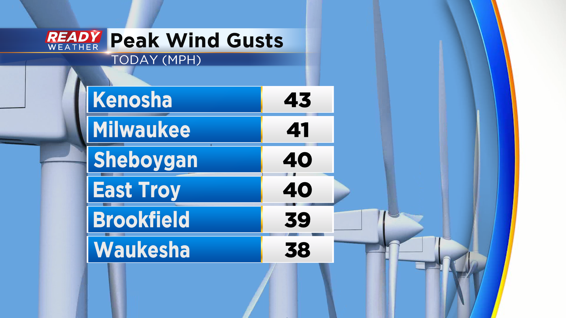
It was a blustery day across southeast Wisconsin with frequent wind gusts between 25-35 mph. A few spots evening saw gusts around 40 mph.
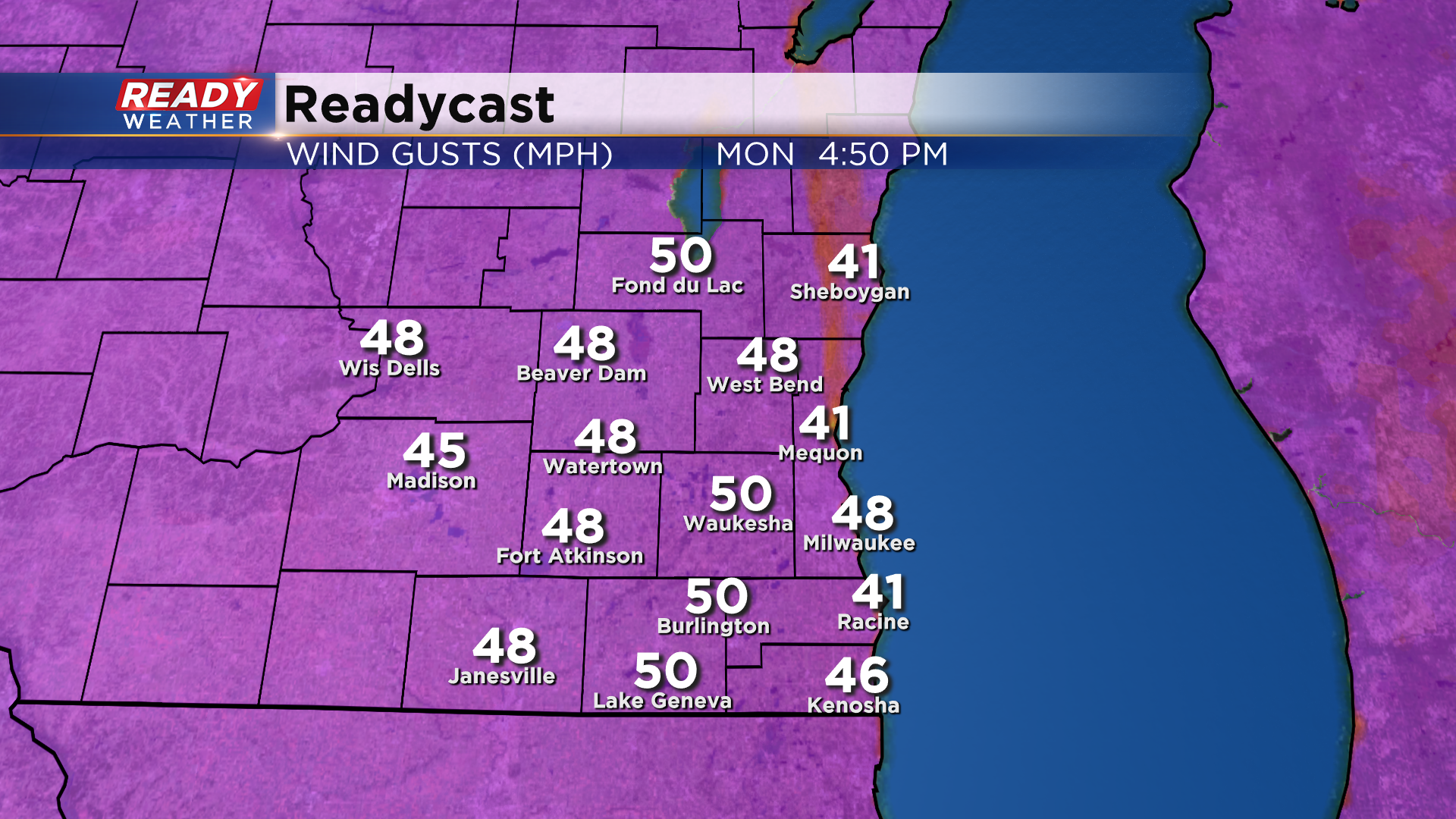
The gusty winds will subside this evening, but they'll turn to the south and ramp back up Monday morning. Gusts between 35-45 mph are likely, especially in the afternoon and early evening when a few gusts may reach 50 mph+.
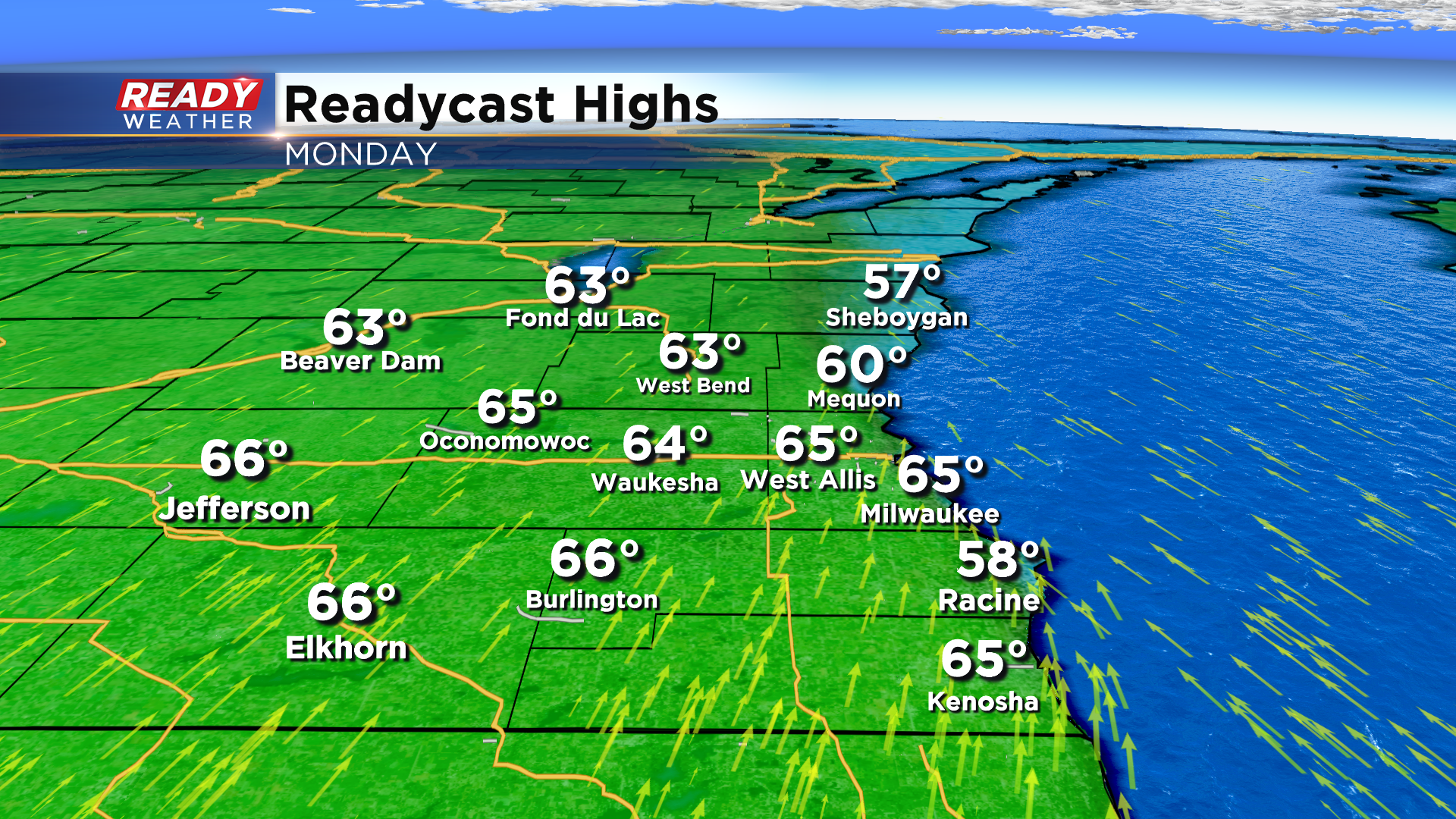
The southerly wind will boost temps into the mid 60s for most of southeast Wisconsin, but because it's a southerly wind it'll likely keep Racine and parts of Ozaukee and Sheboygan counties in the upper 50s.
Unfortunately the 60s aren't here to stay quite yet. A cold front will track through the state late Tuesday morning, which may trigger a few sprinkles. Highs climb into the 50s ahead of the front, but will struggle to reach 40° both Wednesday and Thursday.
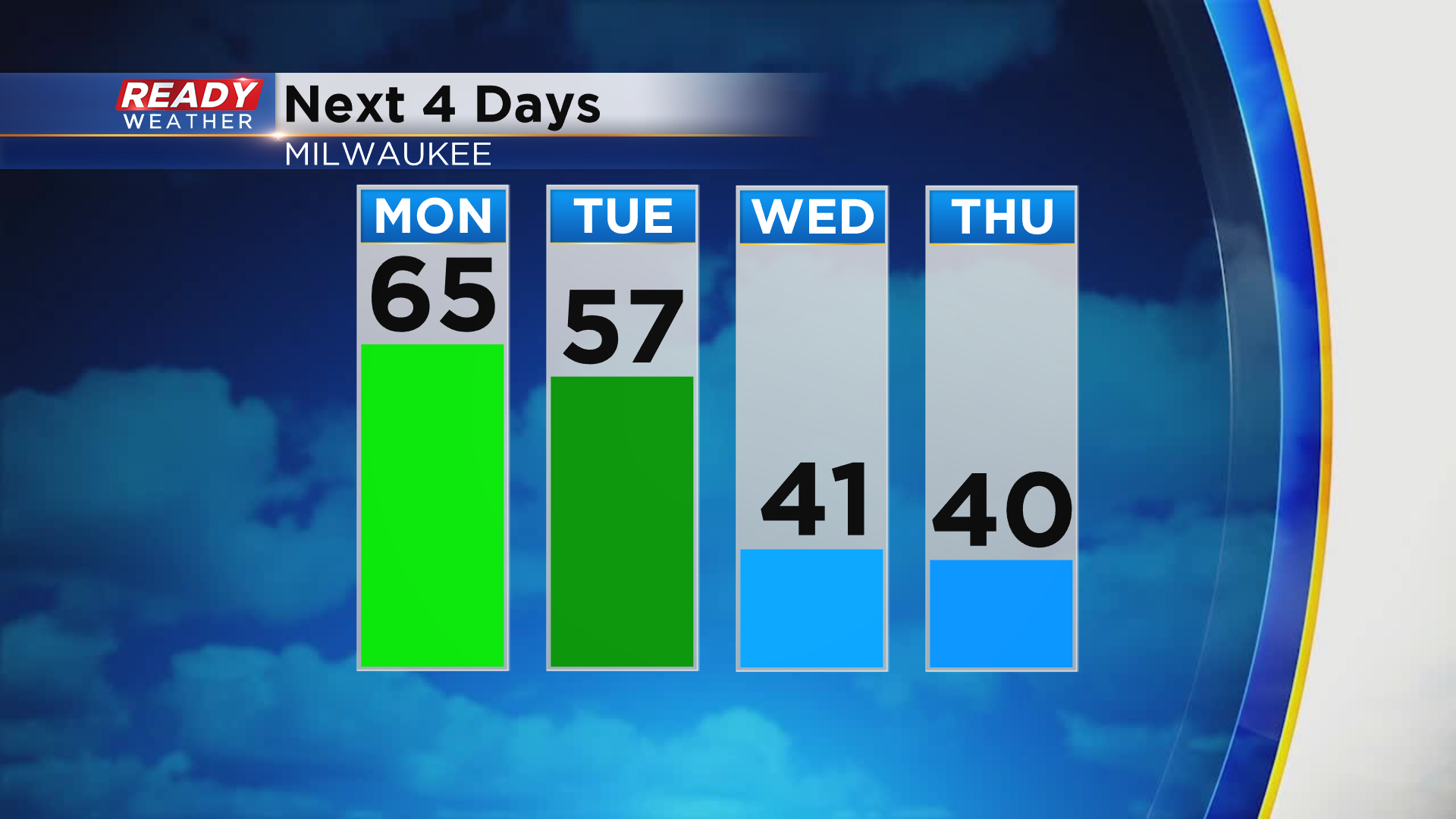
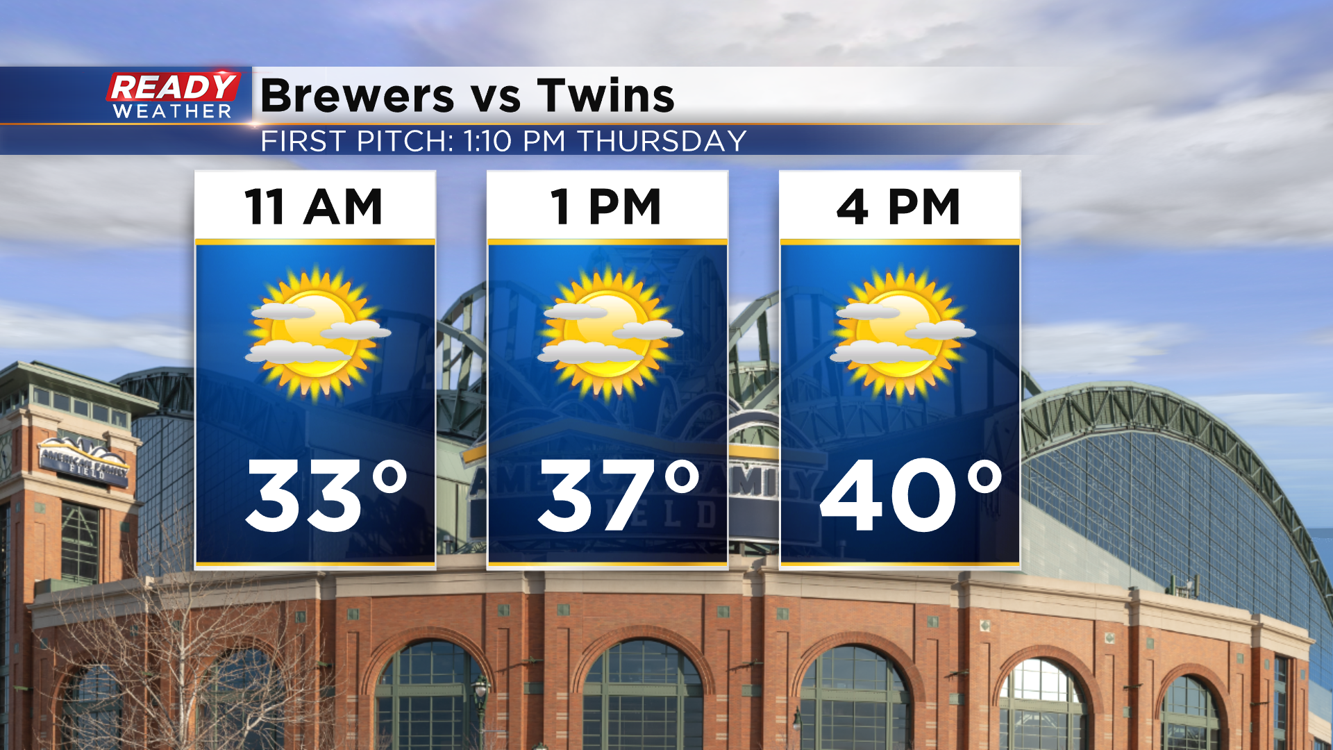
Thursday morning will be the coldest of the week, fitting for Opening Day. First pitch temps may only be in the 30s, but plenty of sunshine is expected.
Download the CBS 58 Ready Weather App to see when the 60s return.
