Wednesday was the warmest day of the year; few more showers possible the next few days


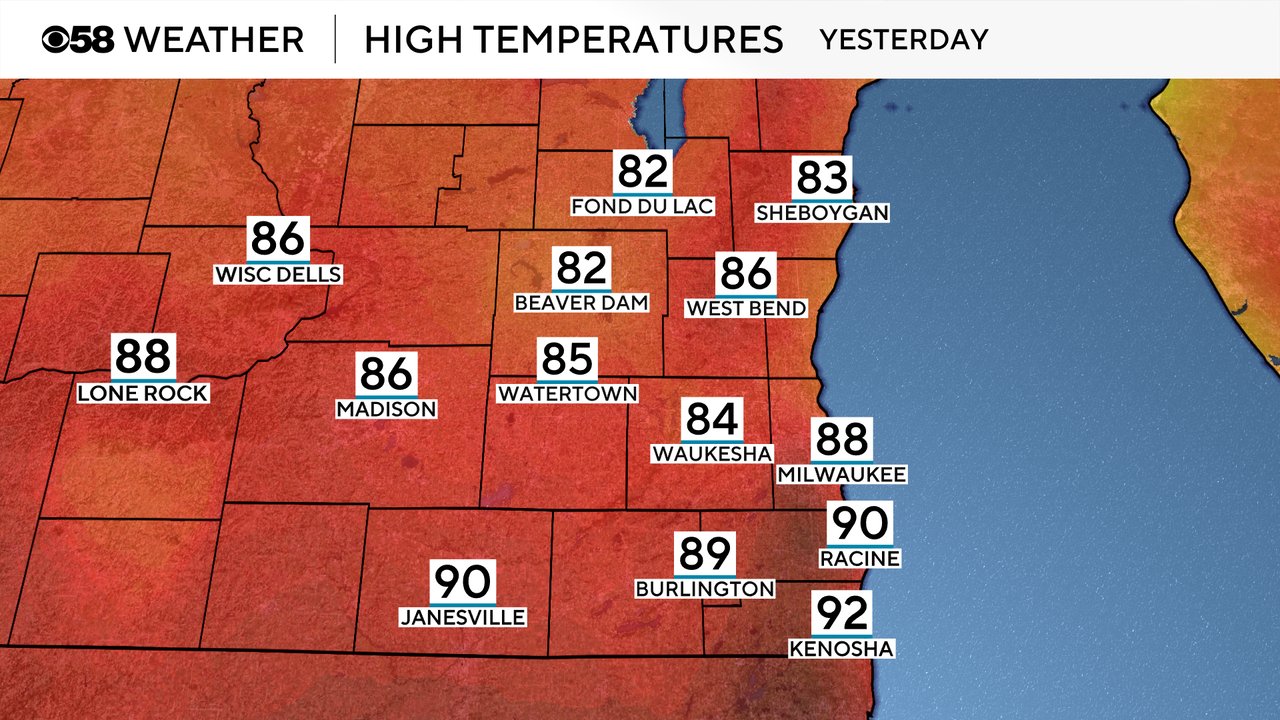
As we predicted, Wednesday was the warmest day of the year! We had widespread 80s across southeast Wisconsin and even a few communities reached the 90s. The warmest temps were in our southeast counties with the strong west wind we had.
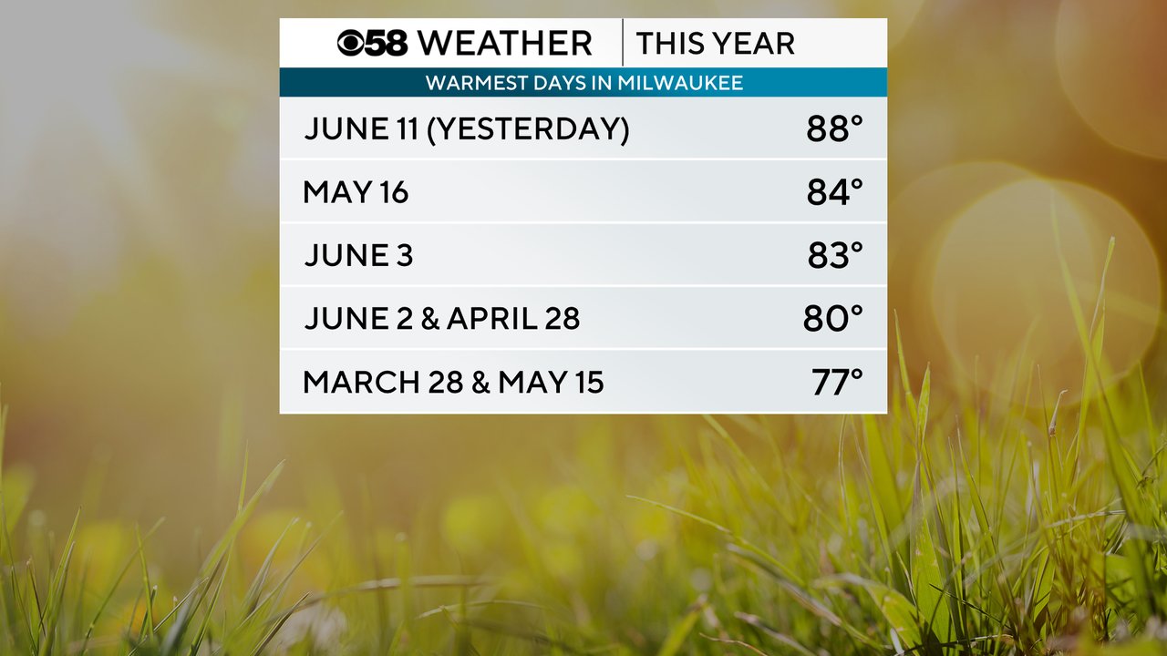
The 88 degrees we reached in Milwaukee Wednesday beat out the middle of May for the warmest temps of the year. A few days at the beginning of June also reached the low 80s.
Temperatures will be a lot cooler the next few days with highs only reaching the upper 60s and low 70s through the weekend. We don't get back to average highs until Monday when we reach the upper 70s.

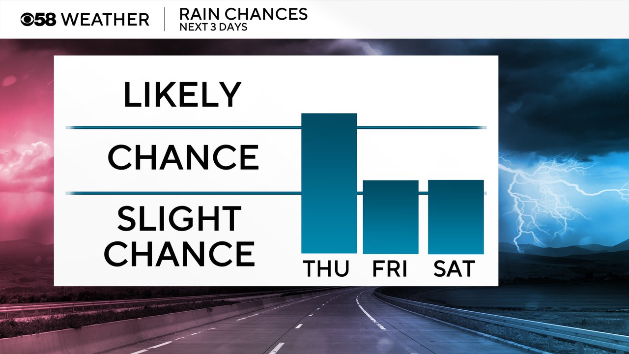
The cold front that brought in the 20 degree temperature drop from Wednesday into Thursday was also responsible for some showers and storms Wednesday night into Thursday morning. A few more showers will be possible Thursday, especially in the morning, and mainly in northern counties.
Here is a radar image that will update with time:

After the morning showers on Thursday we only have isolated chances for showers or storms on Friday and Saturday with many locations staying all dry.
Download the CBS 58 Weather app to track the temps and rain.