Evening Update: Line of storms continue to weaken


Updated: Sunday, August 28th 5:00 pm:
Thankfully, the severe threat is quickly diminishing. Storms are weakening as they move closer to the lakefront. The lightning cores continue to go down which is a good sign.
Scattered rain will likely linger for another hour or so.
______________________________________________________________________________________________________________
Updated: Sunday, August 28th 4:30 pm:
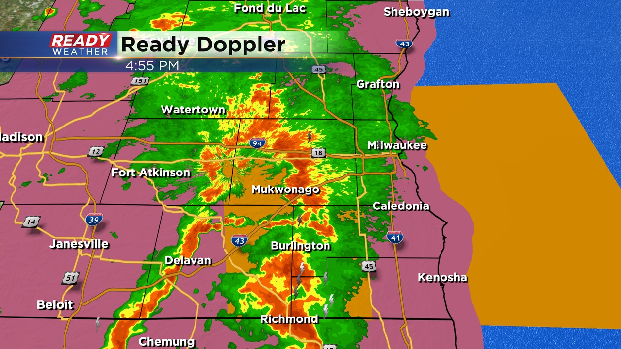
A line of strong to severe storms are moving across southeastern Wisconsin. These storms are moving to the east/northeast between 40 and 50 mph.
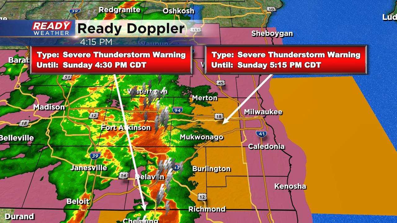
New warnings for Waukesha, Racine, and Kenosha counties have been issued until 5: 15 pm. Damaging winds between 50 to 60 mph are possible.
______________________________________________________________________________________________________________
Updated: Sunday, August 28th 3:15 pm:
A line of severe storms is racing to the northeast at 50 mph and could reach western Jefferson and Walworth counties by 3:30pm. The main threat with this line is damaging winds, but there have been a few weak circulations noted within these storms.
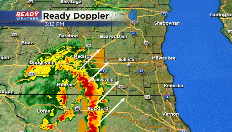
Damaging winds and isolated tornadoes will continue to be the main threats as this line tracks across southeast Wisconsin through 7pm or so.
-----------------------------------------------------------------------------------------------
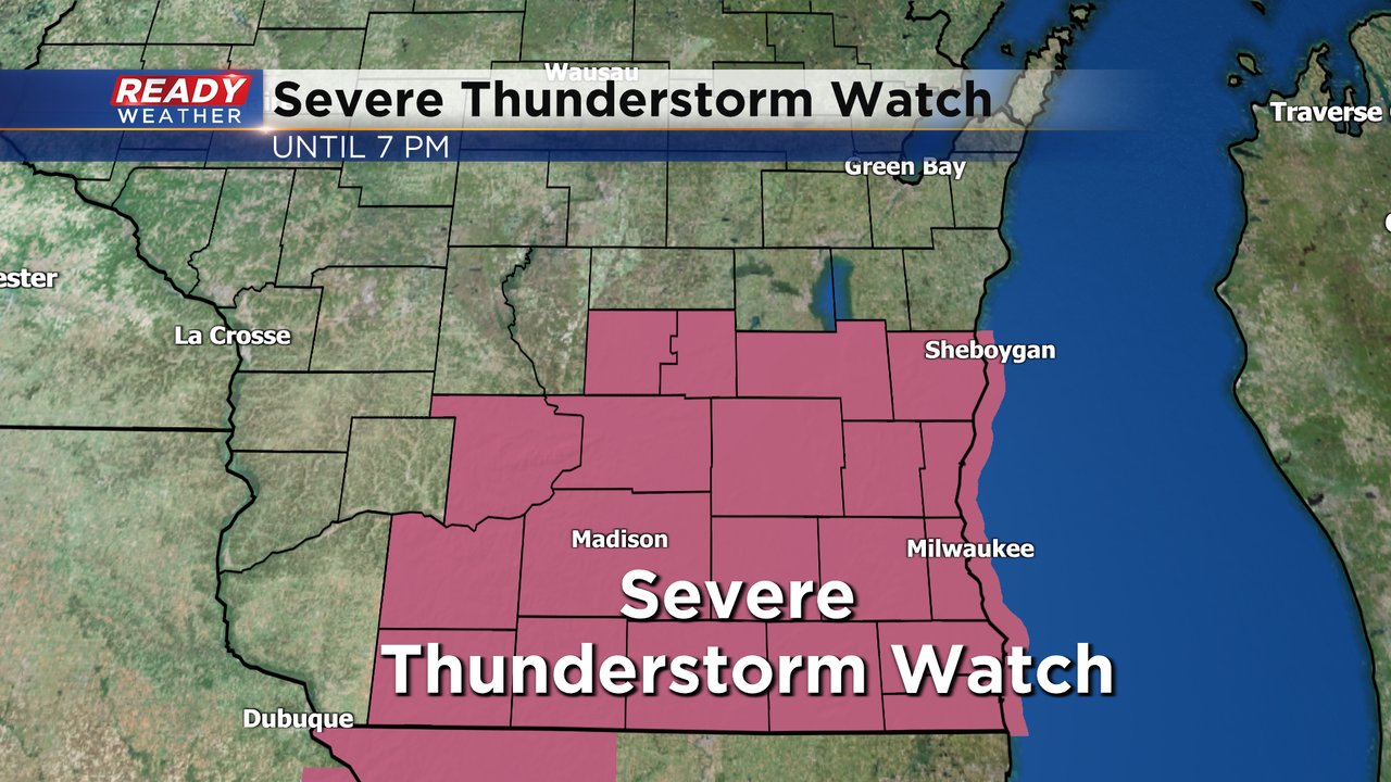
Updated: Sunday, August 28th 1:15 pm:
A Severe Thunderstorm Watch has been issued for all of southeast Wisconsin through 7 pm. Damaging winds, isolated tornadoes, and large hail are all possible. Timing still looks to be between 4-7pm.
Download the CBS 58 Ready Weather App to get alerts sent to your phone.
---------------------------------------------------------------------
Updated: Sunday, August 28th 11:45 am:
Round one of rain has moved through southeast Wisconsin with a nice break in the action on the way for a few hours. Our attention now turns to the localized area of low pressure currently spinning in eastern Iowa, which will trigger our next round of storms late this afternoon.
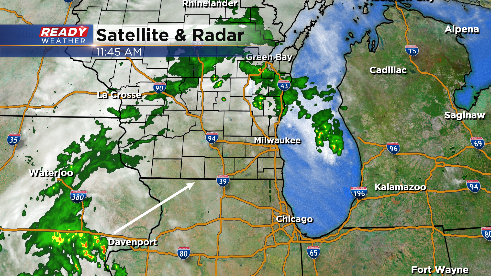
Storms look to fire in SW WI around 3-4pm, tracking across southeast Wisconsin between 4pm-8pm.
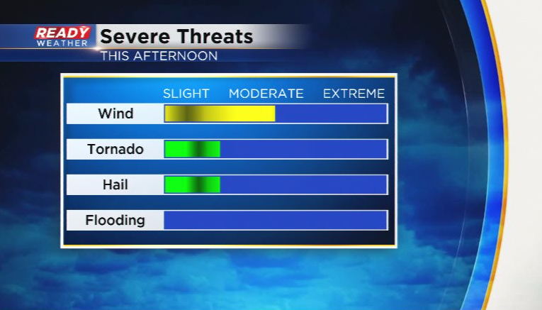
Given the sunshine that's moving in behind round one of rain and the humidity that's in place, storms could be strong to severe. Most of SE WI has been upgraded to a level 2 of 5, Slight Risk, for severe storms later today.
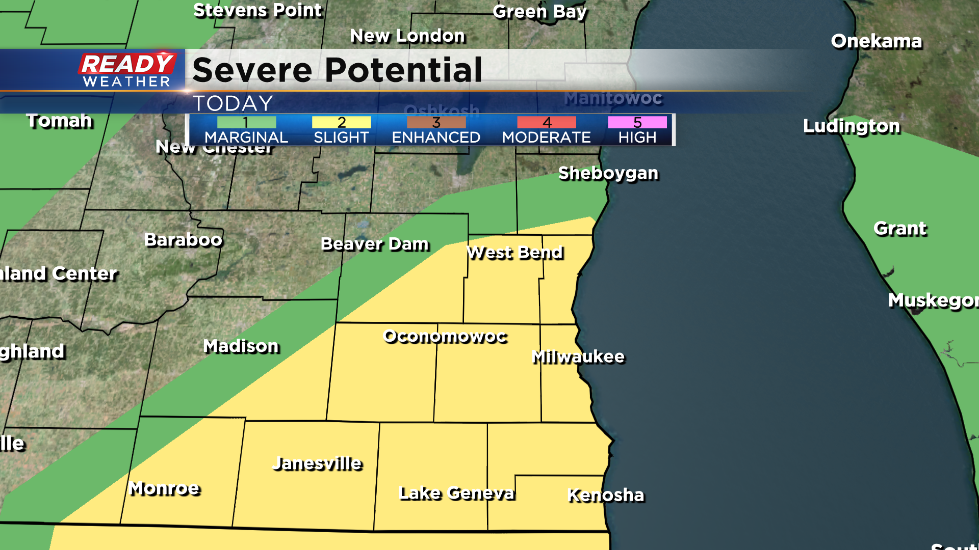
Damaging winds and an isolated tornado or two are the main concerns with storms that develop with a lesser threat for hail and flooding.
Download the CBS 58 Ready Weather App to get alerts sent to your phone and check back for additional updates through the afternoon.
--------------------------------------------------------------
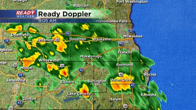
Update as of 9 am Sunday, August 28th...
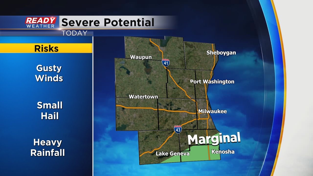
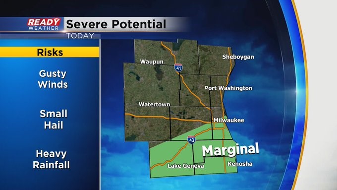
Some beneficial rain moving into the metro area now. Nothing severe. Although the Storm Prediction Center has expanded the marginal risk of severe weather to include the Milwaukee area. Gusty winds, small hail, and heavy rain are all possible. Stay tuned to CBS 58 on air and online throughout the day for the latest weather information.
_____________________________________________________________________________________________________________
MILWAUKEE (CBS 58)--The umbrellas will get a workout through Monday morning at least as a storm system treks across the area. We'll see rounds of showers and storms, some of the rain could be moderate as well. We need the moisture. We're more than a half inch below normal for the month and more than an inch for the year. With this round, we could see a half an inch at least. Some closer to an inch.
Once a cold front moves through late in the day on Monday, we're in store for nice weather with highs near 80 and humidity in check. It actually looks nice right through the holiday weekend. Hard to believe September is on Thursday and Labor Day is the following Monday. Wow!