Wet start to June as we detail Meteorological Spring rankings


These first few days of June have turned wet with strong to severe storms and heavy rain Tuesday afternoon and evening and a round of steady rain early Wednesday. Those showers will come to an end late Wednesday morning but not before dropping another soaking rain. Most of southeast Wisconsin saw at least 0.75" of rain with many areas coming in at over 2".

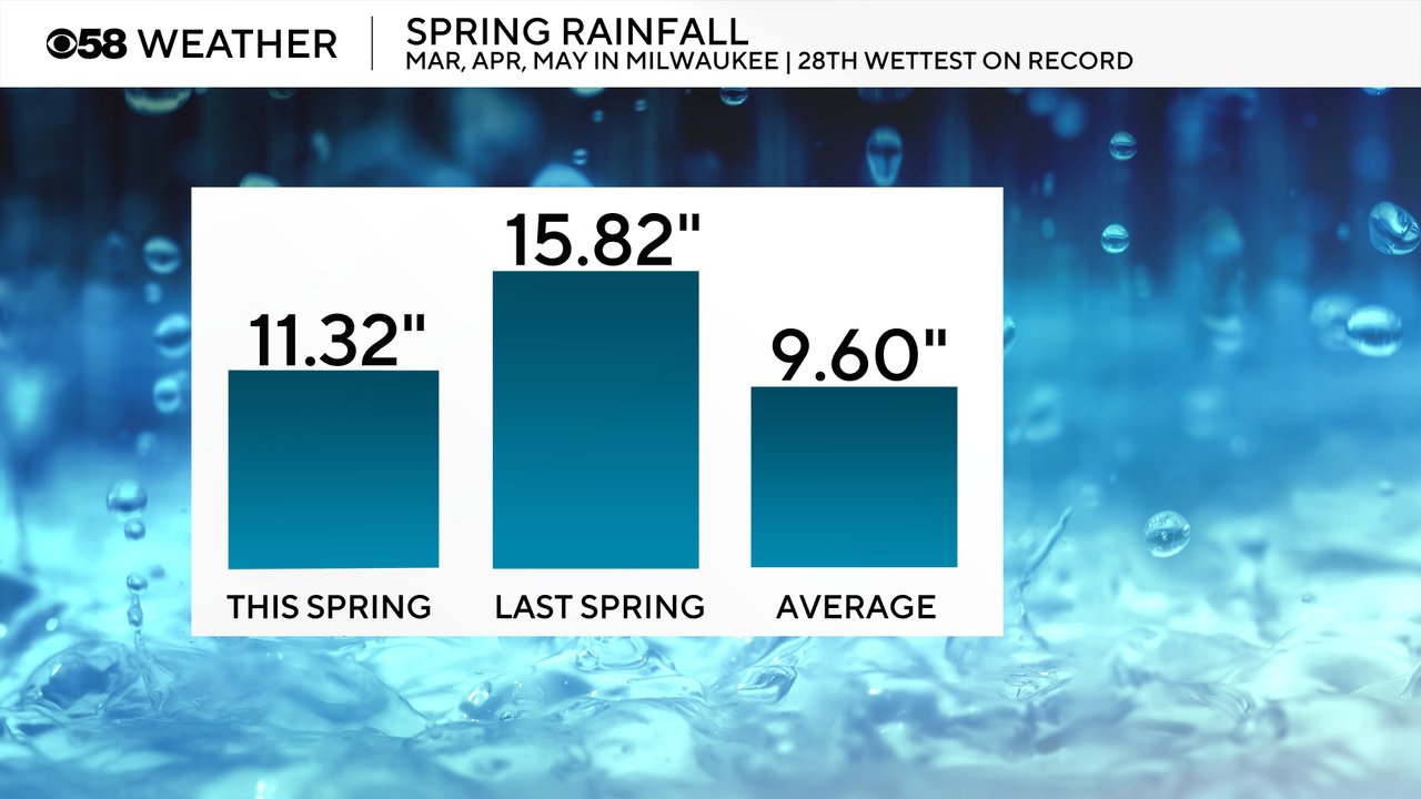
The wet start to June comes after meteorological Spring which includes the months of March, April and May were wetter than average. Over those three months we picked up 11.32" of rain which is almost 2" above average. Last spring was even wetter with almost 16" of rain and was the third wettest spring on record. This year we ended the rankings as the 18th wettest.
We also have to talk about snow on more time this season. During the spring months we saw 5.7" of snow, most of which fell in March. That was over 3" below average for the months of March, April, May and goes down as the 39th least snowy meteorological spring on record.

When it came to temperatures during the three spring months we were a little cool overall. 45.8 degree was the official average temperature which was almost a full degree below average. The warmest temperature happened just a couple of weeks ago when we reached the mid 80s and the coldest time was two months before that in the teens!

Download the CBS 58 Weather app to track the forecast for the summer months!