


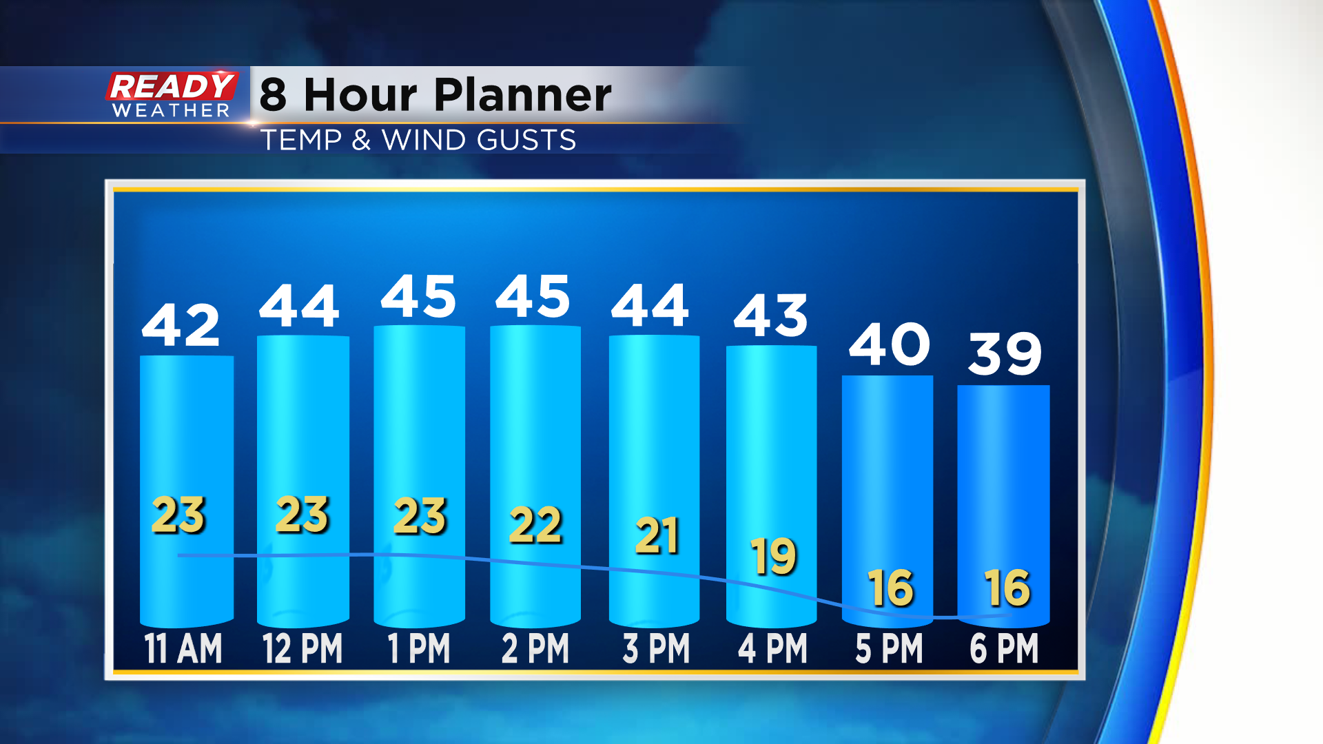
Plenty of sunshine is expected across southeast Wisconsin today after starting the week with clouds and rain/snow showers. Sunshine will help temps warm into the mid 40s, but winds will be on the breezy side with gusts between 20-30 mph most of the day.
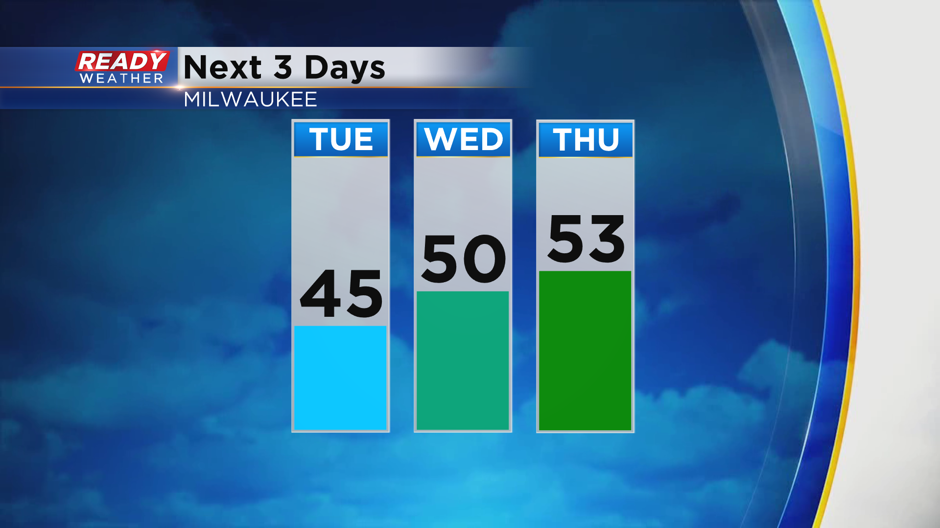
Temps will be even warmer as we head into the beginning of December with highs topping out either side of 50° on Wednesday and low 50s on Thursday. You'll still notice a breeze both days with gusts approaching 35 mph on Thursday.
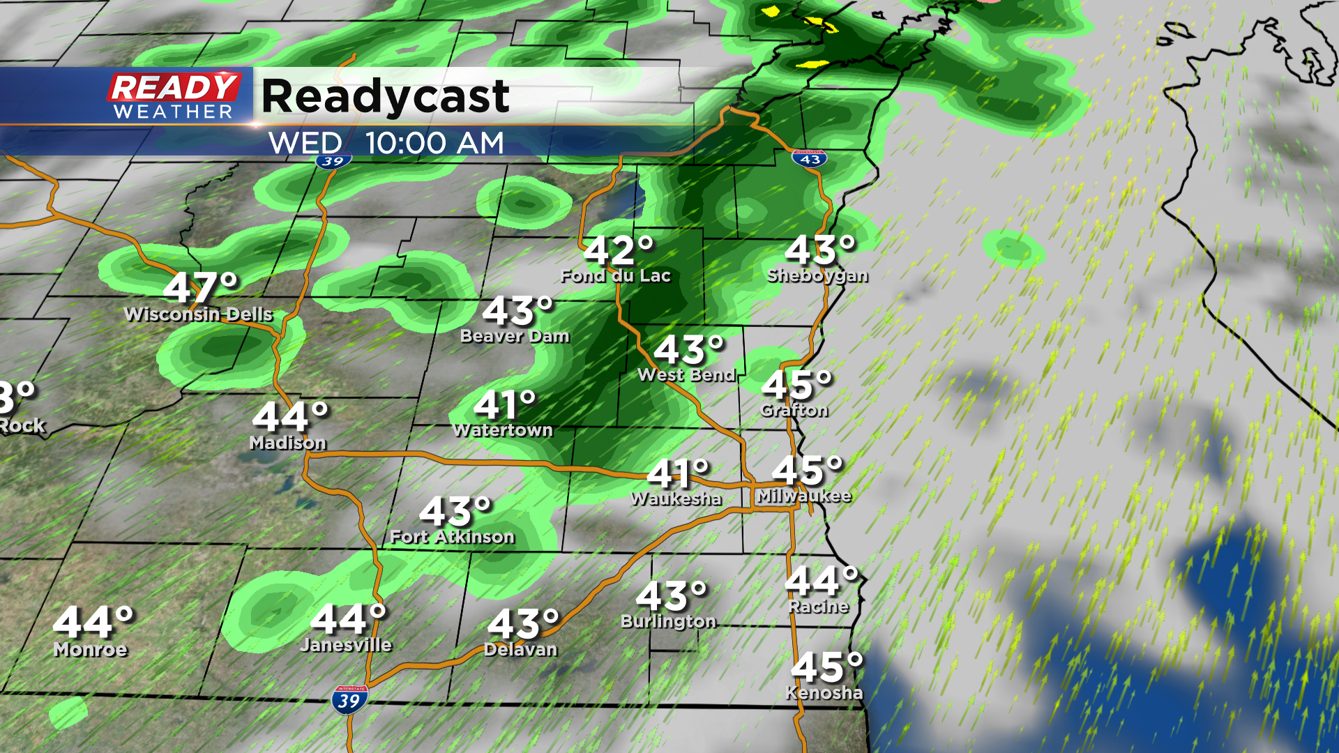
While dry weather is expected today, a few rain showers will move through the area on Wednesday morning. Some wet snowflakes are possible closer to Fond du Lac and Beaver Dam for a brief period of time before changing to rain. No accumulation expected as temps will be well above freezing.
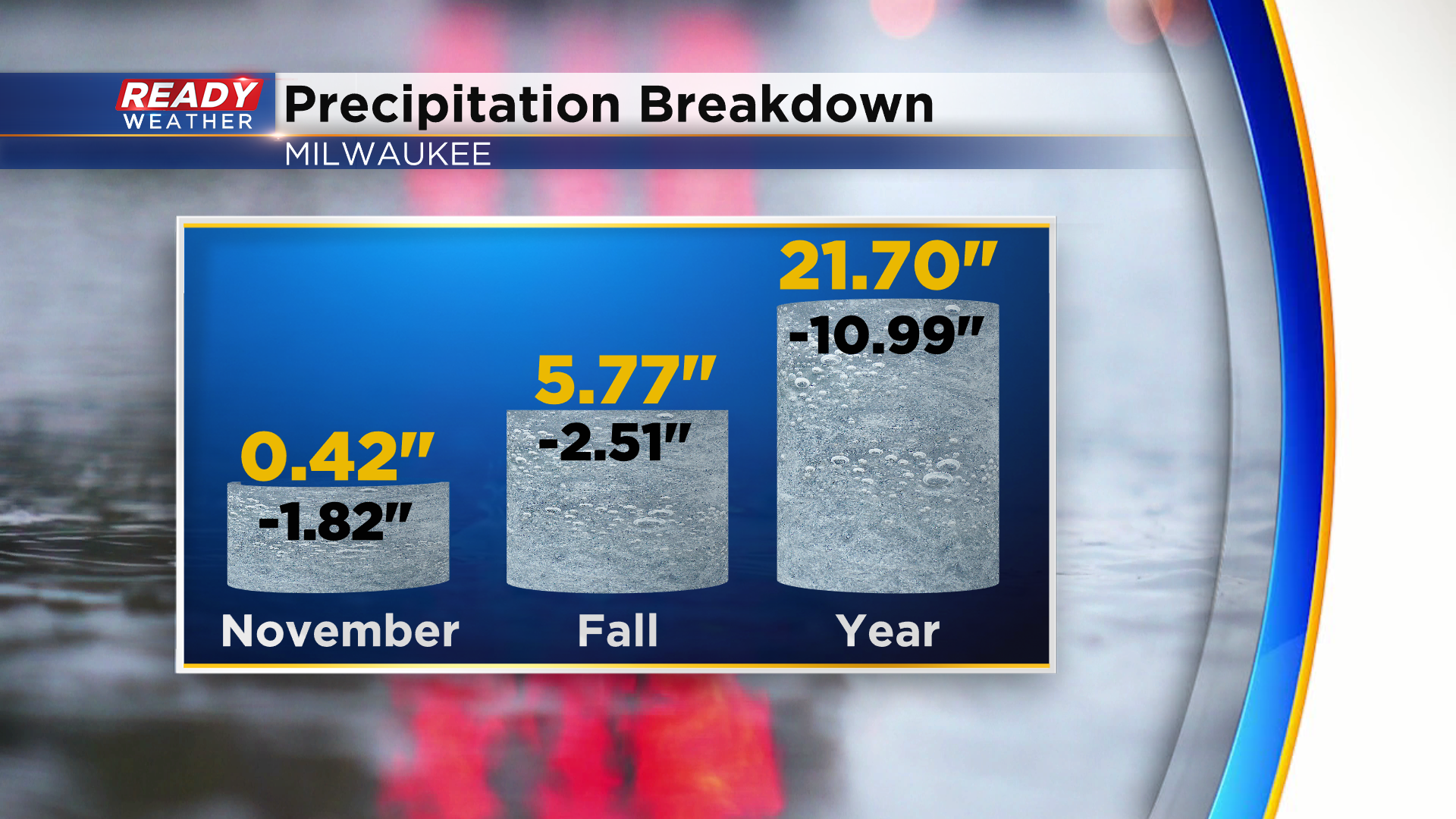
Although rain totals will be light, we'll take what we can get as we're still running at a large precipitation deficit on the year. November will go down as the 7th driest on record with less than a half inch of precip. Milwaukee is running 11" below normal on the year.
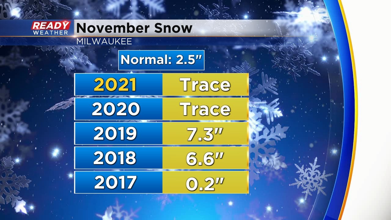
Despite the snow showers we've had this month, there hasn't been any measurable snow. You may remember we didn't have any measurable snow last November either, but MKE had picked up 0.1" in October of last year.
There is a chance for a light rain/snow mix again on Friday, but we may have our first shot at measurable snow by the end of the weekend. Download the CBS 58 Ready Weather App to see the full forecast.