90° possible Tuesday with a chance for strong storms in the evening


Tuesday has the possibility to become the hottest day of the year so far! Upper 80s have been in the forecast for a few days but now 90 degrees looks possible! Right now, last week on June 11th is the warmest day of the year when we hit 88 degrees.

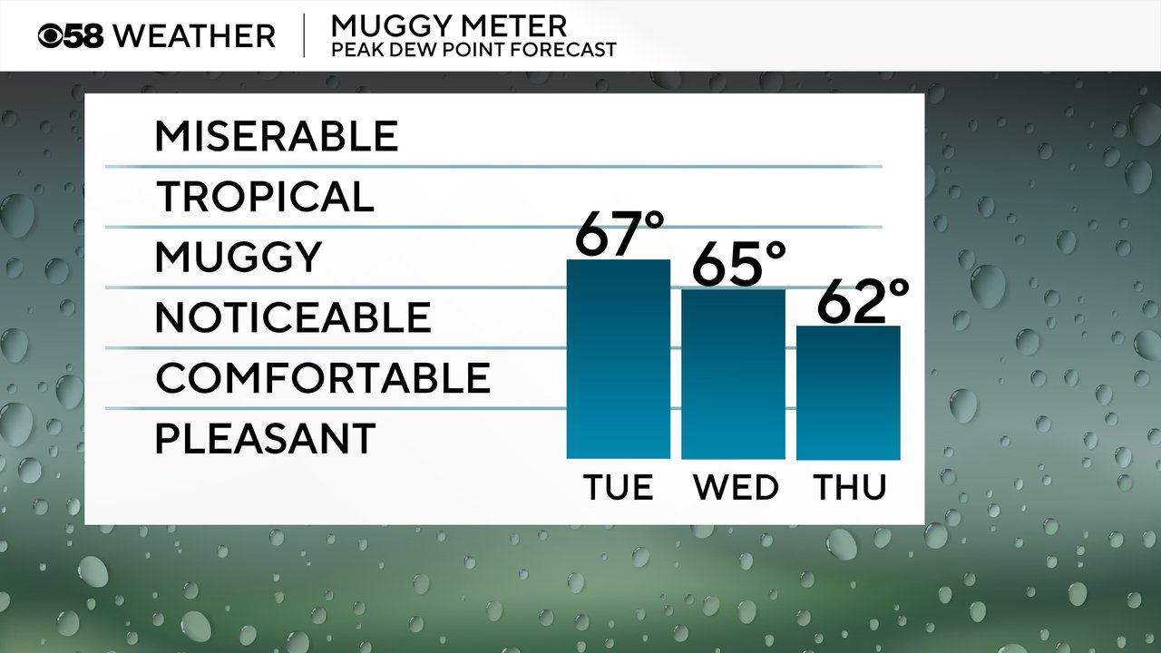
In addition to all the heat it will also be very humid Tuesday with dew points reaching the upper half of the 60s putting us well into the muggy and humid category. That humidity sticks around for Wednesday and Thursday and even Friday will still feel some noticeable humidity before near tropical-level humidity arrives for the weekend with even more heat.
All of the heat and humidity will provide fuel for the possibility of storms Tuesday evening. The storms will focus along a front with most, but not all, weather models bringing those storms into at least our southern or southwest counties this evening.
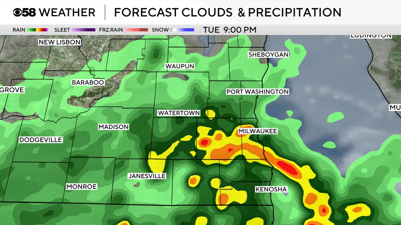
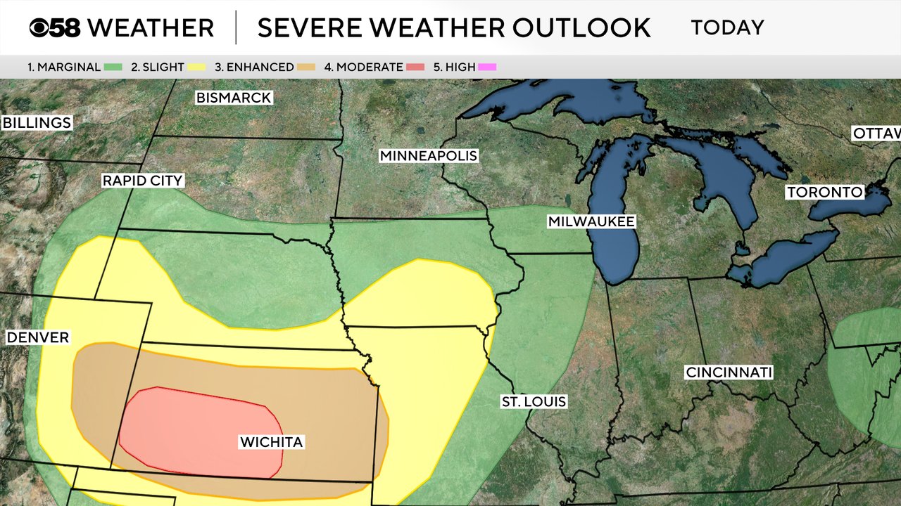
Any storms that do form have the possibility to be strong with some small hail or gusty wind. Most of southeast Wisconsin is under a Level 1 Marginal Risk for severe storms Tuesday but the better chance is in Kansas where we have a Level 4 Moderate risk.
The chance for storms will continue Wednesday and Thursday. Wednesday is looking like the best chance for scattered showers and storms this week with a near 100% chance. Thursday's chance isn't as good but there is still a possibility for storms. Any storms that do form Wednesday and Thursday could also be strong to severe with continued Level 1 or Level 2 risks for severe storms.
Download the CBS 58 Weather app to track the heat for Tuesday and continued strong storm chances.