A dry September comes to an end as we look ahead to a warm start to October


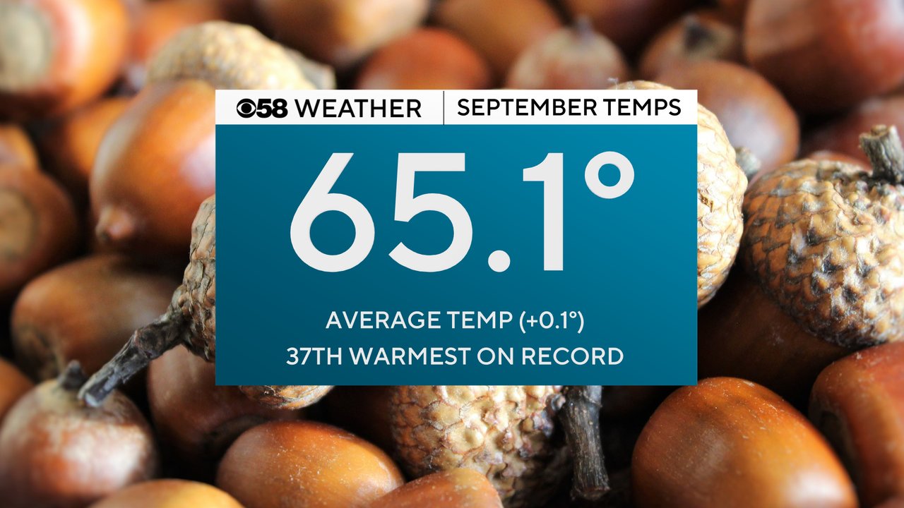
Happy October! The month of Halloween is here but it might not feel very spooky and fall-like with the temps any time soon. The start of a new month means that the previous month is in the record books. When it came to temps during September you can basically split the month exactly in half. The first two weeks of the month were cool and chilly and the average temp was nearing five degrees below average. But then we warmed things up in the last two weeks of the month and we got back to nearly exactly average. The official average temperature for September goes down as 65.1 degrees which is just a tenth warmer than the 30-year average and good enough to be the 37th warmest September on record.
The warmest and coolest temps of September were nearly opposite of what you might expect. Typically the warmest temps would be at the beginning of the month and the coolest temps at the end of the month but this year was exactly the opposite of that. The warmest high happened just this past Saturday when the temperature reached 85 degrees. The coldest temp was in the first week of the month when we dropped into the 40s.

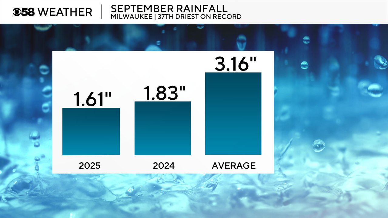
When it came to rainfall we didn't see much in September. the month only picked up 1.61" of rain which is over an inch and a half below average. It was almost drier than last September in 2024 when we started to see drought conditions return. The next drought outlook will be released on Thursday. Officially it is the 37th driest September on record.
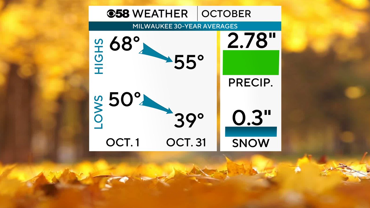
Now we are in the month of October which is a month that sees the average highs and lows drop. The average high drops over ten degrees from 68 on the first day of the month to the mid 50s at the end of the month. The average low goes from 50 October 1st to the upper 30s by Halloween. October also averages nearly 3" of rain and we can get snow. The month officially averages three tenths an inch of snow!
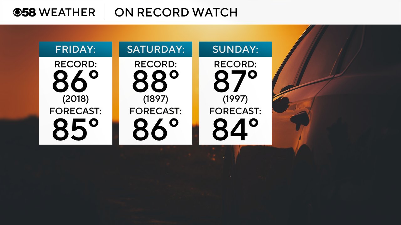
There is no snow in the realm of possibility to start this October though! High temperatures as we head into the first weekend of the month could flirt with records. Highs in the mid 80s could come with a degree or two of current record highs. Friday right now has the best chance fo tying or breaking a record with the current forecast high of 85 just a degree shy of the record 86 set in 2018. Saturday has the warmest record at 88 just two degrees above the forecast and Sunday's record high of 87 is three degrees above the forecast of 84.
If we do reach the upper 80s this weekend or even make a run at 90 it would be the warmest temps we've ever achieved in the month. Currently the hottest temperature during the month of October is 89 hit on October 6, 1963. We've never hit 90 during the month which is a trend I like to call the "never evers". In Milwaukee, we've never hit 100 in September, 90 in October, 80 in November or 70 in December. One of these years one, or more, of those records will fall. In 2024 we came close to hitting 70 in December and this weekend could get close to 90 in October.

Download the CBS 58 Weather app to keep a close eye on the forecast highs for the weekend!