Evening Update: Snow and slick roads expected overnight into Monday morning


Updated: Sunday, March 12th 8:55 pm:
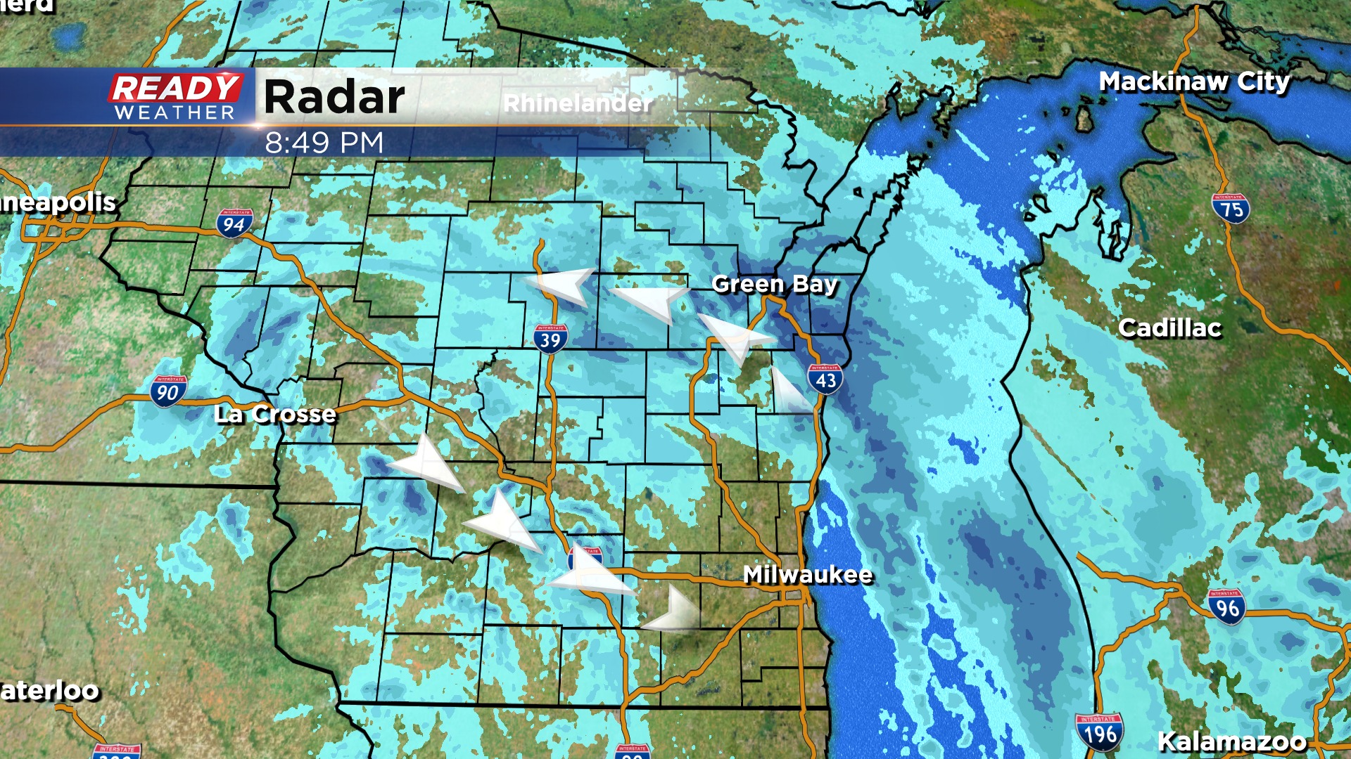
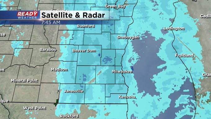
Off and on snow showers have been around most of the day, but there hasn't been much accumulation thanks to temps in the mid 30s. That'll be changing tonight as temps drop back into the upper 20s and light snow wraps back into SE WI. The moderate band stays north for a few hours - stretching from Manitowoc to Green Bay right now, but it will rotate thru from north to south after 2am.
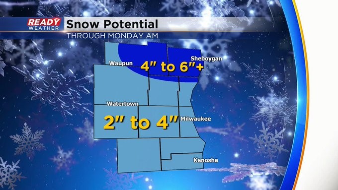
An additional 2-4" of snow is expected areas north of a line from Port Washington to Waupun. The rest of the area can expect an inch or less.
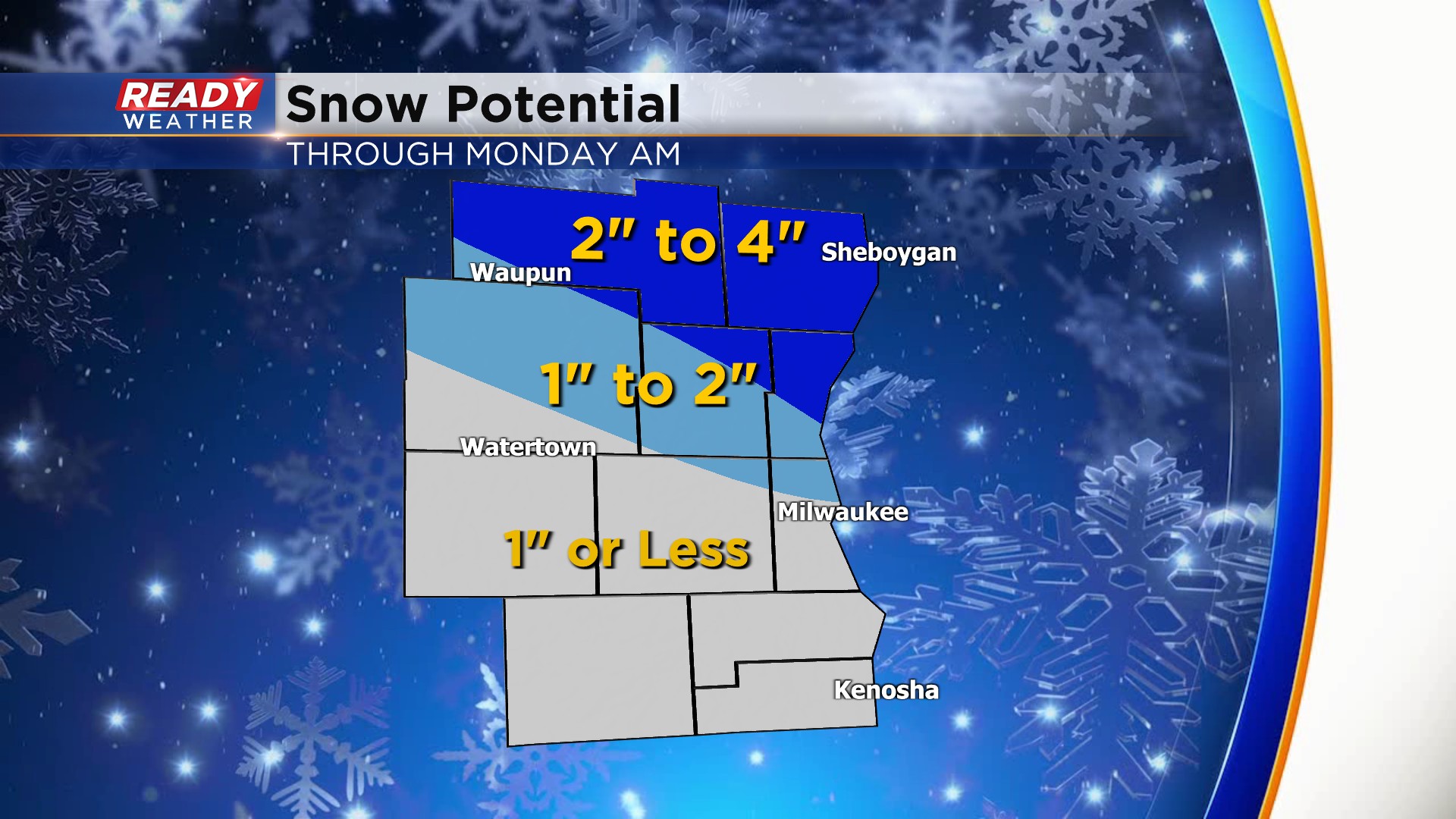
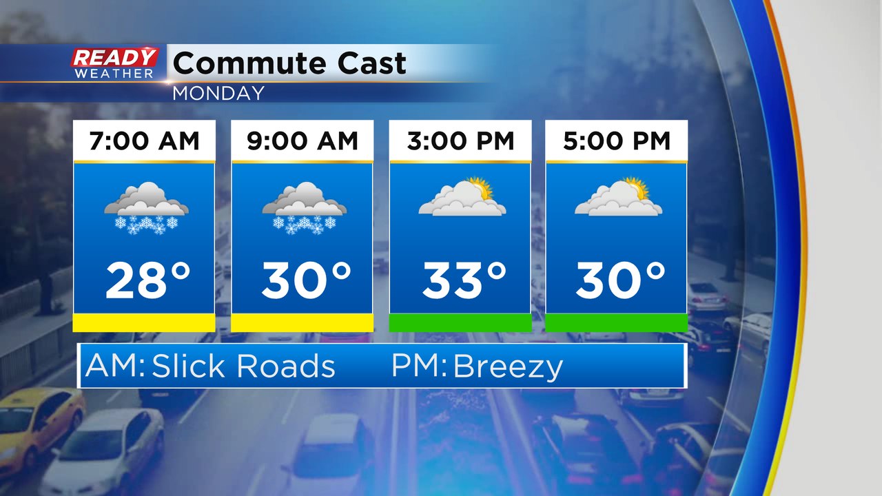
Plan on slippery roads during the morning commute Monday, but snow will end by 10am.
11 a.m. Update (Sunday, March 12th)...
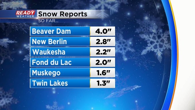
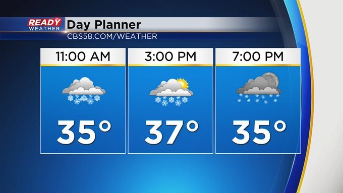
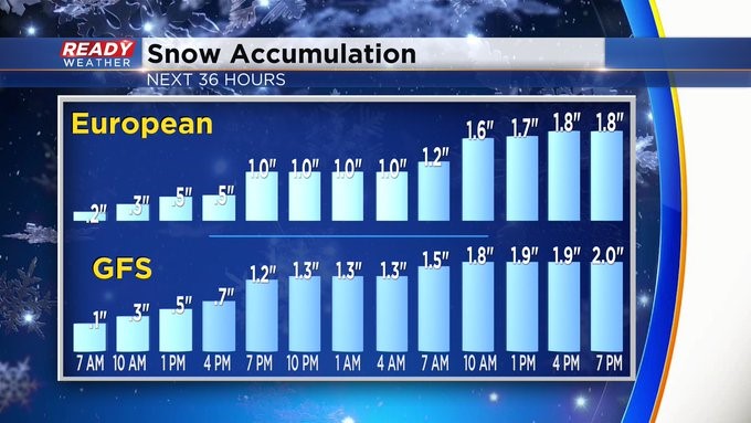
We're getting some snow totals, so far, into the CBS 58 Ready Weather Center. Some spots are getting more than 3 or 4 inches. Looking at the radar, a heavier band is moving into the metro from the west. Expect rates to pick up into the early afternoon. Most of the roads are wet. But tonight, it could be a different story with temps falling below freezing. Still thinking 2-4", generally speaking, is a reasonable range with higher amounts to the north of I-94 especially across Sheboygan and Fond du Lac Counties. This will all wrap up into Monday afternoon. In the meantime, though, expect on/off snow showers throughout your Sunday, Sunday night, and Monday morning.
______________________________________________________________________________________________________________
8 a.m. Update (Sunday, March 12th)...
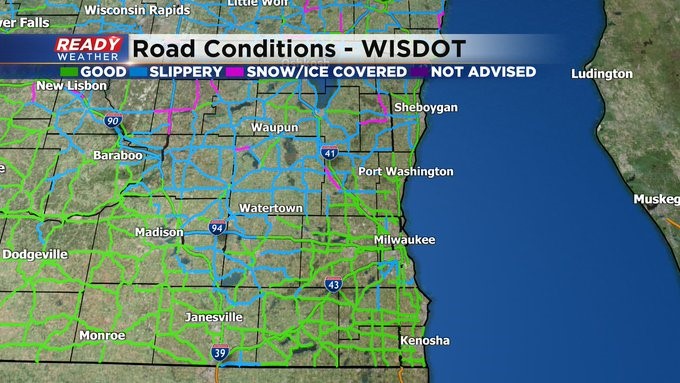
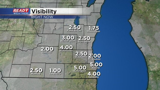
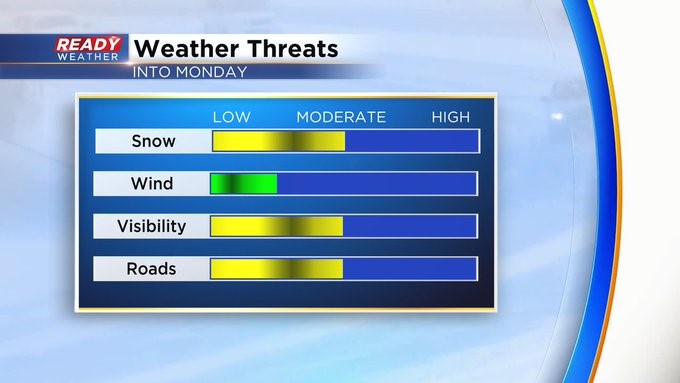
We already have received reports of two inches of snow in both New Berlin and Oconomowoc. Expect to see widespread reports of 2-4"+ the next day with higher amounts well north of I-94 where we have a Winter Weather Advisory. Visibility will be reduced so please slow it down and watch the roads. Luckily the wind isn't too gusty and shouldn't be too much of a factor today.
---------------------------------------------------------------------------------------------------------------------------------------------------------------------------------------
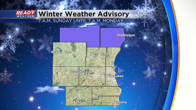
MILWAUKEE (CBS 58)--It's a new day, new week, and the start of Daylight Saving Time. Hopefully you remembered to change the clocks ahead an hour (and change all your batteries in your smoke and CO detectors too.) We have light snow to kick things off this week as you probably have noticed. Expect general amounts to be between 2-4"+ through Monday morning. It'll be around 4-6" in Sheboygan and Fond du Lac Counties where we have a Winter Weather Advisory in place from 7 a.m. Sunday until 7 a.m. Monday.
Our next system will be a wetter one. Expect rain showers to break out, with milder air, some point on Thursday afternoon. It'll mix with some snow on Friday, St. Patrick's Day, before switching to snow showers on Saturday. Highs most of this week will be either in the 30s or 40s.
Please keep sending your snowy pics to either [email protected] or via the free CBS 58 weather mobile app. We love to see them and share them.