Late evening update: Light snow finally filling in across SE WI


Updated: Saturday, March 11th 10:30pm:
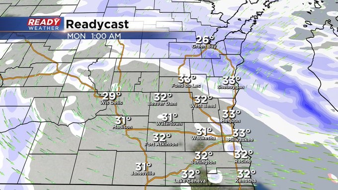
It's taken all evening, but snow is finally reaching the ground in southeast Wisconsin.
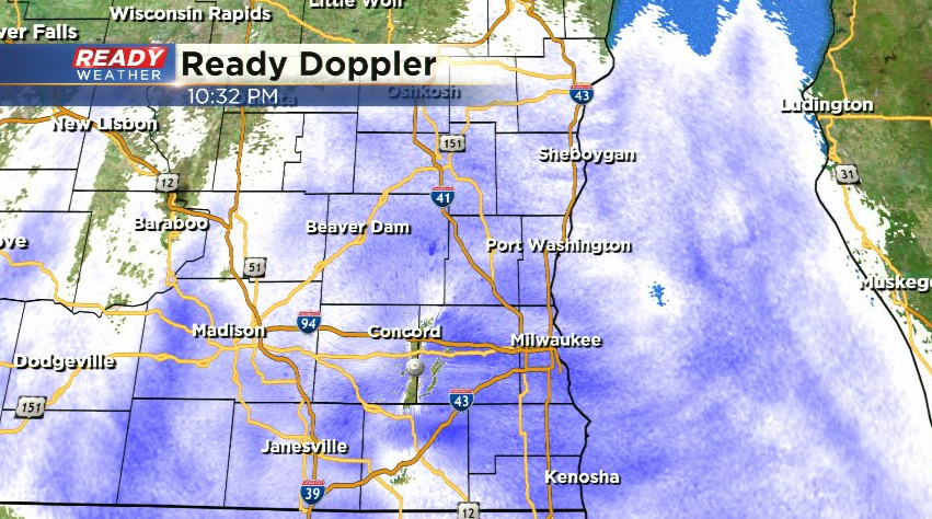
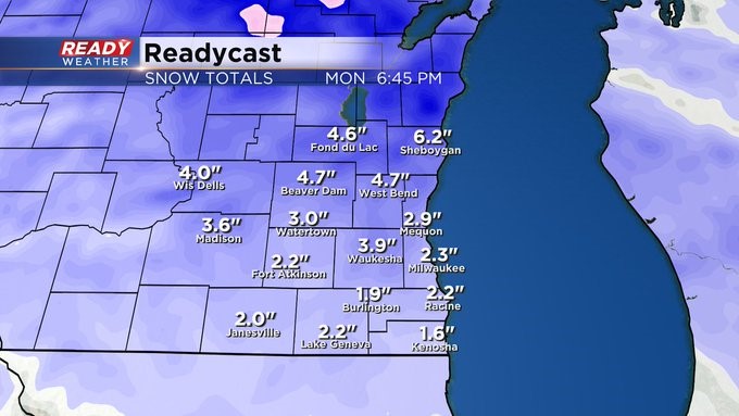
Light snow will continue overnight and for most of the day on Sunday. Snow may pick up in intensity later afternoon and evening near Sheboygan and Fond du Lac counties as a narrow band of moderate snow develops, but there still uncertainty in the exact placement. Snow tapers off Monday morning.
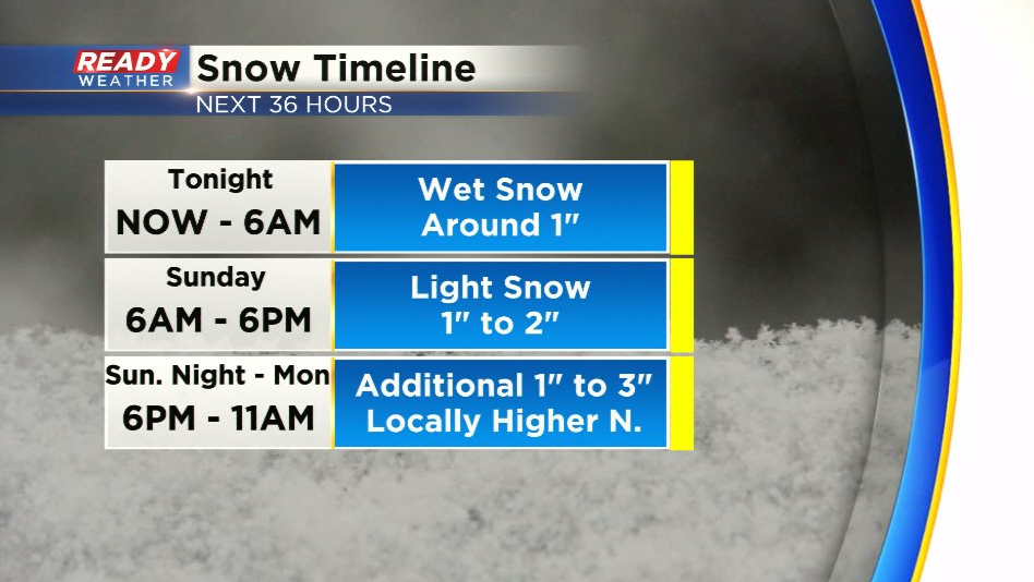
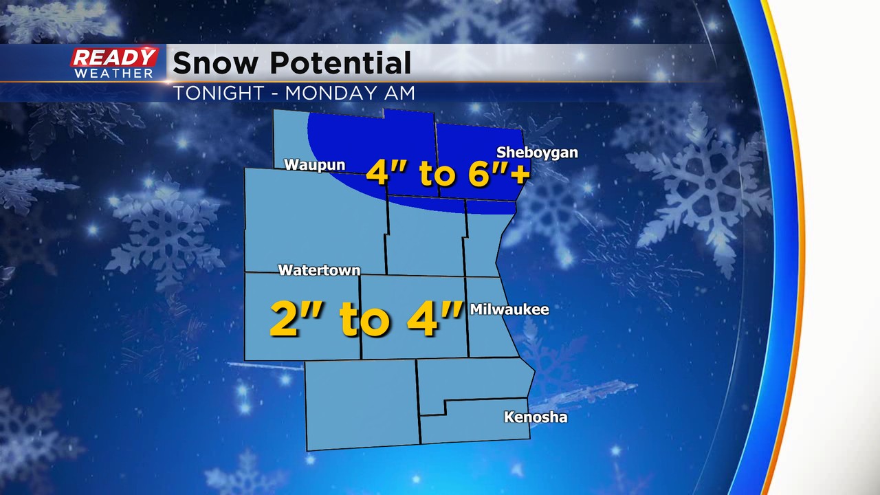
Overall most of southeast Wisconsin will pick up 2-4" of snow throughout the deration of this evening, but locally higher amounts are possible far north that moderate burst of snow is possible.
-------------------------------------------------
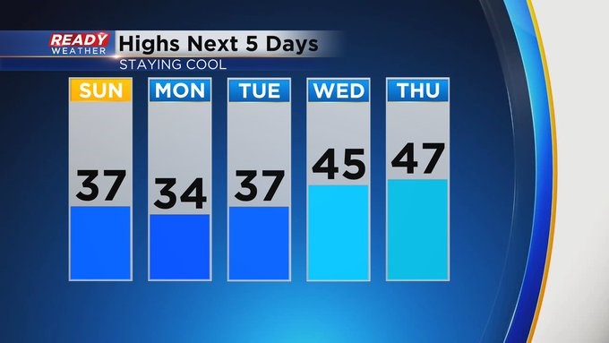
MILWAUKEE (CBS 58)--As we approach mid-March, the only guarantee when it comes to spring weather in Wisconsin is the uncertainty. We've had years (2012) when we were in the 80s. Not this year. For this coming week, look for highs mainly in the 30s and 40s. We should be near 45. Also, light snow could accumulate to a few inches through this weekend into early next week. Then there's the possibility of another wintry system by the time we get to Friday (St. Patrick's Day).
Make sure to switch the clocks ahead an hour before going to bed on Saturday. Daylight Saving Time begins early Sunday morning. So starting on Sunday, we'll have sunsets after 7 pm for quite a while.