11 PM Update: Strong storms remain south of Milwaukee


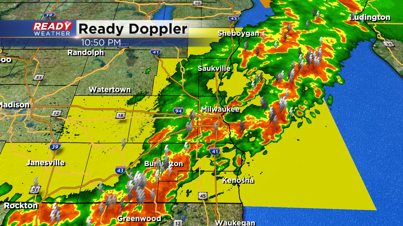
Update: Wednesday, June 15th at 11:00 p.m.
The overall severe threat continues to wind down tonight. Areas south of Milwaukee across Racine, Kenosha, and Walworth counties are still experiencing strong storms capable of very heavy rainfall, small hail, and gusty winds.
We expect the storms to move out of the area by 1 am. The severe threat should be done by Midnight.
______________________________________________________________________________________________________________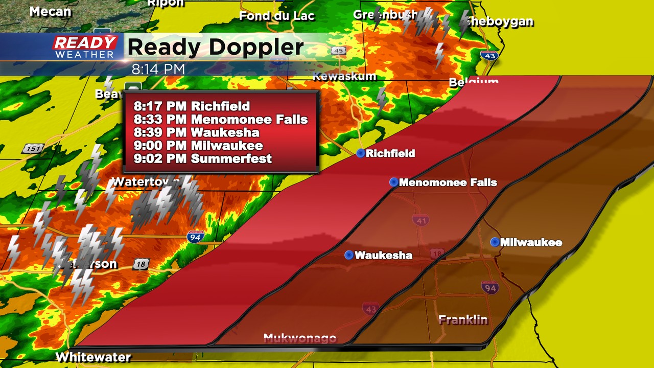
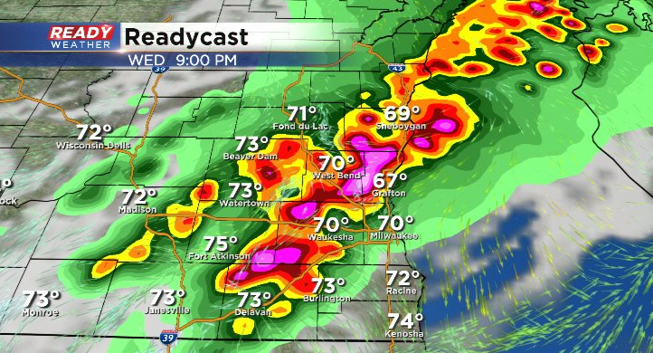
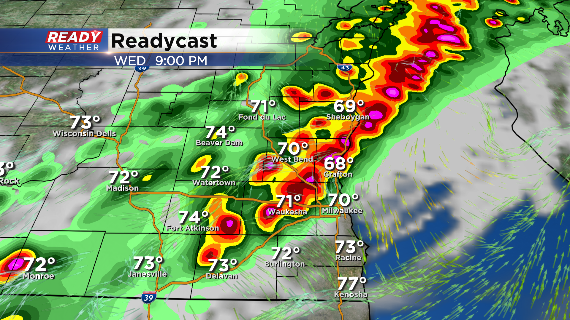
Update: Wednesday, June 15th at 8:15 p.m.
Most of the storms are under severe limits right now. The line is moving east around 40 mph. Storms will be moving into Milwaukee closer to 9 pm. These storms will move out after midnight.
Isolated strong to severe storms remain possible as this line marches east. Areas south of Milwaukee have not had storms yet today, so the atmosphere remains favorable for a strong to severe storm.
____________________________________________________________________________________________________________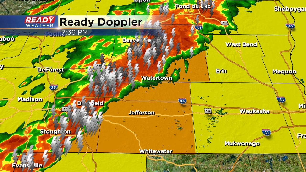
Update: Wednesday, June 15th at 7:45 p.m.
The tornado watch has been extended to include all of our counties until 10 pm!
Strong to severe storms are moving across the northwestern part of the area. Damaging winds and quarter hail are possible. We still expect the storms to move into the metro between 9 pm and 10 pm. New warnings have been issued for Jefferson county until 8:30 pm.
All modes of severe weather are possible, including isolated tornadoes. Stay away from windows until storms have passed.
_____________________________________________________________________________________________________________
Update: Wednesday, June 15th at 6:30 p.m.
Update: Wednesday, June 15th at 5:30 pm
Storms continue to intensify to our west as they draw near. Check it out on Ready Doppler:  In addition to the Tornado Watch, we have multiple Severe Thunderstorm and Tornado Warnings in progress. We've also had confirmed tornadoes on the ground. This threat continues to inch closer to our area. There has been a slight increase in time arrival for storms across our area. Head's up for our northwestern communities by 6pm:
 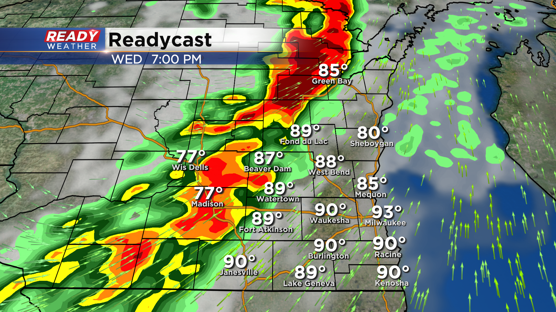 For the heart of the area the best timing for storm arrival is 8-9pm: All types of severe weather are possible through the first part of tonight.
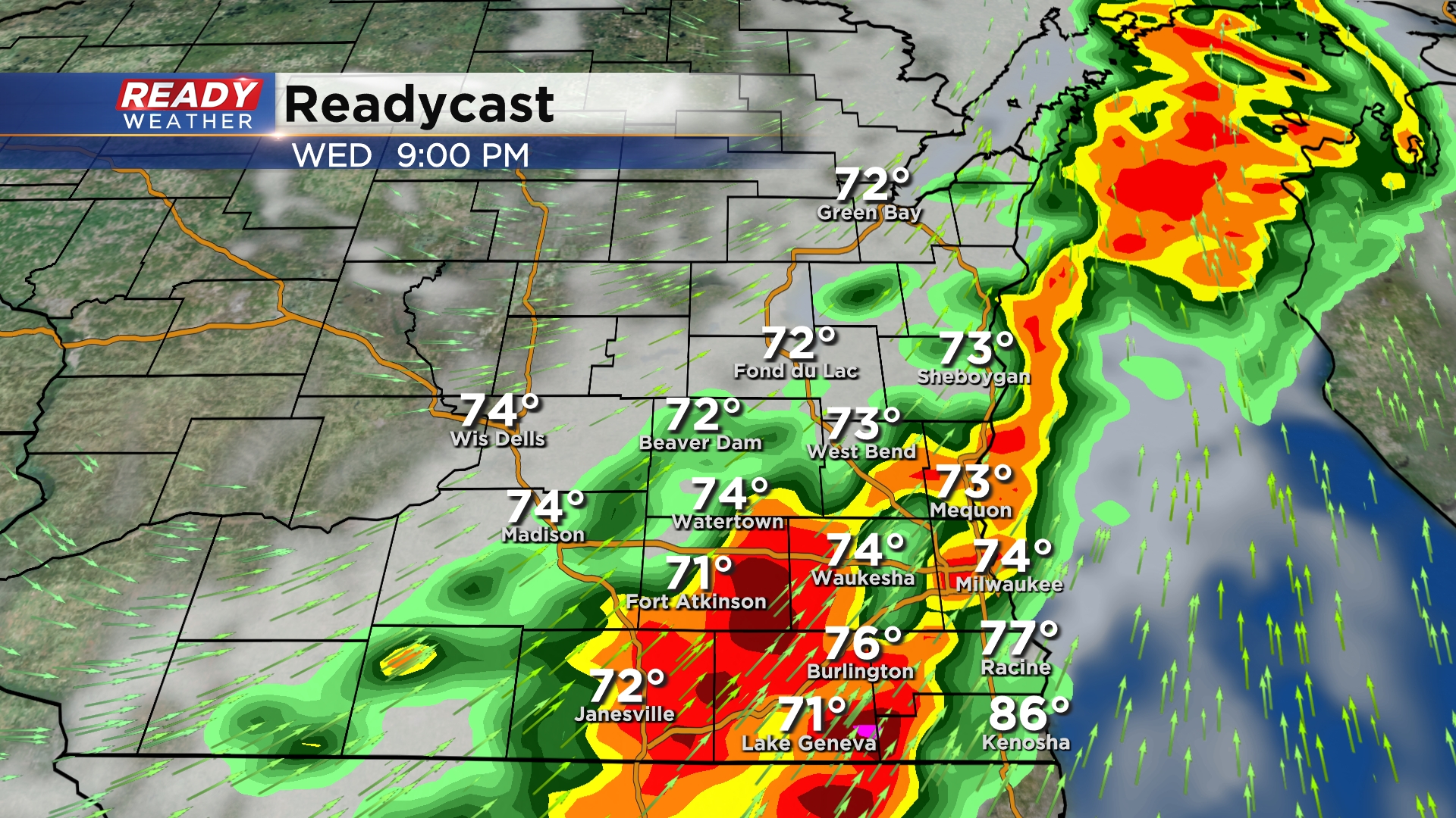 Please use this time now to prepare for severe storms, including rotating storms given the history of storms so far today. Aside from tornadoes we have had wind reports to 80mph with this line of storms. Damage reports continue to pour into office. We will continue to provide updates here online and on air as the evening unfolds. Stay aware, stay safe!
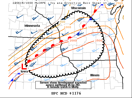
Update: Wednesday, June 15th at 4:00 pm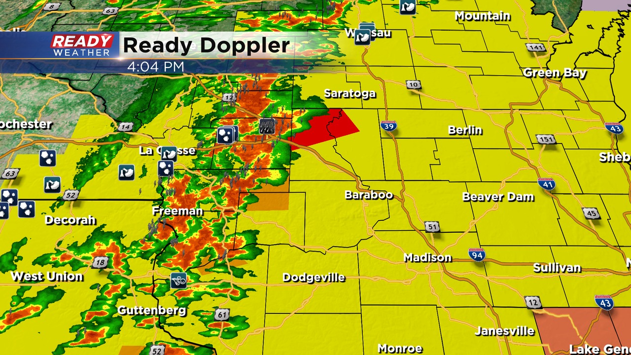
As expected the storms have blown up across western Wisconsin this afternoon. The first tornado warning has been issued as well. This line will hold it's strength as it moves into our area between 7 pm and Midnight.
Damaging winds, hail, and isolated tornadoes remain possible.
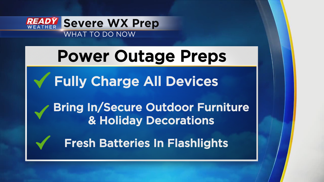
Now is the time to prepare for power outages! Also, make sure you have a good way to get warnings.
______________________________________________________________________________________________________________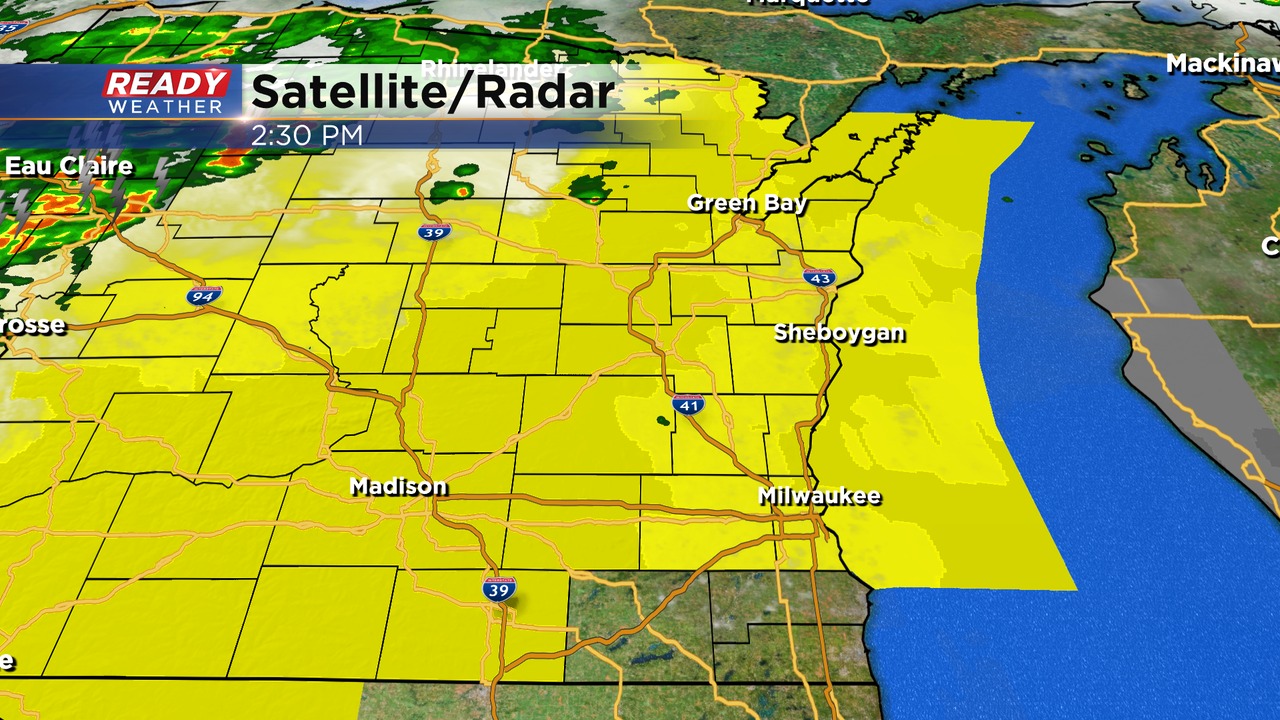
Update: Wednesday, June 15th at 2:30 pm
The SPC has issued a tornado watch for all of our counties except Walworth, Racine, and Kenosha counties until 10 pm. Storm arrival is expected between 7 pm and Midnight. It's possible that those counties will be added at some point.
The Milwaukee metro will likely see storms between 8 pm and 10 pm. All modes of severe weather are possible. Storms are forecast to exit the area after Midnight.
______________________________________________________________________________________________________________
Midday Update: Wednesday, June 15th at 2:00 pm...
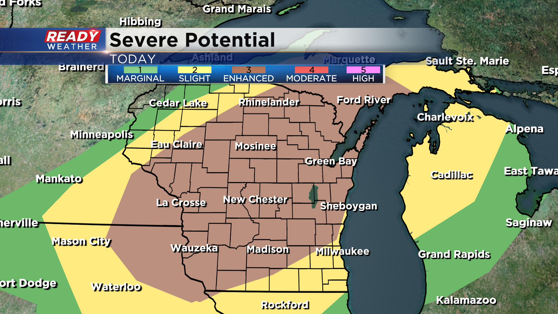
There's a high likelihood that a tornado watch will be issued across western Wisconsin this afternoon.
It's a hurry up and wait game, especially into this evening as a strong cold front closes in from the west. It still looks like the best opportunity for strong to severe storms will be between 7 pm and midnight. Places well north and west of the metro, like Beaver Dam and Watertown, are now under a "Moderate" risk of severe weather. It's a "Slight" risk for the metro. All kinds of severe weather, including tornadoes, are all possible. Please stay tuned to CBS on air and online for the latest developments throughout the day.
__ __________________________________________________________________________________________________________
Updated: Wednesday, June 15th 9:45 am:
Temps have climbed into the low to mid 80s early this morning with heat indices already in the low 90s.
The heat and humidity will fuel a line of severe storms between 7pm-12am. All modes of severe weather are possible, including embedded tornadoes.
The severe risk remains unchanged from early this morning.
--------------------------------------------------------------------------------------------------------
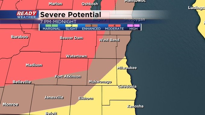
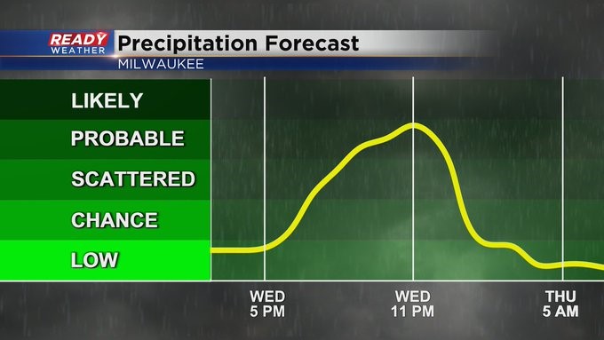
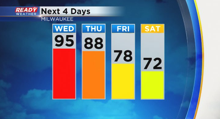
Temperatures only fell into the upper 70s to low 80s last night, setting the stage for another hot and humid day across southeast Wisconsin. Temperatures will rise into the low to mid 90s once again this afternoon under mostly sunny skies, feeling like the 100s once you factor in the humidity. A Heat Advisory continues for all of southeast Wisconsin through 8pm this evening.
The heat and humidity will lead to a good chance of strong to severe storms this evening as a cold front moves through the area. Storms look to move into the area around 7-8 pm, exiting between 12-1 am Thursday.
All modes of severe weather are possible, including damaging winds, hail, tornadoes, and localized flooding. The tornado threat looks highest north of I-94.
![]()
Tornado potential will be maximized across central and northern Wisconsin. A level 3 of 5, Enhanced Risk, for severe storms is in place for a good portion of the state, including Fond du Lac, Sheboygan, Dodge, Washington, Ozaukee, and Jefferson counties. A level 2 of 5, Slight Risk is in place for the remainder of the area.
The cold front will knock the humidity out of here, but it'll still be very warm on Thursday thanks to gusty SW winds and plenty of sunshine. Highs will top out in the upper 80s, then fall back into the 70s through Father's Day weekend.
Download the CBS 58 Ready Weather App to get severe alerts sent directly to your phone.