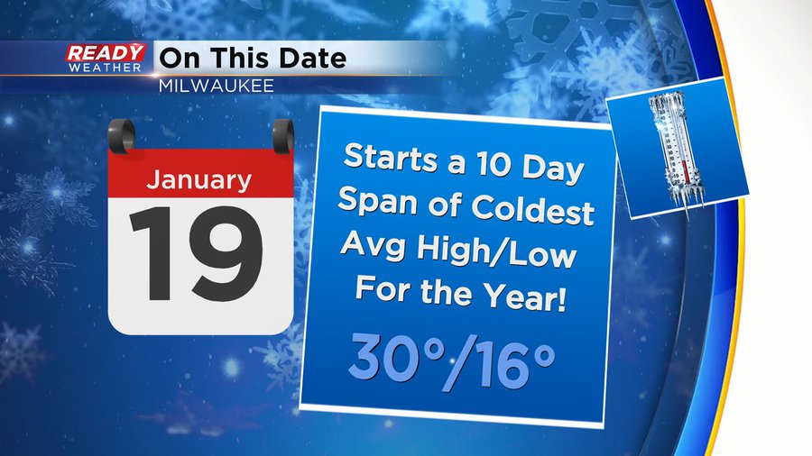
Arctic air is arriving right on time. Today we enter a ten day stretch of our coldest high and low, per the averages, for the year. As of today's date, the average high sits at thirty degrees.
The average low has hit the bottom mark for averages at sixteen degrees. This is the lowest point in our average high and low for the year, for the city of Milwaukee. The average high and low will stay at thirty and sixteen respectively, through the 28th of the month. There after, we'll make the slow climb out of the deep freeze.
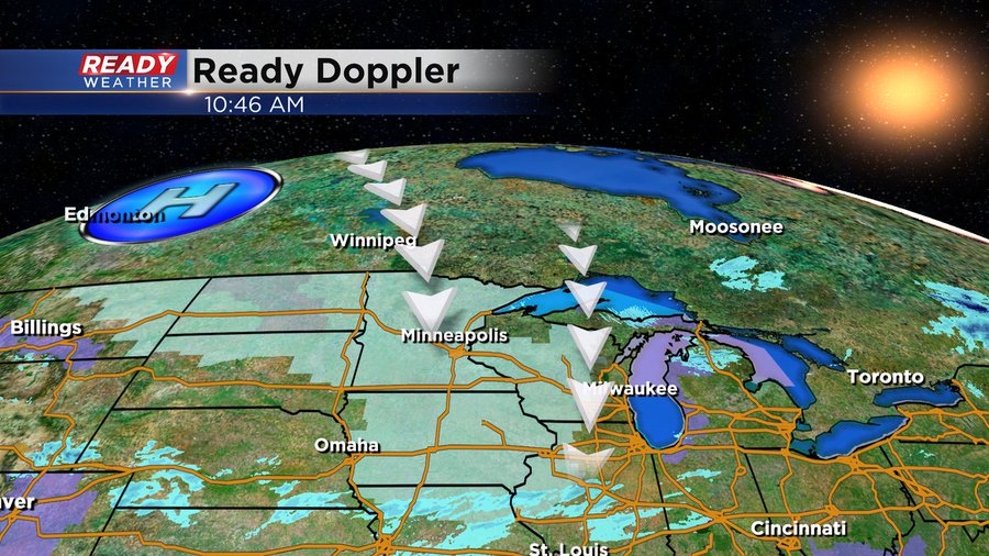
The cold air today comes courtesy of High pressure dropping in from Canada. And delivering a healthy dose of cold along with it.
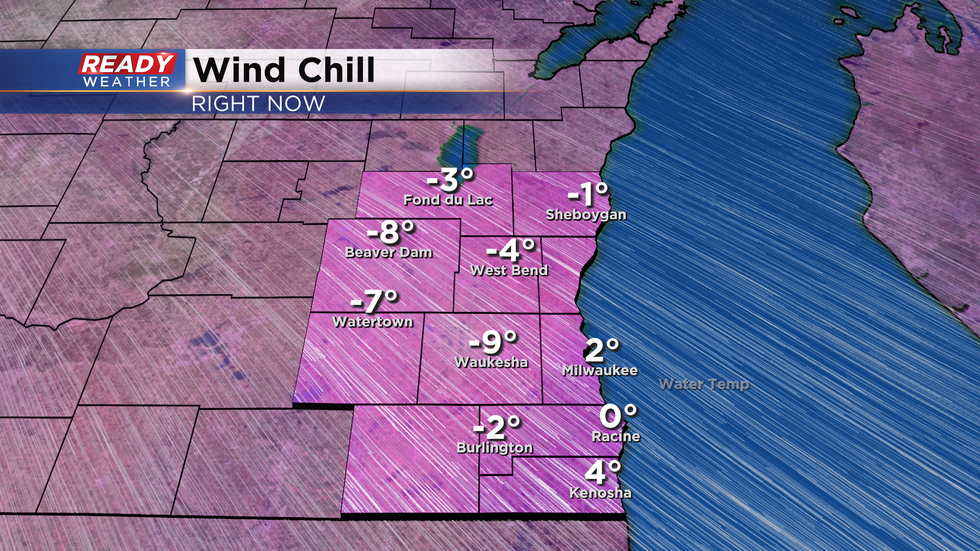
The bright side is that we'll enjoy plenty of sunshine the next few days with this high overhead. But the theme will be fair and frigid. Wind chills will stay below zero for the majority of the next forty-eight hours. There's even a wind chill Advisory posted to our west. With the potential of wind chills approaching -25° in our western communities, there's a chance that advisory could get extended in those locations. Here's a look at the Wind Chill temperatures as of 11am:
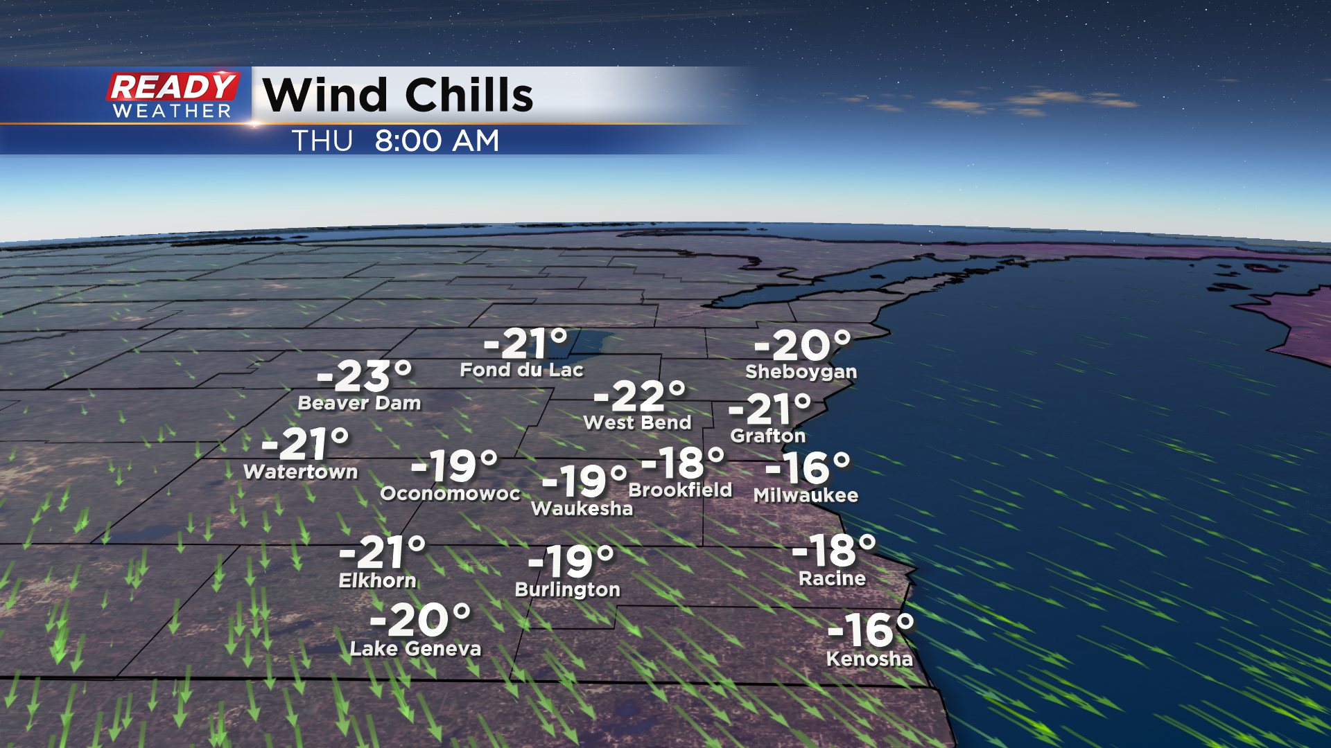
While these numbers drop into negative territory, here's when they hit the lowest point:
Even beyond Thursday morning numbers will likely stay below zero until later Friday morning. During this time. make sure you bundle up as much exposed skin as possible and limit time outdoors, keep your furry friends safe too! We'll keep you up to date on the cold and any new advisory for our area on air and online. Join me today at noon for the latest forecast.
I'm meteorologist Rebecca Schuld