More snow on the way late Friday into Saturday - A Winter Weather Advisory has been Issued


4 pm Update: February 14, 2025

Snow is set to arrive this evening between 5 pm and 7 pm. The snow will be lighter and quickly accumulate. With temperatures in the 20s the roads will quickly become snow covered. Snow this evening into Saturday morning will total 3" to 4".
After a light break Saturday morning, more steady snow is forecast to move back in during the afternoon and evening. Another 1" to 3" is possible during the day Saturday.
As the system departs, the back edge will roll through and linger snow showers into Sunday.
_____________________________________________________________________________________________________________
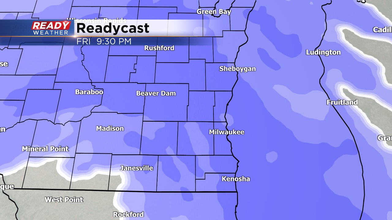
1pm Update: Just a short break in between weather makers as a Winter Weather Advisory has been issued for Friday evening into early Saturday.

A widespread swath of 3-6" of snow is expected with some higher amounts possible, this time across northern parts of the area, especially closer to the lake. Look for snow to start around sunset. Widespread snow should be in progress by 8pm. We anticipate the heaviest snow to fall during the course of the evening with the potential for snow rates at one inch per hour. Snow may continue to linger on and off for Saturday.
Winter snow has finally arrived! Wednesday's snowfall was the biggest of the season so far. It beat out the snows we had in December and in Milwaukee was the biggest snow since March of last year! Most of southeast Wisconsin got 3-8" of snow with a few isolated locations seeing more like West Allis and Racine and a few northwest counties getting closer to 2".

Thursday will be the day to clean up but we don't get much of a break with more snow on the way starting Friday afternoon and evening through Saturday. Snow should not impact the morning or lunch time commutes Wednesday but could start to fall during the Wednesday evening commute with steady snow likely late Wednesday evening through early Saturday.
One of the questions in the forecast right now is how long the snow lingers into Saturday. Some weather models wrap up the snow by Saturday morning while others keep the snow around through Saturday evening. Regardless, the impacts for the storm will be similar to what we just went through Wednesday with snow covered roads expected in the evening hours and some visibility issues with minor blowing snow.
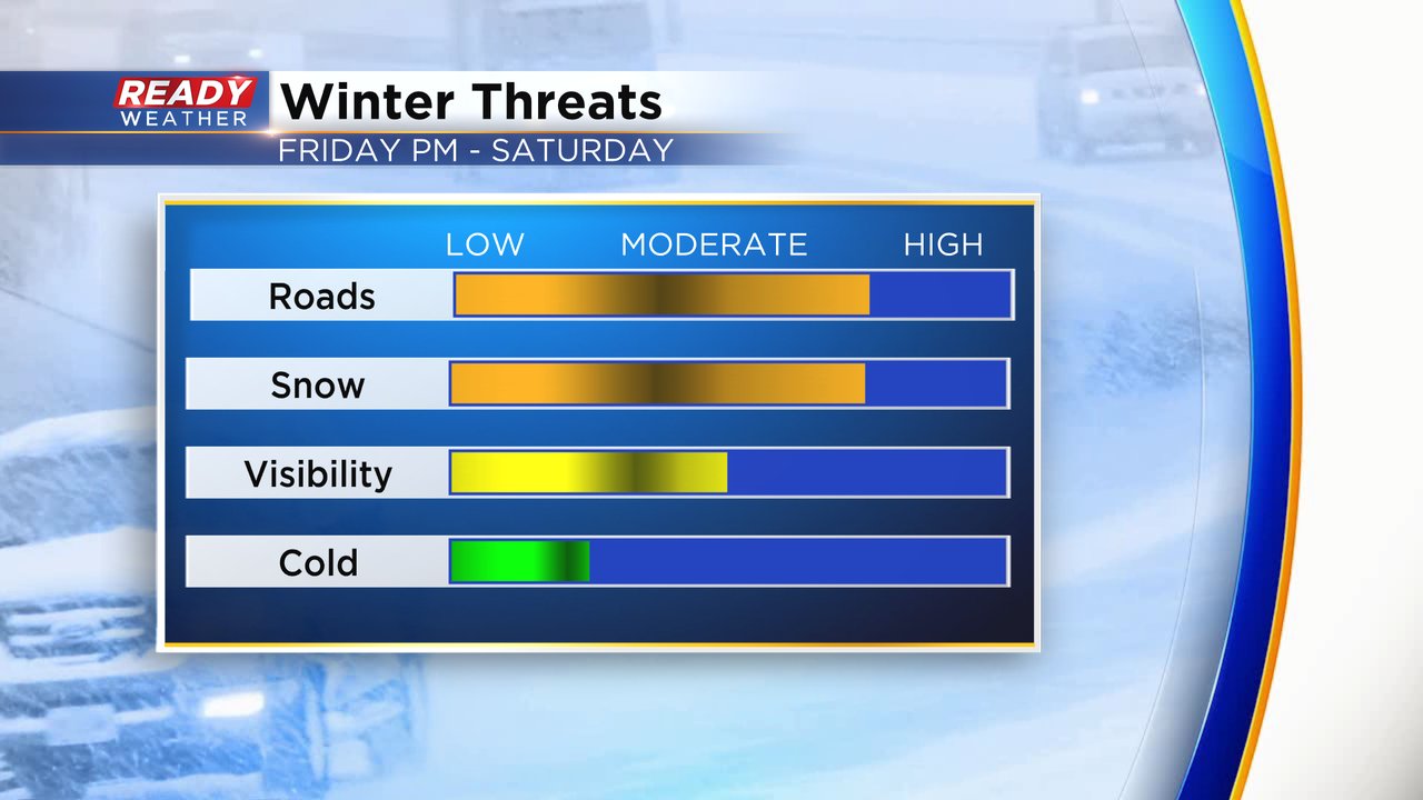
The snowfall for Friday into Saturday will not be as fluffy as Wednesday's snow but also not a waterlogged snow. Right in the range of a happy medium. This is still expected to be a significant snowfall with everyone in southeast Wisconsin getting at least 3" with lower totals right now expected in southern counties where 3-6" is possible and higher totals in northern counties then west towards Madison where 6-9" is possible.

Those snow numbers will likely change over the next 36 hours before the snow starts coming down. Download the CBS 58 Ready Weather app to track the snow with the interactive radar.