After a tropical feel of temperatures held for us over the past few days, the 70s we have to start this afternoon certainly feel nice! Behind our system that brought us rain earlier this week, an easterly wind has returned pushing in cooler air off of the lake. Unfortunately, humidity has stuck around and as winds have come off of the lake, the warmer lake temp has mixed with our warmer dew point temp and created patchy, dense fog. Foggy conditions keep slowly clearing throughout this afternoon giving way to more sunshine, but another chance to experience thick fog will be early in the morning on Sunday.
On another note, wildfire smoke has yet again mixed back into the air, and so an air quality alert has been issued for the remainder of this Friday.
High pressure is mostly dominating our weather this afternoon, and should keep us mostly quiet, but as our next system builds into our west, not only will this bring in a rain chance over the next few days but also bring back in a southerly wind which means more hot weather in store! Expect highs by the end of the weekend to be back into the low 90s, and as the humidity has no plans of exiting anytime soon, feels like temps will once again return to the triple digits!
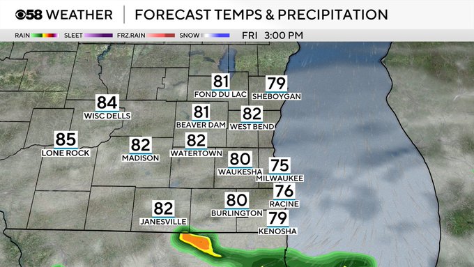
Rain and t-storm chances this afternoon and tomorrow look to be scattered and pesky, so still some sunshine is likely to be seen through the rain and clouds. A better chance for heavier rain and thunderstorms looks now to be earlier in the morning on Monday.