After a mild December, January has taken a different path.
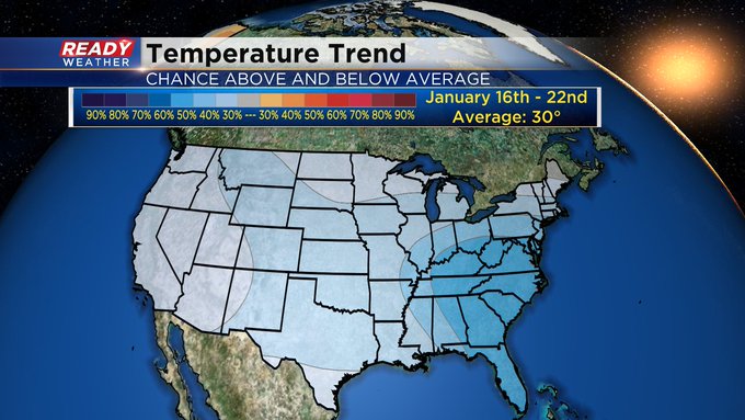
While New Year's Day seemed chilly compared to the days leading up to the holiday, it was just the start of a chillier outlook for the area. As you can see, that was the only day above average on high temperatures. The rest of the month has fared cooler than normal. To date, Milwaukee is sitting five degrees below normal so far this month on day-time highs. And today's date marks another milestone as normal highs drop below freezing. I like to call this time of year the Winter doldrums. Weather has been cold, quiet and rather gloomy. We are entering our coldest time of the year for this area. But it looks like so much of the county will continue to fare colder than normal. A sign of a La niña set up. Thirty degrees is the lowest our average highs go which is the timeframe of this outlook. At least in the short term, temps moderate a bit starting tomorrow. After six straight days in the 20s, Thursday through Sunday should find many spots reaching the low 30s. We even have a couple snow chances mixed in there too. However, behind Sunday's snow comes another push of cold air where high temps may struggle to even reach 20 by early next week.I'm meteorologist Rebecca Schuld


