Coldest temps of the season have arrived with more patchy frost possible

-
1:54

Kenosha Unified School District budget referendum rejected
-
1:28

’Their family is our family:’ City of Hartford staff raise...
-
2:25

State Superintendent candidates ramp up attacks amid education...
-
1:53

Bauman and Brower face off in tight District 3 Common Council...
-
1:44

Neighbors recount saving woman from house explosion in Racine
-
0:54

Young Brewers fans head to Arizona for special spring training...
-
1:19

Nearly $60K worth of items stolen from barber supply shop on...
-
2:29

Frelick bulks up for Brewers
-
2:15

Snow forecasting
-
4:03

Tapas Ricas by Nashalee aims to bring cultural fusion to Milwaukee...
-
5:11

Wisconsin Black Chamber of Commerce outlines programs for 2025
-
2:25

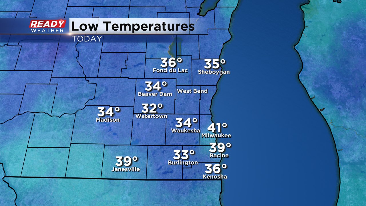
A slow and methodical warmup on the way

It's a chilly start to the new work week! The first frost advisory of the season was issued for Monday morning and came right on time for our average first frost and frost advisory of the year. Lows dropped into the 30s for everyone except Milwaukee and some got down to the freezing mark leading to a good amount of frost, especially away from Lake Michigan.
Lows over the next few nights still stay within the chance for some patchy frost Tuesday and Wednesday morning. By Thursday morning clouds and rain have arrived so frost and freeze concerns go away the rest of the week.
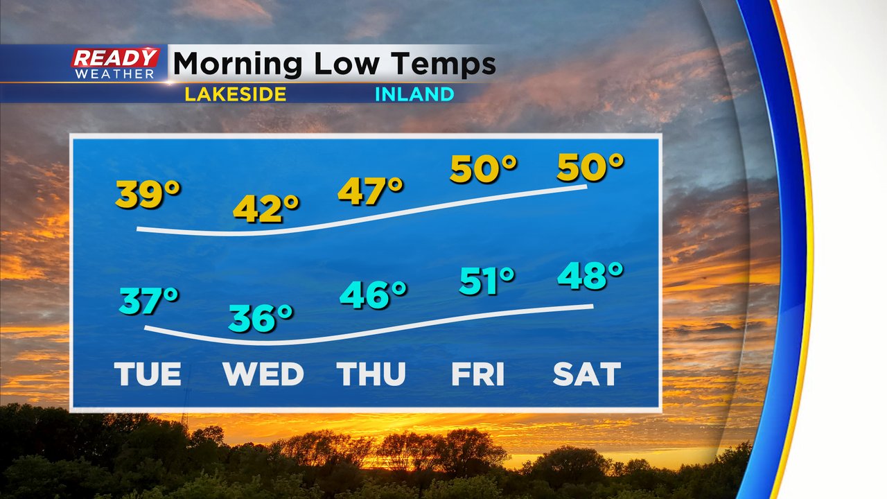
Temperatures dropping into the 30s is only one ingredient you need for frost to form. Another is a clear sky and with more clouds on the way we might not get much frost Tuesday and Wednesday mornings but at least some patchy frost will be possible.

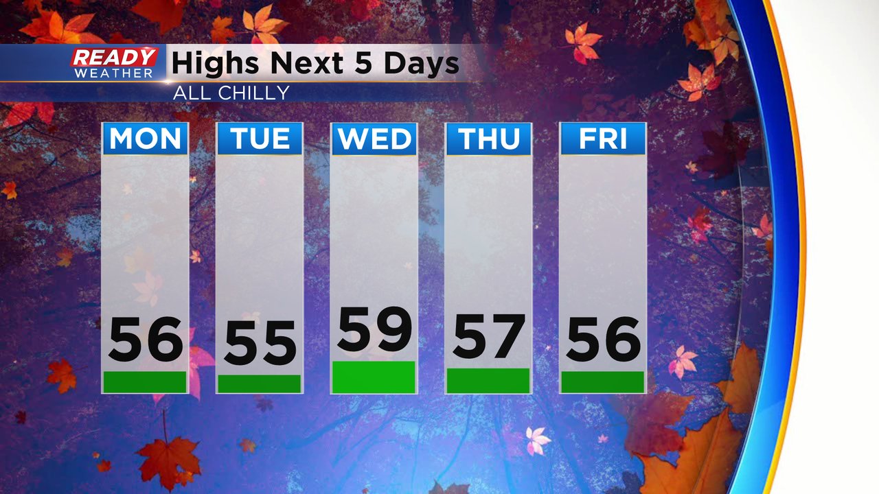
High temperatures won't change much the rest of this week with highs staying chilly in the middle to upper 50s.
Download the CBS 58 Ready Weather app to track the chilly air and a good round of rain on the way for the second half of the week.