Damaging winds give way to cold for Easter
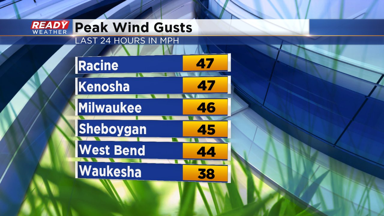
A very windy Saturday has brought in a blast of chilly air. A wind advisory was issued for all of southeast Wisconsin Saturday for wind gusts above 45 mph at times. The peak wind gusts were seen in lakeside counties. Some damage was even reported to buildings in downtown Milwaukee.

A cold front swept through Saturday afternoon dropping temperatures quickly. Before the front arrived highs reached the middle 40s for northern and western spots and low 50s to the southeast. Temperatures will continue to fall all night under a clear sky with lows reaching the teens inland and around 20° near the lake. Chilly temps combined with a stiff overnight breeze means wind chills Sunday morning will be in the single digits for some.
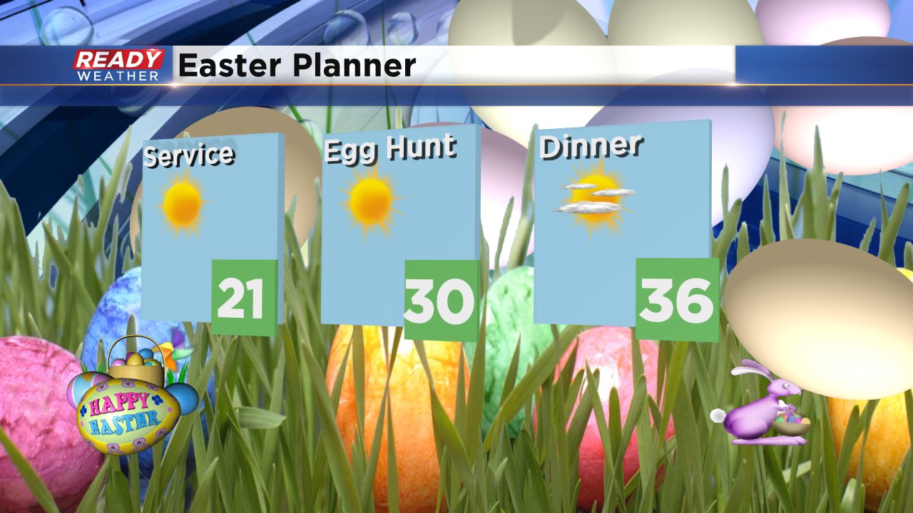
You'll need the tights and jacket all day on Easter with highs only reaching the low to middle 30s and wind chills feeling like the teens and 20s all day. The saving grace is lots of sunshine and dry weather so those outside egg hints can still happen with the right winter gear.
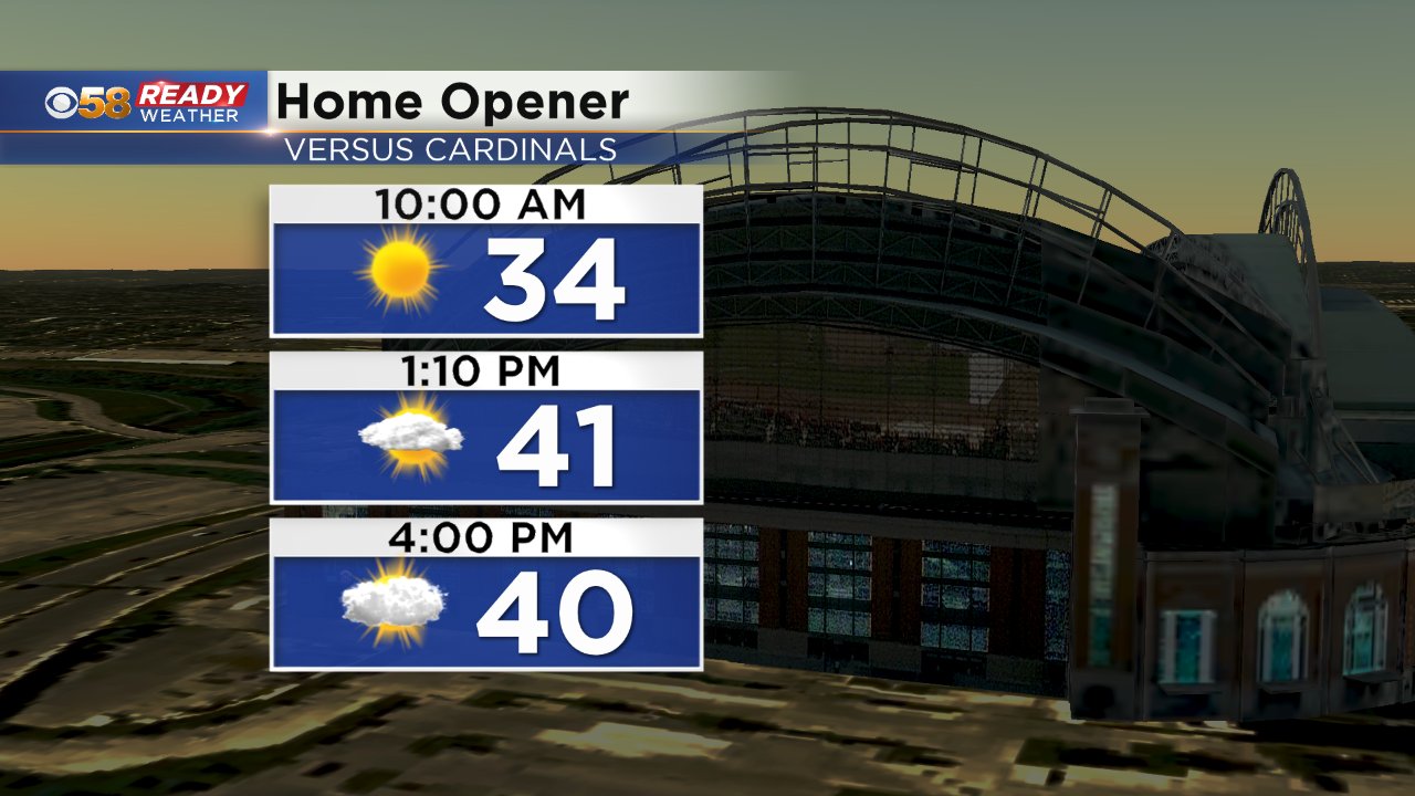
The Milwaukee Brewers Home Opener will also stay dry with sunshine for tailgating giving way to a mostly cloudy sky by the time the game ends.
It's not all sunshine though for the first week of April, the chance for accumulating snow is starting to increase. A wintry mix of mainly snow will start Monday night and continue most of Tuesday wrapping up Wednesday morning. Right now a few inches of snow looks possible, mainly for northern communities. Download the CBS 58 Ready Weather App to follow the latest forecast.
