


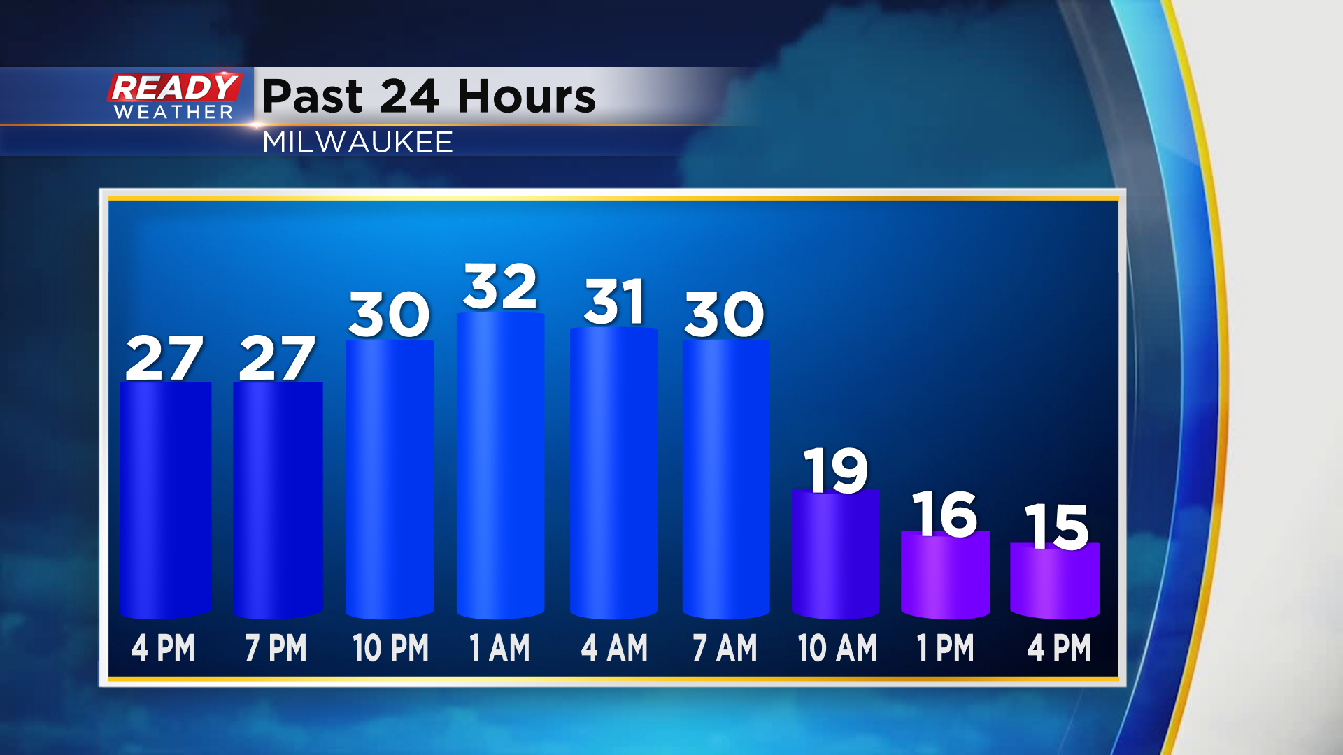
Temps have been tumbling throughout the day behind a strong arctic cold front. Milwaukee reached a high of 32° early this morning, but most of the daylight hours have been spent in the teens with wind chills either side of zero.
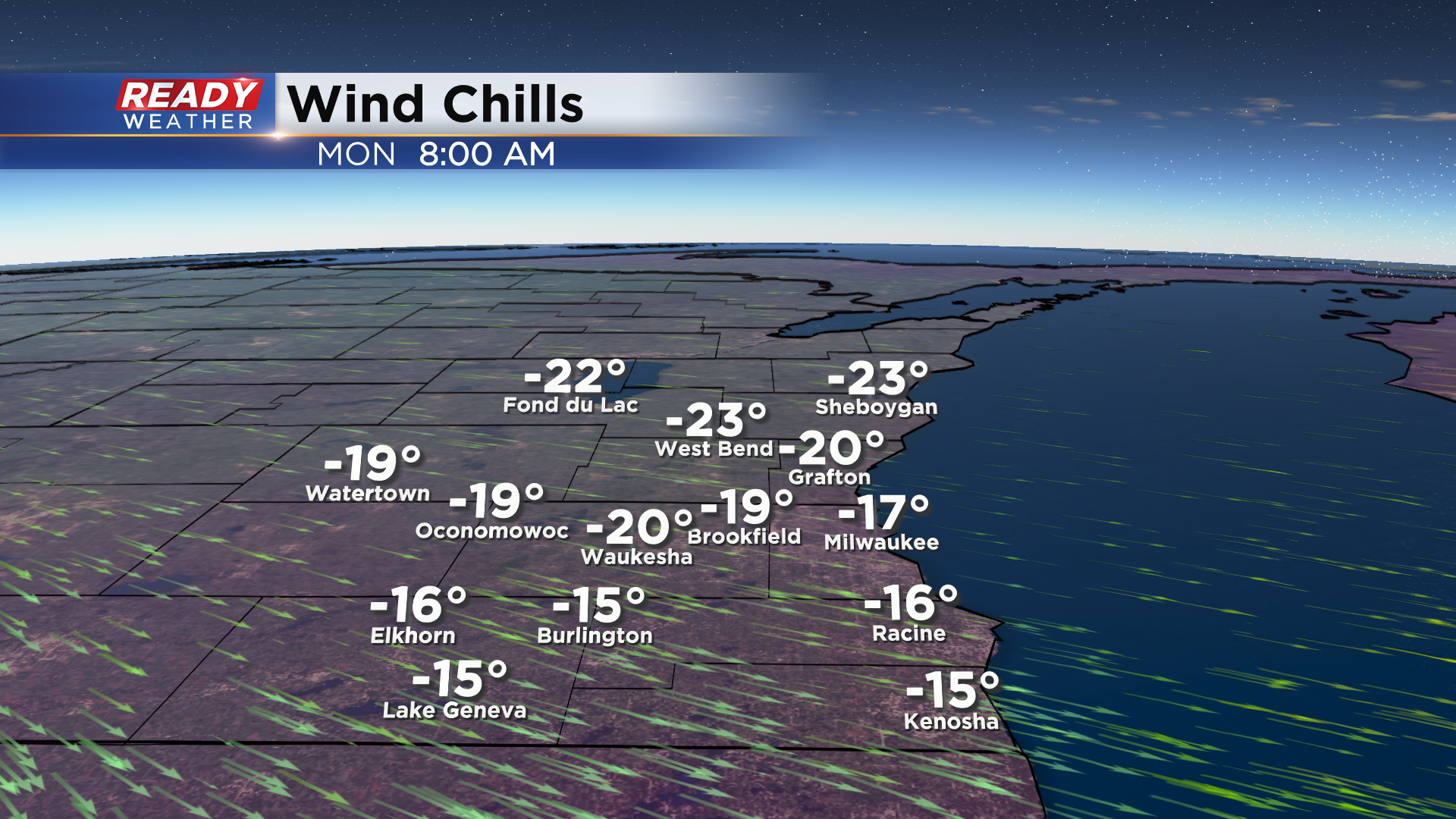
Wind chills will be much colder tonight into Monday as temps tank into the single digits and winds remain between 10-20 mph. Wind chills between -20° and -25° are expected north of Milwaukee Monday morning, with wind chills around -15° along and south of I-94.
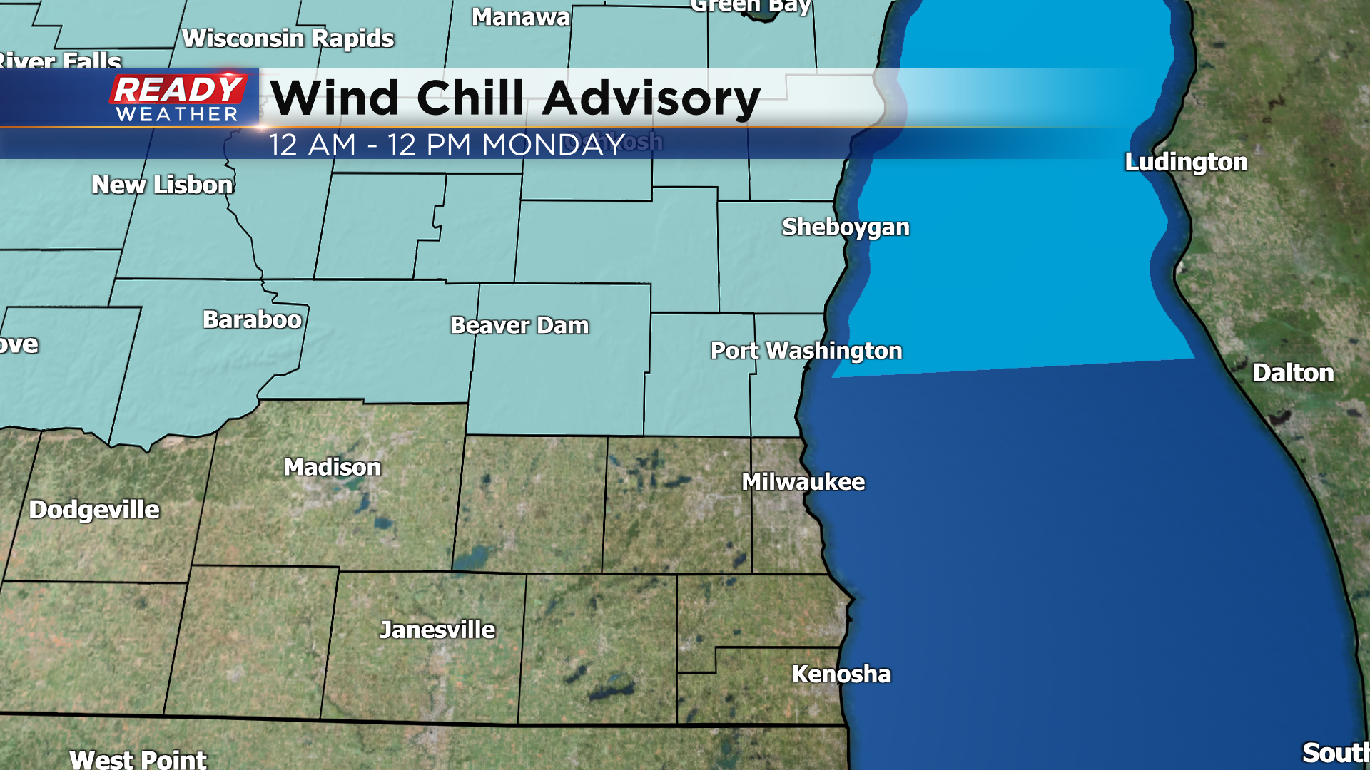
With areas north of Milwaukee having the best chance at experiencing wind chills colder than -20°, a Wind Chill Advisory has been issued for Fond du Lac, Sheboygan, Dodge, Washington, and Ozaukee counties from midnight through noon Monday. Frostbite can occur in less than 30 minutes on exposed skin once wind chills drop below -20°.
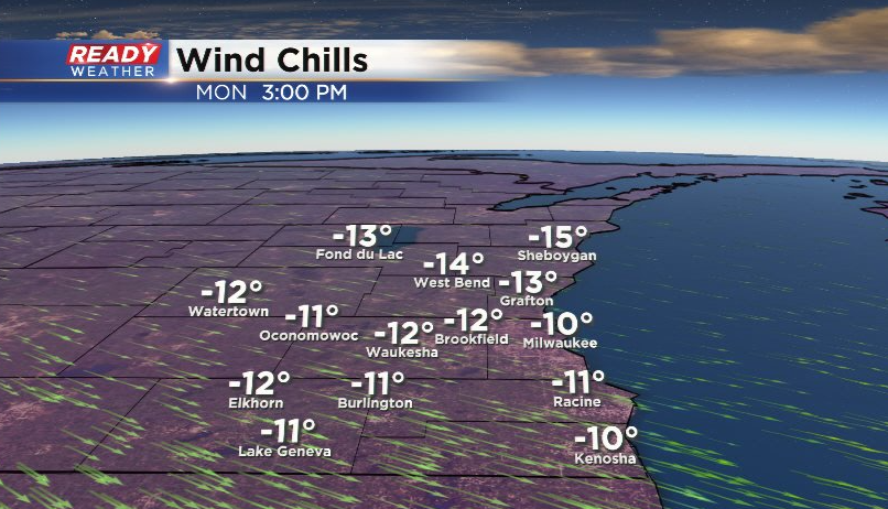
Although the Wind Chill Advisory will expire at noon, wind chills won't get above zero Monday afternoon as temps remain in the single digits for most. Wind chills stay around -10° to -15° in the afternoon.
Wind chills won't be as brutal Monday night as winds become very light, but actual air temperatures will be close to 0° so it won't take much wind to push feels like temps to -10°. Thankfully this arctic air isn't going to stick around. A southerly wind will boost temps into the mid to upper 20s Tuesday and 30s by Wednesday.
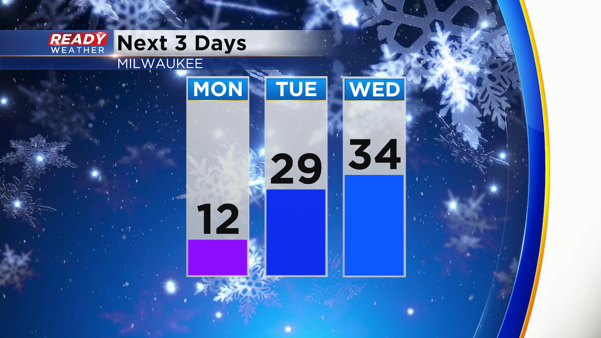
Temps remain in the low to mid 30s for the second half of the work week. Download the CBS 58 Ready Weather App to see when we'll have our next chance of snow.