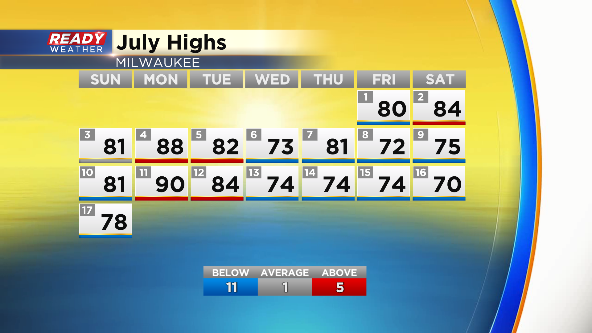
It's been a relatively easy July so far in the temperature department in southeast Wisconsin with only 5 above normal days so far this month, and 5 straight days in the 70s.
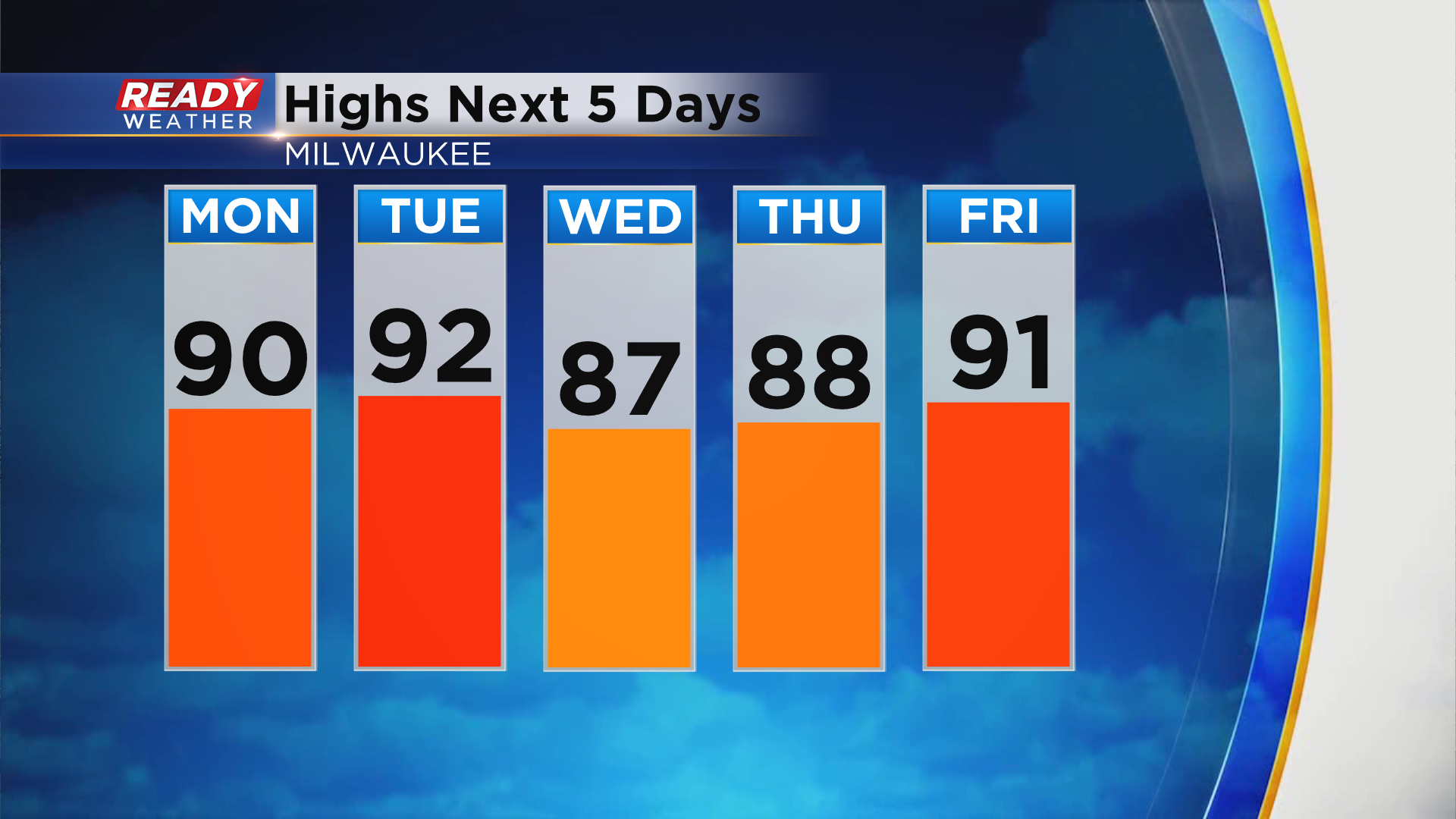
That will all be changing this week as the hottest stretch of weather since 2016 arrives beginning Monday. Highs most of this week will be in the upper 80s to low 90s.
We'll also be dealing with noticeable humidity throughout the week with dew points ranging from the mid 60s to low 70s.
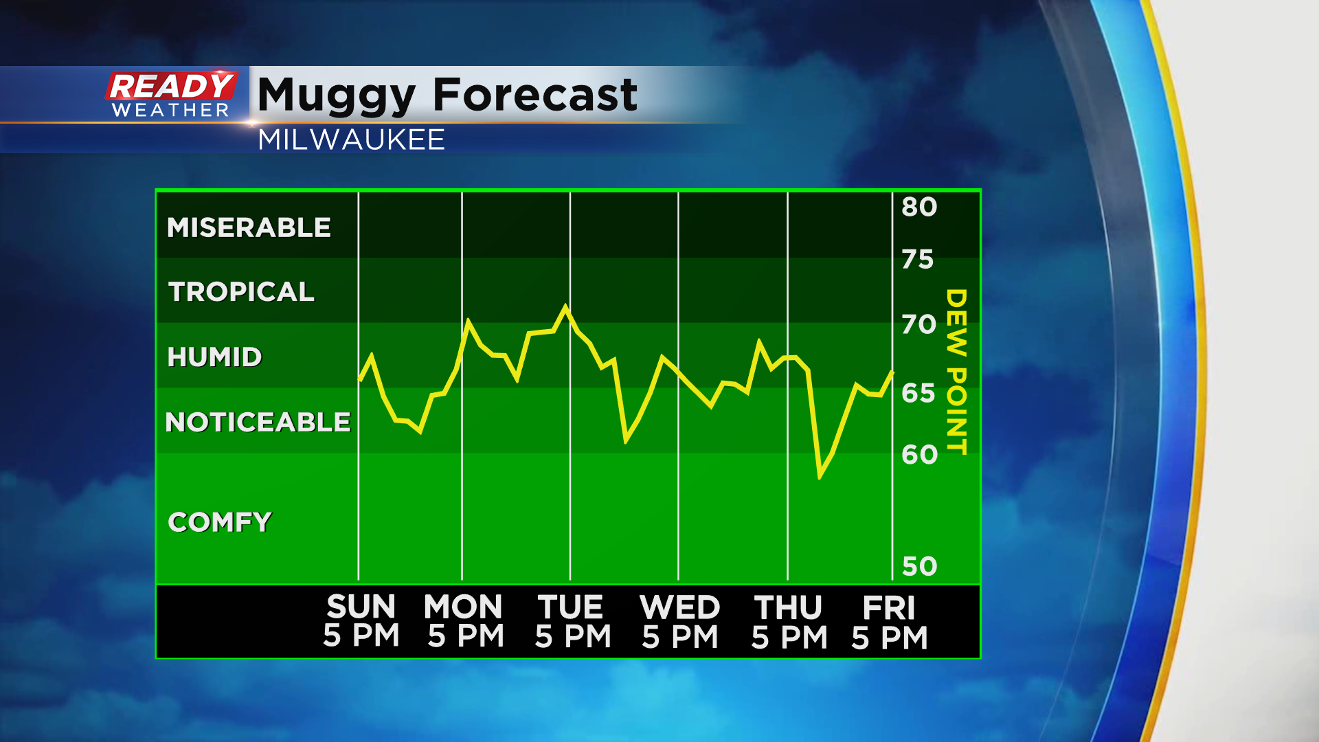
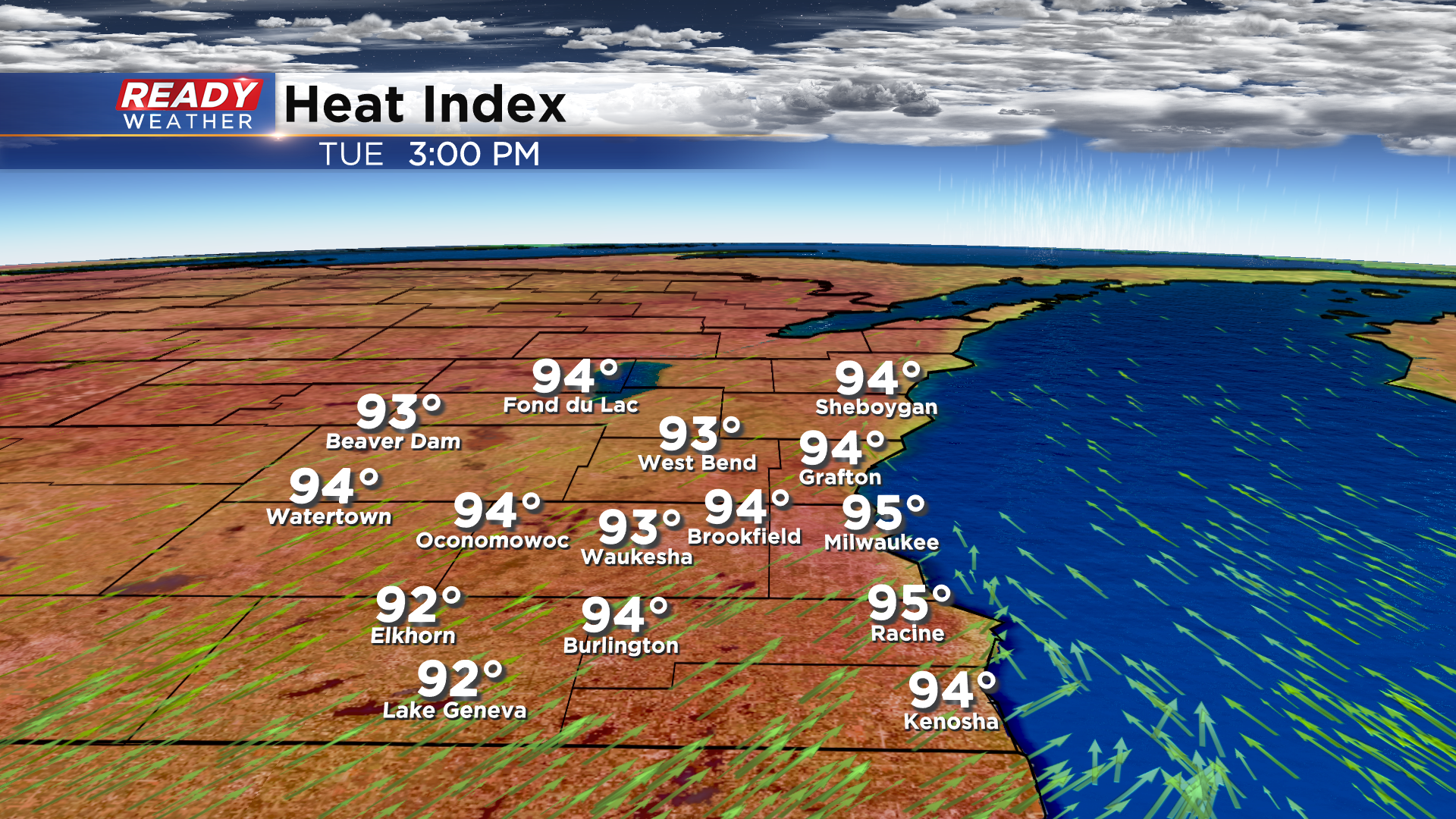
The worst of the humidity arrives on Tuesday with dew points well into the 70s, making it feel like the mid 90s across southeast Wisconsin.
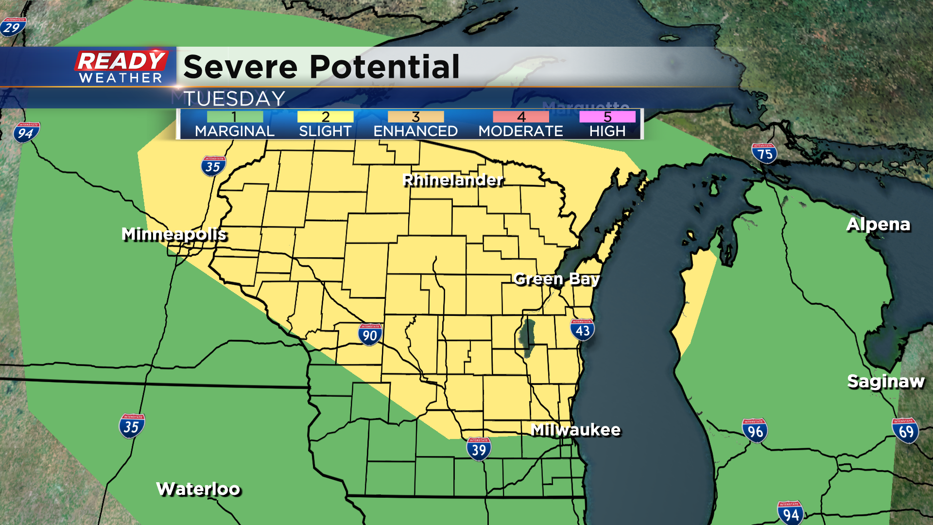
There isn't much rain in the forecast this week either. A weak cold front will push through Tuesday night, which could trigger a few isolated showers or storms, but it'll be so hot that we may not be able to tap into the energy needed to produce storms.
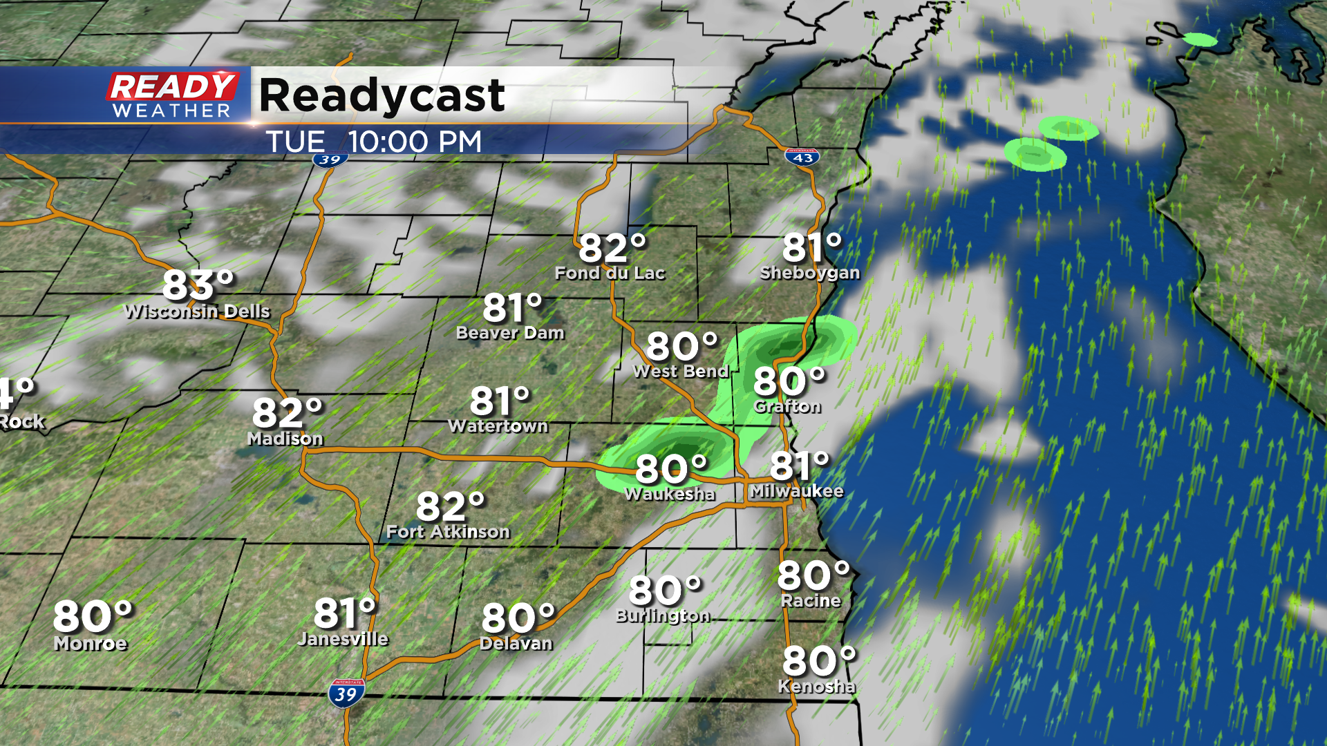
*If* storms are able to develop, they could be strong to severe with hail as the main threat. Right now the best chance for severe storms looks to be across the northern half of the state.
Our next best chance for wet weather after Tuesday night won't arrive until next week. Download the CBS 58 Ready Weather App to see if temps will cool down at all over the next week.
