Late Afternoon Update: A few scattered storms are possible late this evening, but the clouds will limit severity


Updated: Thursday, August 15th 5:00pm:
The steady rain has pushed out over Lake Michigan with lingering drizzle falling from the low clouds.

These low clouds will hang tough, so our severe weather threat for later tonight is fairly low. That being said, we'll be watching for scattered thunderstorms near the WI/IL border after 10pm.

The better chance for strong to severe storms could arrive Friday afternoon. Morning sunshine, temps in the low to mid 80s, and plenty of humidity will help fuel these storms Friday afternoon and early evening. Damaging winds and hail are the concerns along with a brief spin up.

--------------------------------------------------------------------
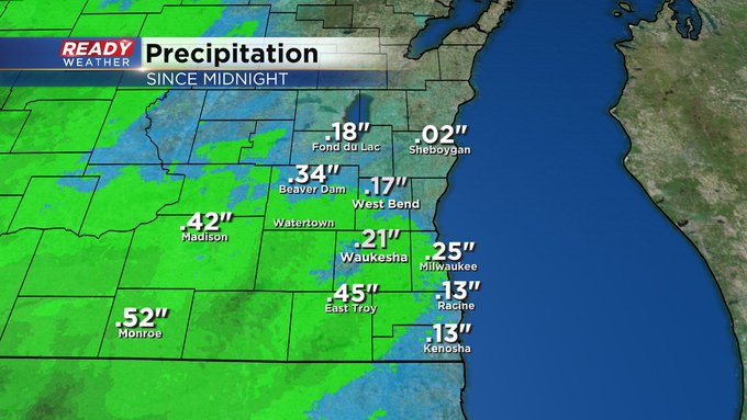
Updated 1:10pm August 15th
Steady rain continues this afternoon. Low clouds and some patchy fog around too, but no storms. Here's how much rain we've picked up so far:
Updated: 11:30 a.m. Aug. 15, 2024
Light rain is in progress across the area. Have a look:

Updated: 9:28 a.m. Aug. 15, 2024
Some light, steady rain has been falling for most of southeast Wisconsin the majority of the morning hours. rain totals are fairly light so far under a tenth of an inch in most locations. An area of moderate rain is about to move into southeast Wisconsin which could drop some heavier downpours through the rest of the morning hours.

The rest of the forecast highlighted below remains on track with some dry time this afternoon and then the possibility of a few more storms this evening. Those storms could be strong to severe if we see more afternoon sunshine.
------
Posted: 7:15 a.m. Aug. 15, 2024
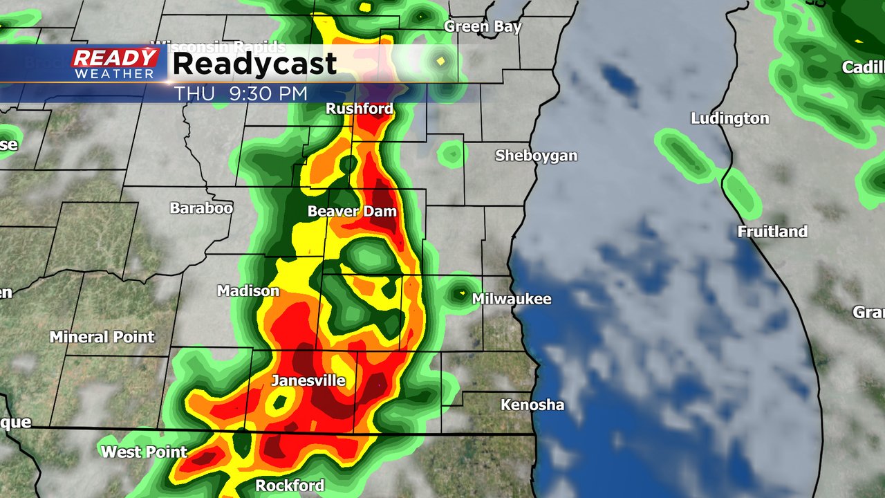
Thursday morning is starting off wet across most of southeast Wisconsin with some scattered showers and even some pockets of steady rain. A few areas of steady moderate to heavy rain and even a few thunderstorms will be possible through the midday hours.
Here's a look at the current radar image that will update with time:

Most of the afternoon hours look dry Thursday but a second round of rain and storms will be possible in the evening. This second round will be very conditional on how much sunshine we see during the afternoon Thursday. More sunshine equals more storms and a better chance for severe storms.
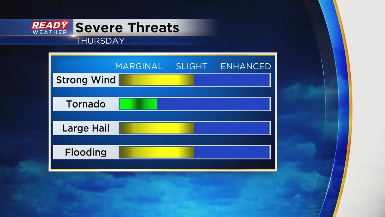
Overall, the severe risk for Thursday has shifted a little to the south but a sliver of Walworth County is still included in the Level 2 Slight Risk. The rest of southeast Wisconsin remains under a Level 1 Marginal Risk and that risk is also in place for Friday.

Any strong to severe storms that do form will bring a strong wind, hail and flooding risk. An isolated tornado cannot be completely ruled out.
Rainfall does look relatively heavy for most of southeast Wisconsin for the rain and storms Thursday, Friday and even lingering showers on Saturday. Rain totals by the end of Saturday will push above 2" in some spots but most should expect at least close to a full inch if not more.

Download the CBS 58 Ready Weather app to track the rain and storms.