Focus shifts from the cold to snow with scattered snow showers Wednesday


6 PM Update: Light snow is forecast to continue across the area this evening. An additional dusting to 0.5" is possible. Temperatures in the teens will allow the snow to stick on roads and continue to create slick spots.
The snow should wrap-up by midnight with lows falling into the teens. Subzero wind chills ae expected for Thursday morning.
_____________________________________________________________________________________________
1pm Update: Snow continues across southern WI. Here's a look at the current radar:

Wednesday morning was still pretty cold with wind chills hanging out in the teens below-zero to about -20. Wednesday afternoon will finally warm above-zero for wind chills and stay in the single digits to around 10 for feels like temps with actual air temps hovering around 20. We stay chilly through Friday with afternoon highs around 20 and wind chills in the morning below-zero and warming to about 10 degrees above-zero in the afternoon.

Some light snow showers have rolled into southeast Wisconsin Wednesday morning and will stay with us throughout most of the day with scattered showers. It could drop a quick dusting to a few tenths of an inch at times.
Here's a radar image that will update with time:

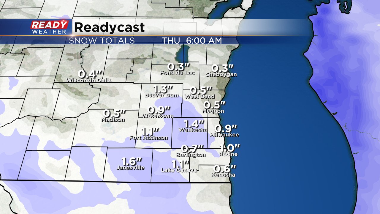
Snow totals by the end of Wednesday will hover around an inch in most communities with some closer to a half inch and others closer to 1.5" or even a bit more.
The light snow Wednesday comes as the northern United States has been missing out on storm after storm. A few weeks ago we were talking about a big storm from Kansas into Kentucky then we saw another one a bit farther south from Tennessee into the Carolinas and now one right along the Gulf of Mexico with over 9" of snow picked up in New Orleans Tuesday which is much more than the measly 1.7" we've picked up in Milwaukee in January going into Wednesday.

Download the CBS 58 Ready Weather app to track the snow Wednesday.