Heavy rain arrives early Thursday morning, mixing with and changing to heavy wet snow during the day
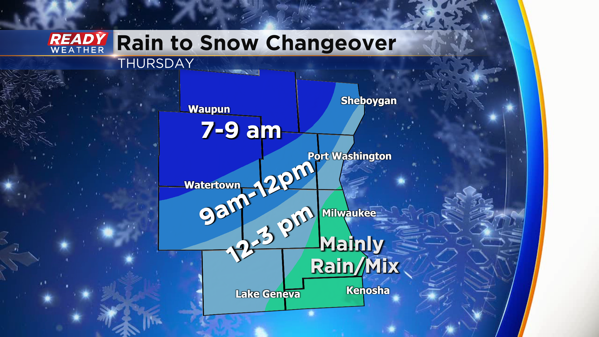
Today is the calm before a quick moving low pressure system tracks across southern Lake Michigan on Thursday. As the system approaches from the southwest, steady rain moves in between 2-4am Thursday morning. Precipitation will stay rain throughout the morning commute, but will start to change over heavy wet snow mid to late morning for areas well northwest of the Milwaukee metro.
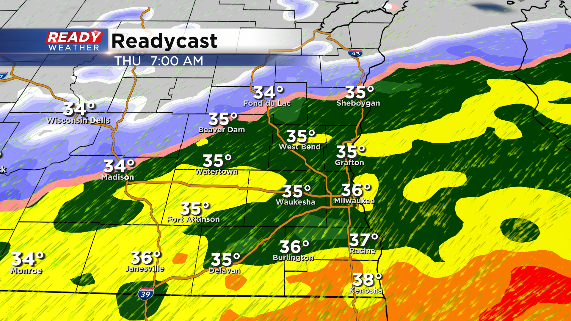
By midday, areas on a line from Sheboygan to West Bend to Fort Atkinson will be changing over to wet snow, while lakeside and far southern areas stay as rain thanks to warmer temps and a "warming" onshore wind off of Lake Michigan.
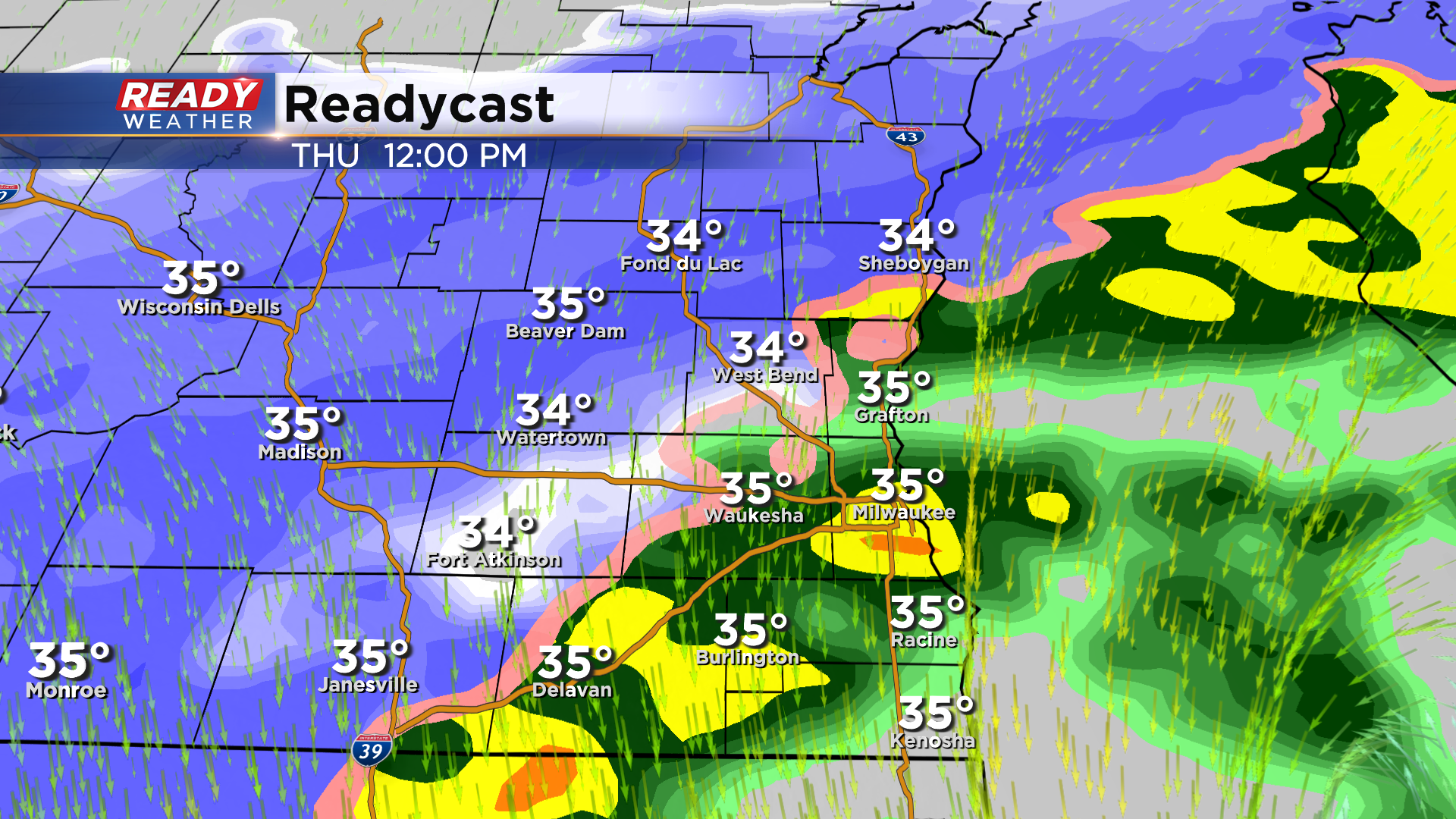
Colder air gradually wraps into the system from west to east during the afternoon which will cause the rain to snow transition, but temps will stay above freezing from Milwaukee to Kenosha so precipitation type could very well stay as rain or a slushy rain/snow mix throughout the afternoon. Precipitation becomes light and starts to taper off after 4-6pm.
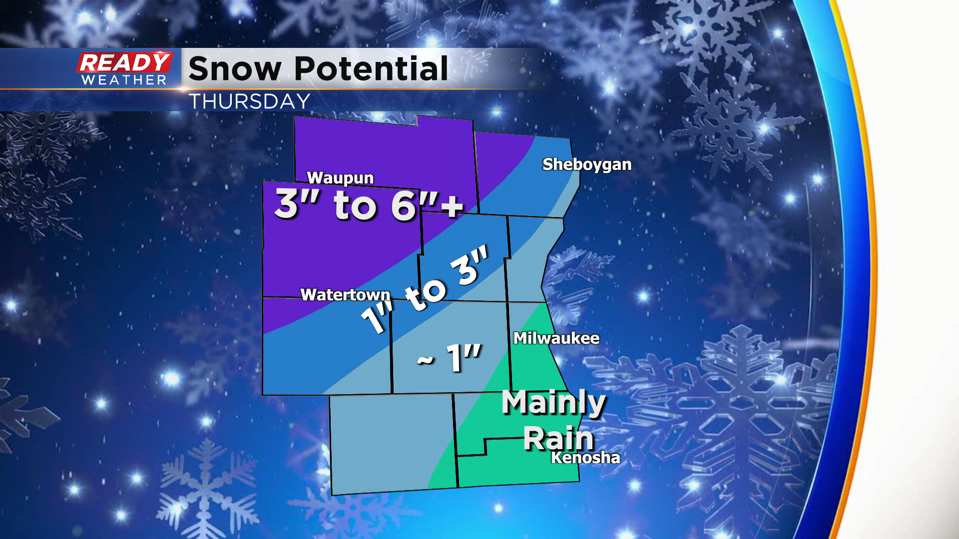
Heaviest snow potential runs north and west of a line from Plymouth to Kewaskum to Lake Mills. This is where we could see snowfall rates of 1"/hr around midday, which will help snow totals pile up between 3-6". There will be a sharp and narrow cutoff in totals from Sheboygan to Fort Atkinson, but a couple inches of slush snow is possible there. Areas from the Milwaukee metro to the state line can expect little to no accumulation.
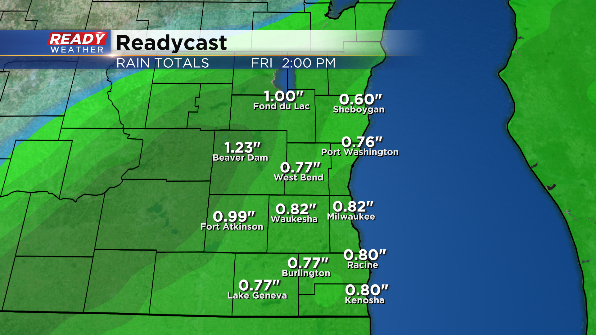
There will be a LOT of liquid in this system by February standards. Between .75-1.25" of liquid will fall with this system, coming in the form of both rain and wet snow.
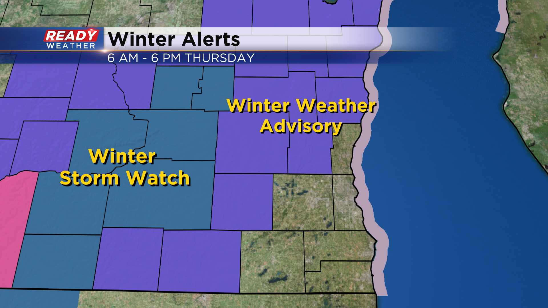
With the potential for 3-6" of wet snow, a Winter Weather Advisory is in place for Sheboygan, Fond du Lac, Dodge, Washington, and Jefferson counties from 6am-6pm Thursday.
In addition to the precipitation, we'll also have to deal with 30-40 mph wind gusts for most of the day. It'll make for a gross and gloomy Thursday. Download the CBS 58 Ready Weather app to get updated forecast videos sent right to your phone.
