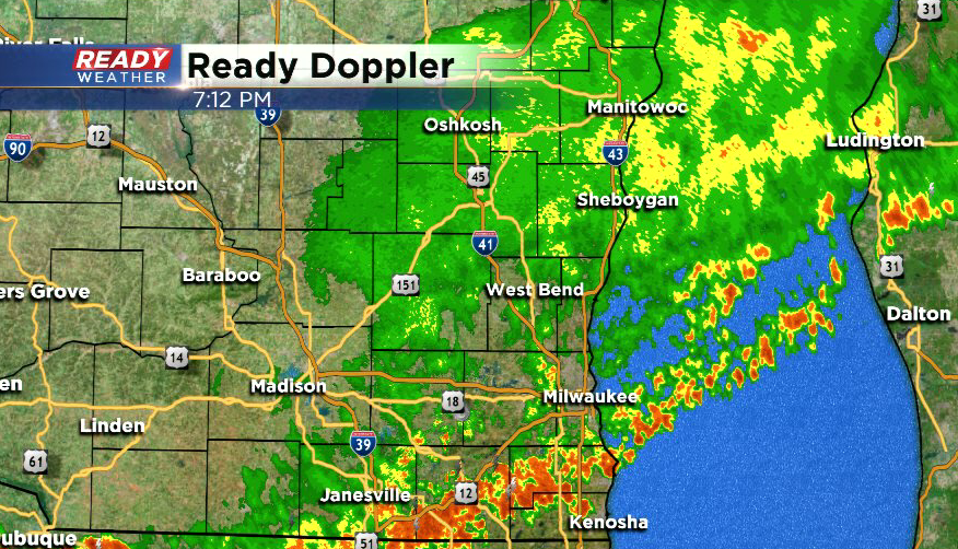
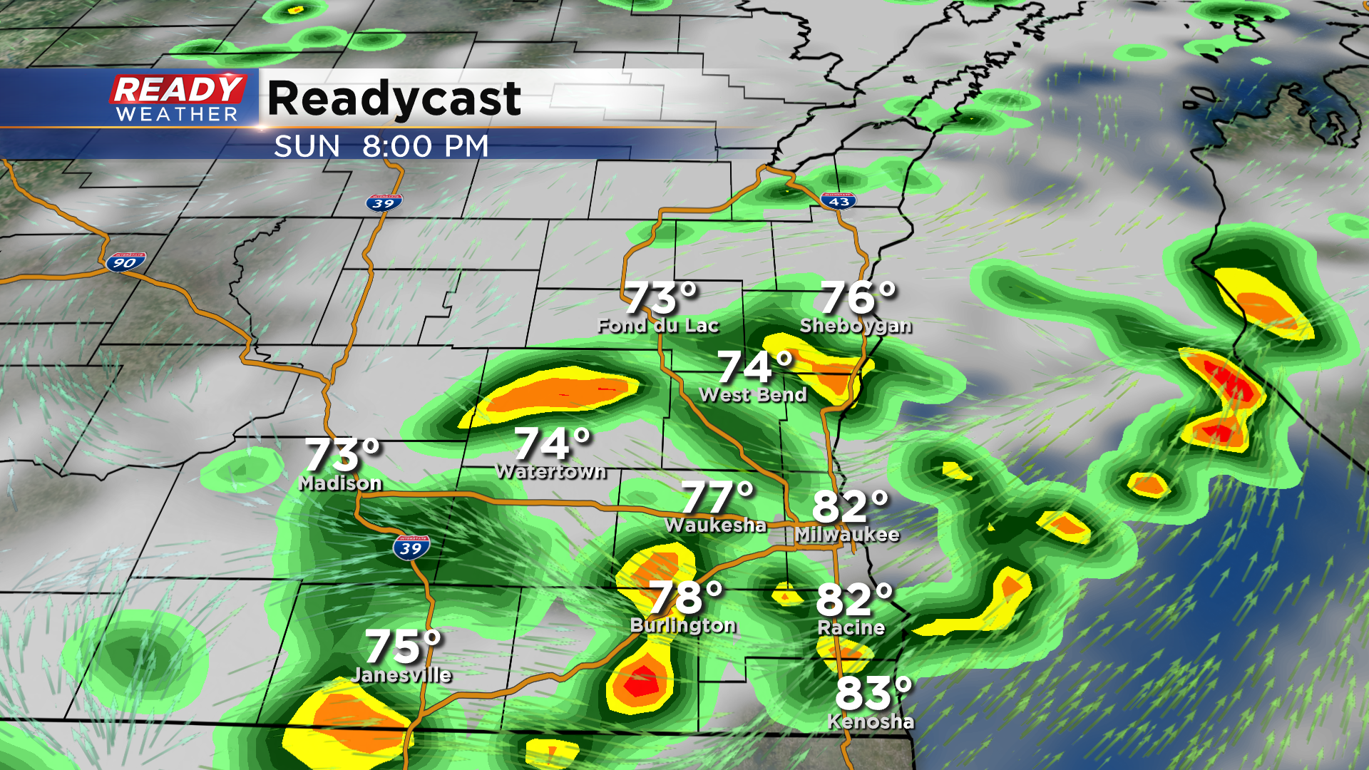
7:15 pm Update: Last of the heavy rain pushing through far SE Wisconsin


Updated: 7:15 pm July 26th, 2020:
The disorganized line of storms with heavy downpours has made it to Walworth, Racine, and Kenosha counties. Heavy rain with localized flooding will be possible until these storms clear the area around 9pm.

Pockets of lighter rain continue behind this line of storms, but it won't cause any additional flooding issues.
Lingering showers will taper off by midnight.
-------------------------------------------------------------------------------------
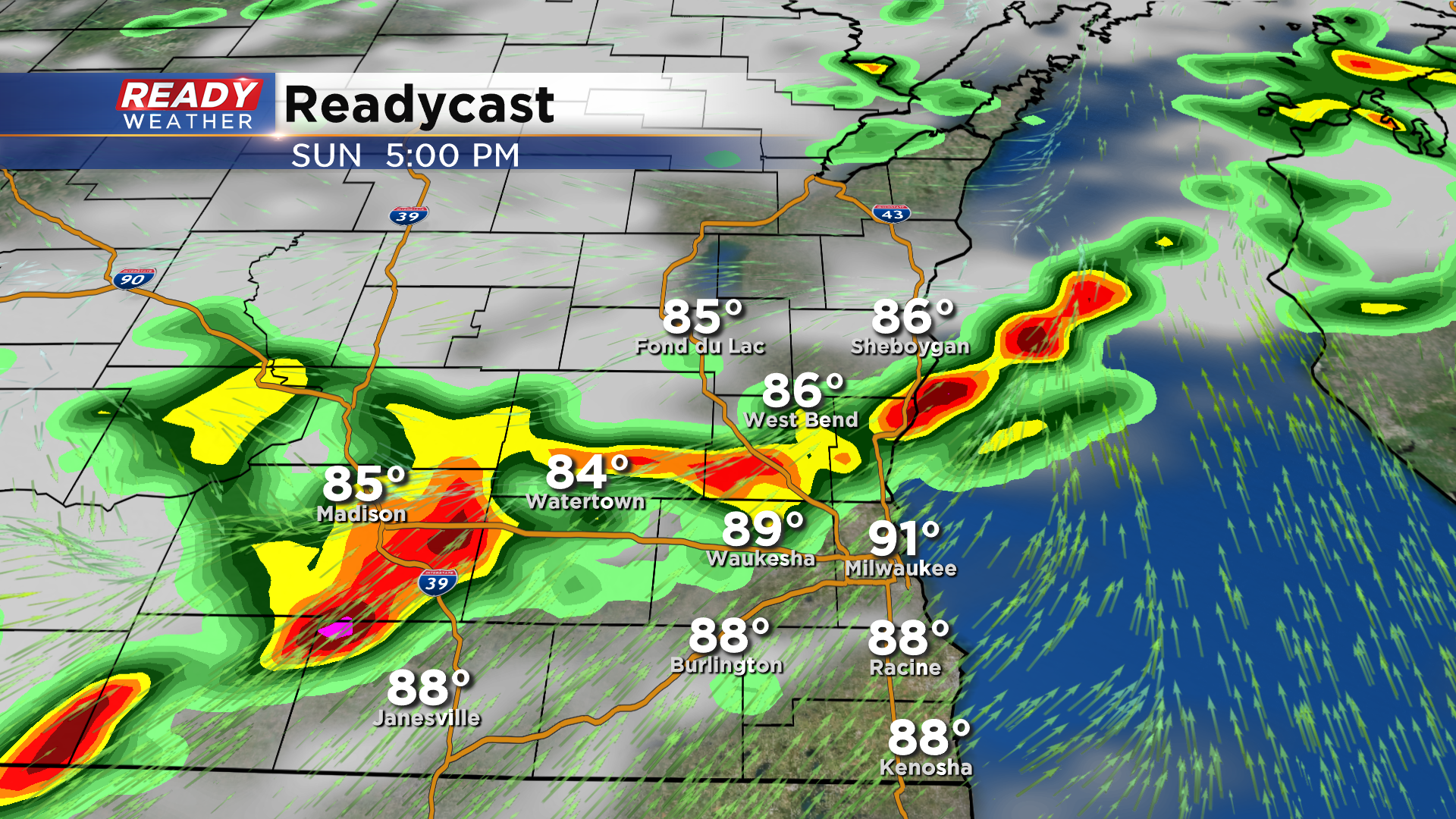
Updated: 5:15 pm July 26th, 2020:
An Areal Flood Advisory is in effect for northern Dodge, Fond du Lac, and Sheboygan counties through 7:45 pm. Between 1-1.5" of rain has already fallen, with an additional 1-2" possible. This could lead to minor flooding or ponding of water on roads.
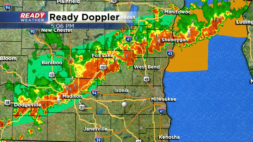
This entire line of storms is producing rainfall rates of 1-2" per hour, and that will continue as this line moves through the rest of SE Wisconsin this evening. The storms itself are tracking NE at 40 mph, while the whole line is dropping south at 20 mph. Storms may also produce 40-50 mph wind gusts, but flooding is the main concern. Current timing for the Milwaukee Metro is 6-8 pm
--------------------------------------------------------------------------
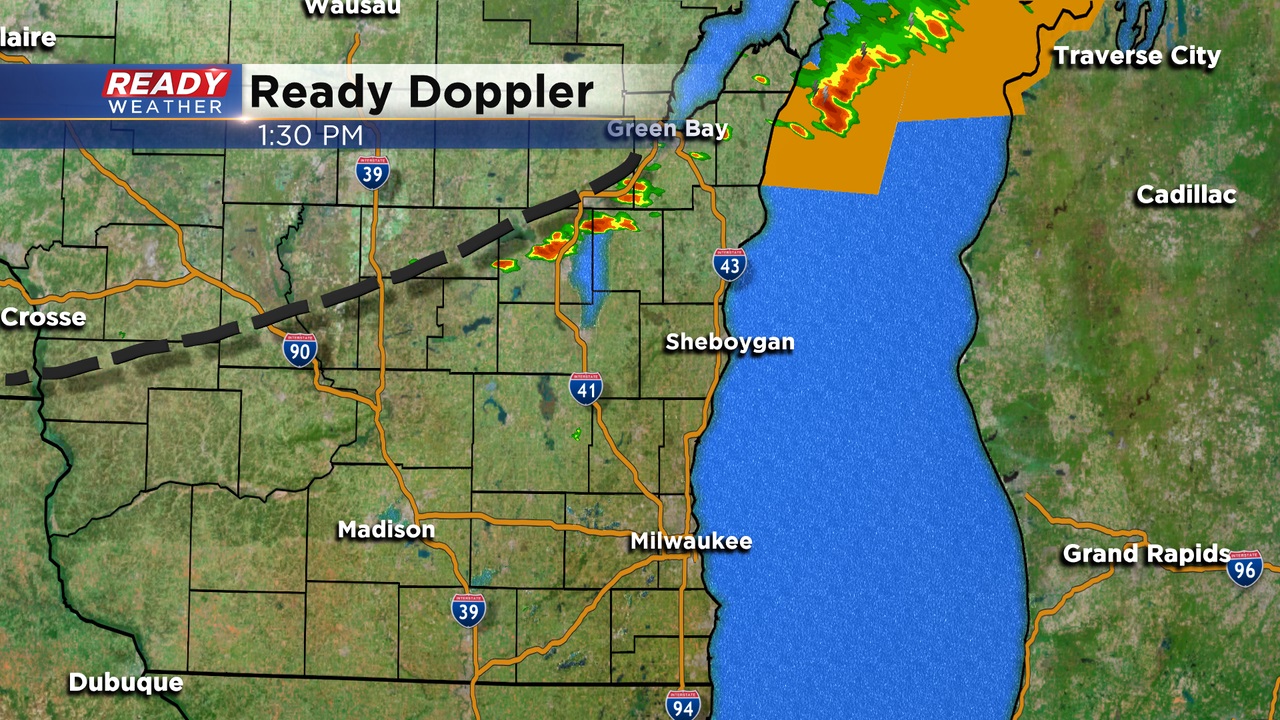
Updated: 3:30 pm July 26th, 2020:
A line of storms as developed ahead of the previously mentioned boundary. Storms are generally tracking to the east-northeast, parallel to the boundary. While storms will continue to track in this direction, the entire line itself will slowly drop southward through 8 pm.
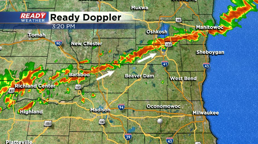
Gusty winds and very heavy rain continue to be the main threats, but we can't rule out some small hail or a very brief funnel cloud. Storms won't be organized enough for widespread severe weather.
-------------------------------------------------------------------------------------------------------------------
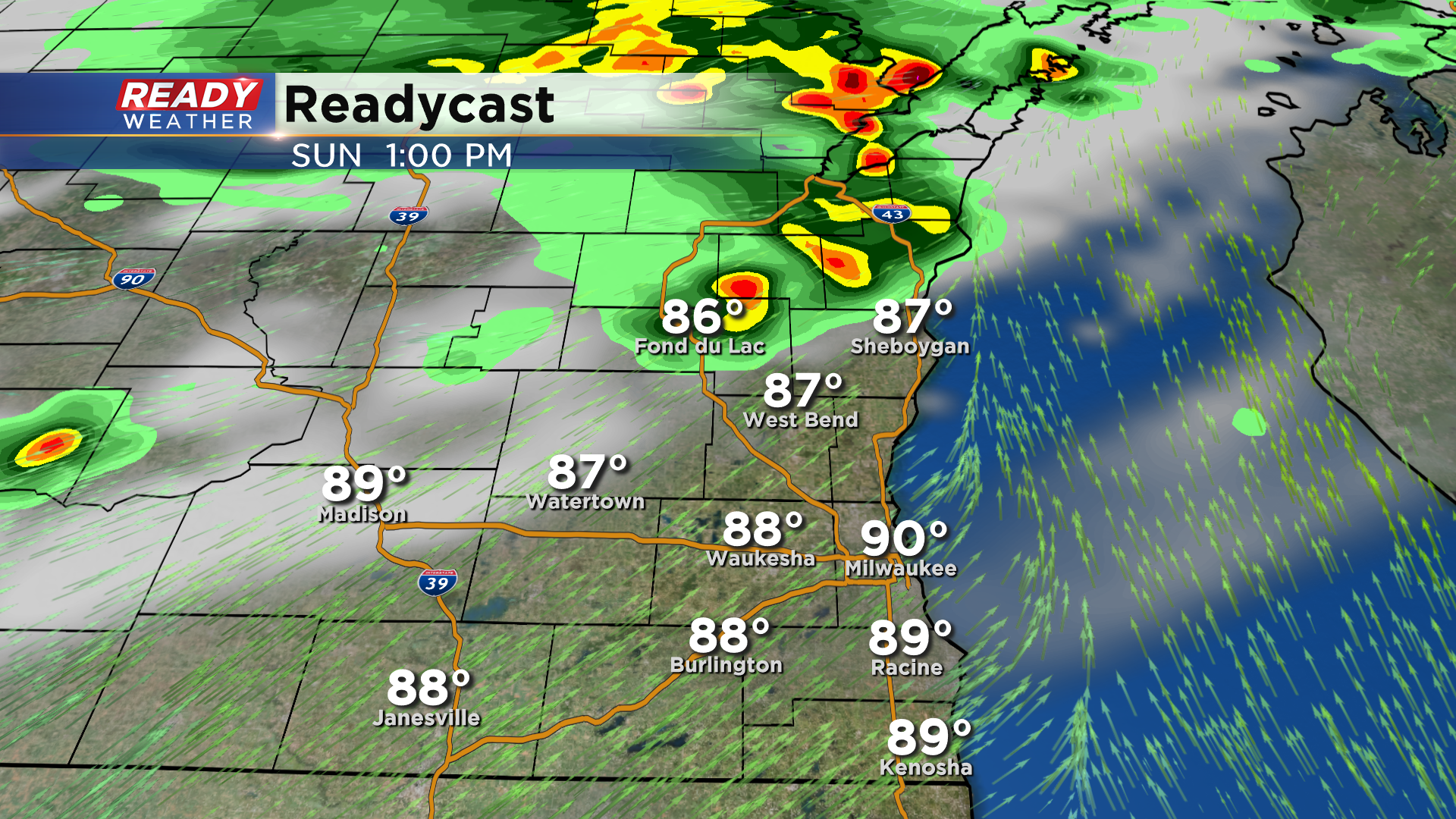
Updated: 1:35 pm July 26th, 2020:
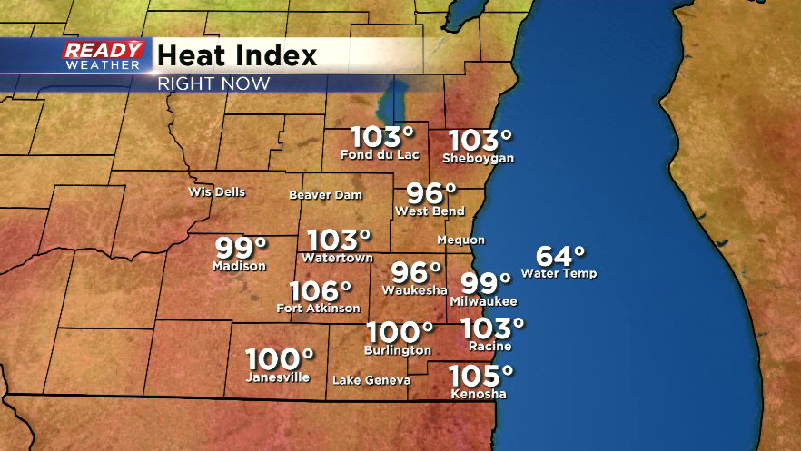
Feels like temperatures across southeast Wisconsin are sitting either side of 100 degrees early this afternoon with actual temps in the low 90s.
Our focus for storm development this afternoon is a leftover outflow boundary from morning rain and storms that tracked across northern Wisconsin that's currently draped from Green Bay to La Crosse. Storms are expected to fire along this boundary as it slowly drops southeast through the afternoon and evening.
Gusty winds and very heavy rain will be possible with any storms that develop, and the slow moving nature of the storms could lead to some localized flooding or ponding. However, our lack of rain over the last week and a half means the ground will be able to soak up a lot of the rain that falls.
-----------------------------------------------------------------------------------------------------
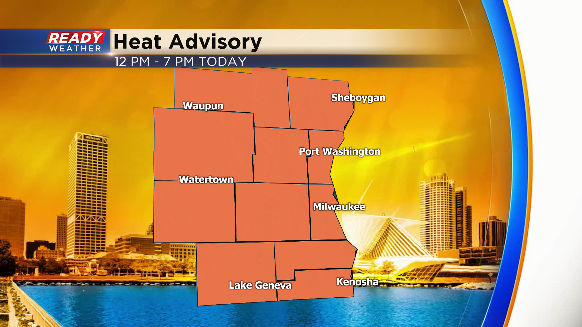
Temperatures are in the mid to upper 80s as of mid morning across southeast Wisconsin, with heat indices already in the low to mid 90s. As temps rise into the low 90s this afternoon, feels like temperatures will peak between 100-105 degrees this afternoon. Due to the extreme heat, a Heat Advisory has been issued for the whole area from 12-7 pm.
Sunshine this morning has been filtered in spots due to ongoing rain and storms to our north and west.
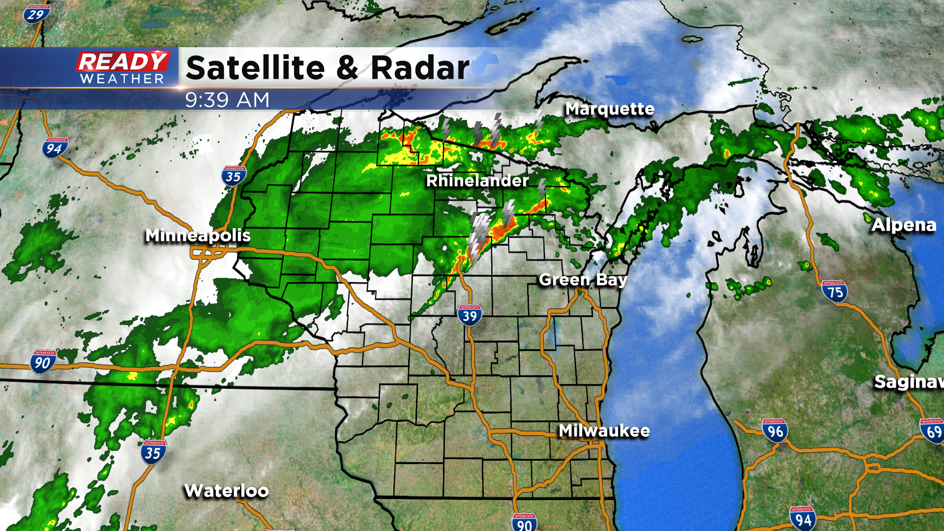
This area of heavy rain has been weakening, but we're expecting more storms to pop up early this afternoon across our northern spots as a cold front slowly sags south.
Scattered storms will become more numerous while slowly dropping southward throughout the afternoon.
Storms will start to lose any strength they have after sunset, with lingering spotty showers expected overnight.
While we're not expected widespread severe weather, a couple of storms could be strong to severe and produce strong winds between 2-8 pm. There's a level 1, Marginal Risk, for severe storms in place for the entire area.
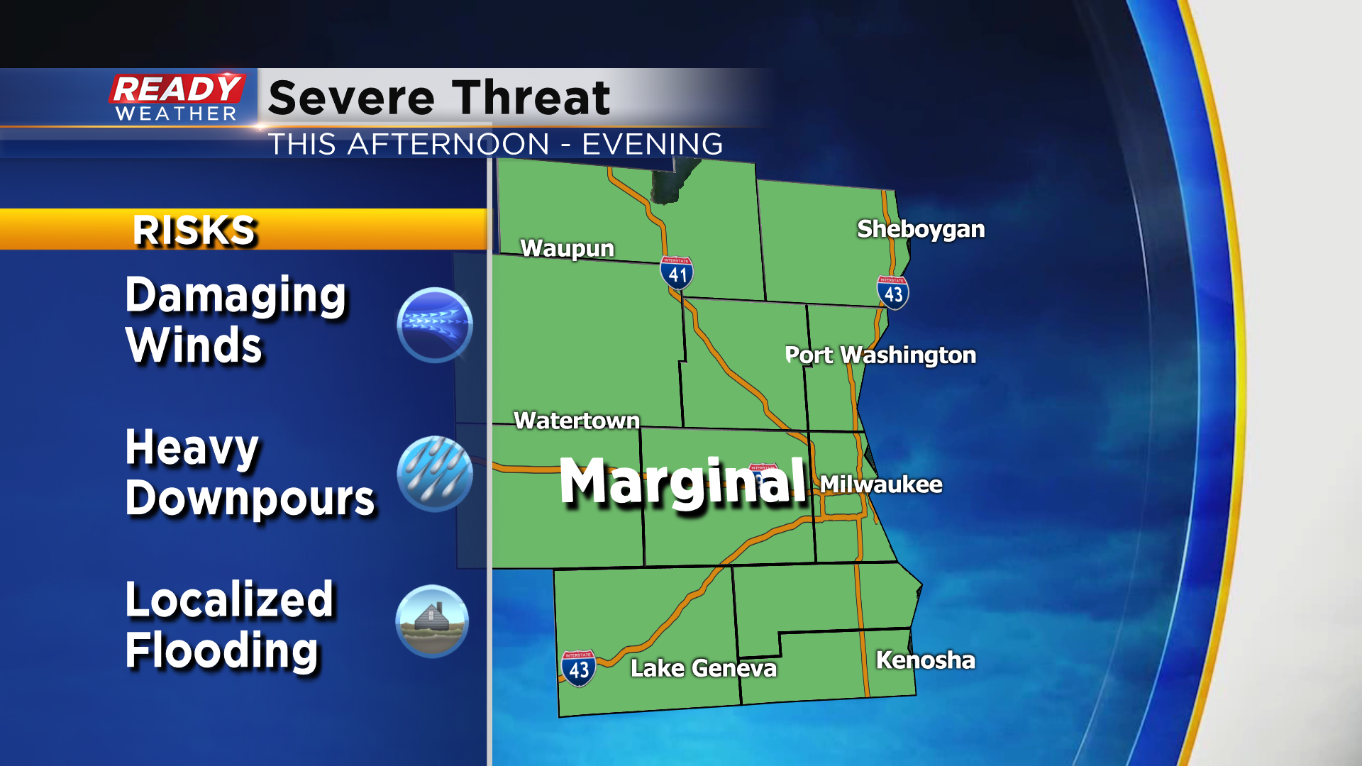
Any storms that develop will be capable of producing very heavy downpours, and the most organized storms could produce rainfall rates over 2 inches per hour. There will be a risk for flooding if storms are able to repeatedly track over the same areas. Download the CBS 58 Ready Weather App to get severe warnings sent to your phone and to track the storms.