Ice Possible Monday Morning
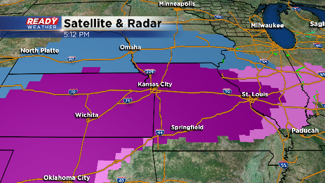
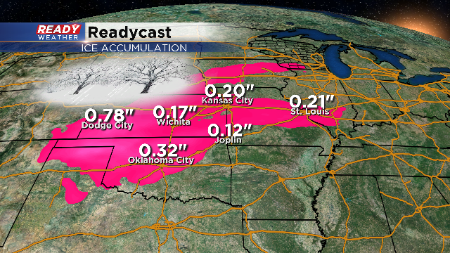
It's going to be a treacherous weekend across the central plains with ice storm warnings in effect until Sunday. Most of the those areas will receive up to a half an inch of ice from persistent freezing rain.
Warm humid air will move north from the Gulf of Mexico and override shallow cold air at the surface. This classic overrunning will create freezing rain for most of the weekend to our south.

This setup will actually impact southeastern Wisconsin Monday morning. Monday's morning lows will be in the middle to upper 20s. Precipitation will start as a mix of freezing rain and snow, and then turn over to freezing rain. Freezing rain is possible from 6 am until Noon. During the afternoon surface temperatures will warm above freezing ending the icing.
There will likely be a enough freezing rain to create a glaze. That glaze will create slick roads. Thankfully it's a holiday, so traffic will be lighter. Please check back here throughout the weekend for the latest forecast discussion..
