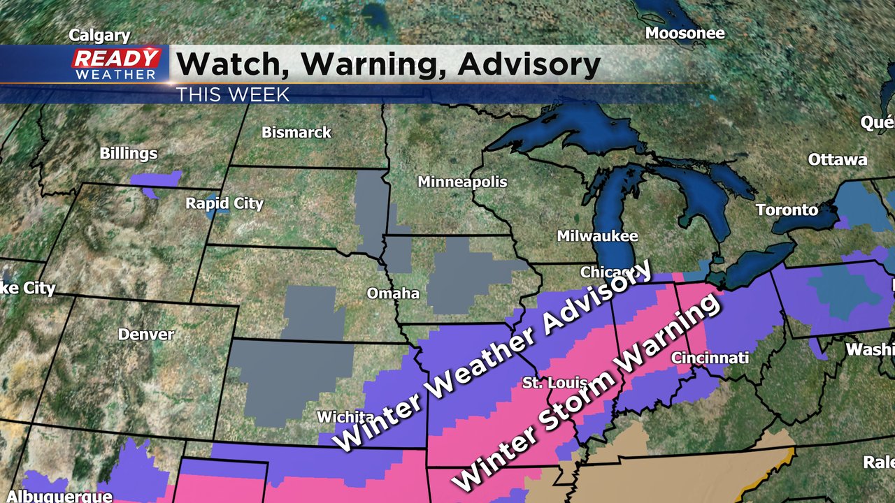
Winter Weather Advisory Issued for Wednesday's Snow


A newly issued Winter Weather Advisory is in place for Milwaukee county as well as our southern tier counties for Wednesday's snow on the way.

Now that the temps have finally started to cool down, our snow chances are ramping up! Sunday morning some communities got anywhere from a dusting to a full inch of snow. Our next round of light snow arrives Wednesday. Snow rolls in during the morning commute and lasts with us through late morning into the afternoon before wrapping up in the evening. A few flurries may linger into Thursday morning.

The heaviest of the snow will this large storm system will be well to our south. Winter weather advisories have been posted south of Chicago with a broad area under a winter storm warning from Texas through Ohio. Wisconsin likely won't see any advisories or warnings with totals expected to stay light.
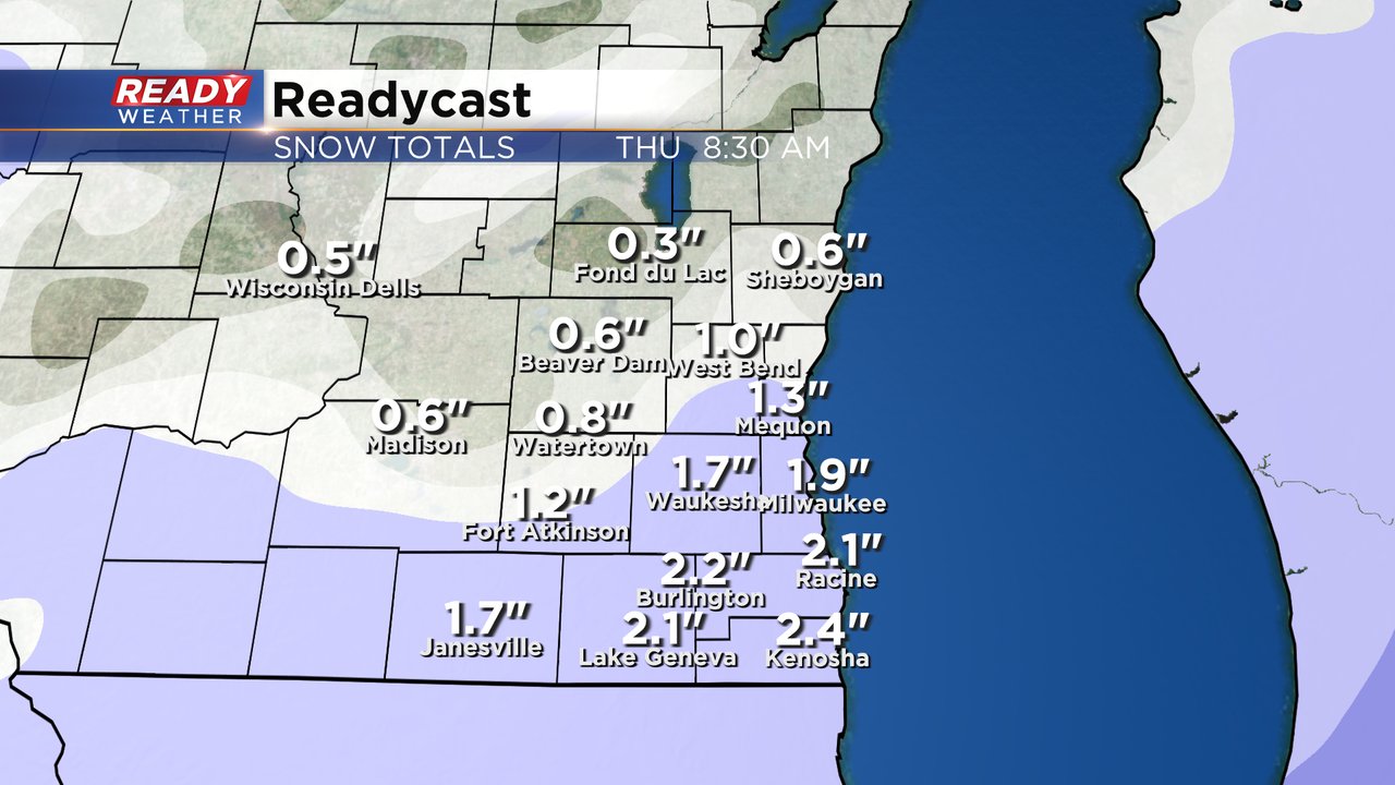
Anywhere from 0" to 2" is expected across southeast Wisconsin. Lowest totals will happen in our northern counties where they see a few tenths of an inch to a full inch of snow. Southern hometowns will be in the 1-2" range with some communities along the IL border possibly seeing as much as 2.5".
Download the CBS 58 Ready Weather app to track the next round of light snow and more on the way Friday, Saturday and Sunday.